Summer Hiking In The Rain Or Through A Heat Miser Deluge
Well, it is August and I haven’t blogged much this summer, I
guess one can call it a summer vacation. However, it time to get back at it and with
this first blog in quite a while I wanted to write a one about hiking and weather that I encountered at Watauga Lake. Since getting back into outdoor activities I have seen all
sorts of weather but one of the most extreme turns in conditions happen back in
July on my last hike in Tennessee at Watauga Lake. It was a memorable hike that featured a rain that could only have come from Heat Miser himself.
We will feel his wrath later.
Panorama of Watauga Lake at Shook Branch.
Waterlogged AT.
Let me say this isn’t the first time I had been confronted
by some kind of surprising changes in the weather. There was my hike to
Cowrock Mountain last year when I went out with a weather forecast of 10%
percent chance of rain and was greeted by fog on the mountain and rain. It did eventually
clear out but it was a lesson in how weather forecast can be off or change.
June, 2013: Fog at Cowrock Mountain
No views at Cowrock!
Vista later in the day.
I witnessed it again on the Roan Highlands the past October.
Again the weather report was for a 10 % chance of rain and it started out like the forecast. When I got to
Carvers Gap it was mostly sunny, but by the time I had traveled the almost mile to
Round Bald clouds had started rolling in. My view from Grassy Ridge Bald was
like the Pink Floyd song “Obscured by Clouds” and by the time I got back to
Round Bald it was raining. It is ironic that I had a similar experience at the
Highlands in July, but in reverse (I will go into more detail later). When we
got to Carvers Gap it was covered in fog, but it eventually cleared out and was
a beautiful day on the balds, but that is the weather on the Roan Highlands!
On the drive up to Carvers Gap in Oct, 2013.
Clear skies & N.C. Mountains in Oct, 2013.
N.C. Mountains later in the day.
Oct, 2013: Clouds cover Roan High Knob.
From summit of Grassy Ridge Bald in Oct, 2013.
I was greeted by familiar weather back in July.
From the summit of Grassy Ridge Bald in July, 2014.
Clouds at the Beauty Spot in Oct, 2013.
Oct, 2013: That white at Rabun Bald summit is clouds...
...here is what it looked like from the tower.
Snow on the AT at Rich Mtn.
I had other experiences with rain at the Beauty Spot, fog on
Rabun Bald and snow at Rich Mountain. However up to this point the most extreme
weather I had to deal with was the wind and cold at Neel Gap and Levelland
Mountain back in late February. I went over that day in this blog, but let me
say this was an example when I didn’t pay enough attention to the weather
report and I faced temperatures in the teens and wind chills at around zero.
Ice at AT near Neel Gap in Feb, 2014.
That wind was constant.
Feb, 2014: In the cold at Levelland Mountain.
So, when Glen and I decided to hike that day we looked at
the weather report and because it said that the weather would start to clear in
the afternoon, we decided first our first stop would be at the Barnett's Gun Range in Hampton to do a little
target practice.We shot a pistol and a rifle, I hadn't been to a gun range in years, but it was fun.
Barnett's Gun Range in Hampton, TN.
Shooting a rifle video below.
You see according to WJHL Channel 11’s own Mark Reynolds it
was supposed to be a nice late in the afternoon, so we got to the trailhead around 3pm.. I will say when we got to the
to Shook Branch Recreation Area Mark look like he had gotten the forecast
right. The sun was out and because of this I would make my first mistake of the
day.
Entrance to Shook Branch Recreation Area.
Beach at Shook Branch
Because of what I heard about the weather and with the sun shining I
decided to leave my rain paints behind in the truck I don’t know why I did; they don’t add
that much weight to the pack, but that is what I did. Also, I told Glen that it
won’t rain and he said you know you are jinxing us, oh how right he would be.
Anyway, as we started out on the Appalachian Trail (AT) I heard
someone say something about bears, I said there are some around here, and I
don’t know if they believed me, but just down the trail we found the proof.
There was a sign that read that the area was closed except for hiking the AT, and
the reason…if you guessed bears you would be right! I had heard about this
closing before we did the hike, but it shows that even in places where you
think there wouldn’t be bears there are.
Closure sign.
But we are hiking the AT.
At this point I must say that the hike at Watauga Lake is a nice one.
While not as challenging as many spots on the AT, hiking around the lake is
never-the-less a beautiful one. I have always though that Watauga is the
nicest of the lakes in East Tennessee.
Panoramas of...
...Watauga Lake.
One of the small islands in the lake.
One of the many "fishermen camps."
Some had these signs.
Vista from one of these camp spots, I see why people want to set up here.
After enjoying some vistas and seeing
plenty of camping sites (were some had closed signs posted) we came to the junction
to the Watauga Lake Shelter. Like camping on the trail, this shelter is posted
as closed and it is not a surprise because not far from the shelter someone had left
an old banana peel. This is the very thing that draws bears and causes shelters
like this one to be posted as closed.
Watauga Lake Shelter.
Shelter closed sign with a little message.
People should read this...
...& not do this.
It was about this time that we started to see a disturbing
omen, it had clouded up and we could hear some rumbles of thunder in the distance. Because we were
not that far from the dam we decided to press on. One of the things we walked
across here and earlier in the hike was Rosebay Rhododendrons. I had hoped to
see these in the Smokies, but I just wasn’t able to get back to the park, so seeing these
here and the previous day at Rock Creek Falls (future blog) was a plus. Another
interesting thing on the trail we came across was where the trail had been
rerouted after a tree had fallen on it. We actually didn’t notice the trail had been
moved until on the way back.
Some examples of the...
...Rosebay Rhododendrons I found.
AT rerouted for a tree.
However, we finally reached the Watauga Dam and it was here
that it started to rain. While it wasn’t hard it was enough for us to reach for
the rain gear in our packs. One of the reasons I got a bigger day pack is so I
could care gear just like this (and those rain paints I left in the truck). If you have never been to Watauga Dam, the AT follows
a paved road and goes right across the top of the earthen structure. It does give a fantastic
view of Watauga Lake and Pond Mountain which towers over the water in the
background.Another cool feature one can
see from the dam is the Iron Mountain Fault that cuts through the rock.
AT has it heads over Watauga Dam.
Holston Mountain from the dam.
The beautiful vista from Watauga Dam.
At the stone marker...
for the dam.
Marker with the view.
The AT has it heads toward Iron Mountain Gap.
The Iron Mountain Fault clearly visible.
Where the road meets the trail.
Watauga Dam, Lake & Iron Mountain.
After a break for lunch the rain died down and it started to lighten up,
we really did think that this was the worst of it for the day. Still, once we
left the road and were back on the trail headed south we could hear some slight
rumbling, but the weather looked good. We even made it the mile back to the
junction with the shelter without incident, but it was right after here that we
noticed it was getting darker, but with the tree cover it was hard to get a
good look at the clouds. Earlier we didn’t notice that it had started raining
until we exited the tree cover. In a light rain one won’t get too wet under the
trees, but a deluge is a different story.
The AT, the calm before...
...the storm.
Anyway, about two-tenths of a mile from the shelter we met a guy who was
on the trail with his dog. His dog seemed excited and after a minute or two the
man and the dog headed the opposite way from us. But then a few minutes later
the dog blew right by us and the man was chasing after him. It was about then that we
heard what had caused him to turn tail and it was a rumble that sounded like a train rolling down the ridge toward us, it was a rain storm. We had just enough time
to get our rain tops out of our bags when it hit.
Rain starts falling...
...& after it slowed down.
I kind of felt like the Burl Ives snowman from Rudolph the
Red-Nosed Reindeer when he says “the storm hit.” I mentioned above about a deluge and
that what it was. I have only seen it rain this hard a few times and once was at
Bristol Motor Speedway where it poured so hard that it soaked through an umbrella,
but here we were over a mile from the truck. One might ask why we didn’t head
back to the shelter that we had passed; I will tell you we really didn’t think
about doing that.
Burl Ives snowman prepares for a storm like I had too.
So, we just put our heads down and started hiking through the pouring
rain. As we went the rain seemed to pick up in intensity. Luckily for us we
were not close to something a creek, like the day before, because honestly
we could have seen a flash flood. It is obvious that I couldn’t take any
pictures because I was just trying to keep my camera dry. I also had to move
Pete to my pocket because he was getting soaked. Unfortunately for my AT Guide
Book it was not as lucky. It was in my side pocket and it was here that I made two more mistakes the first
was not bring a plastic bag to put my maps in then I forgot to put them in my
pack where they wouldn't have gotten as wet. Fortunately the AT and National Geographic
maps proved to be waterproof, however my AT Guide was not and I thought it was
goner.
Maps faired well, but I was worried about my AT Guide.
While I could take pictures, it was a good thing that Glen
brought his Go Pro along. Since it is waterproof (and that was tested) he was able to
film some of our hike back. It does a good job of showing how hard it was
raining, but it didn’t tell the whole story. On the AT in spots there was at
least two-to-three inches of water on the trail. When we passed the lake I
think a glimpsed an old guy with a boat full of animals.
The lake & rainy weather just missed the guy in a boat.
Anyway, it rained on us for over half-a-mile or more. While
it was miserable, all we could do was laugh and trust me I will never forget
this hike. The rain finally started to let up when we passed one of the
fishermen camp sites and by the time we got to the gated spot while still raining the sun had come out, now that is what I call summer. It was interesting on the
final tenth-of-a-mile or so to see these little streams that had dried up now
had water flowing down them.
The now wet gate.
With in a few minutes we had rain...
...& sun.
Sun is now shining, hard to believe we passed through a monsoon.
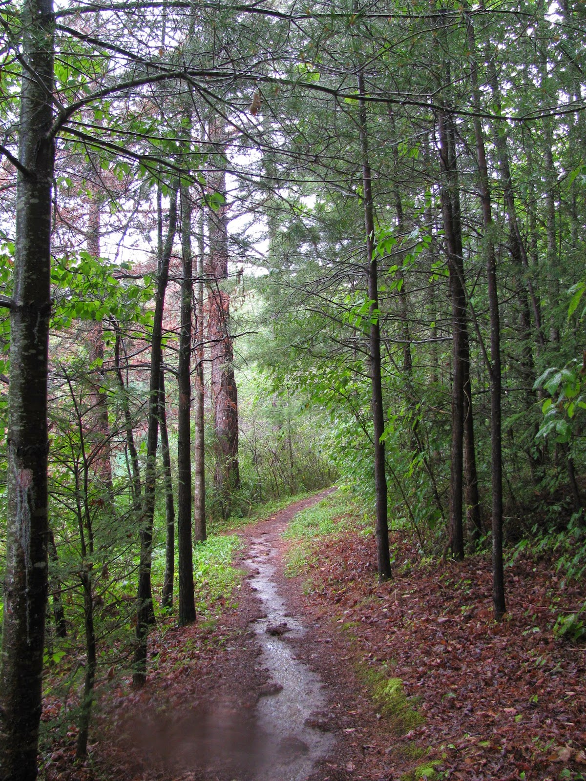
A waterlogged AT.
I am pretty wet.
We we passed this earlier it was dry.
There were still clouds before...
they start to clear leaving a beautiful vista.
When we got back to the truck there...
...were still clouds mixed with sun before...
they start to clear leaving a beautiful vista.
When we reached the Shook Branch beach the sun was out and
it was hard to tell that we had hiked through a monsoon that is except for the
fact that both Glen and I were soaked. Anyway it was a fun and memorable hike.
Oh, while my AT Guide Book looked like it was on its last legs I can report
that it dried out and survived, it is just a little rough around the edges.


.JPG)


No comments:
Post a Comment