
Someday's when I hit the trail I am ready to go, while others I hike my way into it (the hike). Then there are days like today when it just doesn't click....like today. That means that instead of doing over 12 miles I just made it to just over nine miles. Part of the reason was I spun my wheels trying to leave the house. Then I had a delay in Greeneville and finally the gravel part of the road to Jones Meadow was more washed out than my last trip in May. Anyway, that means that I really didn't have the time (or I just didn't feel it) so I cut my hike short at Jerry's Cabin. Big Butt was another four miles out and back and it just wasn't in the cards for Monday. As for the hike itself the first part from Jones Meadow to Big Firescald Knob, on the Appalachian Trail (AT), I have talked about in this in a previous blog. So this first part will be pictures.
 |
| Where I am headed. |
 |
| The road was much rougher than back in May. |
 |
| View from the Viking Mountain Overlook. |
 |
| Jones Meadow... |
 |
| ...& Camp Creek Bald. |
 |
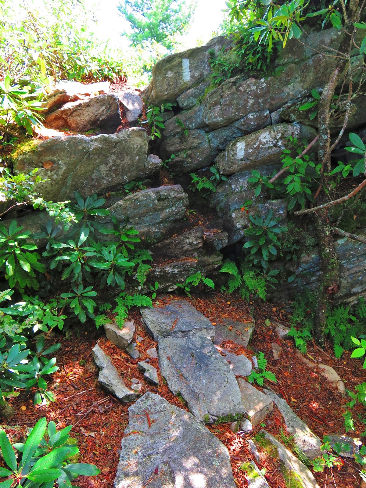
| The start of the blue blaze... |
 |
| ...past the ruins of the old shelter... |
 |
| ...on the down... |
 |
| ...to the AT. |
 |
| The junction to.... |
 |
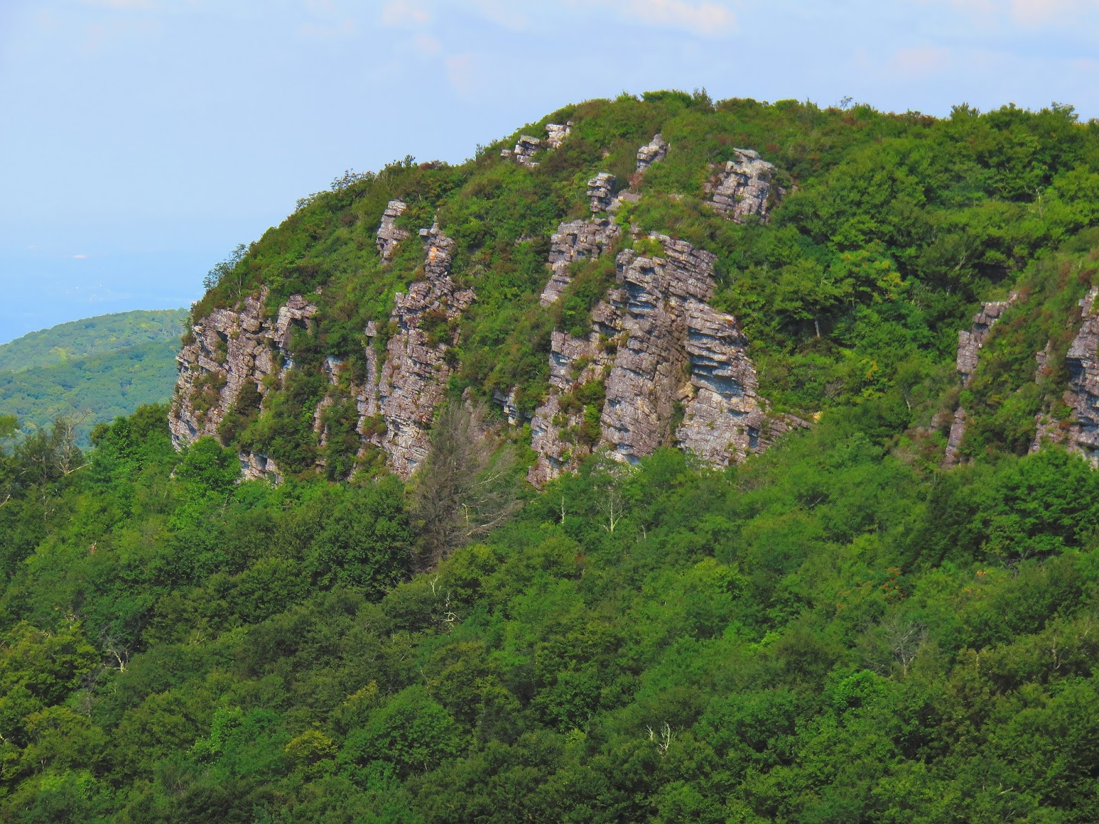
| ...White Rock Cliffs... |
 |
| ...is always a winner. |
 |
| AT carving. |
 |
| One of my favorite trees. |
 |
| When I got to the junction with the Jerry Miller Trail here is what I found... |
 |
| ...here is what it looked like in May. Because of people, we can't have nice things. |
 |
| In Bearwallow Gap I go right. |
 |
| Heading up... |
 |
| ...to Big Firescald Knob. |
 |
| The AT & Camp Creek Bald in High Summer. |
 |
| Big Butt & Gravel Knob. |
 |
| The plaque at Howard's Rock... |
 |
| ...it's story... |
 |
| ...it's vista... |
 |
| ...& vista of Greeneville. |
Once on Big Firescald Knob, I headed northbound on the AT which first takes me past Howard's Rock and a number of other overlooks before heading off the ridgeline. I had come up this way back in October and it just as rugged going down than coming up. There are rock scrambles, narrow rocky paths, a fat man squeeze and some really muddy spots before the trail moves into the woods and to the junction with the Bad Weather Trail in Fox Cabin Gap. From this gap, the AT heads down into Lick Log Gap and then back up Bald Mountain. It is then over Andrew Johnson Mountain before heading down to Chestnut Log Gap and Jerry's Cabin Shelter.
 |
| One of the rock scrambles... |
 |
| ...fat man squeeze... |
 |
| ...rocky blaze... |
 |
| ...another rock scramble... |
 |
| ...& narrow ridgeline trails... |
 |
| ...but wonderful vistas. |
 |
| Looking back at Big Firescald Knob & Camp Creek Bald. |
 |
| I called this muddy spot...the Pit. |
 |
| ...the trail heads down to... |
 |
| ...Fox Cabin Gap. |
 |
| Junction with the new Bee Tree Hollow Trail. |
 |
| Some nice forest that the AT passes through. |
 |
| Widowmaker. |
 |
| Campsite. |
 |
| Junction with the Round Knob Trail. |
 |
| At heads straight. |
 |
| Nice! |
 |
| Cool tree on Andrew Johnson Mountain... |
 |
| ...& Greeneville from it. |
 |
| That is another cool tree. |
 |
| Junction with the Fork Ridge Trail. |
 |
| I made it to Jerry's Cabin. |
Built in 1968 by the US Forest Service it had been one of the shelters I had wanted to visit. While heard it might have seen better days it was pretty cool. Like I said above it was here where I decided to turn back. I did stay for a few minutes and talk to some section hikers. The trip back was like the trip out, but I had a decision to make at the junction back at Fox Cabin Gap. That was whether to take the Bad Weather Trail or go back up over Big Firescald Knob.
 |
| The shelter sleeps six & has a fireplace. |
 |
| It has a shelter sign... |
 |
| ...& one for water and the Privy. |
 |
| ...I had to check out the Privy. |
 |
| At the cabin I found Jewelweed. |
 |
| Jerry's Cabin is where I turned around. |
 |
| On the trail... |
 |
| ...back. |
 |
| ? |
 |
| Back to Fox Cabin Gap. |
 |
| Left Or Right...? |
Last autumn I came the other way on the Bad Weather Trail and then went back over the ridgeline. It would have been the easier route, but because I cut the hike short I wanted to see the vistas of Big Firescald Knob. Let's just say I made the right choice.
 |
| Here are some pictures.... |
 |
| ...when I hiked the Bad Weather Trail in October. |
 |
| Greeneville from the Bad Weather Trail. |
 |
| Here is where the Bad Weather enters Fox Cabin Gap. |
 |
| On this day I went left & headed south on the AT. |
 |
| One of the vistas heading up... |
 |
| ...& over... |
 |
| ...to Big Firescald Knob. |
 |
| Back at Howard's Rock... |
 |
| ...looking down into Phillips Hollow. |
 |
| A last look into North Carolina... |
 |
| ...before heading back toward Camp Creek Bald... |
 |
| ...& Blackstack Cliffs. |
On the way back I had to stop at Blackstack Cliffs I now know to climb down to the cliffs it is easy to see why it is popular. I just hope they put a new sign up soon.
 |
| Headed down... |
 |
| ...to... |
 |
| ...Bearwallow Gap. |
 |
| It is not far from the AT carving... |
 |
| ...to the Blackstack Cliffs junction (they still haven't fixed the sign. |
 |
| Looking over at Big Firescald Knob |
 |
| Blackstack Cliffs U.S.Geological Marker. |
 |
| Vista at Blackstack Cliffs... |
 |
| ...looking toward Greeneville. |
 |
| Nice... |
 |
| The blue blaze back to... |
 |
| ...Jones Meadow & a view of where I was just at. |
I finished the day by hiking up to the Camp Creek Bald Fire Tower. I was on the fence about going, but a couple who were coming down the access road said a rattlesnake was stretched out across it. You know I had to see it, but to my disappointment, it was gone.
 |
| One of the towers. |
 |
| The road up to Camp Creek Bald is lined with... |
 |
| ...Jewelweed (Pale Touch-Me-Nots). |
 |
| The old fire tower... |
 |
| ...& the vista from the first level. |
 |
| Another of the towers on the Bald. |
 |
| The Green Hornet awaits at Jones Meadow. |
While I might have failed in my mission to Big Butt hiking on the Bald Mountains above Greeneville is never a failure. It also gives me a future hike from Round Knob (which I have wanted to visit) to the AT and then Big Butt.