Being from East Tennessee I sometimes take for granted
what a special place the Great Smoky Mountains National Park (GSMNP) is. But, it is America’s
most visited national park so such a remarkable place should of course have its
own Day Hike Series. The first installment of this series will be at one of my
favorite places the area of Clingmans Dome.
A course Clingmans Dome is not only the loftiest peak in the Smokies and
Tennessee it is also the highest spot on the Appalachian Trail (AT) and is the western
terminus of the North Carolina’s Mountain to Sea Trail (MST), that is a lot for one mountain. What is surprising that
all of the times that I visited the park growing up I never did go to the top of
the Smokies at Clingmans Dome. So, in June of 2013 I finally made the trip up,
and then did it again last summer.
Newfound Gap circa 1986.
You will find both AT & MST trails at Clingmans Dome.
Here are some facts about the mountain, it is named after Thomas Lanier Clingman, a U.S.Senator from North Carolina and a Confederate General during the Civil War.
After the war he surveys the mountains in what is now the National Park. Arnold Guyot named the mountain after Clingman in part due to a dispute Clingman had
with Elisha Mitchell on which mountain was taller, Black Dome, which Mitchell
said was the highest and Smoky Dome which Clingman championed. In the end,
Mitchell was right and Black Dome would take his name and become Mount Mitchell
while Smoky Dome is now named for Clingman.
Once called Black Dome...
...now Mt. Mitchell & taller than "Smoky Dome by 40 feet.
To get to the Dome, the first thing is a seven mile drive from Newfound Gap up
the apt named Clingmans Dome Road. This seasonal route usually opens in early
April and closes around the first of December. In winter, the road is a popular
place with cross-country skiers, because the mountain gets on average 79 inches of snow (surprisingly March has the most average snowfall with 26 inches). On the way up there are couple of places to
pull off, my favorite is not far up at Indian Gap. Here is another access point
for the AT as the trail runs parallel with the road from the Dome to Newfound
Gap.
Newfound Gap.
Sign points the way.
What it looks in winter (that why they close the road) (Photo SkiAnything.com)...
...open on our visit in June, 2014.
Stopped at Indian Gap...
...a number of trails cross here including the AT.
I hiked...
...a little of...
...the AT.
White blaze at Indian Gap.
First look of the tower at Clingmans Dome.
So, once you drive up you will find a large parking which
can be described as ample, but it can fill up fast in the summer. It is easy to see why just by the vista at the
parking area. This west to south facing panorama affords views of Mount Sterling, Cheoah Bald, Gregory Bald, Andrews Bald and Fontana Lake. Funny, the views when we got here the last two years couldn't have been different. In 2013 it was partly cloudy, but mostly clear. However, last year we were greeted with fog as we entered the park and while it lifted at Clingmans Dome out toward Fontana Lake we got to see first hand why these are called the Smoky Mountains. Anyway, this view
is an incredible warm-up for what awaits at the top of Clingmans Dome.
Cloudless view from the parking area in 2013...
...& 2014.
That is why they call them the Smoky Mountains.
June, 2013.
June, 2014.
More of the beauty of the Smokies.
Spot with no clouds...
...& with a year later.
Looks like a sea of clouds.
Vista here is amazing without...
...or with clouds.
Parking area panorama.
There are a couple ways to the summit and no there is not a shuttle to the top like Brasstown Bald. No, the easiest way up is the half-mile
paved Clingmans Dome Trail. While it is a paved path it is still pretty steep
and is not really wheelchair accessible, but one could get up here. Right at the start of the trail up on
the left is the Clingmans Dome Visitor Center. It is a nice little visitor
center which has snacks and drinks for sale and an assortment of souvenirs.
There are Rangers there to answer questions and you can even get you National Parks or AT Passports stamped here. But remember there are no bathrooms here
those are the vault toilets at the parking area. Across the trail to the left is an overlook which gives another west-to-south view. Also one gets a good look at the Dome and Mount Buckley.
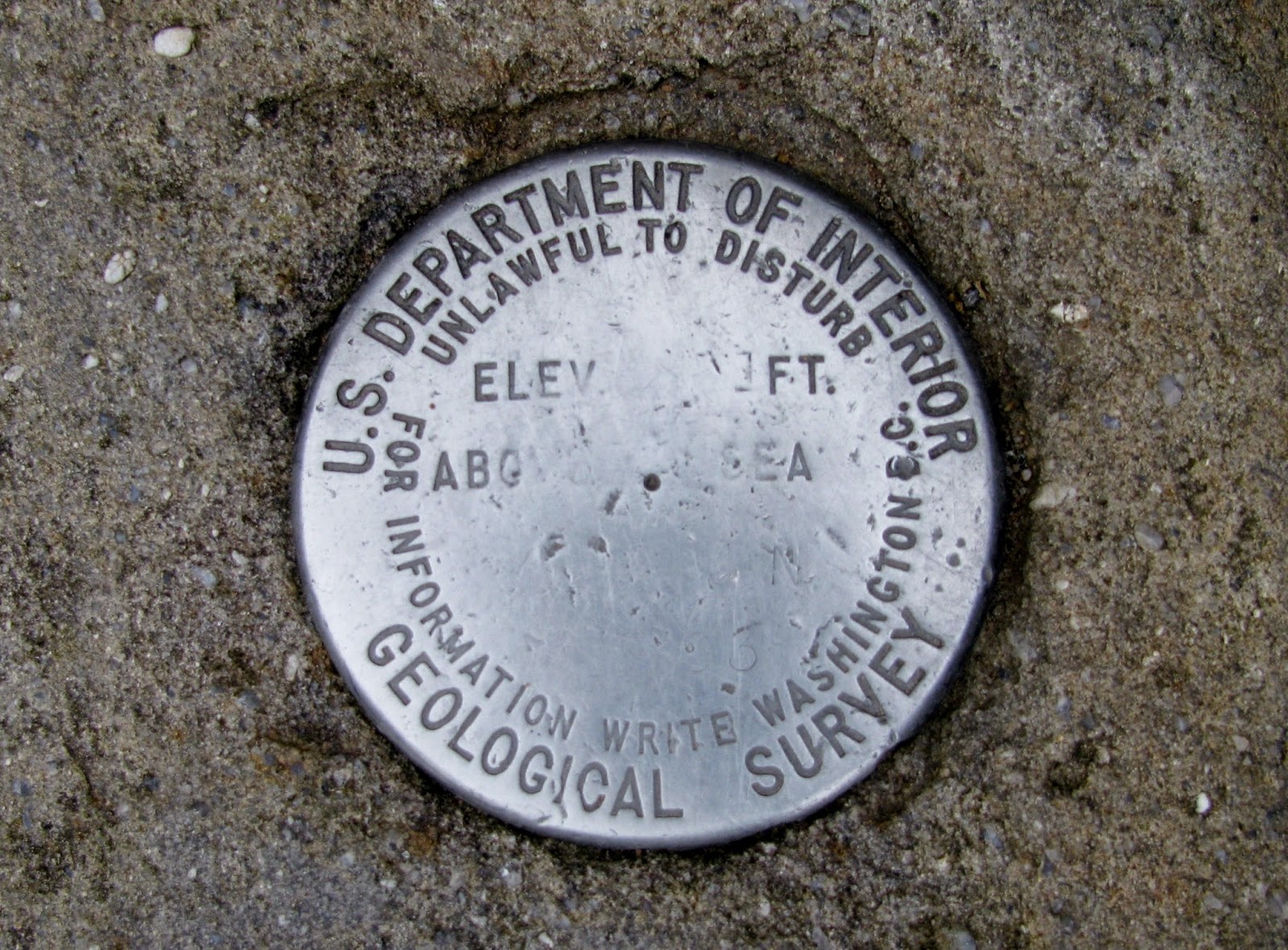
Near the trailhead an information board...
...geological marker...
...& rock field...
...people like to climb, even Wood Boogers.
Start of the paved Clingmans Dome Trail.
Visitor center, but no bathrooms...
...there back at the parking area.
Clingmans Dome towers over the overlook...
...across from the visitor center with this vista.
Looking back to torward...
...parking area.
While paved the trail is steep.
You are about halfway at this sign.
Like I said above the trail up is rather steep, so being
paved may actually be a negative. The trail goes up and then right and it is
not long before you get the first view of the objective, the Clingmans Dome
Observation Tower. This 45-foot tower was built in 1959, replacing the old 40-foot
wooden structure built in the 1930’s by the Civilian Conservation Corp (CCC), which
was dismantled in 1950. This new tower was part of the “Mission 66” program to
upgrade National Park facilities after World War II.
Drawing of the old tower...
...& the modern one.
The design of the tower
can best be described as modern, which was in line with the Mission 66
construction style, with an emphasis on simple design. At the base is a small stone patio which leads to the ramp that
circle up the tower. Architect Hubert Bob wanted a tower while sturdy and long
lasting would have minimal impact on the mountain. Because of the ramp’s design,
with no steps, it is wheelchair accessible (that is if you can get to the top of the ramp or mountain). The tower was added to the National Register of Historic Places in 2012.
The observation tower.
Stone patio.
View under the tower ramp.
The ramp to the round observation deck.
Unfortunately, the tower is not what has impacted the summit, that is a little invader called the Balsam Woolly Adelgid. It is the cousin of
the Hemlock Woolly Adelgid which has devastated Hemlock trees in the southeast. The
balsam variety is an invasive pest from Europe and has infested Fraser Fir
trees, which occur naturally only in the southern Appalachian Mountains, and these
trees have no defense against the adelgid. The evidence of their deadly work
can be plainly seen at the summit of Clingmans Dome and on other peaks in the
Smokies.
The tower and a dead tree.
One of the dying Fraser Fir...
...& sadly some dead ones.
The observation deck itself is 28-feet in diameter. On a
summer day it can get a bit crowded, but when you see the 360 degree panoramic
view, and on good days vistas of 100 miles, you know why. To the south one can see
Andrews Bald, Fontana Lake and the Snowbird Mountains. East are the high peaks
of the Black Mountains including the two summits higher than Clingmans
Dome, Mount Mitchell and Mount Craig. North are some of the iconic peaks of the Smokies
including Mount LeConte and Mount Guyot. In the distance Pigeon Forge and
Gatlinburg is visible. More Smokies peaks can be see looking west including one
in North Carolina, Gregory Bald, and two in Tennessee, Thunderhead Mountain and
Rocky Top.
As you see it gets crowded on the observation tower.
Wood Booger spotted!
Northern View...
...& panorama.
Eastern view...
...& panorama.
Southern view...
...& panorama.
Western view...
...& panorama.
Mount LeConte.
Pigeon Forge & Gatlinburg.
Newfound Gap & in the distance Mt. Guyot.
Just over Mt. Buckley are Gregory Bald (L), Thunderhead Mtn & Rocky Top (R)
Speaking of the state-line, while the parking area sets in
North Carolina and most of the observation tower is in Tennessee the actual
border cuts through the round viewing area. It shouldn’t be a surprise since
Clingmans Dome is the high point of the AT and from the Smokies to the Roans the
AT shares the state-line with the Tar Heel and Volunteer states.
When taking this photo I am in both Tennessee & North Carolina...
From the tower
it is just a right turn down from a sign which points the way to the AT and MST.
Because the AT runs so close to the Clingmans Dome Trail it can be used as a
number of loops. The first time I was here in 2013 I hiked back down,
south, on the AT because it runs parallel
to the tower trail and then used the last junction before the AT moves
awayto connect back to the paved trail
and then to the parking area.
The short trail from the summit to...
...the AT...
...& the western terminus of the MST.
AT & MST share some trail.
The high point of the AT.
I went about 2/10 of a mile
....before heading back.
AT near the summit.
More of the summer trail...
...at 6,000 feet.
White blaze.
Here is the junction where you can start the loop on the AT to the Bypass Trail.
However, last June I past this junction and continued on the
AT for another three-tenths of a mile to the Clingmans Dome Bypass Trail at Mount
Buckley. Before getting to this junction I must mention that there are two
outcrops with stunning northwest views, which includes Mount LeConte and the
best part no crowds!Anyway, the Bypass
heads left and is a half-mile rocky trail that leads to a junction and going left
completes the loop to the parking area. The Bypass Trail can be used to get to the summit, but the Clingmans Dome Trail is shorter, but not as scenic. Back to that trail junction, if one goes straight you take the Forney Ridge Trail.
This brings me to the second part of this GSMNP Day Hikes blog and that is the
hike out to Andrews Bald.
Headed south on the AT...
Some more of the trail.
Looking back toward Clingmans Dome.
Found this short side trail...
...to this vista (it was nice because there was no one else there)!
Mount LeConte in the clouds.
There was a 2nd vista just south of the other one.
That in the distance is the parking area...
...where I am headed.
The junction with the Bypass Trail.
I am taking the Bypass Trail.
Headed down.
Tunnel.
The Bypass Trail doesn't see as much work as the AT...
... & is a little rugged.
Here is where it meets the Forney Ridge Trail...
...you can see the work they have done on it...
On our visit last June this is also where we started the day.
The journey to Andrews Bald takes that straight path on the
Forney Ridge Trail that I mentioned above. From here it is 1.7 miles out to one of the more
popular spots in the park. The trail here is really nice, but it should be as
there was a major rehabilitation of this path completed in 2012. From what I
read the trail was rough and when it rained it was muddy, sloppy and dangerous
(I say it was similar to the condition of the Bypass Trail). So work crews and
volunteers shoveled stone, moved rock and installed eight hundred native stone
steps and built another 150 timber ones. They also put in some raised section
of trail in some of the flat sections, which I guess are prone to flooding. Let me say the work they did
has made this one of the better trails I have hiked…anywhere. For more on the work done check out this link.
This is the trail head to Andrews Bald.
To start the day we went left.
They did a lot of work...
...rehabilitate this trail...
...& they did a wonderful job...
...these pictures...
...show the hard work done.
Where we are headed, Andrews Bald.
In spots it went from trail...
...these raised sections...
...Deb liked it.
While Andrews Bald is the highest grassy bald in the Smokies
(5,680 feet) it is actually at a lower elevation than the parking area by over
600 feet. So, most of the first third of the trail is downhill before reaching
the junction with the Forney Creek Trail, this path heads right on its way down to
Fontana Dam. The trail then heads slightly uphill on its way to Andrews Bald.
It was a round here that we spotted some nice bear tracks on the trail (these
will factor in later).The path finally
leaves the woods on to the open grassy bald.
The junction of the Forney Ridge & Creek Trails.
Now headed up toward Andrews Bald.
On the trail we spotted...
...bear tracks.
The trail winds out...
...to the Andrews Bald.
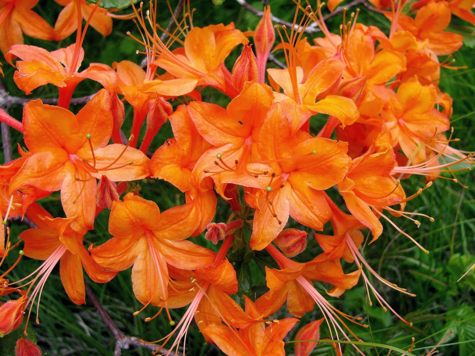
On the day we were there in June was just the right time
because we were greeted by a display of color from the blooming Catawba
Rhododendron and Flaming Azaleas. While both were spectacular, the azaleas were
doubly so. I have to say that they were something special. It said that this
display is only rivaled in the park by the ones at Gregory Bald.
Flaming Azaleas...
...were amazing.
Here was more...
...Flaming Azaleas.
Bubble bees like them...
...& Catawba Rhododendrons.
Another bee.
Besides these beautiful Rhododendrons...
...there was some Mountain Laurel.
There are 20
balds in the park, but because animals no longer graze on them the forest is encroaching
on most of these. However, Andrews and Gregory Balds have been designated as an
experimental research zone, whereby the National Park Service will preserve the
areas as grassy balds.
Some wooden plank trail on the bald.
One of two balds that will be kept clear...
...the Wood Booger...
...& Deb like.
Andrews Bald had mountain vistas & wildflowers...nice!
Headed back on the Forney Ridge Trail.
This sign has seen better days.
After enjoying the beauty of this bald Deb and I headed
back. The backward nature of the trail, the starting point is higher than the
destination, made the hike back a little tougher and I don't think Deb was its biggest fan, but she made it just
fine. I have to say this is a wonderful hike on a great trail and is not to long so it is a must see spot.
Trail back.
At the junction.
It was steeper going back...
...which Deb didn't like.
Steps.
Where we were...
...where we are headed.
One more look at the nice trail work.
These were on a rock...cool.
Deb in the home stretch...
...to the parking area.
On our visit last June the Andrews Bald hike was the first
one we did. Deb didn’t accompany me on the Clingmans Dome loop that I did later. So,
after I returned to the parking area I would have a surprise, something I have waited years to see (this part of the story I chronicled last
year here). To surmise what happen a guy asks what that was down the hill from
the parking area and low and behold it was a Black Bear with a trash can. Yes,
this was the first bear in the wild that I had ever seen so it was perfect
ending to this day at Clingmans Dome.
This Black Bear was eating...
...this trash can.
As he ate...
...we watched.
For a great day of hiking with wildflowers, spectacular view
and maybe you might even spot a bear you can’t go wrong at Clingmans Dome, the
highest spot in the Smoky Mountains!
Hikes at Clingmans Dome
Pete
Wood Booger
Clingmans Dome Trail
My Take:
For Difficulty – 2 Stars
For Trail Conditions – 5 Stars
For Views – 5 Stars
For Solitude – 1 Stars
Overall – This trail, while not long, is steep and it is basically a road bed hike. It wide and paved so the condition is excellent. The view at the top is one of the best in the Smokies and the southeast...period. However, because of this wonderful vista and easy access it is crowded when the road to the top is open. In winter, the crowds will be smaller, but you have to hike 14 miles, out and back, to enjoy it.
Pete’s Take :
For Difficulty – 1 ½ Rabbits Paws
For Trail Conditions – 5 Rabbits Paws
For Views – 5 Rabbits Paws
For Solitude – 0 Rabbits Paws
Overall – I am not a big fan of paved trails and this one is no different. It is obvious that it is in great condition and the views are wonderful, however here comes the but! I can't stand the crowds, especially the snot nosed noisy brats! If it was me I would come in winter because it would have no kids!
AT-Bypass Loop
My Take:
For Difficulty – 2 Stars AT.; 2 ½ Bypass Trail
For Trail Conditions – 4 Stars AT.; 2 ½ Bypass Trail
For Views – 4 ½ Stars AT.; 2 Bypass Trail
For Solitude – 3 ½ Stars AT.; 4 Bypass Trail
Overall – This short part of the AT is across a ridge-line, so it isn't too difficult. The Bypass Trail is a little tougher because it is rocker than the AT. The Bypass could use some maintenance, it is clear to see if you hike the Forney Ridge Trail. There are two really nice vistas on the AT and because of far less people here you might even get it all to yourself. I only saw two other hikers on the AT and Bypass Trails.
Pete’s Take :
For Difficulty – 1 Rabbits Paws AT; 1 ½ Rabbits Paws Bypass Trail
Overall – Well, after the horror of the Clingmans Dome summit it was great to be back on the AT and NO KIDS! I didn't find this loop too challenging, but it was great to set at a vista and just have the view...nice!
Andrews Bald
My Take:
For Difficulty – 3 Stars
For Trail Conditions – 5 Stars
For Views – 5 Stars
For Solitude – 2 Stars
Overall – The have done a lot of work on the Forney Ridge Trail out to Andrews Bald and it shows. Because of the work done the trail is probably less difficult than it once was. As for views, from the vista of the bald to the breathtaking Rhododendrons and Flaming Azaleas it makes this a must see in June, but I think it would be great anytime. Because of this the trail see a lot of traffic, but the bald is large so the people spread out.
Pete’s Take :
For Difficulty – 2 ½ Rabbits Paws
For Trail Conditions – 5 Rabbits Paws
For Views – 5 Rabbits Paws
For Solitude – 1 ½ Rabbits Paws
Overall – OK, I must say that they did a great job on revamping this trail. However, I would have like to hiked the old trail because it sounds like more of a challenge (the Lummox would have whined like a little baby). I will have to say the Flaming Azaleas were impressive, but there were a few too many people for my taste (nothing like Clingmans Dome). Most were hikers so I will cut them a little slack.