There are many great places in Southwest Virginia, but for this Wood Booger, the "Crown Jewel" is the Highlands of Virginia. So, I couldn't think of a better place to go out for not two, but three days than on highlands. You might ask "weren't you there just over a month ago at the beginning of August?" It was on that trip that I came up with the idea for this one. I decided on three days because it is a long drive and I just wanted to.
I was originally going to go Sunday-Monday-Tuesday, but I got in a disagreement with Pete and I busted up my hand. I thought I might have broken it, which would have derailed my trip. However, it was just badly bruised, but since the weather forecast allowed (I didn't want to sleep in the rain again) I decided to move back my start to Monday and finish on Wednesday. I had no problem moving my backpack overnight parking back a day. On Monday, it was off to Grayson Highlands State Park.
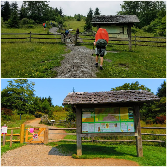
I was greeted by clear skies on my drive towards Mount Rogers, but as I started the climb towards Elk Garden (I didn't go through Dacamus) there were clouds on top of Mount Rogers. Still, it wasn't raining and it would burn off. Once I arrived at Grayson Highlands I got ready and headed up the Massie Gap Trail, the one on the left at the overnight lot.


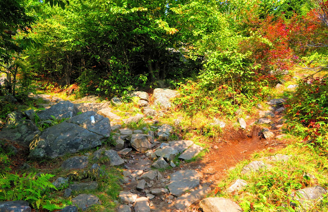
The only time I had been this way to Massie Gap was in 2017 and the weather wasn't good then. Back in mid-summer, I went up the Appalachian Spur Trail. At the gate, the trail from the day hiking parking area merges with the trail I was on becomes the Rhododendron Trail. There is a lot of good views and about halfway I ran into my first pony. For those unfamiliar Grayson Highlands and the Mount Rogers National Recreation Area (NRA) is home to wild ponies. It wasn't too long before reaching the Appalachian Trail (AT) at Massie Gap. This is a popular route to Mount Rogers on the AT and I would follow it for the rest of the day. It is also the same path I followed back at the last of July.


The southbound section to the western border of the state park has wonderful vistas, including where I was headed...up on Wilson Ridge. At the gate to enter the Mount Rogers NRA there was, as on my last visit, ponies! It was three including a mom and colt. Unlike my last trip here, where I went right to the Spring Trail I continued straight on the AT, but first I took a break at a great campsite here.
It is a half-mile up to the saddle where several trails converge. This is the spot I hiked up to and watched the last sunset of July. On this day it was on up Wilson Ridge. On this stretch, I got to navigate the Fatman Squeeze. This is a narrow passage between the cliff face and a boulder. You can go around it, but what is the fun in that.


At the top is the high-point of Wilson Ridge and then drops slightly out to another series of outcrops. above Rhododendron Gap. I thought about staying up here, but I didn't want to camp in the open, so I continued down to the gap. Here there are a lot of connecting trails. The orange-blazed Crest Trail and blue-blazed Pine Mountain Trail, which is the former route of the AT, cut through here. It wasn't long before a reached a bear box sign which meant I had reached my campsite. As I said I wanted tree cover, but I had planned these two nights around camping near bear boxes scattered around the Mount Rogers NRA. This means I didn't have to carry my heavy bear barrel, which I had done on all previous outings here.


It was here that I left my big backpack behind in the bear box and set out on one of the reasons for coming here...to finish the AT between Massie Gap and Thomas Knob Shelter. Getting to the campsite finished more than half of this, but I still had 0.8 miles left. I had been to Thomas Knob Shelter in 2017 and 2018, but from Elk Garden, but never from Grayson Highlands. I will admit it felt harder than it was because I was tired. I decided to get my water here. There is water near where I was camping, but it was easier to gather with the water bg I use because it wasn't piped, but Thomas Knob is.


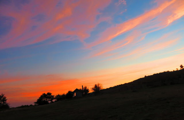
Once back it was time to set up camp. Even though there were three other small groups here because this was such a large camping area we were pretty spread out. I got what I would call the main camping area. I got to pitch under some spruce trees near my fire ring. Yes, fires are okay here as the Lewis Fork Wilderness Area was on the other side of the AT where I was camped. Since I was not far from where I thought about camping I headed up there after dinner for sunset. Like at the start of my day there was a cloud hanging over Mount Rogers. While the sunset into the cloud was still incredible!
Just like the previous evening, I headed up to the ridge above Rhodondron Gap to watch the day begin from what I am calling Sunrise Rock. There was fog in the valley, clouds the sun rose through and some on top of Mount Rogers...again. After packing up it was time to head towards my next campsite, the Scales.


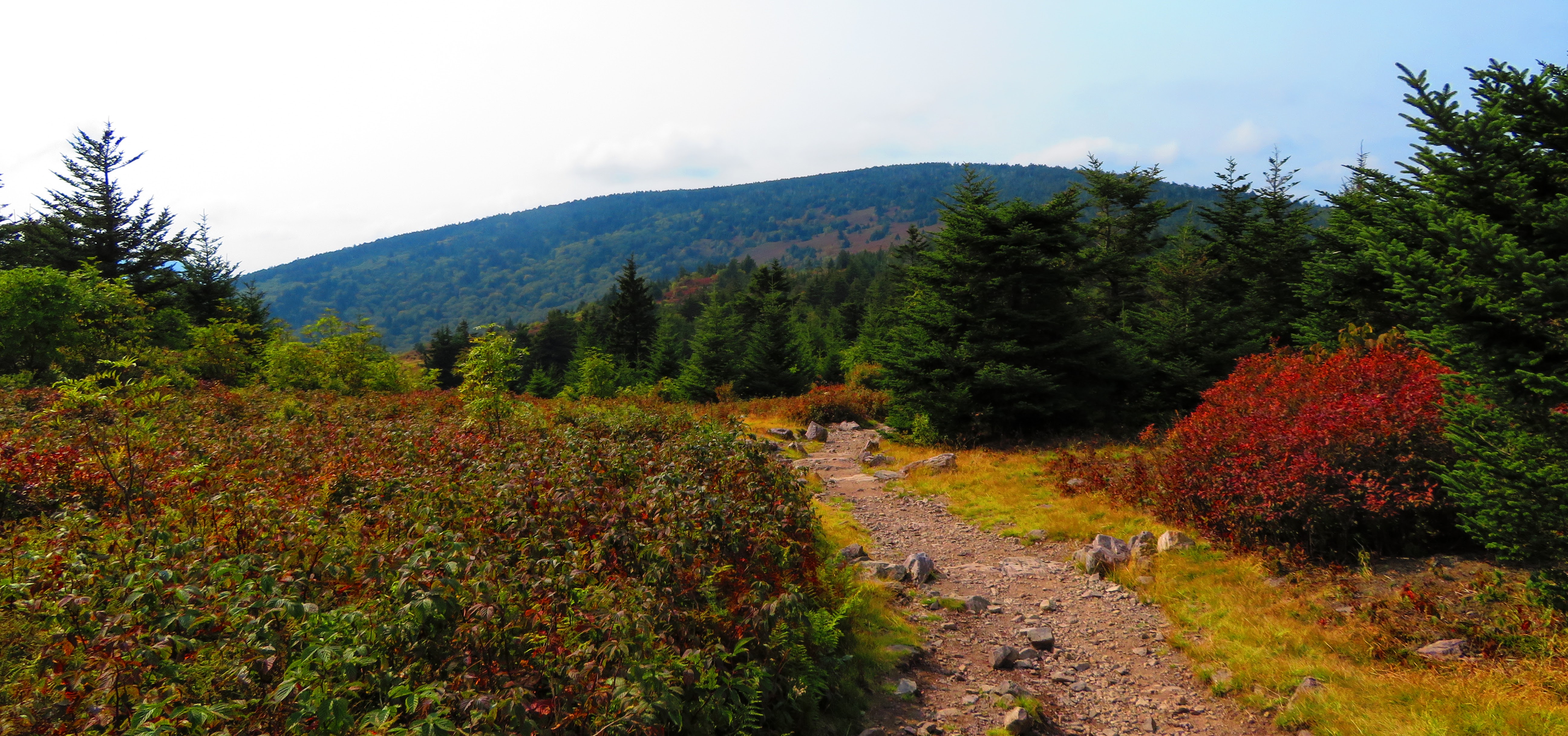
There were two trails I could take. The first is the Pine Mountain Trail, which as I said earlier in the former path of the AT. But I chose the second route, the Crest Trail, which is the one I chose. It has more open views and it was about a half-mile shorter. There were views of where I came from, where I am going, and places in-between. It isn't all views as the Crest Trail does traverse some woods including at the halfway point which is a junction with the Lewis Fork Trail, a great horse camp, and water. On my way, I passed a couple of groups of teenage kids. There were a number of groups out that I passed all three days. I had passed some the day before also and they were all From here it is mostly downhill into the Scales.


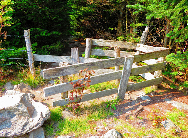
The last time I was at the Scales was on my first visit to the Highlands in 2016. While much hadn't changed as there is plenty of room, the privy and fence that had was there now was a bear box. I decided to camp near the fence and under a small crabapple tree. I have to say the wooden fence is a welcome sight. I meant the ponies earlier, but they're not alone in the NRA. Also, cattle are used to keep invasive species down. While they are all cute in their own way there is a downside. If you have camped here you know that getting around your campsite can be like moving through a midfield of scat. Ponies especially seem to crap in the flat spots that are best for tenting. So, not having to worry about this at camp was a plus.


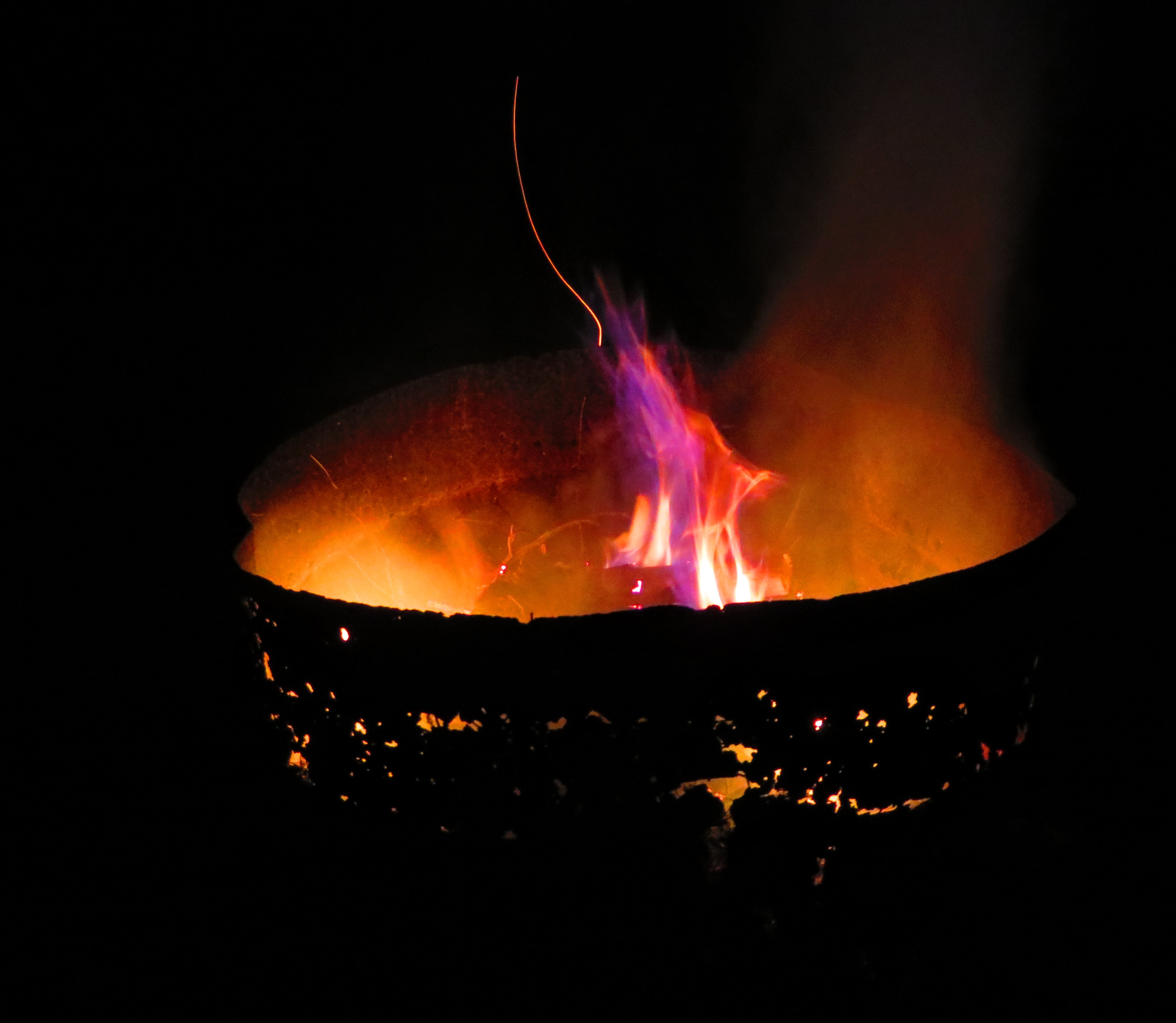
One of the minuses was the water situation. I knew there was a spring close to the Scales. But this box under plywood has long since been useful. There is even a sign on the information kiosk that says better water is up the Scales trail, which I had read about on Guthook (more later). So, as I went looking for water the first spot had seen plenty of pony and cow traffic and that's not good. I went back up the branch looking for a place to fill my water blatter. This first place wasn't good as my water was the color of piss, so I headed a little further down. Just at a gate, I found a spot that was like the spot on the Crest Trail. The difference was the fence around it had collapsed, but I found a spot right near the mouth of the spring with good water. I would later be told there was a cattle trough just a little further down, I am glad I got my water where I did. That evening I built a nice fire and just relaxed.


I decided to get an early start because I am slow I had to get up a little earlier than most. I did take time to watch the color of the sky as the sun rose. It was time to say goodbye to the Scales, but I started down the trail of the same name. This trail is mostly flat with plenty of woods and views. It even went downhill near the junction with the AT.


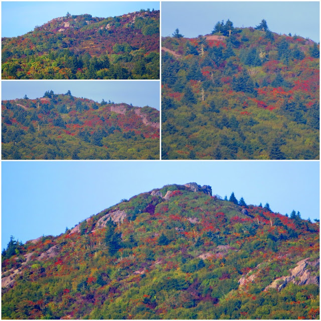


I will admit the Scales Trail did give me a false sense of my abilities as I headed up the AT to finish the last piece that connects Elk Garden to the Scales. One of the highlights was the beautiful fall colors that were starting to shine. Another highlight was finally visiting the Wise Shelter. But first, you pass a great campsite, the last one before entering the state park. There is great water and a bear box. After crossing a footbridge and The thing about Wise Shelter is it is just inside Grayson Highlands State Park which means no tenting around the shelter. Unlike Thomas Knob which sleeps 16, Wise Shelter is a single-level shelter so it sleeps eight. There is also a bear box and a privy nearby.


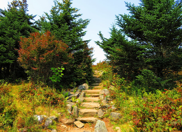
Then, I go by what I am calling the AT Blarney Stone. It is here that the trail gets steep, not steep but that steady kind that just drains one's legs. It does level out once you reach the stile and walk up along the fence line. After about two-tenths of a mile, you will pass through another stile and cross the creek. The again heads uphill, but it is steeper this time. This is over a half-mile up and I will admit this spot got the best of me. But you know you are almost to the junction with the Appalachian Spur Trail when you start to enter scrub trees. Finally, I saw the sign for the spur trail and I discovered I wasn't alone. A pony was there to greet me.
I took a break here because I still had 0.8 miles left to the car. While it was mostly downhill, I was spent. It seemed it took forever to reach the gate where the path crosses the Virginia Highlands Horse Trail. This is the home stretch to the overnight lot and I was thankful it was...I was pooped.
After that, I went to the Virgil J. Cox Visitor Center. I had been there before, but I really hadn't got to look around, especially the like museum there. It was a great three days out in one of Virginia's greatest places.