What makes a great AT Day Hike? Easy access, good trail,
great vistas and that little bit of special, well in Georgia there is one place
on the AT that fits the bill. This place is quite possible the best and it may
be single greatest place in Georgia, Blood Mountain.
 |
| Blood Mountain. |
A course I am not the
only person who thinks this, it is the single most popular hiking spot on the
AT in the Peach State. There are a number of reasons for that; the most obvious
is it is the highest point on the AT in Georgia at 4,461 feet. It’s history, by
most accounts the mountain got its name from a battle fought between the
Cherokees and the Creeks. Legend has it that the mountain ran red with blood. A
course Blood also has some of the best
360 degree vistas in the southeast, these are some of the many reasons for its
popularity, but let’s not get ahead of ourselves.
 |
| The historical marker at Neel Gap. |
The first thing I mention is easy access being a key to a
great day hike and Blood Mountain has that. However, there is something that
needs to be remembered when day hiking here. You can’t park at the Mountain Crossing at Walasi-Yi Center. For those who don’t know the northbound AT as it
comes off of Blood Mountain crosses US 19 at Neel Gap (the official name for
the gap, the old name is Walasi-Yi, which means frog place in Cherokee). One of
the unique things here is that the AT literally cuts through the outfitters
store and hostel, Mountain Crossing.
 |
| Mountain Crossing. |
The first building on the site dates for the turn of the 20th
Century built by a logging company. After that it was used as tea room and
lodging house. In the 1930’s the Civilian Conservation Corps (CCC) built the
main stone building that became the Walasi-Yi Inn. Besides an inn it has been a
restaurant and gift shop. Today the outdoor outfitters, gift shop and hostel is
owned by the State of Georgia and leased to concessionaires.
 |
| George Noble Plaque. |
What makes it so unique is this is the only place where the
AT cuts through a building in its 2,200 mile journey. It makes a good start to
any day hike (or finish). There is a nice vista on the right side deck and a
number of historical markers, including the second George Noble plaque (the
first is at Springer Mountain and the third is at Unicoi Gap) and a great place
to pick up a souvenir or two.
 |
| Day Hikers beware! |
However, ample parking is available 0.3 miles west on US 19
at the Byron Reese Memorial, I will say it is a nice parking area. After you
pass the information kiosk, one of the signs you will notice is for the Blood Mountain
Wilderness Area. For those who don’t know a wilderness area is a land where human
activities are restricted to scientific study and non-mechanized recreation
(like hiking).
 |
| Parking at Byron Reese Memorial. |
To reach the AT from here one must hike up the Byron Reese Approach Trail. When I first hiked from here in April there was a creek crossing (and a
place to get water) near the start of the trail, however in October this stream
had all but dried up, so the water here is seasonal. This blue blazed trail (all AT approach
trails are blue blazed) travels seven-tenths of a mile to Flatrock Gap. The
trail itself has some elevation and a few switchbacks, but it is not too
challenging, my wife Deb handled it with no problems
It is at Flatrock Gap that one has a choice. The first is
the direct path up the AT to Blood Mountain. This route has a 1,800 foot elevation
gain . The second choice one can take is via the Freeman Trail to Bird Gap
and then take the AT north to the Blood Mountain summit. When I first hiked the
mountain back in April it was with Deb. Because of mileage, it is about three
miles round trip and the Freeman/AT loop is 4.4 miles, we decided to go up the
AT to Blood. Now I took the Freeman Trail route back in October, so I can make
a judgment on which way is best.
 |
| Entering Blood Mtn. Wilderness. |
Let’s start with the trail up the AT to Blood’s summit. If you have ever hiked in the North Georgia
 |
| Deb headed up stone stairs. |
Another place I would like to give the GATC some love is
blazing a spot on
 |
| Newly blazed. |
After the first tough climb the AT flattens out a bit were
it passes a nice view and you will also notice three boulders before the trail
heads up Blood’s famous steep rocky slopes. You have to imagine if you were a
SOBO (south bound thru-hiker) that this would not be a welcomed site since it
is one of the last true obstacles between someone and the finish-line at
Springer.
 |
| Deb doesn't look happy. |
 |
| Yonah Mountain. |
I know it was that way for Deb; going up the rock face almost
got the best of her. I probable didn’t help matters by telling her at each
steep rock slope “we are almost there.” I was told by one hiker that we met in
April that the difficulty is magnified in bad weather. He said one he was up
there once in an ice storm it is was almost impassible. One of the best vistas
on Blood Mountain is just below the summit.
One can see Yonah & Buzzard Mountains from here, it is one nice
view. This spot coming or going is a nice place to just sit and enjoy and is a
nice reward for the hike up.
Before I talk about the summit I mentioned there is a second
way to the top of Blood Mountain. Back at Flatrock gap instead of going right
and following the white blaze one goes straight on the blue
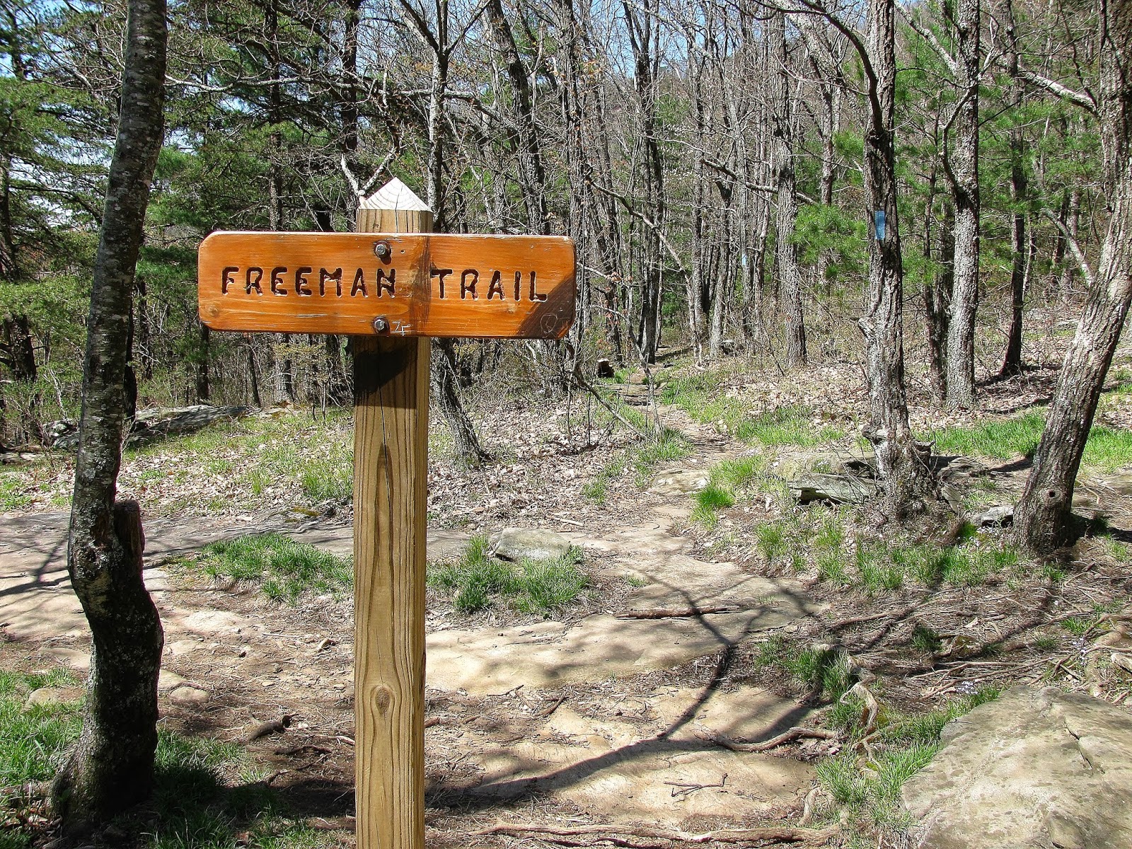 |
| The trailhead for the Freeman. |
At Bird Gap one goes right on the AT, if you go left a
couple a hundred yards you will find a side trail that goes half-mile to Woods
Hole Shelter. I would be remiss in not commenting on one of the nice (or not so
nice) features of Neel Gap and Blood Mountain…wind. On the day in October I went
hiking was the first really cold day of the fall. Actually it might not have
been half bad if not for the cold breeze. It was whipping when I got to Neel
Gap, but it wasn’t too bad on the south
 |
| AT at Bird Gap. |
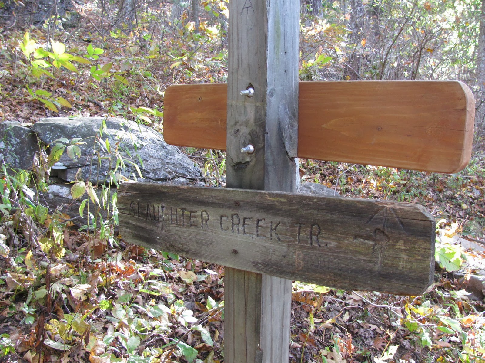
There is also a trail intersection a little over a mile from
Bird Gap at Slaughter Gap. The gap gets its name from nearby Slaughter Mountain
and both from the same battle that gave Blood its moniker. It can be slightly
confusing, depending on what book or map you depend on. First the book
Exploring the Appalachian Trail: Hikes in the Southern
 |
| Sign for Slaughter Gap Trail. |
junction, but does have the one for the Duncan Ridge Trail, but the
 |
| Duncan Ridge Trail junction. |
 |
| Which way too go? |
I really like Doris Grove’s book but the trails don’t
junction together and the actual trail sign on the AT says Slaughter Creek
Trail, not Lake Winfield Scott Trail. The Georgia-North Carolina AT Guide gets
it wrong and so does its map. The closest to getting it right is the National
Geographic map, because it gets the main trails right, but doesn’t show the
campsites. So what is it, the first trail junction you come to is the Slaughter
Creek Trail which goes 2.7 miles to Lake Winfield Scott. Then just up the trail
is the junction to the Duncan Ridge Trail (it is a 35 mile trail that
 |
| Camping ahead. |
Trail, which points right (AT south) and up. This could be one of the sources for the confusion this area seems to have. For thru-hikers or any other campers this spot has sites for eight tents. There is water at Slaughter Creek, but there is a campfire ban from the Slaughter Creek Trail sign to Neel Gap.
 |
| Southwest vista. |
Now meanwhile back on the AT, it is at this point that one
will encounter the only steep part on this section of the trail as you scale
the summit. However, the wind was still the roughest part of the climb. Even
though it is longer (about 1.5 miles) my advice is to take the extra time and
go to the summit of Blood Mountain via the Freeman.
This brings us to why one hikes to Blood Mountain, the
amazing summit. Unlike, some summits where there might be a small vista, at
Blood you’re taken back by how large the area is. There are a number of spots
to taken in incredible view. On the day I was there in October all sides was
awe inspiring but in one of the open spots one could see Sawnee Mountain and
just over the top of it the man-made peaks of Atlanta were
 |
| Sawnee Mtn. & Atlanta. |
However, the heart of the summit is the old shelter. When
one comes up the northbound AT you will pass the privy and then you see the
iconic shelter and that is when you know you have made it. The old shelter is one
of the most iconic on the entire AT. The two-room stone building was
constructed by the CCC (I sometimes wonder if anything would have ever have been
built without the CCC) in 1934. It would be refurbished by the GATC in 1981 and
National Register of Historic
Places . It has two rooms the front one has a stone floor and the second
has one of cement. It is a welcomed respite for hikers to spend the night or to
get out of a thunderstorm. But, be warned you may have to share the space
because the shelter is rumored to have a healthy mice population.
 |
| Blood Mtn. Shelter. |
Since we are on the subject of shelter, there are a number of
places to camp on the summit. Now remember there is no water source and there
is that pesky campfire band, but if you look around one will see plenty of fire
rings including one outside of the Blood Mountain Shelter. However, there is a
reason for the campfire ban you could say that the mountain is a victim of its
own beauty. As I said earlier, this is the most visited spot on the AT in
Georgia and So, the U.S. ForestService (USFS) put in the ban to allow overused areas a chance to return to its
natural state. Remember when on the summit the Leave No Trace policy is the
best policy and honor the no campfire ban.
 |
| Campfire at Blood Mtn. |
Anyway, while the shelter is one of the cool things you will
find near the summit, the view is the real star at the shelter area. To the
west one can look and see Vogel State Park and further out in the distance one
get a clear view of Georgia’s highest peak, Brasstown Bald. The observation
deck can clearly be seen and one can even make out the flat area of the parking
lot.
 |
| Brasstown Bald Observation Deck. |
While the west side vista is just over from the shelter
(which can be seen from Vogel Knob at the nearby state park), one has to climb
to get to the south facing view. There are a number of spots to climb up, but
once you are there it was more than worth the effort. The mountains any thru-hiker must traverse are
visible to the southwest including Big Cedar Mountain. It is
 |
| Brasstown Bald. |
The actually summit is just north of the shelter in a
clearing surround by pines & white oaks. While there is not much of a view,
which I would say is by the tree cover is nonexistent in summer but if you are
into geo-markers the one for Blood Mountain can be found here. I will admit I do like finding these.
 |
| U.S. Geological Marker. |
 |
| Blood Mtn. Summit. |
The hike down, while tricky in spots is not as tough as
coming up the same way. This is one place were NOBO (northbound AT hikers) have
an advantage. I know when going down in October I ran into a group and three in
the party where struggling up the southbound part of the AT. I would say when I
met them they were a quarter-mile from Flatrock Gap and they ask me “does it
get easier” and I could lie to them I had to tell them no. I know one thing Deb
definitely like the hike back down better than going up.
There are places easier to get to the top of, like Brasstown Bald or remote like Springer Mountain, but for my money Blood Mountain is
nearest to my heart, yes I love Blood Mountain. So, if you haven’t been I say
go for it. The mountain is a little rugged, but more than worth the effort.
Also, if you want different view of Blood head to Vogel State Park and check
out the shot of the mountain from across Lake Trahlyta, it is nice.
 |
| Blood Mountain. from Vogel. |