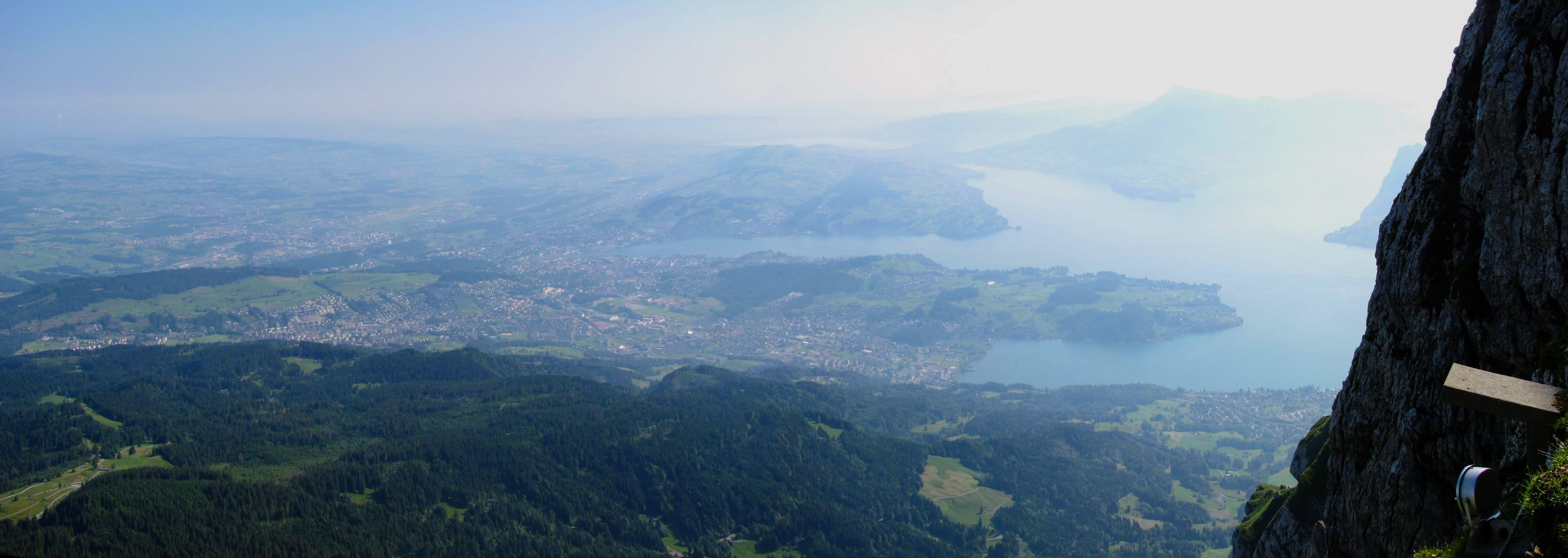
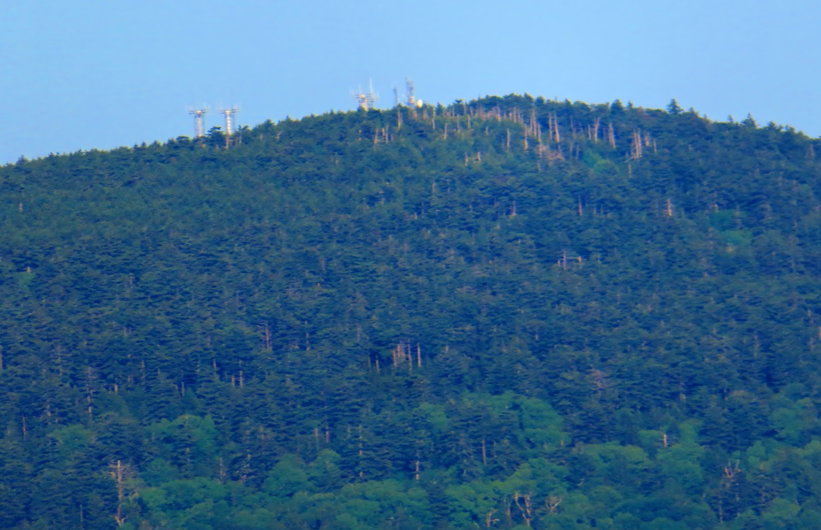
Since I am doing my
Swiss blog on my trip to Europe I am doing a special From....on
Mount Pilatus and
Lake Lucerne.
The mountain also is known just as
Pilatus is located above the city of
Lucerne. According to legend, the mountain got its name because Pontius Pilate is buried here. Also, Pilatus was once believed to be the home of dragons. I went up to the Mountain of Dragons in July of 2010. This is still the tallest mountain I have been to the top of. But there actually isn't one summit, but a number of peaks like Grandfather Mountain called Pilatus-Kulm. The tallest, Tomlishorn (6,983 ft.), I didn't get to go up because I didn't have time. However, I did get to what is the most accessible peak Esel at 6,949 ft. and across the way to Oberhaupt at 6,906 ft. In between is the spaceship-like Hotel Bellevue and since it is centrally located I have done measurement from and too here. This isn't the only accommodations there is also the Hotel Pilatus-Kulm.
Down below is Lake Lucerne and the city where it gets its name. Once I came down on my trip up to Pilatus I took a boat ride from Alpnachstad back to Lucerne. The lake is split up into nine different parts that have individual designations: Urnersee ("Lake of Uri"), Gersauer Becken ("Basin of Gersau"), Buochser Bucht ("Bay of Buochs"), Vitznauer Bucht ("Bay of Vitznau"), Alpnachersee ("Lake of Alpnach"), Stanser Trichter ("Funnel of Stans"), Küssnachtersee ("Lake of Küssnacht"), Chrütztrichter ("Cross Funnel") and Luzernersee ("Lake of Lucerne"). It is said that the lake is the inspiration of the cross on the Swiss Flag.It also has great views of Pilatus.
One thing, all pictures here are from July 16, 2020. So, here is Mount Pilatus and Lake Lucerne From....
Mount Pilatus From....
 |
Map
|
 |
| ....Pilatus-Kulm, Hotel Bellevue |
 |
....Pilatus-Kulm, Esel
|
 |
| ....Pilatus-Kulm, Esel Vista |
 |
| ....Pilatus-Kulm, Another view of Esel |
 |
| ....Pilatus-Kulm, Oberhaupt |
 |
| ....Pilatus-Kulm, Oberhaupt Vista |
 |
....Pilatus-Kulm Hotel
|
 |
| ....Pilatus-Kulm, Tomlishorn |
 |
| ....Pilatus-Kulm, Klimsenhorn from Oberhaupt |
 |
....Cog Train Station (.28 Miles)
|
 |
....Cog Train (0.5 Miles)
|
 |
....Pilatus Cable Car (0.7 Miles)
|
 |
| ....The Fräkmüntegg (0.9 Miles) |
 |
....Amaigen (0.95 Miles)
|
 |
....Pilatus Cable Car (1.3 Miles)
|
 |
| ....Pilatus-Bahn, Alpnachstad (2.0 Miles) |
 |
....Pilatus-Bahnen, Kriens (3.5 Miles)
|
 |
| ....Lake Lucern, Stanser Trichter (4.25 Miles) |
 |
....Astoria Hotel (5.32 Miles)
|
 |
| ....Kapellbrücke (5.58 Miles) |
 |
| ....Lake Lucerne, Chrütztrichter (5 6 Miles) |
 |
| ....Lake Lucerne, Chrütztrichter (5 7 Miles) |
 |
| ....Lake Lucerne, Luzernersee (5 8 Miles) |
 |
....Lake Lucerne, Luzernersee Near Lucerne (5 95 Miles)
|
....Lake Lucerne
 |
Map & Flag it inspired
|
 |
| ....Alpnachersee |
 |
| ....Stanser Trichter (Mt. Pilatus) |
 |
| ....Stanser Trichter (Bürgenstock) |
 |
| ....Chrütztrichter |
 |
| ....Luzernersee |
 |
| ....Kapellbrücke on the Reuss (0.1 Miles) |
 |
....The Reuss (0.2 Miles)
|
 |
| ....Alpnachstad (0.23 Miles) |
 |
| ....Amaigen (1.4 Miles) |
 |
....Pilatus Cable Car (2.4 Miles)
|
 |
| ....The Fräkmüntegg (2.9 Miles) |
 |
| ....Pilatus-Kulm, Esel (3.0 Miles) |
 |
| ....Pilatus-Kulm, Hotel Bellevue (3.1 Miles) |
 |
....Pilatus-Kulm, Oberhaupt (3.2 Miles)
|
 |
....Pilatus-Kulm, Esel of Lake & Lucerne (5.8 Miles)
|