Saturday, January 13, 2018

What Better Way To Kill Some Time Than Hiking At Warriors Path


On Tuesday I had some time between my appointments and my the Clinch Coalition meeting in Norton that evening, so what better way to spend my time than a hike at Warriors Path State Park.


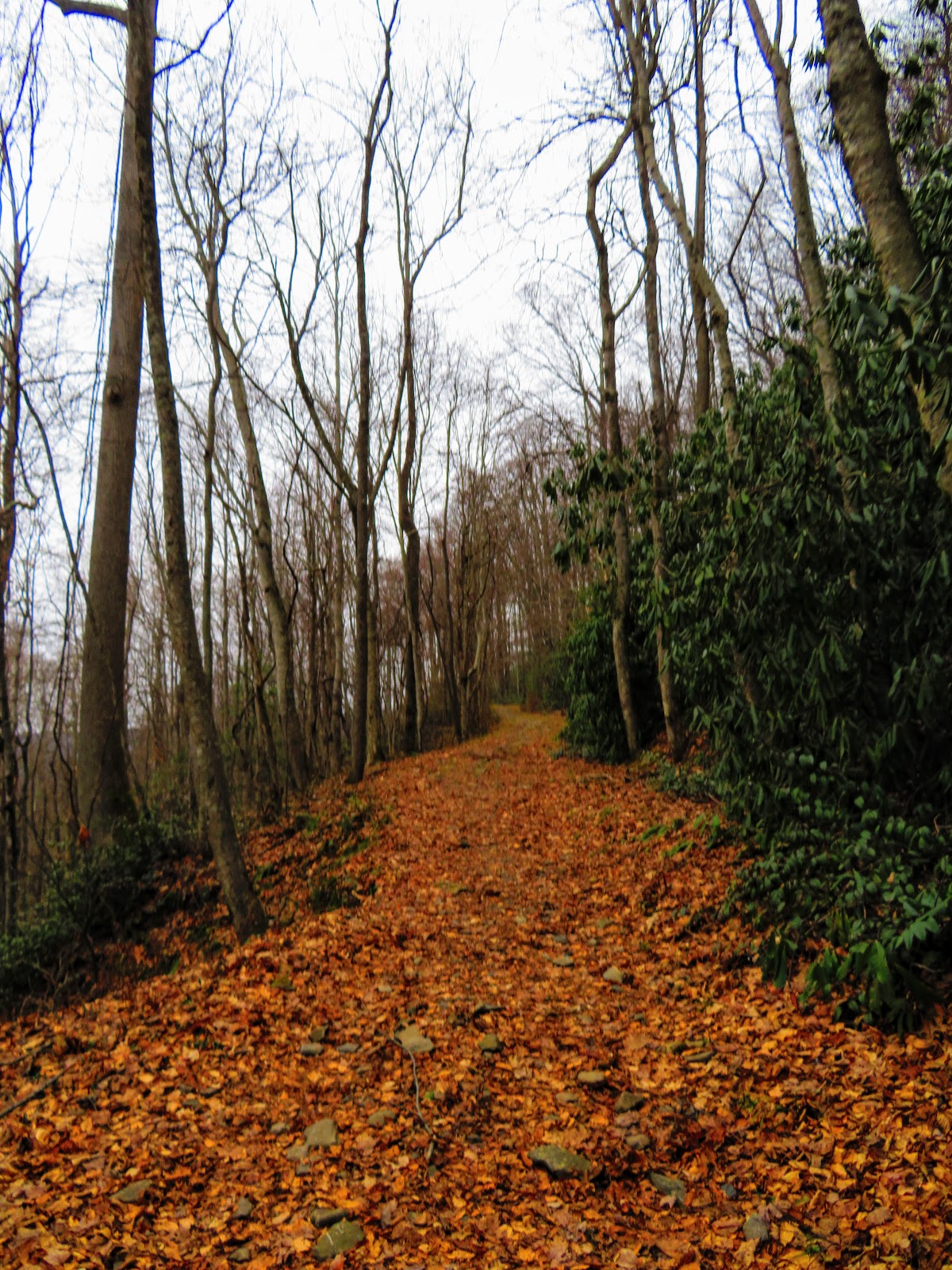
I had wanted to get back here to complete the Falls Creek Loop as I had done only part of this, half of the Devil's Backbone Trail this past March. Like I said there the hike starts at the 17th hole of the golf course and heads uphill first to Rocky Point Overlook and then again uphill to the Lone Cedar Overlook. One thing I noticed like Panther Creek the Devil's Backbone Trail had two blaze colors red and blue...got love Tennessee State Parks.


This was pretty much where March's hike ended, but today I proceeded down the Devil's Backbone Trail which finally reaches Fort Patrick Henry Lake. From here it follows the lakeshore to the mouth of Fall Creek. Here there is a small cascade, but somehow I missed the old homestead, but soon I reached a footbridge, but here you're still on the Devil's Backbone Trail.


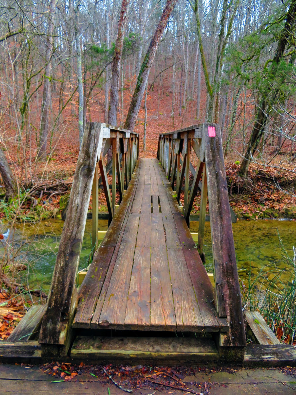
But it isn't too long before you reach another small footbridge and the sign for the Fall Creek Loop. I went right on the mile-and-half loop and the trail a course went uphill, but it wasn't too bad. It passed some fields and housing developments but headed downhill. Here I came to the trailhead and parking area for the loop ( I just wanted to finish this Molloy hike). Anyway, it wasn't long before I crossed that small footbridge to complete the loop.


From here it was back on the Devil's Backbone Trail. There was only one tough uphill, the one from the lake. However, I completed the four miles in two hours, half-hour better than Molloy.


Tuesday, January 2, 2018

Starting The New Year Down The 🐰 Hole In The GSMNP


I guess it is a New Year, but what better way to start than another edition of Down the Rabbit Hole, this time to Indian Flat Falls. Next, to an AT (Appalachian Trail) hike my favorite place to hit the trail, and carry the Big Lummox, is in the Great Smoky Mountains National Park (GSMNP). The Lummox and his ilk will tell you it was cold, but it was Hiking Machine weather. While eight miles, the trail was a one-star (for difficulty) for a hiker of my level.


Indian Flat Falls was nice, but I had to hoist him on my back so we could finish the Middle Prong Trail. While he complained, the load seemed lighter than it had on the way up to the falls. Anyway, while the load was heavy the hiking machine handled it with ease. Overall, it was a good day out, but what hiking day isn't. I even found a rock that looked to honor me...nice!


Monday, January 1, 2018

Closing Out 2017 In The Smokies At Indian Flat Falls


It was the last hike of 2017 and like last year what better places to finish up than in the Smokies on an outing to Indian Flat Falls, Saturday.
This hike was in the Tremont section of the Great Smoky Mountains National Park (GSMNP). It was only my second hike out of this section, the first was a year ago to Spruce Flat Falls. While the Spruce Flat Falls hike starts at the Tremont Center, the trailhead for Indian Flat Falls is at the end of Tremont Road. 


The path up is the wide Middle Prong Trail. The reason it was an old railroad bed and later a road, but it has a gradual incline. Some relics from these days can be found, including the remains of an old car about halfway up. 


Before getting there one passes the Lynn Camp Prong Cascades which are pretty impressive. That is a feature of this trail as it runs parallel with Lynn Camp Prong. It reminded me of the hike up Bradley Fork Trail out of Smokemont, back in May, but the big difference it was much colder on this day with spots of ice on the trail plus a little snow. 


About three-fourths the way up the trail Indian Flat Prong joins Lynn Camp and it is here that the path switchbacks away from the water, but it will eventually come backcrossing at a footbridge. It is not too long before there is a bend in the trail. Middle Prong continues up while a single path goes the right down, tenth-of-a-mile to Indian Flat Falls. 


The falls is a four-tiered cascade, but only the upper two are visible from here. You can bushwack to the other two, but it is dangerous and messes up the vegetation...so don't. 


Because I only needed to complete a two-tenth stretch, I heard up to where the Middle Prong Trail ends and two other trails (Lynn Camp Prong & Greenbrier Ridge) meet with it. Anyway, the hike back just followed the same path, except downhill. Did find an old chimney that I missed on the way up. This hike was a great way to finish out 2017 and the first outing of WinterOitdoors '17-18. Oh, and I finally visited the Towsend GSMNP Visitor Center.