This third week of March has been a strange one.
Snow Miser made a return visit as the past week has felt more like winter than January or February. With strong winds and cold temperatures, I haven't had the chance to get out, much. Oh, the bad weather coincided with Deb's Spring Break and we had planned to hike while she was off. We did make it to Johnson City
Friday, but we still wanted to get an outing in. Also, because of the weather, I wasn't able to get out on St. Patrick's Day for my annual hike.
 |
| Spring snow (this week) on Camp Creek Bald |
So, Sunday was supposed to be a decent day, it was the last day of Deb's break and it was St. Patty's Day weekend which added up to a day out. The place I chose was a hike out of Johnny Molloy's book
Five-Star Trails of Tri-Cities of Tennessee and Virginia called the Fall Creek Loop at
Warriors Path State Park. The hike combined the Devil's Backbone Trail with the Falls Creek Loop Trail for a 3.4-mile outing.
 |
| Shot of the Bulls Gap Fire Tower on the way to... |
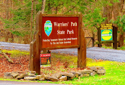 |
| ...Warriors' Path State Park. |
 |
| Visitor center... |
 |
| ...had this sticker. |
The hike starts just past the bridge over
Fort Patrick Henry Lake, at what I call the 17th Hole Trailhead. The reason the start of the trail is at the 17th hole of the Warriors Path Golf Course.
 |
| Across this bridge... |
 |
| ...to the parking area... |
 |
| ...down past... |
 |
| ...17th hole... |
 |
| ...to the trailhead... |
 |
| ...some of the mileage for the hike. |
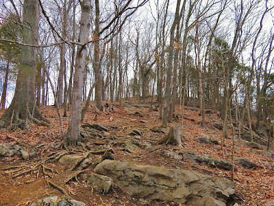
It is here I need to mention that this hike was rated two stars by Molloy, meaning easy with some moderate. I will say it was slightly tougher than list (what a surprise if you have read other critics of Molloy's book) as it had some decent uphill with 8% grade. It didn't help early in the hike the normally sure-footed Pete tweaked his knee and because he is always carrying me (that is what he says) we only made it about seven-tenths in. Which means we didn't finish the Devil's Backbone Trail, but we did pass the three nice views.
 |
| Cut spot on the trail. |
 |
| Ft. Patrick Henry Lake |
 |
| After these steps... |
 |
| ...the trail got steeper... |
 |
| ...Deb heading up. |
 |
| More of the uphill... |
 |
| ...as Deb looks back at Pete... |
 |
| ...because of his bad knee, Pete did want to take part in the blog... |
 |
| ...so we will show "the Hiking Rabbit" in better days. |
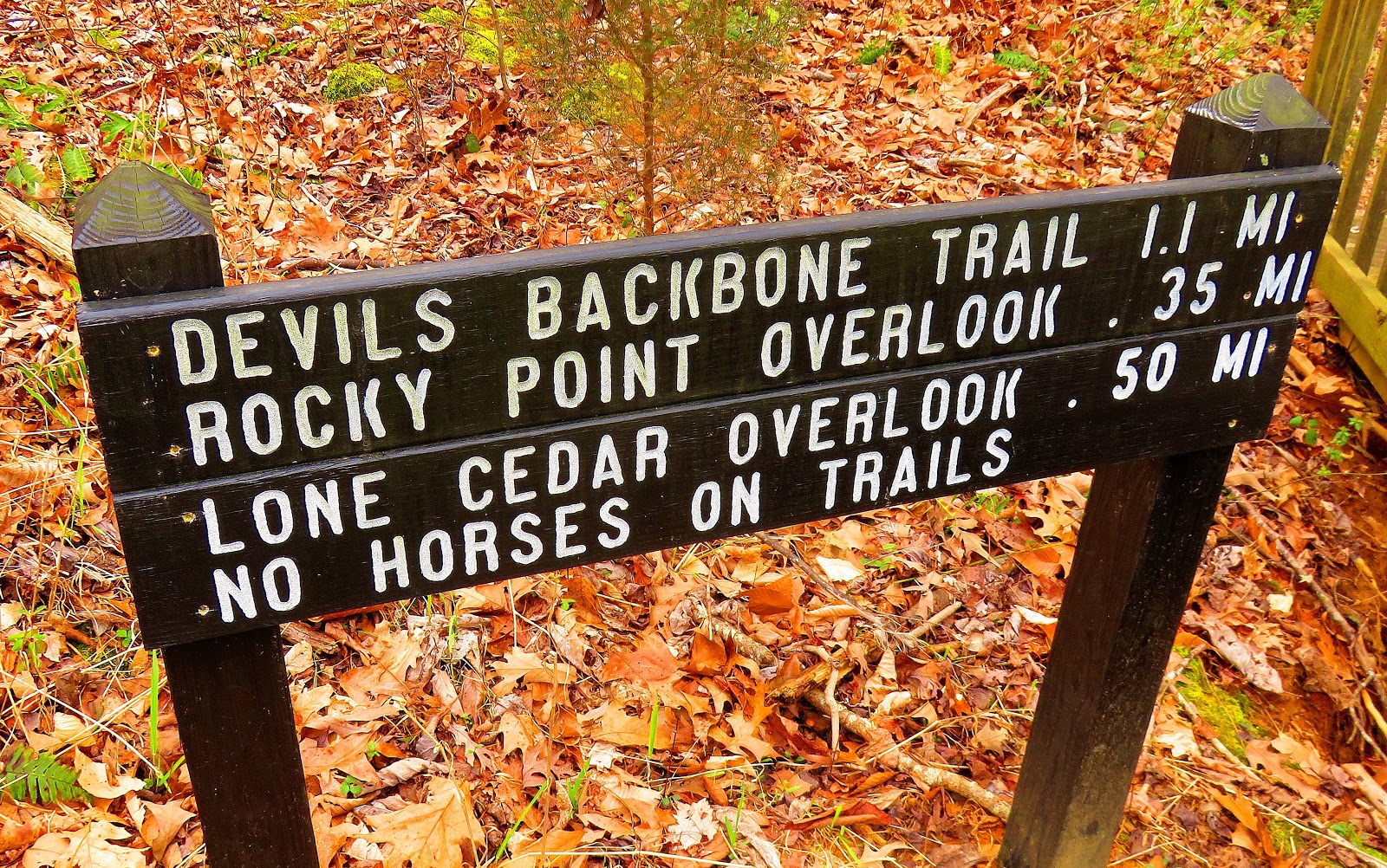
The first was an overlook above the Fourth-Hole of the golf course. The next two, which Molloy's book describes them as overlooks, but are really outcrops. The first Rocky Point Overlook has a good view of the lake, but Lone Cedar Overlook has an even better one. Another cool feature of this outcrop is the dead trees that had grown out of the rock.
 |
| Let just call this the 4th-Hole Overlook... |
 |
| ...view of the lake... |
 |
| ...back at the golf course. |
 |
| Fore! |
 |
| Rocky Point Overlook... |
 |
| ...view of the lake... |
 |
| ...& Deb. |
 |
| This cool tree (looks like a squid) means you are just below... |
 |
| ...Lone Cedar Overlook... |
 |
| ...which had a better look at the lake... |
 |
| ...Chimneytops Mountain... |
 |
| ...the lake... |
 |
| ...& the I-81 bridge. |
 |
| At unnamed outcrop. |
Anyway, with Pete's knee hurting, we didn't go too much further. On the way back we almost hiked out on the golf cart path but stayed on the trail. We finished the day like I do many with coffee and a free donut from
Dunkin. While the day might have been tough and cut short, any day on the trail is better than one that isn't.
 |
| Deadfall we crossed twice... |
 |
| ...some sort of box I missed on the way up. |
 |
| Homestretch! |
 |
| Nice barn. |


No comments:
Post a Comment