The day started at the parking area at the Cloudland Hotel site because I was hiking the Appalachian Trail (AT) out to the Roan High Shelter, which I did wearing snowshoes in January. At this time I was on the fence about staying the night at the shelter. Because there is no overnight parking at the Cloudland Hotel area or the Rhododendron Gardens, I would have to hike the 1.6 miles to the shelter, from Carvers Gap, instead of 0.7 miles with moderate elevation gain.
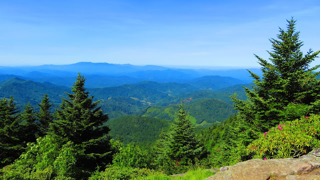
However, whether I decided to camp at Roan High Shelter I wanted to run my drone up there, this would be a bad choice. Let's move ahead to why I said this. See, I wanted to recreate the view from the fire tower that once stood here (the shelter is the old live-in cabin). One of the warning messages you get on the drone is a high-altitude one. This is different than the FAA 400-foot warning this is a caution warning over 6,000 feet in altitude. Anyway, what I needed was obstacle avoidance because maybe I wouldn't have hit the tree. Still, it wouldn't have mattered as I tried to go up through a tight spot in the trees a gust of wind pushed it into the tree, and before I knew it the drone was on its back like a turtle. I ended up with three broken propellers. Yes, I had extras, but they were in the car.
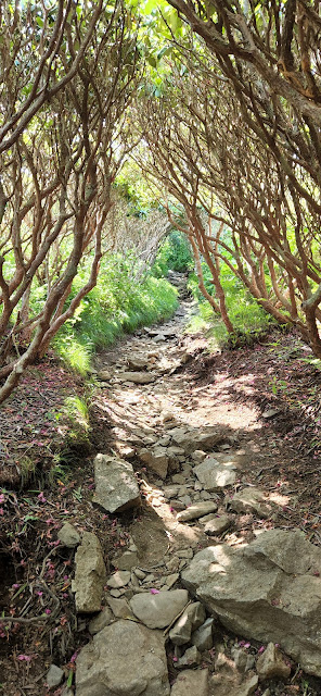
So, back I went and once at the car I changed out the broken ones. If you thought that everything was a-okay, well it is never that simple for this Wood Booger. No, it seemed to function fine, that was until I tried to take off which didn't go well. The drone-powered up and then flew left, off-balanced. I thought I had messed it up...real good. I will admit at this point I thought of going home. Besides what I was thinking was a busted drone, I also forgot my hiking sticks and my left hiking boot was giving me issues. But I sucked it up and did a tour of the Rhododendron Garden and the flowers, despite being past their peak, still had plenty of beauty left. Then it was back to Carvers Gap.
It was at this point I decided I was going to camp at Jane Bald instead of going back to the shelter. But before heading out I decided to take the drone to work on it and see if there was any way to fix it. But when I went to put it in my portable carrier I noticed a set of propellers didn't fit right. When I looked two of them didn't match. So, after searching the truck for the propeller I changed it out and matched it up (they have a little mark or no mark). Then it was a quick test flight and low and behold it took off. Then I landed, packed up, and head towards the AT. As I passed the information kiosk at the start-up Round Bald someone left a walking stick...I guess my luck had changed!
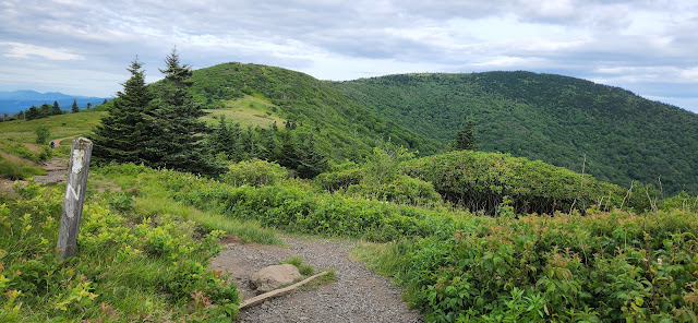
As I have said many times I love this part of the AT across the Roan Highlands. I am always amazed at the difference between summer and winter. I first topped Round Bald then down to Engine Gap before heading u up Jane Bald. Once there, luck for me the campsite was vacant.
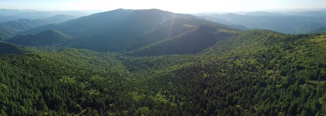
After setting up my tent I decided to give the drone a real test and it passed with beautiful photos.
Even before I ate dinner, I knew that a trip to get water was in the cards. The water source was about half-mile away and half of that was uphill. I was worried about getting back before sundown, which I achieved with time to spare.
It was a beautiful sunset on Jane Bald. After the glow of the Sun faded the wind picked up, but because of the unique overhang where the firepit was made it was safe to build one.
When morning broke I was treated to a gorgeous sunrise making this an excellent camp spot. I moved on in the morning towards Grassy Ridge Bald. Because I was camping there (at my favorite site I hope) I wasn't in no real hurry, which made for a pleasant hike.
The campsite is on the other side of Grassy Ridge Bald in the saddle between it and Big Roan Ridge. I have written about it before, but it is an excellent site with water below. While it is a hidden gem some know of it and it seems like photographers are in this group. When I was here last October I shared the site with Tommy White and his friends. This time when I arrived someone was already at the site, a photographer Lynn Willis and his do Pisgah. He invited me to set up at the site as I did to Tommy and his group last Fall.
The one theme of the day was the wind. It was blowing pretty good all day and it made the setup of my tent tricky. It also meant I was worried about flying my drone since I had crashed it, in wind, the day before. However, a guy came through our campsite and he had one of those new DJI Mini 3's. He did a flight to show me and said not to worry crashes happened he had already had one with his new drone. Later I would first take my drone up over the campsite and then on a rock outcrop on Big Roan Ridge. In both cases, I did get a High Wind Warning and the drone got jostled around but I landed it safely on both occasions.
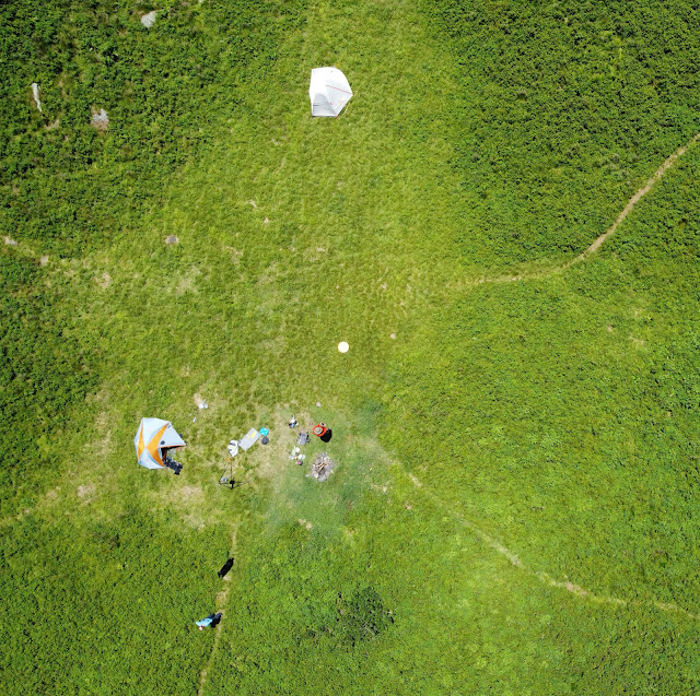
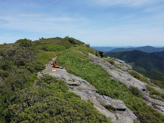
That wouldn't be the last flight of the day as I would get to fly it above Grassy Ridge Bald. See, when I went up to the summit, for sunset, the winds slowed...some. That gave me the chance to take the drone up and higher than I had been all day, over 200 feet. I only received a wind warning once at the highest point of the day. I did set a new overall altitude flight over 6,300 feet. I got some great shots, including my campsite. Oh, it was another wonderful sunset for Grassy Ridge.
While I had seen a number of sunrises from Grassy Ridge I had yet to see a full sunrise from the Big Roan Campsite. Last year in June and October just as the sun was about to peak over the Humps but clouds rolled in blocking the view. Well, not today as the view east was obstructed and was worth the wait...beautiful!
After I packed up and said goodbye to Lynn and my new "girlfriend" Pisgah. It was time to head back, but my plan to fly again at Grassy Ridge was nixed because the bald had the highest winds of the trip, so no drone flight yet.
However, once I got down to Harriet Bald the winds were not bad, compared to Grassy Ridge, so I stopped to put the drone up. I got up for a short flight, just long enough for some photos. About the time I hit 80 feet it got caught in a just of wind and the warning went off. So, I got the shot and I brought it back home.
Next, I crossed Jane Bald and did the slog up Round Bald. But, it was broken up by some gentlemen doing a video I think for the Johnson City Convention & Vistors Bureau and they asked me to be in it. I will post if it comes out.
When I, finally, made it to the summit of Round Bald the winds were blowing but not too bad. So, I went over to Dr. Brown's Trees to send the drone up (it was away from the crowds). I don't think I got it over 70 feet before the warning went off, but I got the shot.
I had one last picture to get with the drone and was at the end of my trip at Carvers Gap. I will admit I really didn't think about getting these shots on Monday, but I did today. This time I got it up about 125 feet before I got the wind alert (but I got the picture).
Oh, one last thing...I make this trip most years to see the Catawba Rhododendrons and I knew this year I was on the backside of the flower peak. But there were Rhododendrons and Flame Azaleas, but I got a surprise, Gray's Lilies! I spotted my first in Engine Gap on Monday, more on Grassy Ridge Tuesday, and more on the way out Wednesday. It is always a bonus to see these rare beauties. Well, that covers my three days on the Roans. It might have started out ruff, but in the end, it was a great two nights on the Roan Highlands. Oh, there will be a picture link at some point...













No comments:
Post a Comment