
Labor Day Weekend means one thing backpacking...well since last year. Anyway, this year it was an outing in the Mt. Rogers National Recreation Area (NRA). When most people think of the Virginia Highlands they think of Mt. Rogers, Grayson Highlands State Park, and stops in-between. Now, these are wonderful places. However, there is another place that is somewhat forgotten...the area of Whitetop Mountain.

Well to the backpack...the day really started in Damascus with a visit to the Deep Gap Shelter. I have been thought the gap on the Appalachian Trail (AT) & the Virginia Highlands Horse Trail. Because of overuse, a new shelter was built, Thomas Knob, and this one was removed to Damascus City Park in 1991.


Anyway, this was a hike organized by Will. This wasn't a Sierra Club hike, but it was me, him, and several others. Don't worry we practiced social distancing and wore masks (especially me).
Well, when we got to Grayson Highlands State Park there was bad news...the backpacking lot was full of you didn't have a reservation. When did they start having that for backcountry backpacking?


So, since we couldn't start from Grayson Highlands what was next? Well, one idea was going out to Buzzard Rock on Whitetop Mountain. That was my day hiking plan for day two. The other was going to Brier Ridge from Elk Garden, it was the hike we did in 2018. Well, a reverse of it because this time we went up the Virginia Highlands Horse Trail.


At Elk Garden, this trail goes right (AT goes left) and offers some get views of Mt. Rogers and our destination Brier Ridge. Before long, about four tents of a mile, you reach the woods, a gate, and enter the Louis Fork Wilderness. While uphill it is a tolerable grade and the reduced pack weight. Being a horse trail one of the things you have to look out for is the stuff that comes out of the south end of a northbound horse.


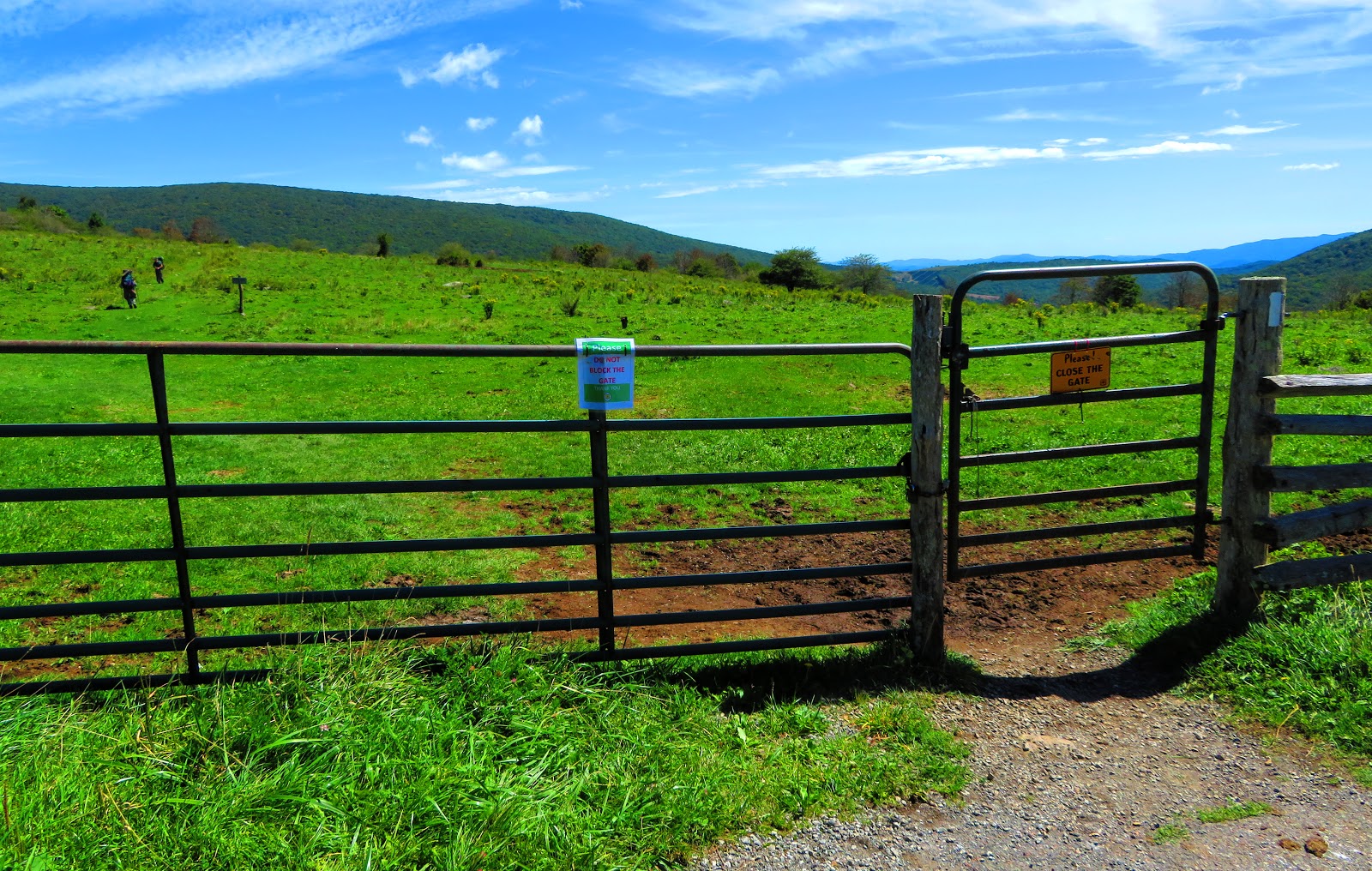
At Elk Garden, this trail goes right (AT goes left) and offers some get views of Mt. Rogers and our destination Brier Ridge. Before long, about four tents of a mile, you reach the woods, a gate, and enter the Louis Fork Wilderness. While uphill it is a tolerable grade and the reduced pack weight. Being a horse trail one of the things you have to look out for is the stuff that comes out of the south end of a northbound horse.


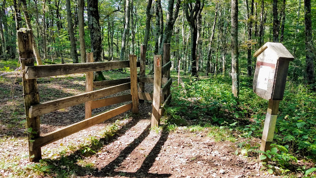
It is 0.7 miles to the junction with the Helton Creek Trail. It is then the same up to Deep Gap, where the aforementioned shelter in Damascus once stood. After pondering camping here it was around a mile to a gate that marked an exit from the Louis Fork Wilderness.


It is here that the hike headed into the open and up to Brier Ridge. This was my second time camping here. The first time was in June of 2018 and it is a great place. Because of the later than expected start time the site we stayed at then was already occupied. We thought of camping down in this one area but thought better of it. Luckily some spots we spied earlier weren't gone.


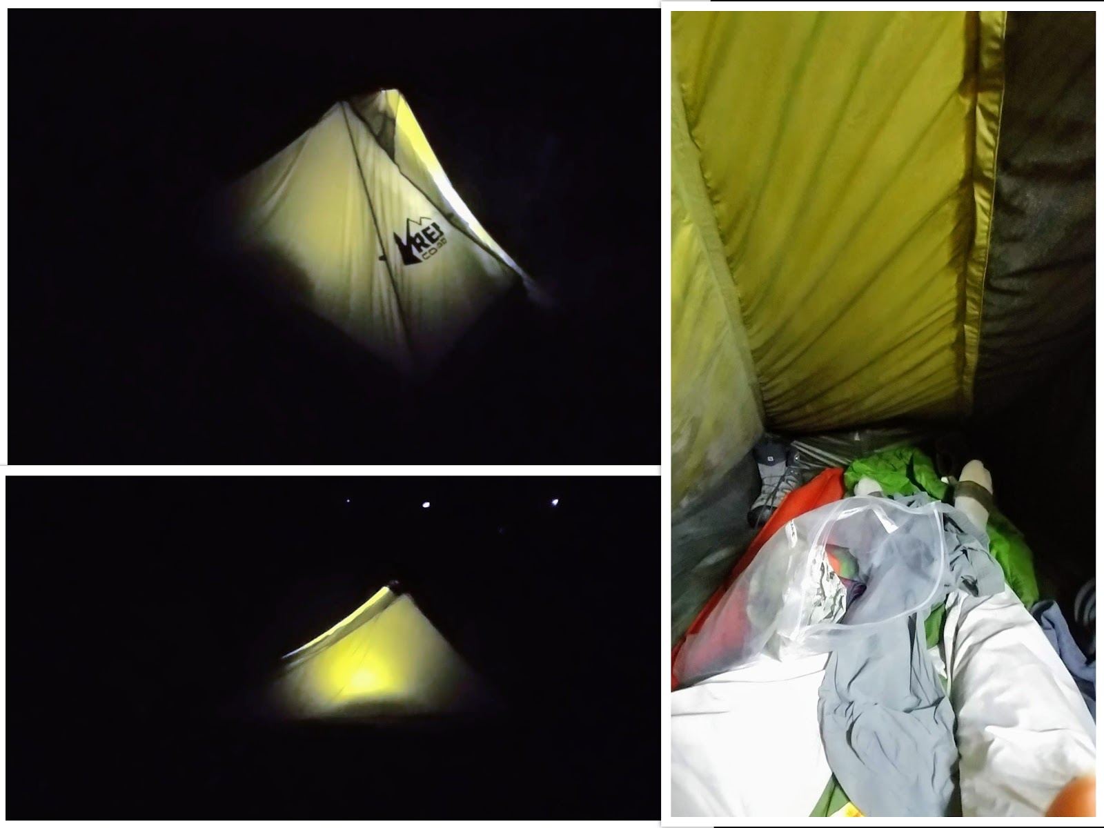
I will admit it took a lot longer to get my new tent up. I had done a trail pitch, but the wind was blowing then, but I got it up. I was going to camp in our original spot, but Will found a spot closer to the woods. So, I went to check it out and discovered a site past here. It was small and somewhat out of the way...just how Pete and I like it.


I will admit it took a lot longer to get my new tent up. I had done a trail pitch, but the wind was blowing then, but I got it up. I was going to camp in our original spot, but Will found a spot closer to the woods. So, I went to check it out and discovered a site past here. It was small and somewhat out of the way...just how Pete and I like it.


I would be remiss not to mention our old friends the Ponies were there when we arrived. They are one of the reasons a lot of the people camped here to come. I have to say I like them too.

For me, something I look forward to, even more, is the sunsets here. It comes up to the right of Whitetop Mountain, which is due west. This sunset didn't disappoint one bit!


An unexpected surprise happened at about 10 pm when I was heading to bed. In the eastern sky, a light started to brighten. I was in for a special surprise...a spectacular moonrise! If you looked to its left there was a bright red light, that is Mars (look closely at the last photo and you can see it).


As for the night in my new tent. It was smaller than I used to and I did have some condensation issues (but others in my group did too). However, I slept well, except waking up cold once (it was in the '40s) and that is the goal of any shelter.
I got up in the morning for sunrise and it didn't disappoint. It came up basically in the same spot as the moon. It was nice!


Something I learned was the Ponies made their presence felt, again, that night. Tommy and Deniese had visited. A guy in the "Tent City" said the Ponies got into their food. Oh, they also left a present where Will had sat the previous evening. I guess they just didn't see me because I didn't get a Pony visit until I was out of my tent in the morning.


The trip back was on the AT which is 0.8 miles longer back to Deep Gap. While some in our group decided to head back the horse trail, I decided to finish on the AT, as it was two-tenths longer, but flatter...which I like better than downhill. Once back at Elk Garden my day wasn't over.


As the rest of my group departed I had a decision to make. I planned to go up to Whitetop Mountain. I could hike the AT uphill or I could cut off the close to five miles roundtrip and drive up and park one-mile from Buzzard Rock. Well, after just hiking about four miles and still a long drive ahead I opted for driving up (good decision).


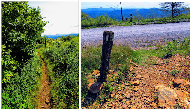
The road up actually wasn't too bad it had only one tough spot. I didn't know if the spot the AT crossed FS-89 would be aa small crossing or large. Turns out it was large, much bigger than I thought it would be. The AT crossed the road, that goes up towards the summit, just past the gate. The trail starts around the southside of Whitetop. On the way, you will pass a really good spring. Before entering the woods I eyed for the first time where I was headed...Buzzard Rock.


It isn't long before the AT comes out the other side where you will notice Buzzard Rock and a smaller outcrop I am calling Raven Rock (I saw them flying around it). I decided to go to the further out which is Raven Rock because I could check out Buzzard Rock on the way back and there were far fewer people. After enjoying lunch I headed back and as my luck would have it no one was at Buzzard Rock.


It was here I needed to decide either to go back down the AT and then drive to the top or hike up Virginia's Second Tallest Mountain. I decided to hike up. The path up was on the route the AT used to take and let me say it had incredible views all the way up. I took an old jeep road up to a parking area before I hiked a road around to another parking area. I was looking for a spot called Lovers Leap. Lucky for me a couple came in on a motorcycle and knew where the short trail started down to a really nice.


After leaving here my next goal was to find the Whitetop summit. I knew there was a FAA Guidance Transmitter on the very top and I found the towers and locked gate on the summit. I will mention that there were site seers on top, but also campers and people on ATVs. My guess is that the out of towners go to Elk Garden and Grayson Highlands State Park but Whitetop is frequented by locals.


Anyway, I decided to take the road back instead of backtracking to the AT. Let me say it was another good decision (I had a lot of those today) because the views were awesome! In the end, I even got to finish on the AT which was fitting for this day. I have to say that Whitetop Mountain is a new favorite place of mine.


So, it was back in the car and on the way back home with a brief stop in Damacaus., Overall it was a great overnight in the Virginia Highlands...


As the rest of my group departed I had a decision to make. I planned to go up to Whitetop Mountain. I could hike the AT uphill or I could cut off the close to five miles roundtrip and drive up and park one-mile from Buzzard Rock. Well, after just hiking about four miles and still a long drive ahead I opted for driving up (good decision).


The road up actually wasn't too bad it had only one tough spot. I didn't know if the spot the AT crossed FS-89 would be aa small crossing or large. Turns out it was large, much bigger than I thought it would be. The AT crossed the road, that goes up towards the summit, just past the gate. The trail starts around the southside of Whitetop. On the way, you will pass a really good spring. Before entering the woods I eyed for the first time where I was headed...Buzzard Rock.


It isn't long before the AT comes out the other side where you will notice Buzzard Rock and a smaller outcrop I am calling Raven Rock (I saw them flying around it). I decided to go to the further out which is Raven Rock because I could check out Buzzard Rock on the way back and there were far fewer people. After enjoying lunch I headed back and as my luck would have it no one was at Buzzard Rock.


It was here I needed to decide either to go back down the AT and then drive to the top or hike up Virginia's Second Tallest Mountain. I decided to hike up. The path up was on the route the AT used to take and let me say it had incredible views all the way up. I took an old jeep road up to a parking area before I hiked a road around to another parking area. I was looking for a spot called Lovers Leap. Lucky for me a couple came in on a motorcycle and knew where the short trail started down to a really nice.


After leaving here my next goal was to find the Whitetop summit. I knew there was a FAA Guidance Transmitter on the very top and I found the towers and locked gate on the summit. I will mention that there were site seers on top, but also campers and people on ATVs. My guess is that the out of towners go to Elk Garden and Grayson Highlands State Park but Whitetop is frequented by locals.


Anyway, I decided to take the road back instead of backtracking to the AT. Let me say it was another good decision (I had a lot of those today) because the views were awesome! In the end, I even got to finish on the AT which was fitting for this day. I have to say that Whitetop Mountain is a new favorite place of mine.


So, it was back in the car and on the way back home with a brief stop in Damacaus., Overall it was a great overnight in the Virginia Highlands...

No comments:
Post a Comment