I made a new friend on Saturday at Panther Creek State Park. His name is Theodore Roosevelt, but he goes by Teddy. No Teddy isn't the 26th President, he is the park's resident Barred Owl. He came to Panther Creek in February after being injured on I-40 near Crossville (see photo for his story). Because of his injuries (he is blind in one eye), he will live out his days at the aviary next to the park's visitor center and will be involved with educational programs across the region. He even has toys in the visitor center. So, if you are at Panther Creek State Park say hi to Teddy.
Wednesday, December 20, 2017
Panther Creek's New Resident...Teddy!
I made a new friend on Saturday at Panther Creek State Park. His name is Theodore Roosevelt, but he goes by Teddy. No Teddy isn't the 26th President, he is the park's resident Barred Owl. He came to Panther Creek in February after being injured on I-40 near Crossville (see photo for his story). Because of his injuries (he is blind in one eye), he will live out his days at the aviary next to the park's visitor center and will be involved with educational programs across the region. He even has toys in the visitor center. So, if you are at Panther Creek State Park say hi to Teddy.
Tuesday, December 19, 2017
No Snow Or Mountain Lions But Great Lake Views At Panther Creek S.P.
Since the weather was supposed to be better and I was left with nothing to do Saturday. Well, I shouldn't say that because I had some duties at home that once again put a time limit on what I could do. So, since I was lazy getting up there were two criteria for the hike. First, it had to be close and second not really over four miles. For that reason, I chose Panther Creek State Park.
The hike I chose was called the Maple Arch Double Loop. In Johnny Molloy's book 
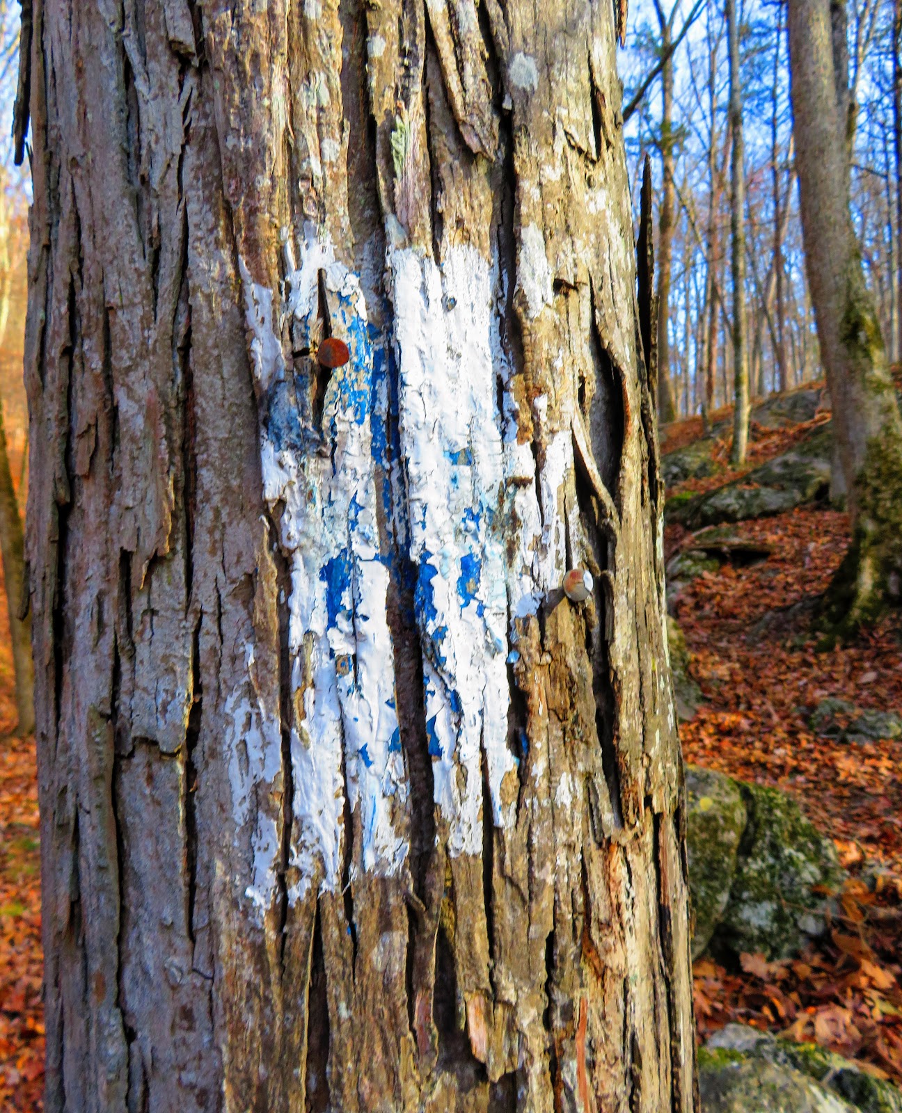
Five-Star Trails: Knoxville it is listed as a 5.5-mile hike. I knew I would be pressing it to complete it, but once I started I knew that I would only really get to do the first loop. The reason the trails at Panther Creek are really poorly blazed (like an Alabama grad designed them). The Ore Mine Trail (which begins at the end of the Spoone Picnic Area) that I started on had not one, or two, but three different blazes (red, white & blue).
Also, it switched blazes, from red to white with the Lost Road Trail, which also shared the yellow blaze of the Maple Arch Trail at some point. Molloy's book wasn't a great help as his description did match the trails. I almost got turned around once, but I just took the most logical path and it worked. Oh, the park map was worthless, but I knew that from an earlier hike here. I talked with a mountain biker who echoed these sentiments, but he said the plan was to blaze the trails and have new maps.
Once I head down toward the Cherokee Lake, on the Lost Road Trail, I noticed another thing. There were some cut trails that also didn't help, but I finally reached the lake. I decided to head down the Maple Arch Trail for a bit.
After about four-tenths of a mile, I decided to head back. But instead of going back on the trail I took advantage of lower winter pool and hiked the lake shore. The views were better, I could even see Bean Gap on Clinch Mountain.
Once back on the trail I rejoined the Lost Road, to complete the only loop I would on the day. Just down the trail, the Lost Road Trail went left and I took the multi-use trail to the old road which is now a horse trail. I then hiked up to the junction I had crossed before I took a left on to the Lost Road Trail and decided not to do the Sinkhole Trail. The reason, once back at the parking area I headed up to the Stencil Ford Overlook to end my day.
Saturday, December 16, 2017
When Time Is An Issue Buffalo Mountain Fits The Bill (& It Had Snow Too)!
Friday, I was in Johnson City so I decided to include a short hike in my day and went to a snowy Buffalo Mountain Park.
Yes, when I drove into Johnson City I noticed snow on the mountain which is always a plus. However, the weather wasn't as predicted it never got above freezing and it was "sticky" cold. That is that damp kind of cold that sticks to you.
My hike was up to White Rock, the series of cliffs on the east side of the park with the main one being White Rock. I have talked about this hike here, but when I got to White Rocks it started spitting snow.
After enjoying the cliffs and going past the communication towers I headed back down Tower Ridge Trail. It is a steep trail that might be slightly more so than the White Rock Trail. Since it is not used as much it had more ice and snow and was slicker in spots. I also passed where the new pink blazed the Noggin Trail runs into the blue blazed Tower Ridge.
Overall, while cold it was a good short hike coming at just over three miles, not bad. After I enjoyed the sites of Johnson City.
Subscribe to:
Posts (Atom)