
There have been a number of mountains that I have considered my backyard, but the one that served that duty during my college days was Buffalo Mountain in Johnson City. So, this mountain has always held a special place in my heart so since I have returned to Tennessee it would only be natural that I returned to here.
 |
| Entrance I have seen many times! |
 |
| This sign was up when I was at ETSU. |
Since I got back into hiking I have visited the Buffalo Mountain three times. The first two were in 2013 one in the summer and the other after Christmas. My latest visit was my first since I relocated to East Tennessee and it was earlier in the month. So, I think it is way overdue that I do a Day Hike Blog on this old favorite of mine.
 |
| The main trail sign at the upper trailhead July 2013... |
 |
| ...December 2013... |
 |
| ...& January 2016. |
I first must mention a little history that this Wood Booger has with this mountain. Back when I was at college at East Tennessee State University (ETSU). Back then the mountain was U.S. Forest Service (USFS) land, so we use to hike and camp here. I have watched the 4th of July Fireworks from Huckleberry Knob and taken a drunken stroll up to the Communication Towers in the dark. In 1994 in a land swap with the USFS Buffalo Mountain became a Johnson City Park.
 |
| I hiked to these in my college days. |
My first visit here in almost two decades came in the summer of 2013, which was an abbreviated hike with Deb. Then I returned for a more comprehensive hike in December of the same year. Like I said I finally returned earlier in January for another hike. This blog I will mainly cover the loop hike to the three main spots of the hike; White Rocks, Tip Top and Huckleberry Knob which is called the "Grand Circuit." One thing to know when hiking at Buffalo Mountain is that there are two trailheads at the park. The upper trailhead is the larger one, which also as picnic pavilions. However, this one is open in three seasons, from March to November. So, the only one open year round is the trailhead at Hartsell Hollow.
 |
| July 2013: Parking at the upper lot. |
This will be are starting point for this blog, but one thing to remember parking is limited right at the trailhead. There are more spots down from the main area so just remember…DON'T BLOCK ANYONE IN! There used to be an information board here with a park map, but it is not there now. So, it is a good idea to download the map from the Buffalo Mountain Park page. From here one will cross a creek, twice, and on the second will find a new footbridge. The blue blazed trail heads up about two tenths of a mile up to the junction with the white blazed White Rocks Trail. One of the two trails in the park I haven’t hiked is the half-mile up into Hartsell Hollow.
 |
| Parking at the lower trailhead... |
 |
| ...during winter DON'T BLOCK PEOPLE IN!!! |
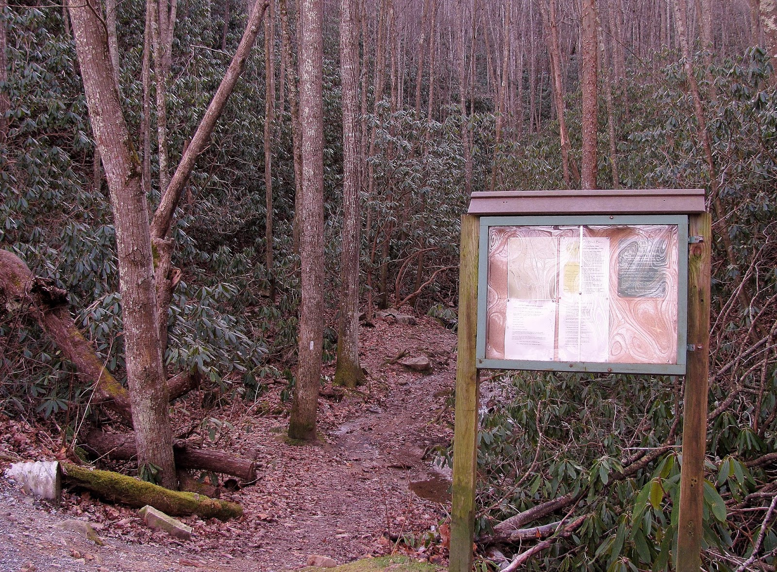 |
| The Hartsell Hollow Trailhead use to have a information board... |
 |
| ...two years later it was gone. |
 |
| First stream crossing. |
 |
| In December 2013 crossing this stream was via log & hand cable... |
 |
| ...now there is a small footbridge. |
 |
| Icy stream. |
 |
| Junction with the White Rocks Trail. |
 |
| This hike goes left |
The white blaze trail for this hike heads left, first switch backing before heading steeply uphill, one will pass a blue blaze which leads to the tower access road. Just a short jaunt for here one comes to a power-line cut and the first nice view of Johnson City of the day. Here one will also find the junction to the Tower Ridge Trail. This .75 trail runs the ridge above the Communication Towers Access Road. Now I don’t know much about this trail because I haven’t hiked it. When I went up the Communication Towers back in the day it was via the road and these days (which I also did back in the day) I followed the White Rocks Trail.
 |
| Another trail sign. |
 |
| These blazes lead uphill. |
 |
| The power-line cut offers... |
 |
| ...this view of Johnson City |
 |
| Lower junction with the Tower Ridge Trail...someday. |
.
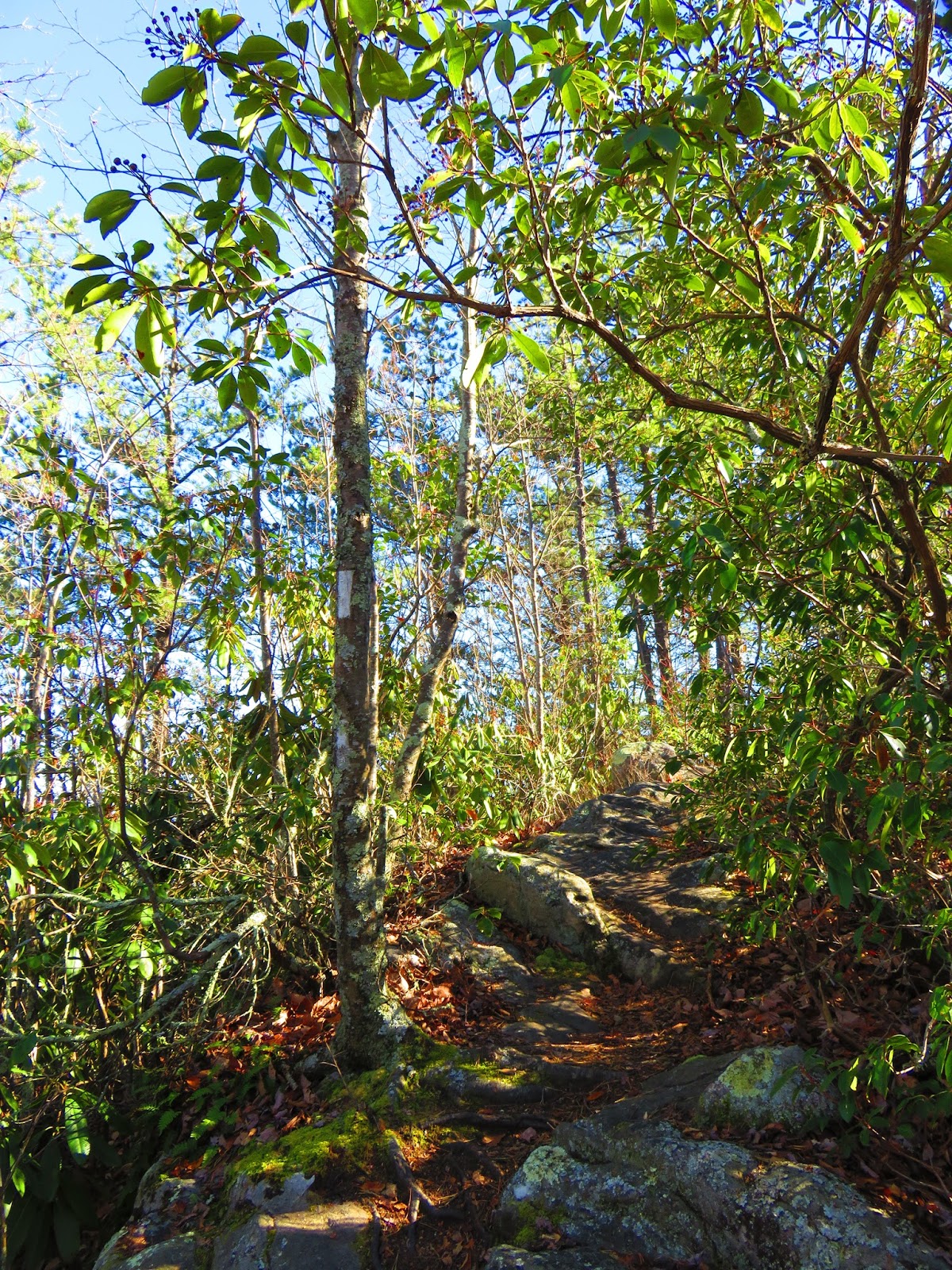
From here to White Rocks is about a mile. First the trail crosses the access road and it can be slightly confusing, but the trail goes across on the right. Again it is mostly uphill with a little switch backing, before coming to the first outcrop. There are four that make up White Rocks including the main outcrop. Here there is a sign which points the way out to this wonderful view of Buffalo Valley and Johnson City. Out in the distance is Milligan College and Elizabethton. The most prominent peak is Holston Mountain, but the Roan Highlands are also visible. If you get a clear day Bays Mountain, Kingsport and High Knob are all visible.  |
| The White Rocks Trail leads to this... |
 |
| ...view... |
 |
| ...& this better one where you also can see... |
 |
| ...the main attraction. |
 |
| Headed out to... |
 |
| ...White Rocks... |
 |
| ...where you can see... |
 |
| ...downtown Johnson City.... |
 |
| ...the Mall area... |
 |
| ...Holston Mountain... |
 |
| ...Milligan College... |
 |
| ....& Elizabethton... |
 |
| ...Roan Highlands... |
 |
| ...Kingsport (in the distance High Knob)... |
 |
| ...& Bays Mountain. |
 |
| The fourth outcrop. |
When you back track to the trail you will pass the fourth outcrop and it is here the trail gets confusing. It looks like it goes straight, but this is just a dead-end. There is a lot of this at Buffalo Mountain. Instead of going straight you want to go left up the rocks. Once here the trail goes uphill and around the Communication Towers.
 |
| Don't go straight, but left... |
 |
| ...up the rocks. |
At one time most of the media in Johnson City, including WJHL Channel 11 and WETS Radio, but the majority of these have moved to Holston Mountain. Still, there are a round four towers still on Buffalo Mountain. As you pass the towers one will intersect with the blue blaze of the upper portion of the Tower Ridge Trail.
 |
| Most media towers have moved to Holston Mtn... |
 |
| ...but there are still plenty on Tower Ridge. |
 |
| The upper junction with the Tower Ridge Trail. |
This hike follows the white blaze left before coming to a bench. Here is another confusing spot. The trail sign points straight for the path to the next destination Tip Top. However, the white blaze continues right. Making it even more confusing on some maps the trail changes name to the Fork Ridge Trail. Believe me, just follow the white blaze. The trail straight is an old unused trail, with red makings that I believe are not blazes, but tree boundary markers (which means you left the park). So, to continue on the White Rock Trail go right young man!
 |
| At this bench the sign points straight... |
 |
| ...but go right & follow the white blaze, but remember... |
 |
| ...this sign has been removed. |
From here it is seven tenths of mile to the High Ridge spur to Tip Top. It heads downhill from Fork Knob and then heads back up hill, before coming to a trail junction. This leads down the Fork Knob Trail to the Lady Slipper Trail (more on that later). About another third of a mile you finally come to the junction for the High Ridge Trail which heads out to Tip Top.
 |
| Reminder that Buffalo Mtn. was once National Forest. |
 |
| White blaze with red mark. |
 |
| Headed uphill to... |
 |
| ...a bench & another trail junction (I will come back to later), but I am headed toward... |
 |
| ...High Ridge Junction... |
 |
| ...& out to Tip Top. |
 |
| ...oh, here is the old sign (Dec. 2013). |
In Johnny Molloy book he skips this part of the hike, but that was his loss. The trip out to Tip Top is my favorite part of the hike. Because of fire damage, the High Ridge Trail offers wonderful views of the Roan Highlands, Unaka Mountain and Big Bald to name a few. I would be re missed to mention that on the ridge the closest peak is Pinnacle Mountain and its refurbished fire tower. The final push up to Tip Top is a climb, but at the summit there is a picnic table and bench which offer a chance to take a break. While there are some trees the views are still nice. There are the views I mentioned earlier to the north, but south one can see most of Johnson City with the VA Hospital and ETSU being the most prominent.
 |
| The High Ridge Trail where you have views like... |
 |
| ...Buffalo Valley... |
 |
| ...Pinnacle Mountain... |
 |
| ...& its refurbished fire tower... |
 |
| ...over its shoulder... |
 |
| ...Big Bald. |
 |
| Unaka Mountain. |
 |
| Roan Highlands & an up close view of... |
 |
| ...Grassy Ridge, Jane & Round Balds. |
 |
| You can even see Grandfather Mountain. |
 |
| Tip Top... |
 |
| ...at the summit is picnic table... |
 |
| ..which is in memory. |
 |
| From Tip Top there are great views of Johnson City, including... |
 |
| ...the VA Hospital... |
 |
| ....& ETSU. |
On the way back offers the same wonderful views as going out. On returning to the trail junction the loop trail continues left and even though white blazed (and on the official map still White Rocks Loop) on the trail sign this path has another name change to the Cascade Trail. In winter this part of the trail is shaded so on a cold day you will feel it. Also there are spots were the trail is narrow, so watch your step. Anyway, the trail swings downhill before coming to the small Buffalo Mountain Cascade.
 |
| Headed back from Tip Top. |
 |
| The White Rock Trail heads right toward the Cascade... |
 |
| ...but the trail in winter is shaded, icy... |
 |
| ...& narrow in spots. |
 |
| The Buffalo Mountain Cascade. |
After passing it is slightly uphill and on this stretch there are some nice views. Before reaching the final vista of Huckleberry Knob there is another junction with the Fort Knob Trail. Where this trail starts is back up the mountain and heads down about half-mile where the Lady Slipper Trail slips off to the right. I did this section back in December of '13. This quarter-mile loop gets its namesake from the Lady Slippers that dot the trail in the spring. The Lady Slipper does connect back with the Fort Knob before it rejoins the White Rocks Loop Trail.
 |
| Here we are back at the Fork Knob Trail... |
 |
| ...which I headed down back in 2013. |
 |
| The blue blaze trail eventually... |
 |
| ...intersects... |
 |
| ...with the Lady Slipper Trail. |
 |
| Here is where the Lady Slipper connects with the White Rocks Trail. |
At this point is not too far to the junction to Huckleberry Knob. There used to be a trail sign here, but it is not too confusing. The blue blaze to Huckleberry heads straight and the White Rocks Loop goes right. It is a slight uphill until coming to the vista of Huckleberry Knob. I will admit there is no place in the park that I have visited more. It was a go to spot back in my college days and all-three trips I have made in recent years I have found my way there. It offers an excellent view back to Tip Top and down the valley toward Greeneville. But, the best view of all is of Johnson City. When I came back here in the summer of 2013 I had noticed that a bench had been added to the spot. Well, on my last visit it was nowhere in sight.
 |
| July 2013: The sign is there... |
 |
| ...& still there five months later... |
 |
| ...but not two years. |
 |
| Summer... |
 |
| ...& winter trail to... |
 |
| Huckleberry Knob, |
 |
| From this vista one can see... |
 |
| ...all of... |
 |
| ...Johnson City. |
 |
| Looking at State of Franklin. |
 |
| Chimneytop Mountain. |
 |
| Tip Top. |
 |
| Once there was a bench... |
 |
| ...but now it is gone. |
Well, it was back to the loop for the the .3 miles back down to where there is another junction, this time to the path down to the upper trailhead. Here there is plenty of parking, picnic tables and picnic pavilions. Also here there is still an information board with not one, but two maps of the park. I need to point out that the white blaze continues from here, but a trail also continues above, now with white round blaze (like the Mountains-to-Sea Trail). When the two trails reform it is back to the rectangular white blaze (like the Appalachian Trail).
 |
| Headed back toward... |
 |
| ....the junction... |
 |
| ...to the upper parking area with picnic pavilions. |
 |
| From the end of the lower lot is the... |
 |
| ...white blaze... |
|
| ...above it is round white blaze. |
These two trails intersect to reform the White Rocks Loop Trail before heading back down to Hartsell Hollow to finish the loop. At this point it is just a left turn back on the trail to the lower parking area with the hike coming in at over five miles. It is something that a park of this quality is in the backyard of ETSU, so if you are in Johnson City give it a visit.
 |
| Back to the Hartsell Hollow junction. |
 |
| Crossing streams leads to... |
 |
| ...the lower trailhead. |
No comments:
Post a Comment