Monday, November 8, 2021

The Pinnacle Of Autumn Colors On Pinnacle Mountain


My fire tower tour of East Tennessee continued on Tuesday with a trip to Pinnacle Mountain.
I will admit three towers in eight days happened more out of happenstance than planning. Another thing that wasn't planned was a six-year gap between my last visit to the Pinnacle Mountain Fire Tower. It's not like I planned it that way. It was always on my radar, but most times it was a backup hike or so else took president, but it always got pushed to the back.

November 2015 trip (the summit marker is no longer there)

Recent tower trips to Camp Creek Bald & Bays Mountain

So, Wednesday I head towards Unicoi and the trailhead at Jack Sinder Park. It is located just off I-26 at Exit 32 which has flush toilet bathrooms. Since I was last here it has had more parking and a new play area.  
Something else that awaited me at the trailhead was beautiful fall colors. While October might have passed the autumn splendor was still on display aplenty on this hike.


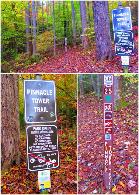
Speaking of the hike is 4.8 miles (one-way) on a green-blazed trail that has added those plastic diamonds like Margarette Falls and Rock Creek Falls. While long the trail has a relatively gentle grade making the uphill not as severe. The reason this is a multi-use trail as hikers share it with cyclists. Besides being well blazed & an easy grade there are also mile markers along the way.


Left: Margerette Falls (T), Rock Creek (B) & Pinnacle Mtn. (R)


At around the 3.5-mile mark, the trail reaches a large junction and parking area (which will factor in later) where the green-blazed Pinnacle Tower Trail meets the orange-blazed ATV Trail and the access road to the top. So I went through the wood style and headed the final half-mile to the summit. The trail meanders up the west side of Pinnacle Mountain before heading the final way up the south side. When you see the towers in the trees you are in the homestretch to the top.


Top: Gated Acces Road; Bottom: Orange-blazed ATV Trail (ATV from Nov. '15)


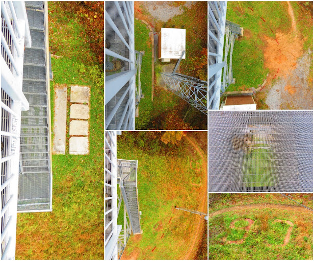
Once at the summit why you hike here stands before you...the Pinnacle Mountain Fire Tower. Now it will be obvious this isn't the original fire tower. That one was built in the 1930s before being retired in 1989. It was in 2007 that a partnership between the Partners of the Cherokee National Forest and US Forest Service breathed new life into this East Tennessee treasure. Work on the refurbished tower was completed in 2011. The tower is all metal, including the grated floor. 


The ceiling compass shows some age

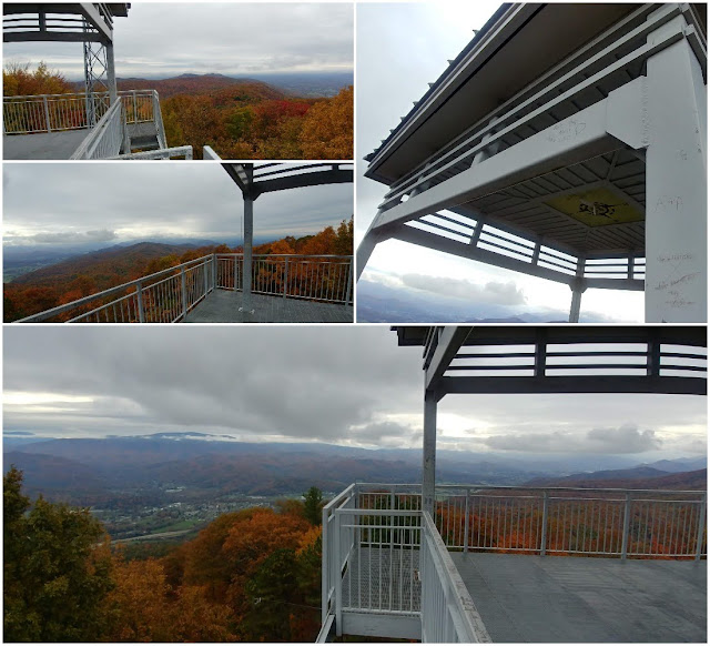
The one thing about the tower that hasn't changed is the view. It is a 360° one that includes Unaka Mountain, Big Bald, and Pinnacle's nearby sibling Buffalo Mountain Park. On this day there were also clouds around some of these peaks and of course beautiful autumn colors.


Unaka Mountain

Big Bald (T), The Roans (ML), Cloudy Holston Mtn. (MR) & Buffalo Mtn. Park

After lunch and enjoying the view I decided to do something different and hike back the access road. It cuts almost a mile off the trip back. But, what it lacks in length it makes for in incline. So much so that most of the section from the junction to the tower is concrete. That means if you want to do this loop it is best to do it, like I did, go up the tower trail and down the access road. Oh, there were plenty of lovely fall colors to make this a worthy detour.


As I mentioned earlier the gentle grade of the trail makes the uphill less extreme it also helps the downhill too. Because it isn't steep (or rocky) you can make a great time heading back. Before long I reached the one-mile marker and in a flash, I was at the trailhead. I did miss my window to try out the Mid-City Grill so I finished the day at the White Duck Taco and Yee-Haw (I haven't been to either in almost two years).


Photo Links:

Friday, November 5, 2021

It was Hiking Machine Hikeday on Coldsprings Mountain!

Today wasn't just Friday, but Hikeday...HELL YEAH, DADDY! Today, I dragged (literally) the Lummox up to Coldsprings Mountain from Horse Creek (Recreation Area).
While the Lummox complained about it being cold and the Coldsprings Mountain Road (FS-94) being too steep, but I am going to cut him some slack.

 Even though I did have to drag him to the finish we climbed almost 3,000 feet and hiked near 10 miles...now that is whuppin' tails and crushing trails, Hiking Machine style! Well, with that I just have one thing to say, I am out...BITCHES!


Thursday, November 4, 2021

A Little Hunting & Fall Colors On An Overdue Visit To The Cabin

 For a number of reasons it has been a month since going to the Cabin in Southwest Virginia and that is way too long.


Besides just checking on things there were two other reasons I headed over. First, was autumn colors, while past prime, there was still plenty. I hiked up to the area up top, around Wood Booger Ridge and the colors were beautiful. 


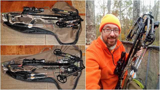
The other purpose I was up there was the second reason and do a little hunting. Now you might ask "Wood Booger, isn't it early for that?" Well, not with something I recently picked up a crossbow, a Barnett Hyper Whitetail 410. Now, this little tool gives me a larger window than the two weeks around Thanksgiving. Anyway, I spent over an hour sitting in a tree stand and all I saw were squirrels. 


But it was a nice overnight for me and even more for my Dad! 


Tuesday, November 2, 2021

Who Puts The Pinnacle In The Mountain...PETE, THE HIKING MACHINE!


Hell yeah, the Hiking Machine here, and I finally dragged the Lummox back up to Pinnacle Mountain today...DADDY! It only took six years to get back to the Pinnacle Mountain Tower Trail. The Lummox was happy with the leaf colors, but I don't give a s**t about them. No, I like this trail because it is how I like long and strong like the Hiking Machine. I will admit it could be a lot steeper. 


While I was "whuppin' tails and crushing trails" what was the Lummox doing? Cheating! On the way back the Lummox wussed out & went down the access road instead of back on the trail to the junction. It cut out almost a mile. If we were going to use this road we should have gone up because it was steep, but the Lummox wouldn't do that...douche! Anyway, I still got about nine miles in and that carry 200 pounds! Well, with that I only have one more thing to say, I am out...BITCHES!


Monday, November 1, 2021

This Camp Creek Bald Benchmark Is One-Of-A-Kind

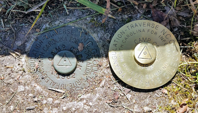
As readers of this blog know one of my favorite mountains is Camp Creek Bald. Also known as Viking Mountain, Camp Creek Bald is what I consider my Appalachian Trail (AT) Backyard. I have had many adventures on this mountain, so it holds a special place  It isn't a secret that I have an affection for summit or benchmarkers, on tops of mountains in particular. I had always wanted to find the one on Camp Creek Bald and did it back in Halloween of 2018 as someone had uncovered it. So, when on Etsy I stumbled across a guy Jerald who runs MountainMonkeyCo. He specializes in making custom summit markers. It didn't take long for me to decide on what I wanted to be done...Camp Creek Bald. 

The summit marker is above the slab (L) & Me with it (R)

Clockwise: The picture I sent (TL), The proof Jerald sent (TR) & the finished product

The summit marker (T) & mine on top of it (L & B)

Jerald said all I needed to do was send a description of what I wanted and would send a design, so I sent a picture and it was long before I got the proof. After approval I got a private listing on Etsy and in a week it was ready to ship, but Jerald first sent a photo of the completed summit marker...it looked fantastic. He even added the raised circle on the center of the marker. Yes, it is the same size as I put it on top of the real marker on the summit. In closing I will say, I might be biased but I think mine from MountainMonkey looks better. But they do share one important thing, they are both one-of-a-kinds.