
Early spring is the beginning (or end) of Maple Syrup Season and I will speak a little more about this in a future blog. While some know the word Sugarlands from the moonshine place in Gatlinburg, but the name comes from the area in the Smokies that was once thick with Sugar Maple Trees.


So, for a number of reasons I decided to kick-off for Spring-Thru ‘16 in the Great Smoky Mountains National Park (GSMNP) and specifically the Sugarlands area. Now my first stop, as usual, was at the Sugarlands Visitor Center. I have stopped here many, many times and I still love stopping here. However, after all this time I never have talked a lot about it so here are a few words. For those who don’t know the visitor center is located two mile from the Gatlinburg entrance of the park, at the junction of Newfound Gap Road and Little River Road (that goes to Cades Cove). There are two building, the first is the one that houses the bathrooms, which will not the most luxuries are more than adequate.


The larger building houses the main visitor center. Here there are Park Rangers to answer questions and plenty of maps and information brochures on hand for a small fee (no more than a dollar). If you want souvenirs of all kinds you will find that in the gift shop. You can even buy bear spray, about $13 cheaper than some outdoor stores, and you even get the holster for free ($12.95 separate at REI). However the best part is the museum in the visitor center. On display are examples of wildlife found in the park. There use to be a black bear on display, but it was moved to the lobby of the theater. There is a movie shown here about the history of the park, but I still haven’t seen it. Oh, also in the lobby there is a display on the air quality and visibility at the vistas in the park. Inside the same building, but a separate entrance, is the Backcountry Office where the passes for camping in the park can be found. There is a bank of solar panels behind the center.


Besides the visitor center Sugarlands offers some short (and others a little longer), but fun hiking opportunities. The first is a one-mile out-and-back trail out to Cataract Falls. I have written briefly about the hike to here before, but this is a small 25-foot cascade, while not the most spectacular in the park, is not half bad. Remember in summer this trail can be quite busy. But remember climbing to the top of this waterfall is not recommend. It is a steep climb and I believe that there is a Yellowjacket nest near the top. The Park Service has had to rescue people from the top...no joke!


Another option is heading out to John Ownby Cabin, which heads left once you cross the footbridge (while Cataract Falls goes right). This hike has a little more elevation than the Cataract Falls hike and is slightly longer coming in at 1.2 miles. Sugarlands also serves as the trailhead for the Cove Mountain Trail and the Gatlinburg Trail. This last trail like it says is a two-mile path from Sugarlands to Gatlinburg.


For my first hike of Thursday I left Sugarlands and headed about four miles to the trailhead for Sugarlands Mountain Trail. One of things to know about this hike is that it shares a parking area with Laurel Falls at Fighting Creek Gap. The hike to this 80-foot waterfall I did back in August. It is one of the most popular hikes in the park. The 1.3 mile trail to the falls is paved and isn’t as steep as say Abrams Falls (it is not as long either), so it sees large crowds. That means the vast majority of cars at the trailhead are for the falls, so if you don’t get there early you might have to park a half-mile down at Maloney Point.


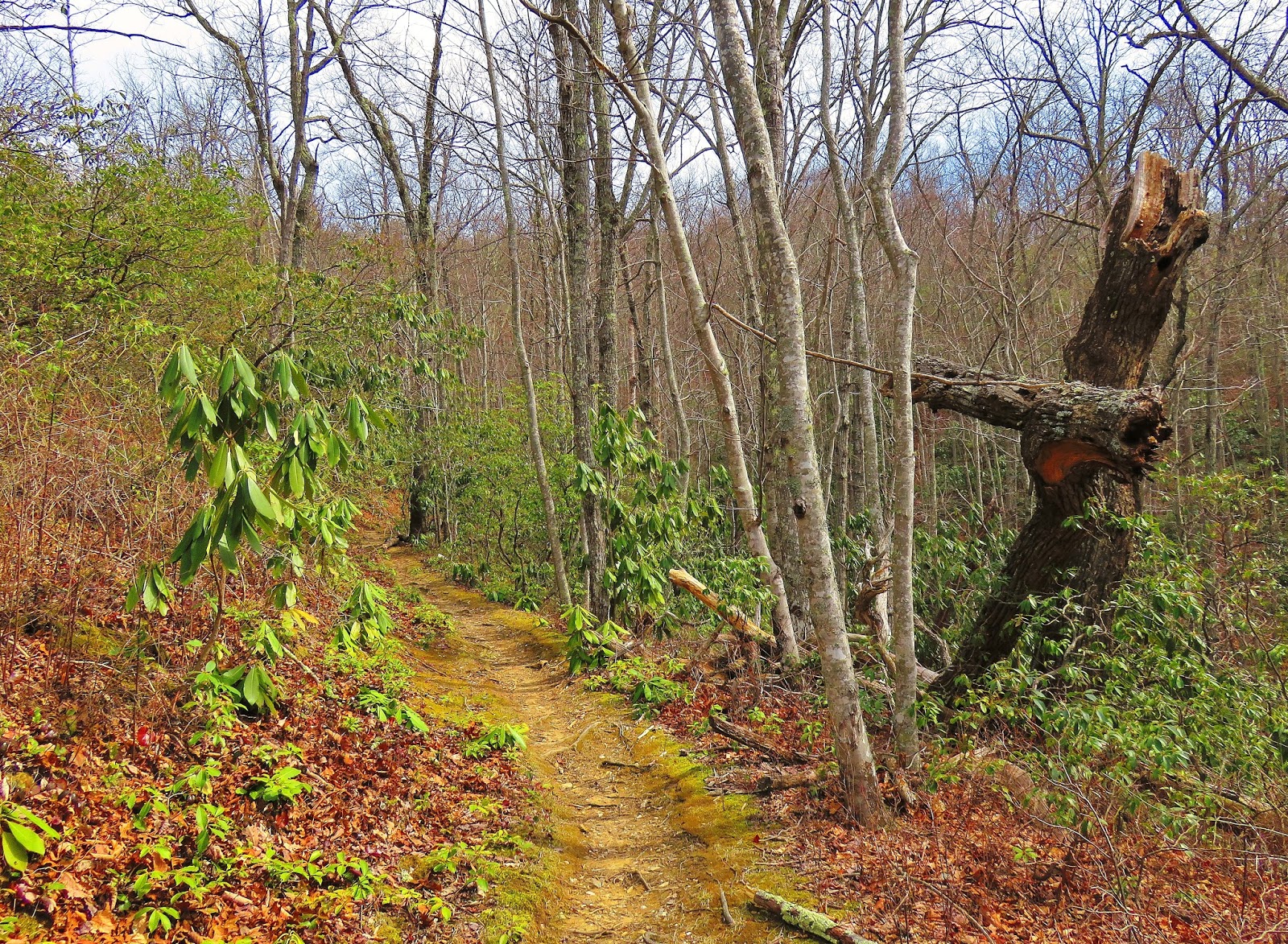
Anyway, the Sugarlands Mountain Trail starts across the road from the Laurel Falls Trail. This trail climbs up and over Sugarlands Mountain, 12 miles before intersecting with the Appalachian Trail. This hike involved one-fourth of this trail, 3.1 miles one-way. You will notice right off that the trail has a steep grade. This climb is over a half-mile and will get the blood pumping. When the trail does level out some there will be a couple of decent winter views into Sugarlands Valley and Mount LeConte. Now the trail rolls along a ridge-line and was one of my favorite parts of this trail.


At the one-mile mark the trail heads down a half-mile to Mids Gap. Going down this spot doesn’t seem steep, but it will when you start the journey back up. The trail then gradually heads up again through some rhododendron tunnels (I love these), but it was about this time that I spotted my first sign that black bears had awoke from their winter slumber. I had expected this might be the case since the temperature had shot up into the 60’s in this area (& high-70’s at Gatlinburg). Also, this area is known for having a lot of bear activity, so when I found scat I wasn’t surprised (that is why I brought bear spray).


At around the two-mile mark I started to look for the larger vista that this trail was supposed to offer. I did find another fine winter one with views of Bull Head and Sugarlands Mountain. So, I continued on, but it wasn’t long before I found my way to the turnaround point at Husky Gap, but no vista? When I looked at my book with information about the hike it let me know that the spot I passed was it. At one-time this might have been a spectacular vista, but now it has grown-up and now is mostly a winter one. After taking a break at Husky Gap, which is one of the major trail crossings on the Tennessee side of the park, it was time to head back toward Fighting Creek Gap. Like I said above the toughest part was the half-mile climb out of Mids Gap.


When I got back to the trailhead what I noticed, besides the number of cars and quadrupled, was the temperature had shot up. This will be something that would only will get worse later in the day. On the way back I made stops at Maloney Point and the visitor center before heading to the second hike of the day.


The reason for this was I got done on Sugarlands Mountain ahead of time and I wanted to hike some more miles, so I chose the Old Sugarlands Trail. The trailhead is located just down from the Sugarlands Visitor Center. The trail is a mixed use path as hikers share the route with horses. The Old Sugarlands Trail travels 3.9 miles to the Cherokee Orchard area and the trailhead for Rainbow Falls, but it first crosses the paths with the Bull Head Trail. A 6.2 mile loop can be made using the Two-Mile Branch Trail, but my hike was an out-and-back to the Sugarlands Cemetery. Since it is used by horses the trail is wider than normal and only has one uphill spot at about half-mile in. One of the most pleasant parts of the first half of the hike is it runs parallel with the West Prong of the Pigeon River. There are a number of spots where you can enjoy the beauty of this river.


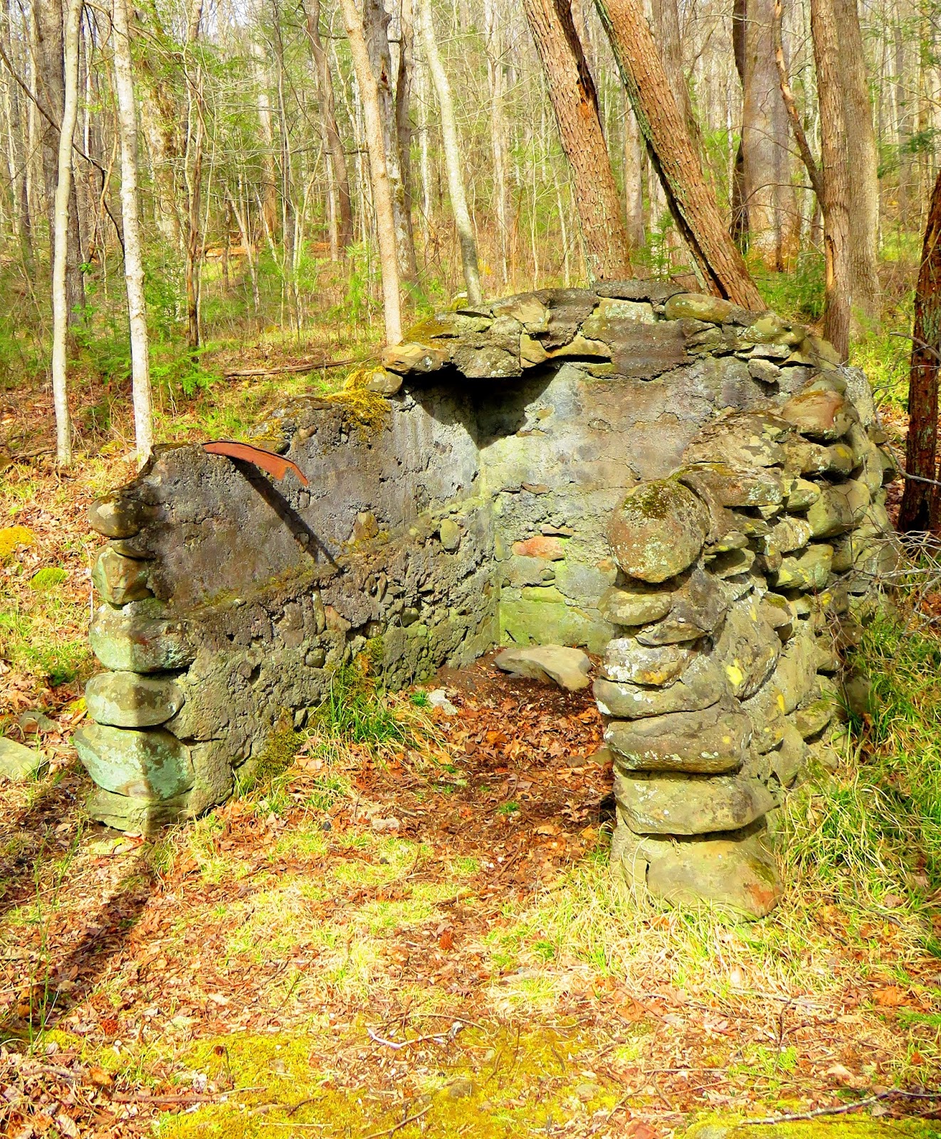
At 1.1 miles the trail crosses a bridge that one of the many branches (this one Bull Head) that flows into the river. The path finally curves left away from the river and at 1.4 miles heads right at the a T. Here is also sight of an old Civilian Conservation Corps (CCC) camp. Not much is left except for the entrance of the camp.


Another tenth-of-a-mile forward is another junction. The Old Sugarlands Trail goes left while the trail to the cemetery goes right. This old roadbed heads about half-mile to a junction with the left one takes you another 1/10 a mile to the Sugarlands Cemetery. I wandered around looking at some of the old tombstones that dot the area. Remember if you visit here respect the cemetery it is a historical places that people still come to visit pasted loved ones. One of the things I noticed on the way to the cemetery was the Forest Service had placed a hog trap. For those who don’t Wild Hogs are a problem in the park and I had seen one of these traps on display at Cable Mill, but this is the first I have seen placed in the wild.


The biggest problem on the way back was that it was so damn hot! I just need to say to all of those people who go on about how they love this type of weather...it is early March people! It was strange because the trail still looked like winter, but it felt like summer. When I got back to the trailhead there was one more surprise, to the left of where my car was parked was turkeys. If you have ever been around Sugarlands you will most likely have seen these birds roaming the roadside or outback of the visitor center.


Well, that was my day in Sugarlands and I didn’t even have any moonshine.
No comments:
Post a Comment