Since I got back into hiking there have been a number of places I have want to hike out of and at the top of the list was Sams Gap. I had traveled though this gap most of my life. It use to be my preferred route to Florida and I usually went though here on the way to Florida. I remember when it was a two lane road (that Matt almost drove us off on the way back from Key West) and how it transformed into Interstate-26. So, coming home from Georgia I passed through the gap many times and stop at the Metcalf Overlooks (East & West) to enjoy the views..
 |
| Sams Gap sign. |
 |
| The old road... |
 |
| ...headed into North Carolina... |
 |
| ...& the new... |
 |
| ...Interstate 26. |
Over all this time I knew the
Appalachian Trail (AT) crossed through Sams Gap, but it wasn’t until I got back into the outdoors that hiking here became a goal. Every time I passed though I would think about hiking out of here and of the last few years I almost did a few times, but this happened and that happened. I almost went here when I did the
hike at
Chestoa. So, back on a Saturday, in early February when I was deciding where I was going to hit the trail I decided it was time to do a day hike out of Sams Gap.
 |
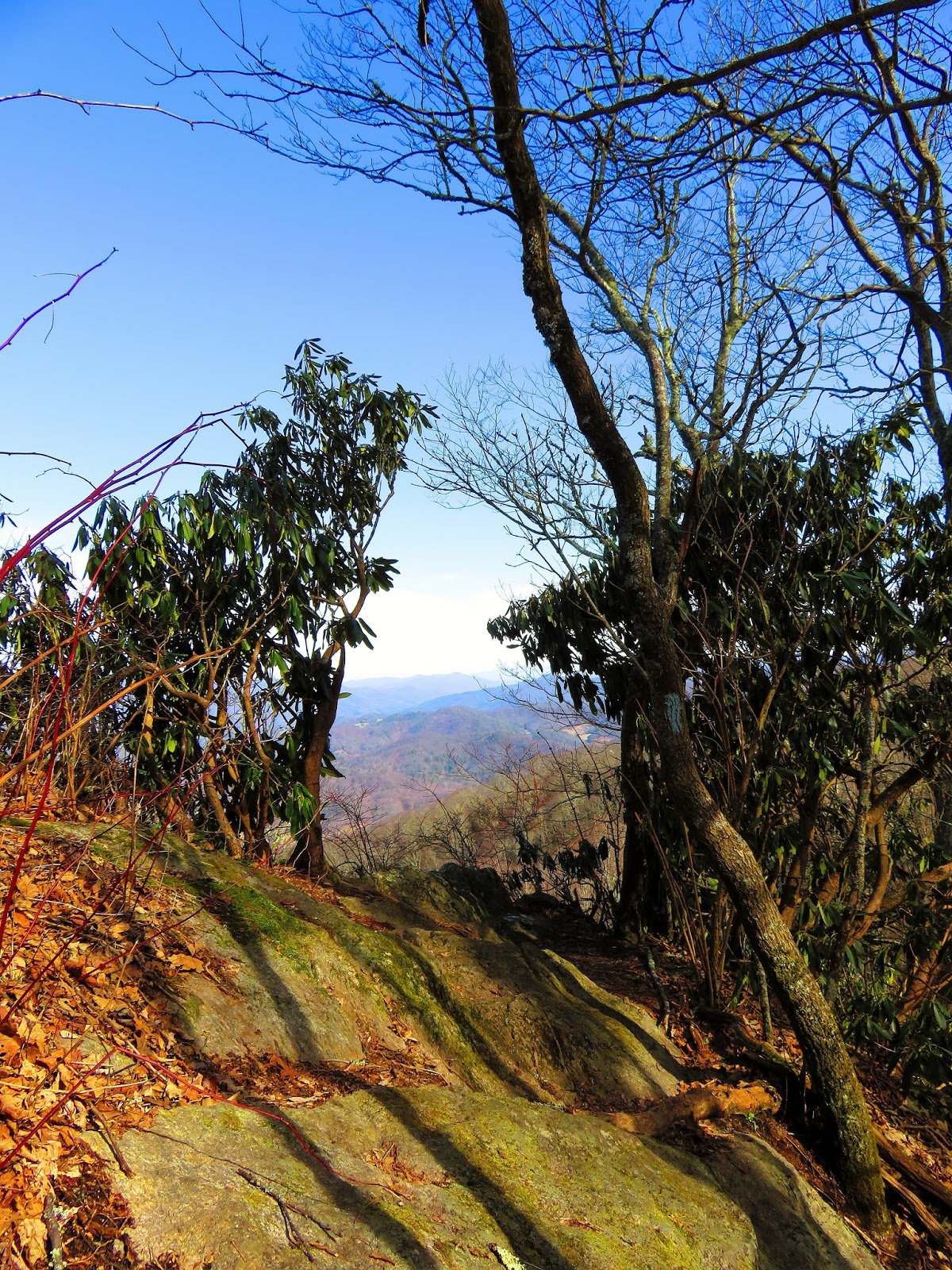
| View of Nolichucky Gorge from Cliff Ridge. |
Before heading to the trailhead I first stopped at the the Metcalf Overlook East. For those who have never been on I-26 through Sams Gap, right before you reach the top of the gap there is a pull-off for the parking area of the overlook. It is a short walk up to the large stone overlook that affords views into Tennessee and one of my objects for the day High Rocks. Another thing I love about this overlook is a lone tree that towers over this spot. I have to say it is one of my favorite trees. I have been stopping here for years and was always a highlight when I was heading back to Georgia.
 |
| East Metcalf Overlook. |
 |
| View of the parking lot from 2005... |
 |
| ...& my favorite tree in 2012. |
 |
| Looking into Tennessee from the overlook. |
 |
| Where I am heading to hike to High Rocks. |
 |
| Piece of the old road. |
The actually quickest (and easiest) way to were the AT cross at Sams Gap is head into North Carolina and back up. Unlike the old day were the trail just crossed the road, today it passes under the interstate, so one has to take the
Wolf Laurel exit three miles into the Tar Heel State. Once off the exit there are two lefts. The first points toward Wolf Laurel, but at the second right goes to the ski resort, left Sams Gap.
 |
| The exit for Sams Gap... |
 |
| ...& Wolf Laurel |
 |
| One of the bridges at Sams Gap. |
I will say that when they put the parking area in after completing I-26, that they did a real good job. It is a large, paved spot with ample parking. It reminds me of places like
Woody and
Newfound Gaps. Being a gap there is two directions one can go on the AT and on this day I was heading south up to High Rocks and Hog Back Ridge Shelter.
 |
| Parking at Woody Gap... |
 |
| ...Newfound Gap... |
 |
| ...& Sams Gap. |
 |
| AT headed north toward Big Bald. |
At the start the AT follows the road before turning left on an access road that leads to a small cemetery. It doesn’t stay on the road long before it turns left again past fenced in equipment and finally heading into the woods. It switchbacks some a short distance before coming to a stone monument on the left. It commentates the Moye Tract and sits were a road comes up to the trail.
 |
| AT headed under the bridge... |
 |
| ...up the road... |
 |
| ...which heads to this small cemetery... |
 |
| ...& this view... |
 |
| ...left the AT heads... |
 |
| ...into the woods. |
 |
| Moye Rest monument. |
Just down the trail one will come to were the trail turns a corner and there is a small path that leads up to a Knob over Sams Gap that I call Sams Knob. It has a slight winter view where you can see the slopes of Wolf Laurel. If you don’t take the detour the AT will eventual come to a fence-line which it will parallel for most of the trip to High Rocks. The trail through here doesn’t switchback much it is mostly up, but some down. At about a mile the trail will head up a section of rocks. From here another winter view, this time of the Metcalf Overlook.
 |
| Side trail up to... |
 |
| ...Sams Knob. |
 |
| The AT past Sams Knob. |
 |
| The AT follows... |
 |
| ...a fence-line. |
 |
| AT heads up rocks... |
 |
| ...with slight winter view. |
There is something that you will notice on this stretch of the AT there is a lot of double blazes. These usually indicate a trail junction, but here they are more to show where the path might split off, but most are at spots where the trail maintainers put in drainage. I am not complaining because too many is better than too few.
 |
| There were plenty of double blazes... |
 |
| ...on the trail. |
At about a mile-and-a-half on an uphill stretch there is a cool AT emblem carved into a tree. Finally about 4/10ths of a mile is the junction for High Rocks. It is a blue blazes trail with a sign that says “Vista 200 feet.” It is a short downhill with a small rock scramble to a nice view into Tennessee and Buffalo Valley. The main peak visible is
Pinnacle Mountain and if you have something to see through you can spot the fire tower on its summit. Down in the valley I-26 is clearly visible. If you climb up on the rock you get a great view of
Unaka Mountain and the bald of the Beauty Spot. From what I read this is a better winter view and I will have to say that they would be right.
 |
| AT passes a tree... |
 |
| ...with carved logo. |
 |
| Trail that leads to the High Rocks vista... |
 |
| ...in 200 feet. |
 |
| High Rocks... |
 |
| ...marker... |
 |
| ...& vista. |
 |
| I-26... |
 |
| ...Wolf Laurel ski slope... |
 |
| ...Pinnacle Mountain... |
 |
| ...Beauty Spot & Unaka Mountain. |
After enjoy the vista it is on to my next destination...the Hogback Ridge Shelter. The trail heads up to the top of High Rocks and on the way up one gets a nice view of
Big Bald and its summit. The trail then heads down a series of switchbacks before before reaching a sag (at two miles) and then heads uphill before down to a trail junction. There are a couple of signs here, one is a cool AT sign one way points north to Maine and the other south to Georgia. The other two signs (on each side of the AT sign) point the way to the Hogback Ridge Shelter.
 |
| Trail across High Rocks Ridge. |
 |
| Summit of Big Bald. |
 |
| Trail heads down... |
 |
| ....to the junction for... |
 |
| ...Hogback Ridge Shelter... |
 |
| ...while AT goes left or right. |
A blue blazed trail leads a tenth of a mile to the shelter. It was built in 1984 by the
Carolina Mountain Club and is a basic three sided shelter. There is a picnic table and bear cables. The interesting thing is that there is a sign at the cables that explain how to use them. To the left is a water source (which I didn’t visit) and right heads to a privy (which I did). Unlike other I have seen (kike at Blood Mountain and Ice Water Shelter in the Smokies) it doesn’t have a door. Hogback Ridge Shelter was my turnaround point, so after having some lunch I headed back.
 |
| Blue blaze... |
 |
| ...to the shelter... |
 |
| ...which was built over 30 years ago... |
 |
| ...inside... |
 |
| ...with carved AT logo. |
 |
| Bear cables... |
 |
| ...how to use them. |
 |
| No door privy. |
While there was some uphill in the first half-mile back most of the trip was downhill and it is this way heading north on the AT to Sams Gap. So here I would like to give people a word of caution who will be headed through here soon during thru-hiking season, it can get slick in spots. When I came in the trail was still frozen, but as the day warmed the trail thawed and on the way back it got slick and sloppy in spots. I had handled it pretty well until I was in site of I-26 and I fell on my ass on a muddy downhill spot. Just wanted to remind people to be careful.
 |
| Headed back... |
 |
| ...north... |
 |
| ...on the AT. |
 |
| I slipped in sight of... |
 |
| Sams Gap. |
Once back to the car I had one more stop on the way back toward Johnson City and that was the Metcalf Overlook West. I have stop here many times (but not as often as the East Overlook) and I will have to say that it is even better than the East one. This has four overlooks. The main lower section provides views back to Buffalo Valley and Pinnacle Mountain, but the most prominent mountain is Big Bald. There are not many places with a better view of this iconic AT mountain.
 |
| Metcalf Overlook West exit. |
 |
| The main overlook... |
 |
| ...has place to sit... |
 |
| ...one of the offshoot spots. |
 |
| View in summer. |
 |
| Great view of Little... |
 |
| ...& Big Bald. |
The other three overlooks require a short but steep hike. The first and second ones are not too hard to get to as each require a short hike. The third is at the top and is a 150 foot climb in 800 feet. Once at upper overlook it provides views back to where I just hiked at High Rocks. If you walk to complex of overlooks it is a steep 7/10ths of a mile.
 |
| The short trail...past 2nd overlook... |
 |
| ...& the third. |
 |
| My first trip up to the top overlook in June of 2013... |
 |
| ...first time at the overlook... |
 |
| ...almost three years later. |
 |
| High Rocks. |
 |
| Headed back down... |
 |
| ...to this wonderful overlook. |
 |
| Nice! |
So, if you are looking for a day hike on the AT Sams Gap makes a fairly easy spot to jump on the trail.
Sams Gap Hike Rating:
My Take:
For Difficulty – 2 Stars
For Trail Conditions – 4 Stars
For Views – 3 Stars
For Solitude – 4 Stars
Overall – This is not the most difficult stretch, but you will get a workout. The trail here is well maintained and blazed. The view at High Rocks is a nice winter view. While there were cars at the trailhead I passed no one, the only people I spotted were hunters.
 Pete’s Take:
For Difficulty – 1 Rabbits Paws
For Trail Conditions – 4 Rabbits Paws
For Views – 2 Rabbits Paws
For Solitude – 4 Rabbits Paws
Overall – For a hiker of my ability this was a piece of cake. As always the AT here is in great shape. The views are...alright. We passed no hikers and being a rabbit men with guns make me uneasy.


No comments:
Post a Comment