It is been quite a while since I have done a ...From Blog. The last time I did one of these was on the last of the Georgia Giants,
Tray Mountain, but now is the first I have done on a mountain in Tennessee and what better one to start with than
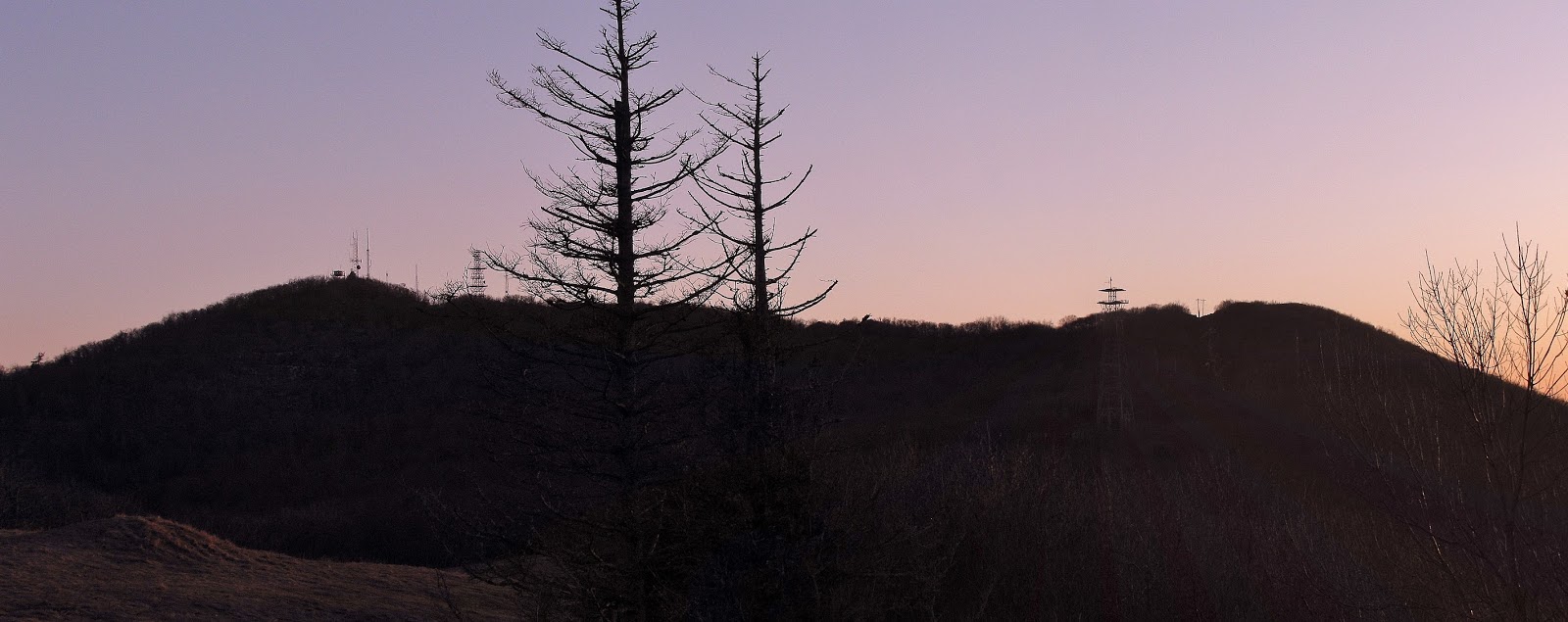
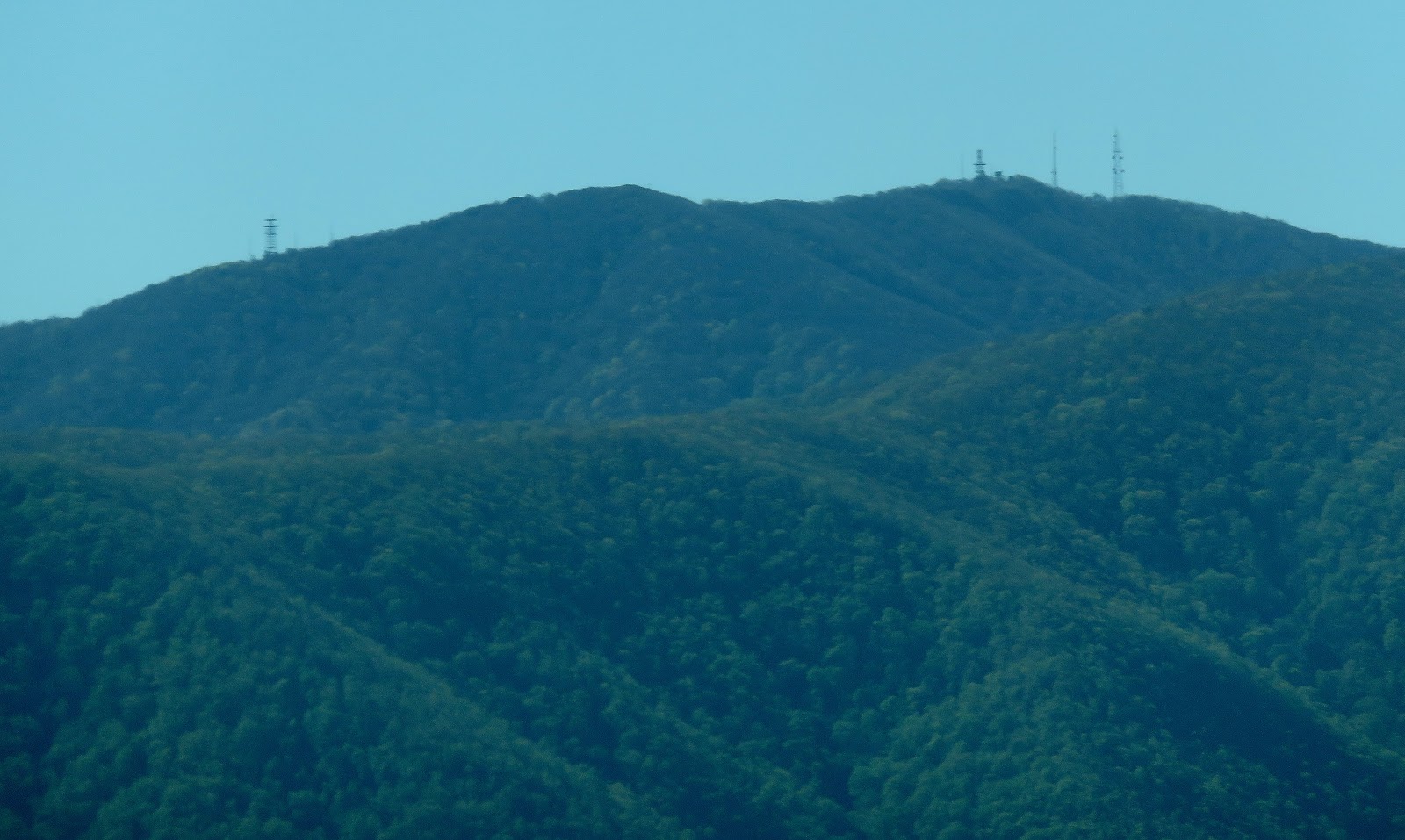
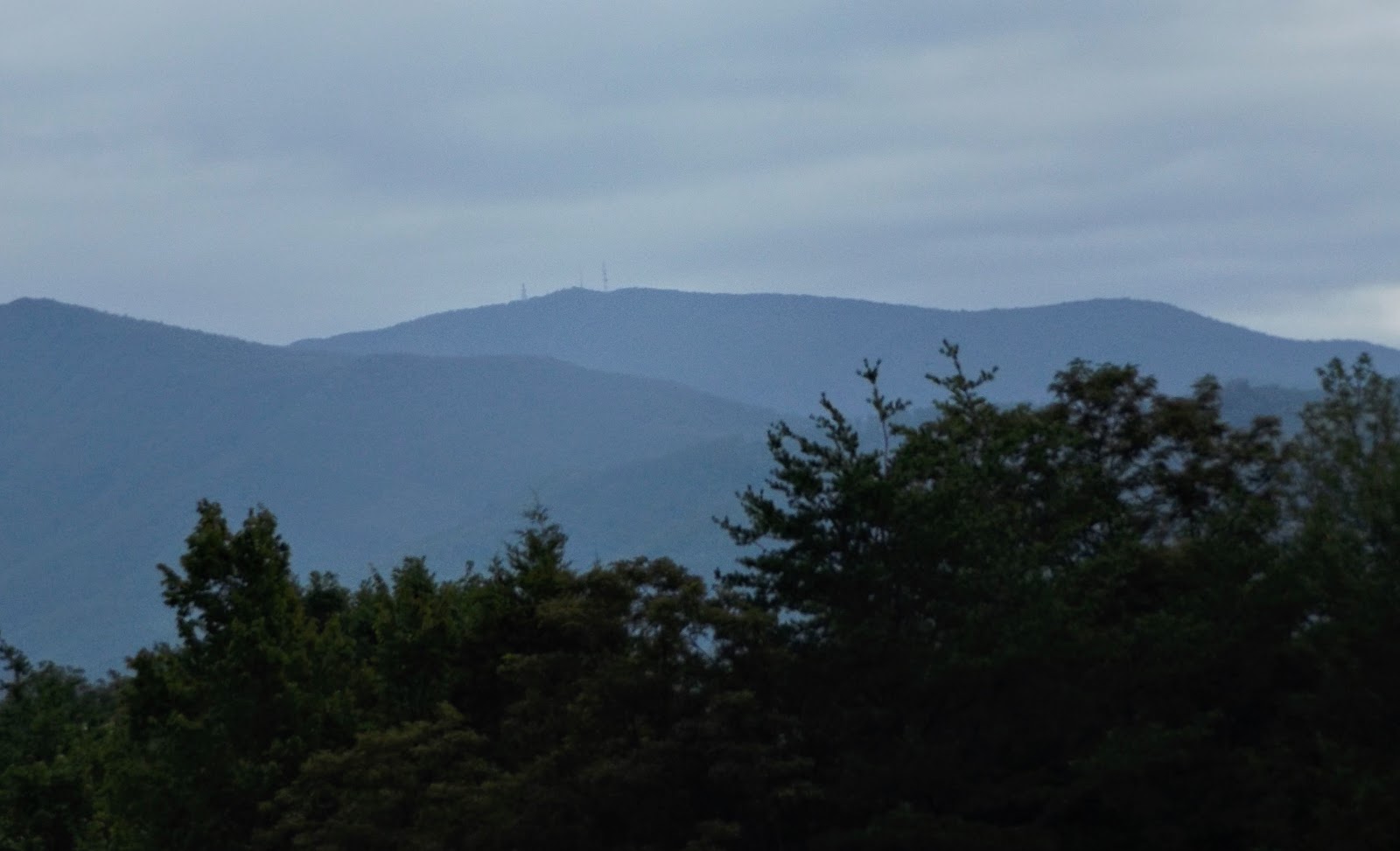
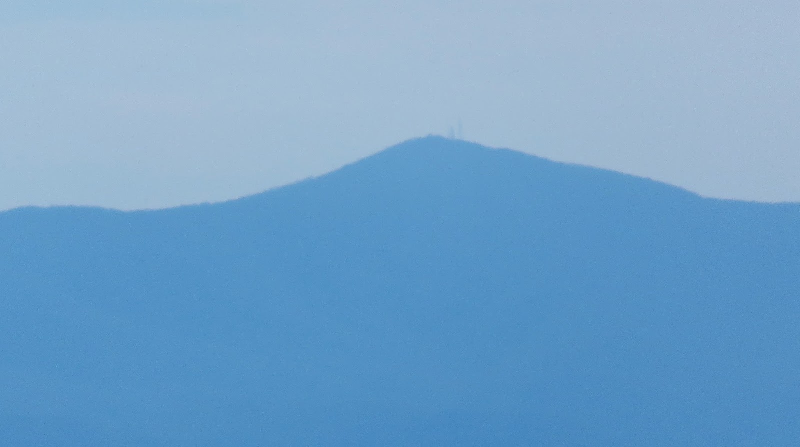
Camp Creek Bald. Also known as Viking Mountain Camp Creek Bald is what I call "my backyard" as it towers in the distance over Greeneville. At 4,844 feet it is not the tallest mountain in Tennessee or even in Greene County (that is
Gravel Knob - 4,852 feet) it does have an opposing mastiff. It is also easy to spot because of the towers, including the old round fire tower. I wrote an extensive
blog about the mountain back in April of 2015. I have been to its summit on six occasions making it my second most visited peak behind
Blood Mountain (seven). So, there was no question what the first mountain outside of Georgia I would do a From...Blog on. Also, technically this mountain is not just in Tennessee, but also North Carolina as the Bald Mountains straddle the state line. So here is From....Camp Creek Bald.
....Camp Creek Bald
 |
| August 29, 2016: Fire Tower at Summit |
 |
| January 2, 2021: Fire Tower |
 |
| January 2, 2021: Northeast Vista |
 |
| January 2, 2021: Northwest Vista |
 |
| January 2, 2021: West Vista |
 |
| January 2, 2021: South Vista |
 |
| January 2, 2021: Southeast Vista |
 |
| November 26, 2016: Tower Above Summit |
 |
| April 30, 2016: Summit Block |
 |
| October 31, 2018: Summit Marker (Overhead) |
 |
| October 31, 2018: Summit Marker |
 |
| May 7, 2016: West Below Summit (65 ft) |
 |
| April 30, 2016: East Below Summit (100 ft) |
 |
| April 5, 2016: Area of Towers (46 yds) |
 |
| April 5, 2013: Communication Tower # 1: (60 yds) |
 |
| August 29, 2016: Communication Tower #3 (95 yds) |
 |
| April 30, 2016: Communication Tower #2 (100 yds) |
 |
| March 31, 2018: Camp Creek Bluffs (101 yds) |
 |
| March 31, 2018: Vista from CC Bluffs (101 yds) |
 |
| October 31, 2018: Fall Vista from CC Bluffs (102 yds) |
 |
| October 15, 2015: Old Phone Tower (.42 Miles) |
....Appalachian Trail
 |
| April 5, 2013: Near Junction with Pounding Mile Trail (146 yds) |
 |
| April 5, 2013: Near Campsite with Water (.40 Miles) |
....Bald Mountain Road (Cherokee N.F.)
 |
| November 26, 2016: Viking Mtn. Overlook (.40 Miles) |
 |
| October 31, 2018: Vista from Viking Mtn. Overlook (.40 Miles) |
 |
| November 26, 2016: Winter View (0.45 Miles) |
....Jones Meadow (Cherokee N.F.)
 |
| May 7, 2016: View of Lower Parking Area (.54 Miles) |
 |
| October 15, 2015: From Lower Parking Area (.55 Miles) |
 |
| May 7, 2016: View of Upper Parking Area (.70 Miles) |
 |
| August 29, 2016: From Upper Parking Area (.80 Miles) |
 |
| October 15, 2015: View of Site of Old Valhalla Inn (.83 Miles) |
 |
| October 15, 2015: Vista from Site of Old Valhalla Inn (.83 Miles) |
 |
| April 5, 2013: Site of Old Valhalla Inn (.83 Miles) |
 |
| April 11, 2015: Close up of Summit at Site of Old Valhalla Inn (.83 Miles) |
....White Rock Cliffs (Pisgah N.F.)
 |
| November 26, 2016: From Outcrop (1 mile) |
 |
| May 7, 2016: Close up of Summit From Outcrop (1 mile) |
....Blackstack Cliffs (Cherokee N.F.)
 |
| April 5, 2013: From Little Firescald Knob (1.1 Moles) |
 |
| May 7, 2016: From the Cliffs (1.1 Miles) |
 |
| May 7, 2016: Close Up of Summit From the Cliffs (1.1 Miles) |
....Baxter Cliff (Pisgah N.F.)
 |
| March 31, 2018: From the Cliff (1.42 Miles) |
....Jerry Miller Trail (Pisgah N.F.)
 |
| March 31, 2018: Huckleberry Gap (1.44 Miles) |
....Kennedy Cabin (Cherokee N.F.)
 |
| November 29, 2017: From Meadow (1.5 Miles) |
 |
| November 29, 2017: Close-up from Meadow (1.5 Miles) |
....Big Firescald Knob
 |
| May 7, 2016: Main Outcrop (1.78 Miles) |
 |
| October 15, 2015: Summit from Main Outcrop (1.78 Miles) |
 |
| May 7, 2016: Howard's Rock (1.79 Miles) |
 |
| August 29, 2016: from Howard's Rock (1.79 Miles) |
 |
| October 15, 2015: North End of Ridgeline (2.2 Miles) |
 |
| October 15, 2015: Far End of the Ridgeline (2.4 Miles) |
....Greene Mountain (Cherokee N.F.)
 |
| November 29, 2017: From Near the Summit (2 Miles) |
 |
| November 29, 2017: From Greene Mountain Trail (2.3 Miles) |
....Viking Mountain Road (Cherokee N.F.)
 |
| October 15, 2016: Dillard Place (2.72 Miles) |
 |
| November 26, 2016: Just Below Dillard Place (3 Miles) |
 |
| April 5, 2013: Pull off (3.2 Miles) |
 |
| November 26, 2016: Front of Farm (3.5 Miles) |
....Round Knob (Cherokee N.F.)
 |
| September 21, 2016: Round Knob Trail (3.20 Miles) |
....NC-212
 |
| July 27, 2019: From the Road (3.43 Miles) |
....Shelton Mission Road, TN
 |
| September 15, 2019: From the Road (4.30 Miles) |
....Coldspring Mountain
 |
| September 21, 2016: Bald Meadow (4.80 Miles) |
 |
| September 21, 2016: Summit from Bald Meadow (4.80 Miles) |
....Greystone Road, TN
 |
| October 31, 2015: From the Road (5 Miles) |
 |
| October 31, 2018: From the Road (5.9 Miles) |
 |
| October 31, 2018: From the Road (7 miles) |
....Big Butt
 |
| September 21, 2016: Big Rocks (5.5 Miles) |
....Devil's Fork Gap, NC/TN
 |
| July 27, 2019: From AT (6.5 Miles) |
 |
| July 28, 2019: Up close of the summit from AT (6.5 Miles) |
....TN-350, Greene County, TN
 |
| May 3, 2017: Near the Nolichucky River (7.7 Miles) |
....TN 107, Greene County, TN
 |
| August 29, 2017: Houston Valley-Garrett Rd. (8 Miles) |
....South Greene High School, TN
 |
| December 20, 2015: TN-107 (8.3 Miles) |
....Rich Mountain (Pisgah N.F.)
 |
| October 20, 2015: From Fire Tower (8.3 Miles) |
 |
| February 9, 2020: From the Fire Tower (8.3 Miles) |
 |
| February 9, 2020: With Snow (8.3 Miles) |
....Jones Bridge Road, Greene County, TN
 |
| October 31, 2015: On the Road (8.8 Miles) |
....TN-107, Tusculum, TN
 |
| March 17, 2017: Nolichucky River Bridge (9.5 Miles) |
 |
| October 31, 2015: Tusculum Cutoff (10.2 Miles) |
....Shiloh Road, Greene County, TN
 |
| April 6, 2013: Near Shiloh Presbyterian Church (9.9 Miles) |
....Tusculum Trail, Tusculum, TN
 |
| December 27, 2014: Subdivision Trailhead (10.16 Miles) |
 |
| December 27, 2014: From Subdivision (10.35 Miles) |
 |
| July 4, 2014: Farm House (10.4 Miles) |
 |
| March 11, 2017: Pleasent View Drive (10.47 Miles) |
 |
| October 1, 2016: From Field Just off the Trail (10.7 Miles) |
 |
| February 14, 2017: TN-107 Footbridge (10.8 Miles) |
 |
| July 4, 2014: Doak School Trailhead (11 Miles) |
 |
| July 4, 2014: Green Valley Trailhead (11 Miles) |
....Glenfield Subdivision, Tusculum, TN
 |
| June 10, 2013: Glenfield Trail (10.8 Miles) |
 |
| January 3, 2014: From Cul-sac (10.9 Miles) |
....TN-107
 |
| March 28, 2019: Greene/Washington County Line (10.9 Miles) |
....Laughlin Hospital Trail, Greeneville, TN
 |
| March 31, 2014: Back Trailhead (11 Miles) |
 |
| June 10, 2013: from Trail (11.2 Miles) |
....Takoma Nature Trail, Greeneville, TN
 |
| November 5, 2016: From Cutline (11.4 Miles) |
....Plaza Shopping Center, Greeneville, TN
 |
| February 25, 2017: In front of Harbor Freight (11.6 Miles) |
....Paint Rock Trail (Cherokee N.F.)
 |
| August 29, 2017: Halfway on trail (11.75 Miles) |
....Chimney Rocks (Cherokee N.F.)
 |
| November 22, 2016: Chimney Rocks Trail (12 Miles) |
....TN-107, Cocke County, TN
 |
| August 29, 2017: Houston Valley Road (12.5 Miles) |
....Greeneville, TN
 |
| April 3, 2019: From Downtown (12.5 Miles) |
....Big Bald (Cherokee/Pisgah N.F.)
 |
| July 8, 2018: From Summit (12.8 Miles) |
 |
| July 8, 2018: Close Up from Summit (12.8 Miles) |
....Limestone, TN
 |
| March 5, 2016: US-11E (15.1 Miles) |
....Meadow Creek Tower (Cherokee N.F.)
 |
| January 2, 2016: From the Refurbished Tower (15.7) |
 |
| January 2, 2016: Summit From the Refurbished Tower (15.7 Miles) |
....Mosheim, TN
 |
| February 13, 2017: US-11E (17.2 Miles) |
....I-81, Baileyton, TN
 |
| November 5, 2015: Exit 30 with Clouds on Summit (20.6 Miles). |
 |
| November 21, 2015: Exit 30 Cloud Free (20.6 Miles). |
....Max Patch (Pisgah N.F.)
 |
| February 24, 2017: From Summit (21 Miles) |
....Jonesborough, TN
 |
| June 7, 2016: US-11E (22 Miles) |
....Unaka Mountain (Cherokee N.F.)
 |
| October 19, 2019: Pleasant Garden Overlook (24 Miles) |
....Yoder's Country Store, Bulls Gap, TN
 |
| November 19, 2016: Off US-11E (24.4 Miles) |
....Buffalo Mountain Park, Johnson City, TN
 |
| May 16, 2019: From Huckleberry Knob (26.84 Miles) |
....The Craggies
 |
| June 14, 2013: Craggy Gardens (29 Miles) |
 |
| June 14, 2013: Craggy Dome Parking Area (29 Miles) |
 |
| June 14, 2013: Craggy Pinnacle (29 Miles) |
 |
| June 29, 2019: Craggy Gardens Visitor Center (29 Miles) |
....St. Clair, TN
 |
| December 3, 2018: Thorps Chapel Rd. (30 Miles) |
....Mount Cammerer (GSMNP)
 |
| October 19, 2018: From the Fire Lookout (30.8 Miles) |
....Mount Mitchell
 |
| June 14. 2013: Observation Tower (31 Miles) |
....Morristown, TN
 |
| February 25, 2017: Junction of TN-160 & I-81 (31.2 Miles) |
 |
| February 25, 2017: Near Wayne Hansard Park (37 Miles) |
....Mount Sterling (GSMNP)
 |
| December 16, 2016: From the Fire Tower (31.8 Miles) |
....Little Rock Knob (Cherokee/Pisgah N.F.)
 |
| April 10, 2019: Tower visible behind Gravel Knob (32.85 Miles) |
....Bays Mountain Park, Kingsport, TN
 |
| January 25, 2017: From Fire Tower (35 Miles) |
 |
| January 25, 2017: From Cliffside Overlook (35 Miles) |
....Piney Flats, TN
 |
| January 4, 2021: US-19 (36 Miles) |
....House Mountain State NA
 |
| March 16, 2019: House Mountain - East Side (59.2 Miles) |
....High Knob (Jefferson N.F.)
 |
| September 30, 2017: From the Tower (61 Miles) |
Soon I will have a From....Blog on the other peaks around Camp Creek Bald.


Great pics! I can see Camp creek bald and the blackstacks from my front porch. I never tire of the mountains. Thanks...Marty
ReplyDelete