
Wow! It is hard to believe the last Season Blog I did was last year's Fall Outdoor Series, so I have some catching up to do. I am going to start with the 2018 Fall Outdoor Series and then move back over the time. I will try to get these all done before having to do WinterOutdoors '18-19, but we will see. As I said in an earlier blog I was going to make some changes to how I do these, but I decided not to, so this is basically like how they were done in the past. I will try and do a Top 5 blog on my favorite hikes of the 2018 Fall Outdoor Series. Anyway, it was a good season and with that said here is the 2018 Fall Outdoor Series.
Total Days Out: 25; Hiking Days: 24 Total Hikes: 26; Urban-Other Hikes: 3 Total Miles: 108.8; Hiking Miles: 104.8; Urban-Other Miles: 4.0
 |
| Longest: Mt. Cammerer - 11.5 Miles (10-19-18) |
 |
| Shortest: High Knob Tower Trail - 0.5 Miles (09-29-18) |
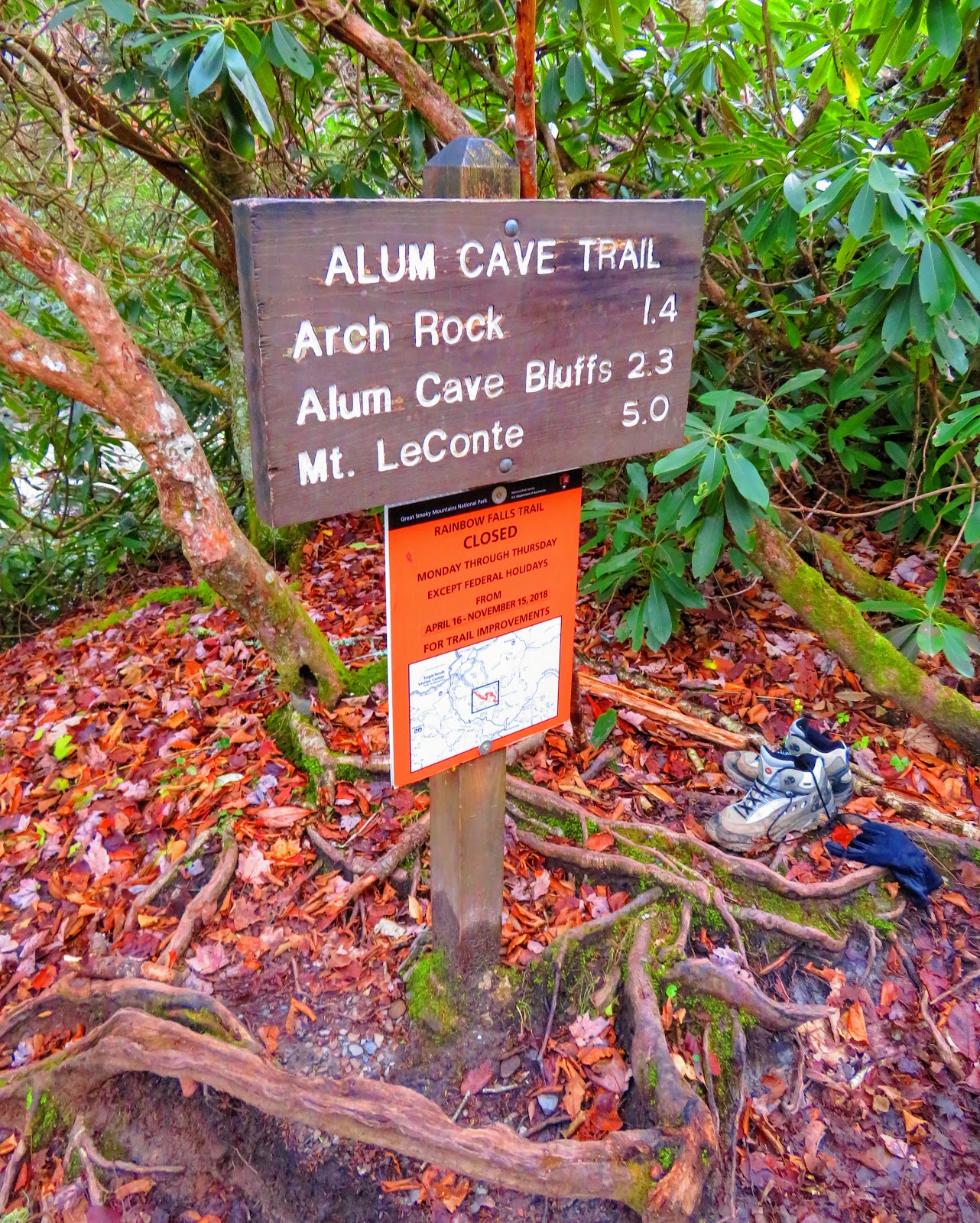 |
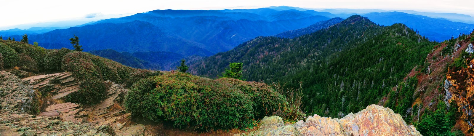
| Coldest: Alum Caves to Mt. LeConte - 25° & 5° Wind Chill (11-23-18) |
 |
| Warmest: to Devil's Backbone 85° (09-02-18) |
Mountain Peaks: 15
 |
| Highest Peak & Point: Mt. LeConte - 6,594 ft. (11-23-18) |
 |
| Shortest Peak: Russell Knob - 1,812 ft. (11-04-18) |
 |
| Lowest Point: Leatherwood Ford - 875 ft. (10-19-18) |
Fire Lookouts, Towers & Water Towers: 5
 |
| Highest & Shortest: Mt. Cammerer - 4,928 ft. & 16 ft. (10-19-18) |
 |
| Tallest: Camp Creek Bald - 21 ft. (10-31-18) |
 |
| Lowest: High Knob - 4,222 ft. (09-29-18) |
Cliffs & Outcrops: 48
 |
| Highest: Cliff Tops - 6,555 ft. (11-23-18) |
 |
| Lowest: Upper Pogue Creek Canyon - 1,616 ft. (10-20-18) |
Overlooks: 24
 |
| Highest: Cataloochee Valley Overlook - 3,496 ft. (09-24-18) |
 |
| Lowest: Leatherwood Ford Overlook - 875 ft. (10-19-18) |
Waterfalls: 22
 |
| Largest: Foster Falls - 120 ft. (10-06-18) |
 |
| Smallest: Blue Hole Falls - 9 ft. (10-07-18) |
Bodies of Water: 14
 |
| Largest & Lowest: Cherokee Lake - 45 Sq. Miles & 1,067 ft. (09-15-18) |
 |
| Smallest & Highest: High Knob Lake - 4 Acres & 3,550 ft. (09-29-18) |
 |
| Highest River: Little River - 1,647 ft. (09-20-18) |
 |
| Lowest River: Big South Fork - 875 ft. (10-19-18) |
Trailheads: 34
 |
| Highest: Mt. Cammerer Trail - 4,950 ft. (10-19-18) |
 |
| Lowest: Wolf River Trail - 877 ft. (11-10-18) |
Gaps: 13
 |
| Highest: Bearwallow Gap - 4,432 ft. (10-31-18) |
 |
| Lowest: Wear Cove Gap - 1,828 ft (09-06-18) |
Campsites: 3
 |
| Highest: Cataloochee CG - 2,626 ft. (09-24-18) |
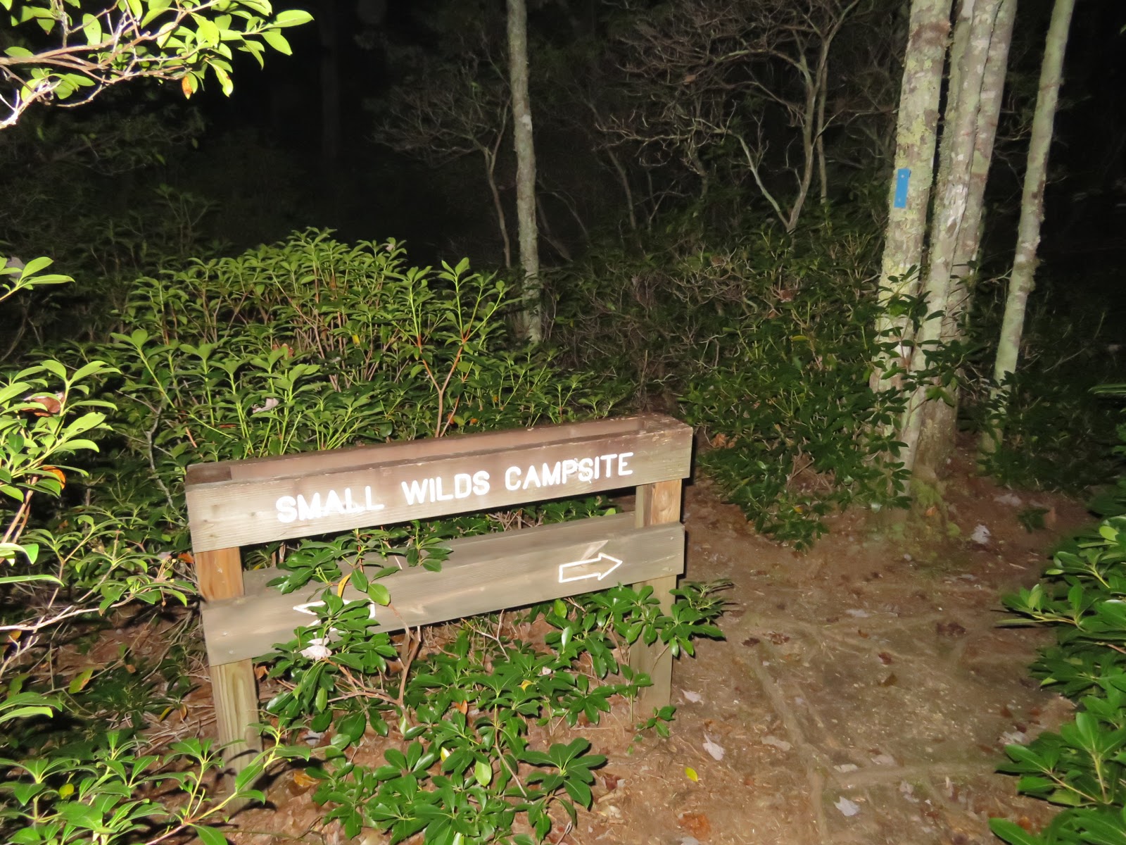 |
| Lowest: Small Wilds Campsite - 1,819 ft. (10-06-18) |
Gift Shops & Visitor Centers: 11
 |
| Highest: Mt. LeConte Office & Store - 6,353 ft. (11-23-18) |
 |
| Lowest: Alvin York SHP Visitor Center - 898 ft. (11-10-18 |
National Parks: 6
 |
| Highest: GSMNP - 6,594 ft (11-23-18) |
 |
| Lowest: Big South Fork NRRA - 875 ft. (10-19-18) |
State Parks: 4
 |
| Highest: Grundy Forest STA - 1,848 ft. (10-07-18) |
 |
| Lowest: Alvin York State HP - 898 ft. (11-10-18) |
Recreation & Picnic Areas: 3
 |
| Highest: High Knob RA - 3,555 ft. (09-29-18) |
 |
| Lowest: Metcalf Bottoms Picnic Area - 1,677 ft. (09-20-18) |
Major Trails: 3
 |
| Appalachian Trail: 3 |
No comments:
Post a Comment