
Thank God the long nightmare is unofficially over. While it will get hot again we did get a taste of autumn as the calendar flipped to September. While it has been mostly a hot and miserable summer the one bright spot was HikeSummer ‘16. I will say that this was one of the best hiking seasons to date. In June there were some great wildflower hikes to places like Mount LeConte, Gregory Bald, and the Roan Highlands. Plus I did a little wilderness training. In July I had an excellent backpacking trip with the Harvey Broome Group at Grayson Highlands State Park and a trip to Jacksonville. August started like July with another overnight with the Sierra Club, this time in the Shining Rock Wilderness The I finished up the month with hikes on the Appalachian Trail (AT) around the area. So, before the 2016 Fall Outdoor Series can get in full swing here is a look back at HikeSummer ‘16.
Total Days Out: 30; Hiking Days: 27
Total Hikes: 24; Urban-Other Hikes: 4
Total Miles: 127.1; Hiking Miles: 120.7; Urban-Other Miles: 6.4
 |
| Longest: Rainbow & Bullhead Trails to Mt. LeConte - 15.2 Miles (06-10-16) |
 |
| Shortest: Blue Hole - .25 Miles (08-25-16) |
 |
| Warmest: Mulberry Cove NT - 103 Degrees (07-28-16) |
 |
| Coldest: Grayson Highlands S.P. - 50 Degrees (07-09 & 10-16) |
Mountain Peaks: 26
 |
| Highest: Mt. LeConte - 6,593 ft. (06-10-16) |
 |
| Shortest: Persimmon Ridge - 1,900 ft. (06-07-16) |
Fire Lookouts, Towers & Water Towers: 5
 |
| Highest & Shortest: Camp Creek Bald FT - 4,844 ft. & 21 ft. (08-29-16) |
 |
| Lowest & Tallest: Rich Mountain FT - 3,643 ft. & 30 ft. (07-17-16) |
 |
| Tallest: NAS JAX Water Tower - 130 ft. ( 07-24 to 30-16) |
 |
| Shortest: Ridge Water Tower - 40 ft. (06-07-16) |
Cliffs & Outcrops: 62
 |
| Highest: Cliff Tops - 6,555 ft. (06-10-16) |
 |
| Lowest: Manatee Point - 2 ft. (07-27-16) |
Overlooks: 25
 |
| Highest: Roan Rhododendron Gardens - 6,167 ft. (06-16-16) |
 |
| Lowest: Mulberry Cove Overlook - 0 ft. (07-25 to 30-16) |
Waterfalls: 11
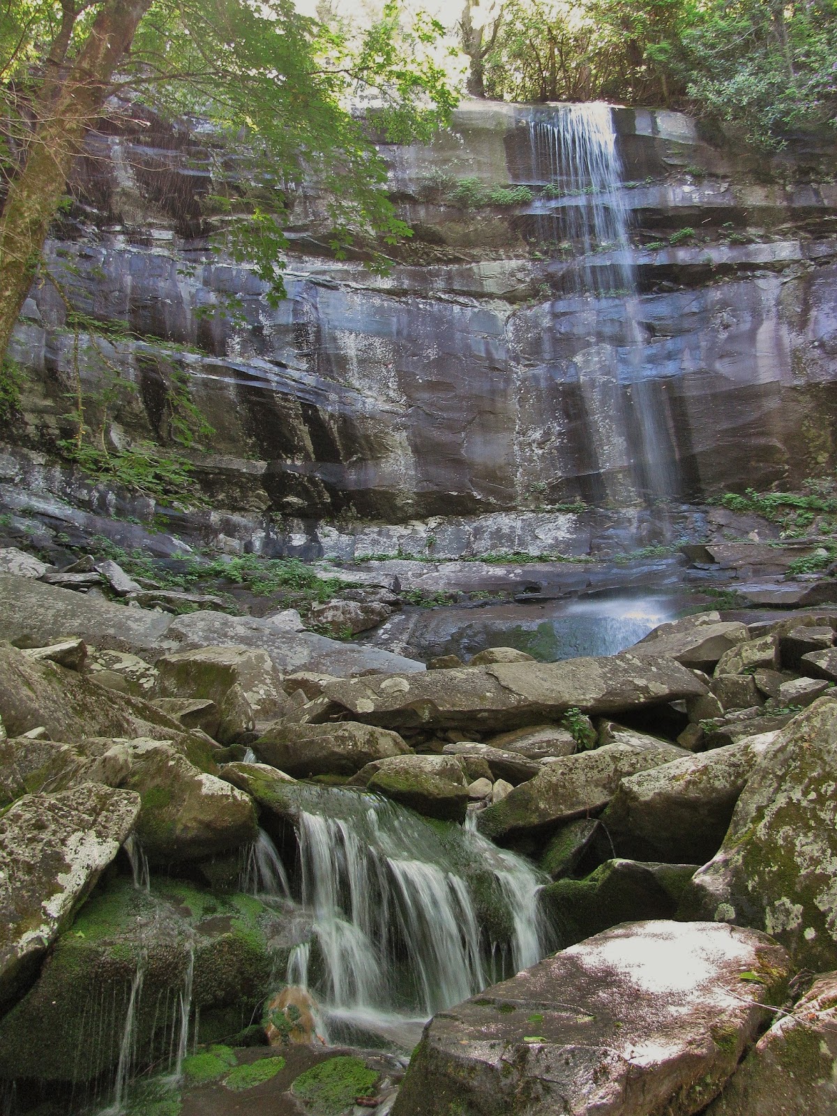 |
| Tallest: Rainbow Falls - 80 ft. (06-10-16) |
 |
| Shortest: Upper Blue Hole - 10 ft. (08-25-16) |
Bodies of Water: 36
 |
| Ocean: Atlantic Ocean - 41 Million SQ Miles (07-29-16) |
 |
| Largest Lake: Cherokee Lake - 44.97 SQ Miles (06-30-16) |
 |
| Highest Lake: Watauga Lake - 1,959 ft. (07-10-16) |
 |
| Smallest Lake: Davey Crockett Lake - 383 Acres ( |
 |
| Lowest Lake: Douglas Lake 876 ft. (07-24-16) |
 |
| Highest River: Doe River - 2,681 ft. (June 3-Times) |
 |
| Lowest River: St. John's River - 0 ft. (07-25 to 30-16) |
Trailheads: 43
 |
| Highest: Rainbow Falls-Boulevard Trails - |
 |
| Lowest: Mulberry Cove NT - 10 ft. (07-25 to 30-16) |
Gaps: 34
 |
| Highest Hiking & Road: Toll House Gap - 6,087 ft. (06-16-16) |
 |
| Lowest Hiking: Cumberland Gap - 1,601 ft. (06-30-16) |
 |
| Lowest Road: Moccasin Gap - 1,266 ft. (July 2-Times & Aug. 2-Times) |
Shelters: 5
 |
| Highest: Mt. LeConte Shelter - 6,465 ft. (06-10-16) |
 |
| Lowest: Jerry's Cabin - 4,166 ft. (08-29-16) |
Gift Shops & Visitor Centers: 26
 |
| Highest: LeConte Lodge - 6,400 ft. (06-10-16) |
 |
| Lowest: NAS JAX Pro & Gift Shop - 19 ft. (07-24 & 27-16) |
Wilderness Areas: 2
 |
| Highest: Shining Rock - 5,725 ft (08-13 & 14-16) |
 |
| Lowest: Little Wilson Creek - 4,370 ft. (07-09 & 10-16) |
Recreation & Picnic Areas: 9
 |
| Highest: Mt. Rogers NRA - 4,913 ft. (07-9 & 10-16) |
 |
| Lowest: Fishermen's Cove - 8 ft. (07-27-16) |
Campsites: 3
 |
| Highest: Shining Rock Wilderness 5,350 ft. (08-13 & 14-16) |
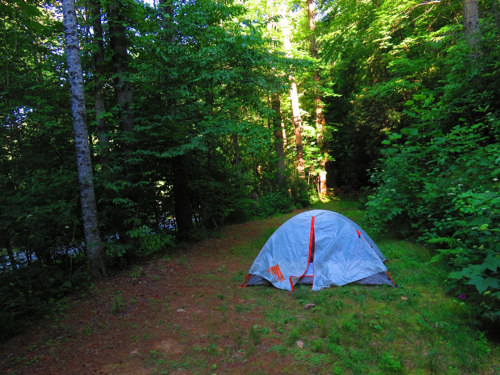 |
| Lowest: Lost Mine Campground - 1,885 ft. (06-24 to 26-16) |
Major Trails: 16
 |
| Appalachian Trail: 9 |
 |
| Mountains to Sea Trail: 1 |
 |
| Art Loeb Trail: 1 |
 |
| GSMNP: 5 |
No comments:
Post a Comment