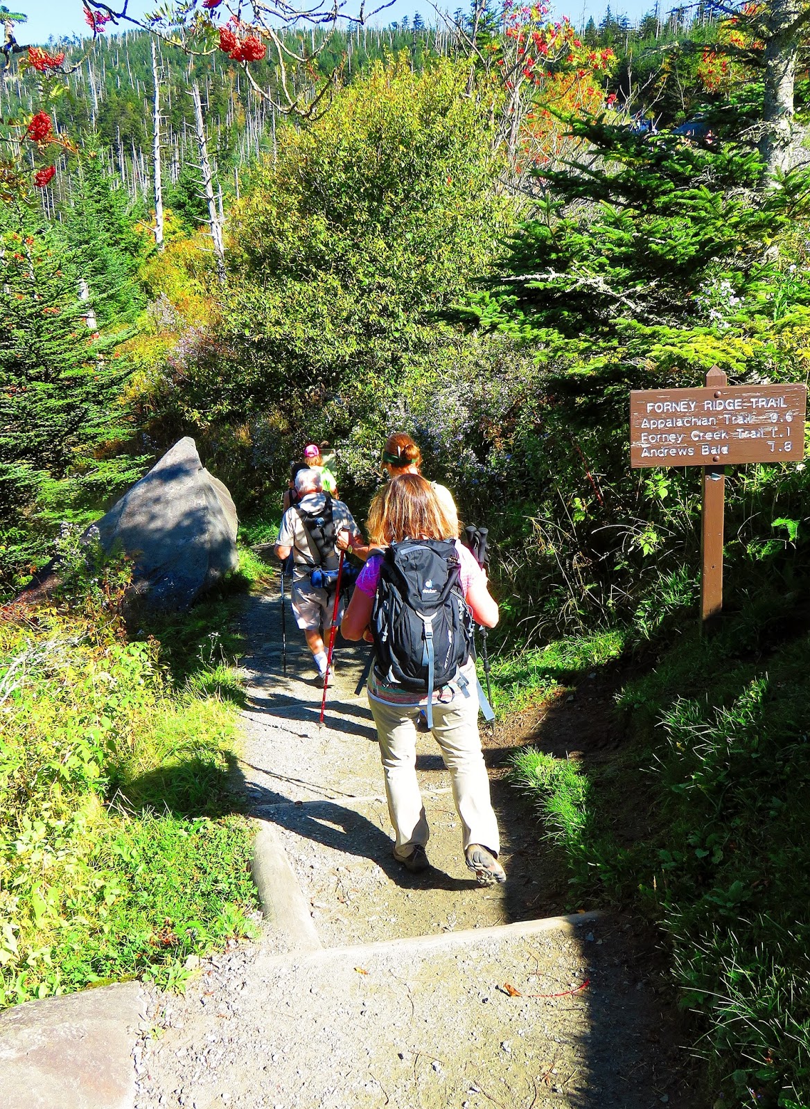
The hike started at Clingmans Dome Parking Area, but instead of heading up the half-mile (paved) summit trail our Hike Leader, Denise, decided we would head up the Clingmans Dome Bypass Trail and connect with the Appalachian Trail (AT) which the rest of the hike would follow.
The vista from the Clingmans Dome Parking Area.
Now that is cool!
Start of the hike....
...to the 1st junction, we went right...
...up the Clingmans Dome Bypass Trail....
...to the junction with the AT.
I showed the group the Mt. Buckley vista...
...view of the next stop.
Headed up...
...the AT.
We made a brief stop at the Clingmans Dome Tower and the vistas were beautiful with clear skies (more on this later).
Going up...
...Clingmans Dome Tower.
North...
...East,,,
...South...
...West vista.
Wood Booger in the tower (Photo by Denise Edwards).
We then headed north on the AT first down and then up Mount Love (6,446 ft.). It was in this area where our Hike Leader said there might be Faries, some might have seen Hobbits, but I thought it was a bit Squatchy. We then descended into Collins Gap before heading up the mountain with the same name.
The Hike Leader getting us back on the AT...
There were some magical spots on the trail.
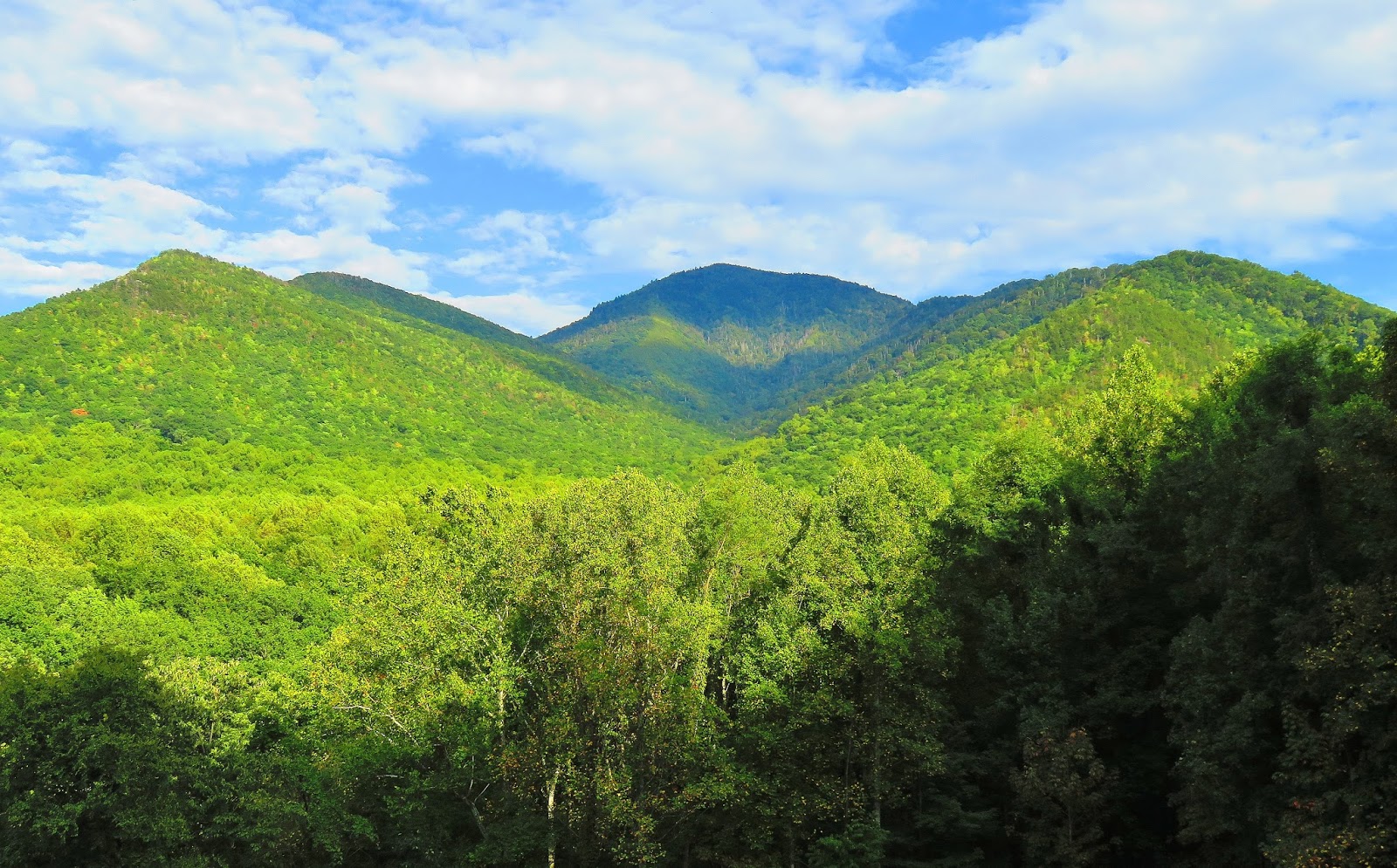
This is a good vista...
...with a great view of Pigeon Forge.
Two of our group, Susan & Betty.
There were parts of the trail that smelled like Xmas.
Len, Margaret, Susan & Betty headed down some rock steps.
A nice open spot.
Here are some pictures...
...on the AT...
...through Collins Gap...
...& up...
...Mount Collins.
The weather was still nice we stopped for lunch on another 6,000-foot peak, Mount Collins, but around the time we reached the junction for the Mount Collins Shelter it started to really cloud up. Less than a mile later we reached the Fork Mountain Trail, which is where the Mountains-to-Sea Trail (MST), which shared the same trail for 3.5 miles, splits from the AT. For those who don't know the MST Western Terminus is Clingmans Dome and from there it heads across North Carolina to the Outer Banks.
The trail to Mount Collins...
...& some of the forest near its 6,182 feet summit.
An after lunch picture of our group.
It is about this time when it started to cloud up.
The trail & a cool tree on Mt, Collins.
The only vista on Mt. Collins (notice the ominous clouds).
At cuts through some fallen trees.
Junction with the trail to Mt. Collins Shelter.
Here is the Western Terminus of the MST...
...here is where it splits from the AT>
The other thing that happened was it started raining. The NOAA Weather site said there was a 30% chance of rain for Clingmans Dome, but it was supposed to be light and it did start that way. However, that soon changed as it got harder and stayed that way for well over an hour. Because of the 30% chance, I brought rain gear, but because I am always prepared I brought an extra emergency poncho and gave it to Len. I wasn't 100 percent prepared because I didn't bring the backup camera and as a result, I didn't get a lot of pictures (I had to secure my main camera) of the trail filling with water (video below, from my Watauga Dam hike, gives an idea what it was like).
It was about now that it started to rain.
I would soon learn why there was raised spots on the trail.
Len (with my Emergency Poncho) & Margaret.
The Lovers & Peeping Tom Tree.
So, when we reached Indian Gap some in our party wanted to hike the Clingmans Dome Road back. When we read the trail sign we thought it said 3.3 miles and was four o'clock. With that information our Hike Leader decided that it would be faster to take the road back, it was the right call. But, let me add that when I got home later I discovered looking at my AT books and maps (also looking at an old picture from Indian Gap) that the mileage was not 3.3, but 1.7 miles, we were looking at the Road Prong Trail and not the AT. This Wood Booger take responsibility for this error as I was carrying said books and map, oh well I will have to go back and finish that part. On the road back two of our party (Len & Betty) were ahead of us had a car pull over and was going to give them a ride back. It was decided that I would also ride back to Newfound Gap because I was the shuttle car back to Clingmans Dome.
We have arrived at Indian Gap.
Here is the sign I miss read!
Wet road back.
It was at this vista I was picked up...
Margaret, Susan & our Hike Leader await my return (photo by Denise Edwards).
I got back to my car and picked up Susan, Margaret and our Hike Leader and shuttled up to get our cars for our rendezvous at Newfound Gap. Even with the hike cut short by weather (and an inability to read a sign it was a great day and I would like to thank my fellow hikers for making it so (especially our Hike Leader as I know the trails and tribulations of leading hikes...good job).
At Clingmans Dome, you can tell I am water logged!
Clouds at Newfound Gap.
Where we started out hike.
This is why they call them the Smoky Mountains.
On the way back I stopped at Carlos Campbell Overlook.


No comments:
Post a Comment