Appalachian Trail (AT) Section Hiking...I have been talking about starting a series on the one I have completed. Before I decided to do this as a series I had done blogs about AT Section Hikes in the past. So, some of these blogs will be brand new and others will be a reboot of ones I have already done, but some stuff added, others removed, mostly involving pictures. That is what this first one will be on Tesnatee Gap to Neel Gap, a retool of my March 2014 blog...
AT Section Hiking: Tesnatee Gap To Neel Gap (also Wildcat Mtn. & Hog Pen Gap). One of the things I will take out of this blog will be Tesnatee to Hog Pen Gap (sorry Pete) part.
I have debated on what order I would put these blogs up. I first thought to put them up AT Northbound, but since I have done some of these Southbound I decided against that. The same also goes for doing them Southbound. So, what I am going to do is in the order I finished each AT Section. That is why I am starting with Neel Gap to Tesnatee Gap. Also, I will number these by the AT Guide Book. As this one is the
North Carolina-Georgia Guide it is Section 14.
So, for those who may not know what a section hike is let me elaborate. Most people are probably familiar with an AT Thru-Hike. For those who are not it is when you complete the 2,200-mile trail from
Springer Mountain in
Georgia to
Mount Katahdin in
Maine. You can go either south to north (like most people do) or vise-verse or do what is called a flip-flop and a person who does this is a thru-hiker. There is another way one can complete the AT and that is in sections. While the
Appalachian Trail Conservancy gives the name 2000 miler to anyone who completes the trail if you do it in parts they are "unofficially" considered a section hiker.
There are many ways to section hike. One way I had somebody tell me about Friday was that they met a guy who had hiked from Katahdin to
Damascus last year and had started this year from Springer and was going to Damascus to finish the trail. One of the most popular ways is to do it by state and finally, you can do it in parts and this is what I did. In the AT Guides for each area, the trail is split into sections. While I can’t go into all of these in the
Georgia/North Carolina edition of the guide one of these is from Neel Gap to Tesnatee Gap, which is Section #14 and that is the part I wanted to complete.
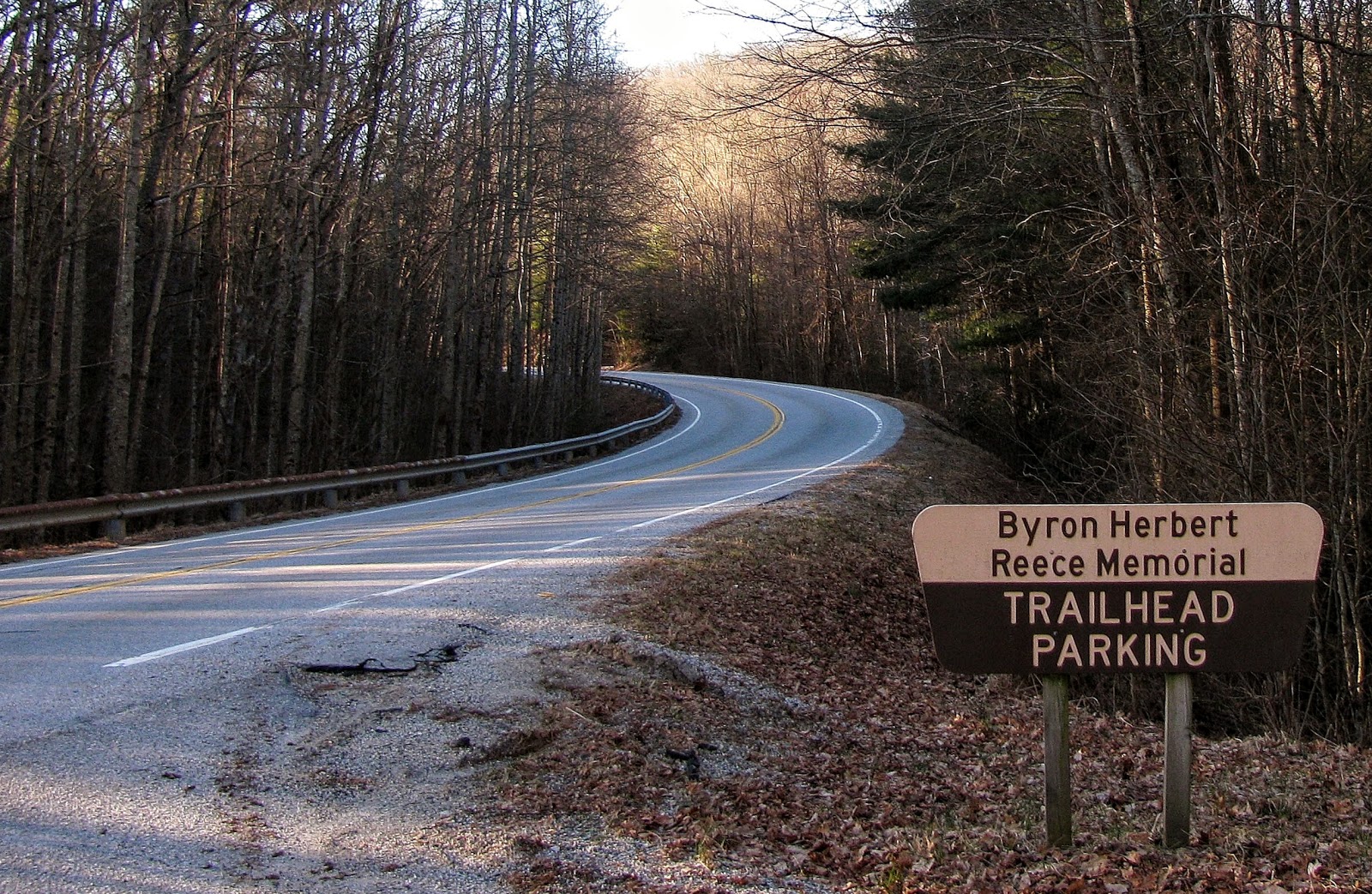
This section covers 6.5 miles, and I will be doing this one AT North to South. Unlike some sections were I did one or another I am doing this one North to South because I have hiked out of Tesnatee Gap more than North from Neel Gap. Also, if you are doing this as a section it is easier, logistically, if you start from Tesnatee (or Hog Pen) Gap. You can't park at Neel Gap because the parking there is for
Mountain Crossing. Because of this, you have to park at the Byron Reese Memorial, so this adds 1.7 miles to the hike. So, Tesnatee Gap is located off GA-348 better known as the Richard B. Russell Scenic Highway. The AT crosses it twice, once at Hog Pen Gap and where this hike starts at Tesnatte Gap.
 |
| Mountain Crossing |
 |
| Day Hiker Parking |
 |
| View from Richard B. Russell Scenic Highway |
This gap gets its name from the Cherokee word for Wild Turkey, guess what I have seen some (but no rattlesnakes). Besides the AT it is also the trailhead for the
Logan Turnpike Trail. The trail is on the site of an old road that used to come over the mountain and was officially closed in 1925 after US 19 opened through Neel Gap. Four-wheel-drive vehicles used the road until it was barricaded by the
Forest Service in 1981.
 |
| Tesnatee Gap |
 |
| Old Logan Turnpike now trail |
Since this is a gap it is a climb up of 700 feet in one-mile. Like most mountains in North Georgia, the switchbacks on the trail helps that the accent up
Cowrock Mountain. While not near as hard as Blood Mountain or as I was to find out later
Levelland Mountain, it is a nice aerobic stretch. One of the things that stood out on my way up was the difference in the AT headed up to Cowrock Mountain for my last time here back in June (2013). Then it was flush with green and blanketed in by
fog. I wrote another blog about the differences between times I hiked this stretch in early summer versus early spring, so check it out. I hiked this on several occasions, but on the day I finished this section I saw something cool
 |
| Summer & Winter |
As I hiked up the trail I spotted a large bird fly past, I knew immediately it was an owl. While I got a decent look, but I am not sure which kind, but I pretty sure it was a barred owl. Anyway, it was really cool. Oh, one more thing, a flat spot on the approach up once stood the Tesnatee Gap Shelter. Built-in 1938 it was said to be an Adirondack style shelter build of American Chestnut. The shelter was removed in 1975 because of its proximity to GA-348.
Eventually, I made to the rocky open area of the magnificent vista of Cowrock Mountain. When I was here in June it was covered in clouds, but on this day the view was spectacular. To the southwest, one can see
Tray Mountain and
Wildcat Mountain and to the south and southeast
Yonah and
Horsetrough Mountains. This is a wonderful place to stop and have lunch, take a break or just sit back and take in why I for one love being on the trail, for spots like this. Something I discovered on this trip was to the right of the main outcrop on the other side of the big rock is a great view including
Blood Mountain. Just remember this is one of those winter, early spring views.
 |
| Cowrock... |
 |
| ...vista |
Well, I thought my next stop was over a mile away at
Wolf Laurel Top, but on the way about ¼ mile from Cowrock, I discovered another outcrop that, because of the fog and leaf cover, I missed in on my first trip. I come to discover that it is called Green Cliff Top and it is another fabulous vista. This south-to-southeast view gave great looks at Springer,
Black, and
Big Cedar Mountains. Out in the distance, I spotted
Stone and
Sawnee Mountains and to the left of Sawnee I just could make out…if you guessed
Atlanta that is the right answer. Oh, and it would not be the last time on this day that I would see the Chocolate City. Oh, once again there was a nice view of Blood Mountain and also my final destination Levelland Mountain.
 |
| Black & Big Cedar Mountains |
 |
| Blood & Slaughter Mountains |
At this point I would be remised not to mention that this day I was on the AT, the thru-hiking season was in full swing. I can’t really say how many hikers I passed (since I was headed south on the trail), but it looked at one point like a hiker highway. I did play my annual game of who I thought would make it to Katahdin and who wouldn’t. There was one guy I met from Habersham County who was thru-hiking the AT solo, he knew the North Georgia Mountains and looked like someone who might make it. I will say I ran into others that I was surprised made it past Neel Gap.
Just around the two-mile mark, you will descend into Baggs Creek Gap. Well, it was on to Wolf Laurel Top, which is a decent but not too hard of a climb, but once again just as I was making my way up I discovered another rock outcrop I missed in June this time looking north with one of the best views I have found of
Brasstown Bald.
 |
| Brasstown Bald |
Once I got to Wolf Laurel Top I discovered that there were actually two outcrops that offered wonderful vistas of Cowrock, Yonah and Horsetrough Mountains. as I have already mentioned, there was no view from here in June from the fog. At the second outcrop, I met a group of thru and day hikers. It was fun to trade stories, one guy was from Chicago, and I got to talk a little about one of my other passions,
Blackhawks hockey.
 |
| Reaching Wolf Laurel Top vista |
There is a great camping spot here, which is good since this AT Section has no shelter. So, on I went descending slightly before going uphill and started the approach to Rock Spring Top at BLANK miles. The trail skirts the west side of the mountain and the mountain has no outcrops, but there is a blue blaze to the spring that gives the mountain its name.
 |
| Wolf Laurel Campsite |
So, it was back down the trail to Swaim Gap and with that the journey up Levelland Mountain. I will say that the mountain looked imposing as I approached it. I will say while the conditions were far more extreme on my February 2014 hike up the northside of Levelland, on the actual mountain, the southside up was much harder. Thankfully the trail was a switchback, but I will say that it about got the best of me, but I had been hiking at a good clip and didn’t stop a lot. However, about 2/3 the way up I did take a quick break as there was an outcrop which included another view of good old Sawnee Mountain and Atlanta. To be truthful this vista is better than the one at the open area on Levelland Mountain. After struggling up the mountain I crested a hill and there was my objective the rocky open face just below the summit (at 4.3 miles) I think there used to be a better view here, but what is here is a Winter one.
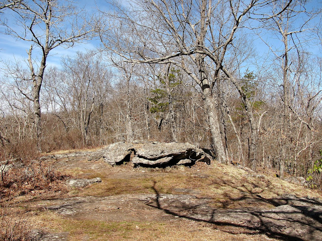 |
| Levelland Mountain |
After enjoying this summit it was time to descend towards Neel Gap. About four-tenths of a mile down to Bull Gap. There is a campsite here the uphill out of the gap is slight, before heading back down. From here it's about a mile down to Neel Gap and there is some switchbacking. You do know when you have arrived when you see the information kiosk, then signs for Raven Cliff Wilderness and Neel Gap. Most of all you will see Mountain Crossing. This is the only building that the AT goes through. When you get here that is the end of this AT Section. How you get back to Tensatee Gap is your call.
 |
| Heading into Mountain crossing & Neel Gap |


No comments:
Post a Comment