To this point, I had completed six sections of the Appalachian Trail (AT), but there was one that had alluded me. This was the one I have wanted to do since I got back into hiking and that was the trek across the Roan Highlands.
This AT Section (Tennessee-North Carolina #6) runs from Carvers Gap to US 19E just outside of Roan Mountain. I had hiked here many, many times from Carvers Gap out to Grassy Ridge Bald, it is my favorite day hike. I had also hiked to the Humps from Roaring Creek Road, so I had already done about half of this section. Still, I wanted to do this section all in one go. Like I said above, this hike had been it the work for years, but I had decided that 2019 was going to be the year (with the help of Pete and the Hikeleader).
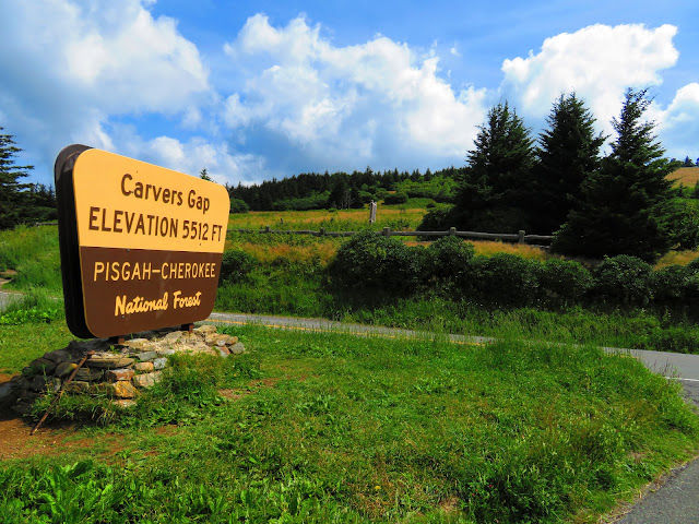
The first part of this hike is one of my favorites anytime of the year. I have blogged about it many, many times but the AT starts through a fence and rhododendron at Carvers Gap before moving through balsam and fir trees on the Westside of Round Bald. Just before exiting the trees, you will see some large rocks. These rocks are close to a billion years old and were once part of South America.
The first part of this hike is one of my favorites anytime of the year. I have blogged about it many, many times but the AT starts through a fence and rhododendron at Carvers Gap before moving through balsam and fir trees on the Westside of Round Bald. Just before exiting the trees, you will see some large rocks. These rocks are close to a billion years old and were once part of South America.
It is a 0.7-mile climb that takes one past view and Dr. Brown's trees before reaching the summit of the bald. The top straddles the state line as Tennessee is to the left and North Carolina, right. Also, you could see the big climb of day two...up Big Hump.
Then it is graded descent into Engine Gap. First, you pass the cover of my ATC (Appalachian Trail Conservancy) map and then past Rest Rock. It offers a nice view on top of it heading down and a place to rest when climbing Round Bald from AT South. Engine Gap is the mile point of the hike. In Summer you might find ripping blueberries, but you will also have a favorite picture spot of Jane and Grassy Ridge Balds. On this trip, the signs for Gray's Lilies were still up but the flowers were gone, but I was lucky to take them in a few weeks before.
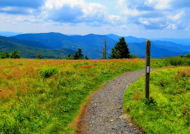
From there it was up the aforementioned Jane Bald. I had commented on another blog that work was done on the trail here. Well, the barriers were up for the cut trail and the AT had been improved. At 1.3 miles you reach the rock outcrop on Jane Bald with one of the best views in the Southern Appalachians. It is another tenth of a mile to the summit of Jane Bald. Before leaving Jane Bald there are some nice views of the Humps, Grassy Ridge, and Mount Mitchell.
The AT then heads into a saddle and then up to what I have started calling Harriet Bald It is named for Harriet Cook, the sister of Jane (who the Bald is named). There are great vistas throughout, but one particular side trail has a spectacular view of the Roans one has crossed. Finally, you will come to a trail junction. Right, I had been up many times to Grassy Ridge Bald. But I had never been left on this part of the AT so I was excited to head that direction.
The trail skirts Grassy Ridge Bald and since it was still above the hardwoods views of Hump and Little Hump Mountains could be had. I had read there was spring the first two-tenths in and after seeing signs of water we came to a piped spring which one in our party fixed (and another group we camped with said it saved them). Also around here was the site of the old Grassy Ridge Lean-To.
It was about this time the AT hit the main treeline and the scenery greened up. The mile to Low Gap featured trees, wildflowers, a nice campsite, and another great view of the Humps. You know you are in Low Gap (Mile Marker 3.7) when you reach Stan Murray Shelter. Originally known as Roan Highlands Shelter, it was built in 1977 and sleeps six. The name was changed in 1994 to honor Murray who was a former chairperson of the ATC and founder of the Southern Appalachian Highlands Conservancy and a friend of the Roans.
Now the AT headed up through some open areas over Elk Hollow Ridge. As the trail headed back in the woods in summer you will come across wildflowers Wild Bergamot, Cutleaf Coneflower, and others, but the main event was the Turk's Cap Lillies. At about five miles in it is down to Buckeye Gap then up to a small peak and view. It wasn't long before things started to look familiar, and we heard people as we made it to Yellow Mountain Gap at 5.6 miles.
From there it is 0.3 miles down to the Overmountain Shelter. I will have more to say about Overmountain, but it was closed indefinitely in late 2019 after I stayed there. But there is plenty of area to camp here and great views to boot. Before getting there is a large piped spring, which can dry up in Summer, but there is a sign pointing to an all-season water source on the way to the barn.
The next part of the hike was one I had done to the Humps. This is a steep climb up Yellow Mountain, but there are great views... stunning. At about a mile, after passing some cool quartz rocks, you will come to a junction the AT goes left while a trail goes right up to an open spot on Yellow Mountain and a trail on out to the balds of Big Yellow Mountain. That part of the AT goes through the woods and comes out in the saddle between Yellow & Little Hump Mountains with a view of Big Hump at 6.8 miles.
Then starts, the about the half-a-mile trek, up Little Hump Mountain. At about halfway there is a large rock formation (one with AT logo) and offers a good spot to take a break and enjoy the vista of the Roans. After that continue to the top of Little Hump and an excellent view of the main event of the day Hump Mountain (or as a call it Big Hump).
First, the trail heads right into the woods before coming out again and then back on an open area going back south. This spot can be confusing because on my first trip I had to look at the map to make sure I was going the right direction. I would say in foggy conditions it could get confusing. The first rule of thumb is to follow the White Blaze. Before long it is back in the woods past two trails on each side of the AT with tent sites and then to the area of even more camping. This is the main area for camping, including a Blue Blaze down to a piped spring at around eight miles.
From here the AT enters an open area with the mastiff of Hump Mountain in front of you. This gives you a hint of the hike ahead. First, you must pass through Bradley Gap for the 600-foot climb over the next mile to "get over the Hump." When I hiked this the first time the climb didn't seem near as hard, but my pack was smaller then.
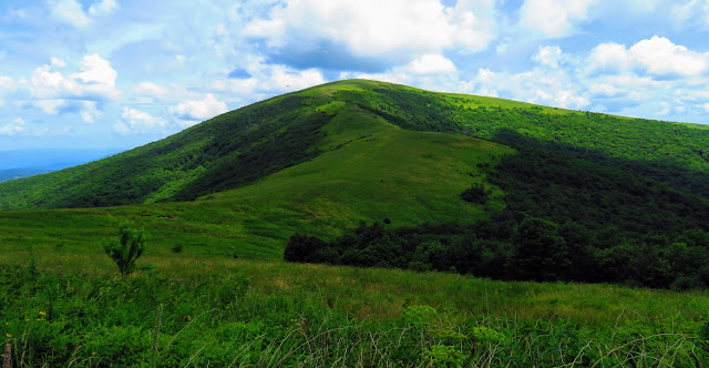
When you reach the fence that signals that the slog up Hump was almost over. Soon the trail bent left, past the view of my friend Glen's Dad's Cabin in Shell Valley and up to the summit... Mile Marker 9.4. At the top is, truly, one of the region's finest vistas...overall Big Hump is one of my favorite mountains.
As you start down from the summit you past a plaque in honor of Stan Murray as you start out on to Houston Ridge. The open ridge gives views into Volunteer and Tarheel states including Pond Mountain, Beech Mountain, and Grandfather Mountain. If you look back the partly bald of Big Hump fills the horizon. On this mile-long ridge, you will go through the stiles of two fences before reaching the woods.
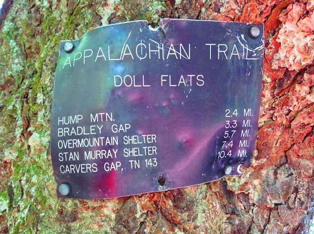
The trail heads down steeply and over this part, the trail is rocky, really rocky. It seems longer than 1.5 miles, but finally, there will be views to the right and a sign that signals the arrival at Doll Flats, completing almost 12 miles. The AT crosses an open area reminiscent of Coldsprings Mountain above Greeneville. It offers a nice view back to Hump Mountain.
As the trail re-enters the woods a sign indicates that the AT leaves North Carolina after 313 miles and enters Tennessee for almost all of the next 75 miles (except for a dozen yards in NC near Jones Falls). In the woods here there are some abundant campsites and a great water source while a distance (at least 0.2 miles) has two pipes.
The final three miles heads down, but it passes a spot that once was a view, then through Fatman squeeze, a cool rock overhang, and then a stream to the left. Then you arrive at a large rock house which, I believe, is the remints of the old Wilder Iron Mine. You know it is the home stretch when you reach the site of the old Apple House Shelter, which was removed in 2012 and is now a campsite.
The trail is pretty flat here until you hear the road and it is uphill to US19E. This 15.5 miles of hiking over two days (six Monday & 9.5 Tuesday) finished my seven AT Section. Just a word about the end of this section. If you do this section it is best to add another three-tenths of a mile and park at Mountain Harbour Hostel as this crossing is notorious for vandalism.
So, that finishes the 14.8 miles of the AT Section I had most wanted to finish. This made the first section in 2019 I would finish, but not the last.














No comments:
Post a Comment