A Backpack That Was A Tale Of Two Days On The Virginia Highlands
It was the tale of two days on this past weekend's backpack in the Virginia Highlands. Saturday was a beautiful day with temperatures not bad for the last day of July. While Sunday was rainy, damp but cool (not all bad).
Same spot (T) Saturday & (B) Sunday
This was my first "official" Sierra Club outing in almost two years (at 2019 Fall Chapter Meetings). I also had done a backpack with will since an unofficial outing last year at Brier Ridge on the other side of Mount Rogers.
2019 Sierra Club Chapter Meeting
Last year at Mount Rogers
So, this year the backpack was to start from the overnight lot near Massie Gap in Grayson Highlands State Park. This was where we were supposed to head out of last year, but because of the circus that was 2020 at popular trailheads, we had to hike out of Elk Garden because Grayson Highlands was full. Well, they instituted a reservation system so we snagged a couple of spots.
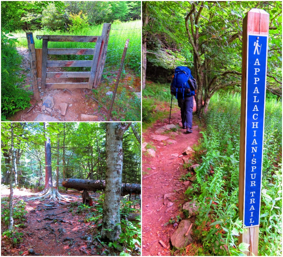
Overnight parking trailhead
There are a couple of ways up to Massie Gap and we took the long way up the Appalachian Spur Trail to the Appalachian Trail (AT) proper.
Once on the AT there were views aplenty past the rock I went up on in 2017, so I went up another. All of this was done before reaching Massie Gap. But it's no surprise for the Virginia Highlands. If the Roans has a rival for the most scenic spots in the southeast it is here in Virginia.
From Massie Gap, we still had a half-mile on the AT and the stile where we left the state park (which we have to do to camp). It was here where we had our first contact with the famous Ponies of the Virginia Highlands. On my previous five visits, I had seen the ponies, but it is always cool.
Once past the gate, it was into the Mount Rogers National Recreation Area (NRA), where we left the AT going right on the Rhododendron Gap Trail and then right again on the Springs Trail which we were camping on.
There was a plan to do a day hike back up the AT to Thomas Knob Shelter an over four-mile hike. However, setting up and other stuff took slightly longer than expected. So, I decided not to go out to Thomas Knob but thought about an alternative option to Wilson Ridge to watch the sunset. Will even said that one could follow the pony and cattle trails up eventually to the AT.
My tent & camp
Repurposing a pour-over
Camp had a visitor
After I ate clouds moved in, I had pretty much given up, but then I just decided to hike up to this rock above camp. Well, when I got there the main ridge didn't seem that far away, so I kept going. I passed a nice camp spot and then I ran into a path I would later figure out was the Rhododendron Trail. See, this was a real spur-of-the-moment hike...no map or water. Eventually, I made it to the saddle and found the AT. I found ponies, so of the same ones from earlier, and cows most were Longhorns like I saw near the Scales in 2016. I had thought of heading up to Wilson Ridge, but it was a half-mile one way and I also didn't bring a headlamp. See, the sun was receding and so had the clouds and I had a good view of the sunset from the gap.
Cool campsite
More Ponies...
...& Cows
I found her again
Sundown
I did get turned around once heading back but I found that nice campsite and went straight and was back in camp. It was a nice evening... little did I know it would change overnight.
Calm before the storm
That change was rain and I honestly can't say it was expected because the forecast called for a chance of the wet stuff. It started about 3 am and I had to zip my fly down. I keep it open on my REI Flash 1 because my little one person is single-walled and has condensation problems. I expected rain I didn't expect the wind which blew rain in under my front vestibule at times. Because of this, I had tried to fix my flapping fly but only made it worse. The thing about a tent is you have to stake down you can make it unstable very easy and the wind exacerbated the problem.
So when I awoke there was no sunrise just a windy, wet, soggy, and foggy morning. It meant I had to spend more time in the tent than I wanted because it really is built to just sleep in. The one good thing is it wasn't too hard, but when it rains everything seems to get wet.
Soggy
Almost had views...
...then gone
Next time!
Back to the state park
All the views of the previous day were mostly "Obscured by Clouds" by I still decided to go up the rocks closest to Massie Gap. The crowds of Saturday were washed away by the rain. While I got lucky that the rain stopped on the rocks, but when I got back to Massie Gap and started towards the overnight lot the skies opened up.
Headed up...
...there was some view
The last half-mile was a really soggy slog so I was happy to get to the car. With the wet and low clouds, I decided to forgo Pond Mountain and just went back to walk around Damascus. I walked across the old railroad bridge, which is part of the Virginia Creeper Trail, visited the future AT Center, and went by the old Deep Gap Shelter and AT sign. It was a great way to end a great weekend in the Virginia Highlands...


Great photos and especially of things I didn't see like the sunset and lots more ponies. And didn't know abut the AT Center in Damascus, looks nice.
ReplyDelete