Monday, April 6, 2020

AT Section Hikes - Georgia #17: Springer Mountain To Hightower Gap


There are a lot of sections on the Appalachian Trail (AT) but if you are going northbound toward Mount Katahdin then there is only one first and that is Springer Mountain to Hightower Gap. However, for me, the North Carolina-Georgia Section #17 was my third completed part and I did this at the end of May 2015.


As anyone familiar with the AT knows Springer Mountain is the southern terminus of America's Hiking Trail. It wasn't always as the southern terminus of the AT was moved here in 1958 from Mount Olglethrope, 23 miles South. My first trip to Springer was back in March of 2013, and it was my first real outing after getting back into hiking. A lot of people actually start from Amicalola Falls State and make the tough eight-mile trek, past the 759-foot falls to the summit of Springer Mountain. I have made over half-way up the Approach Trail to the Hike Inn Junction. You can drive to the trailhead which is of USFS-42. From Dahlonega to the Springer Mountain Parking Area at Big Stamp Gap is about one-hour drive-up Forest Service Roads. It is rutted in place but a passage car can make the trip. You will know this as the large parking area here fills up fast, especially during thru-hiking season and weekends.


The Arch at Amicaola Falls State Park


When you get there you will discover that there is no direct access to Springer Mountain. The parking area for the southern terminus is about a mile from the summit, so like any thru or section hiker to reach it one must backtrack south on the AT. That means while the section hike is 8.6 miles you actually do 9.6 because of the extra mile back to the summit. I have done this hike twice, so for the trip up, I am going to use pictures from my 2013 visit which was in very early Spring and then the on the way back and the rest of the section, pictures I took in late May of 2015. Oh, you will notice a sign I have here is no longer at the Springer Mountain Trailhead.


The hike up is not too steep but rocky, which means it isn't a hard mile. At about the 0.8-mile mark you will first come to a side trail that goes left is the southern terminus of the Benton MacKaye Trail (BMT). Down the Benton MacKaye, a hundred yards or so is the plaque. I have written about this trail before but it is named in honor of MacKaye the man who came up with the idea for the AT. The trail named in his honor travels over 300 miles ending at Big Creek Recreation Area on the other side of the Great Smoky Mountains National Park.


Benton MacKaye Trail Junction...

...& Southern Terminus

Just up from there is another side trail, on the left,  which leads to the Springer Mountain Shelter. This shelter 1993, it sleeps 12, has water, bear cables and tent site. Once at the summit one finds a rock vista facing west toward the Cohutta Mountains. Some have said that the mountain is not that special and yes there are better views just on Georgia AT alone. However, being here I must say there is something mystical about the mountain. from the first white blaze to the two plaques, the southern terminus and the first George Noble you know it is special.


Springer Mountain Shelter


Springer Mountain Vista

With the Springer Mountain Plaques


After passing back across FS 42 and the parking area we headed down the AT and at mile marker 1.3 you reach the first crossing with the BMT. It is not long before you cross Stover Creek for the first time. Then three-tenths on is another meeting with the BMT. After that is another crossing of Stover Creek.


After passing the trail for the Stover Creek Shelter, which is 2.8 miles from Springer, but I didn't go to it has it was almost a half-mile both ways. But for information purposes this shelter is fairly new it was built in 2006 to replace an older one. It sleeps 16 has cables and a privy plus a few tent sites nearby. Just past this junction, there is another crossing over Stover Creek and then beside the creek. The AT passes some nice hemlocks here. At the 4.2-mile mark, the BMT trail comes in from the east. For the next mile, the iconic white rectangle blaze shares the path with the white diamond of the BMT.


Before the AT and BMT split you will first reach Three Forks. Like the name says it is the fork where the three streams Chester, Long and Stover Creeks meet. I wrote about this stretch taking in Long Creek Falls in more detail here. Georgia has a lot of waterfalls, but on the AT in the Peach State there was only one large one waterfall, but it turns out there are two. First, there is a 25-foot sliding cascade I call Lower Long Creek Falls. It is reachable by a steep manway.


Lower Long Creek Falls

The second is the more famous Long Creek Falls. The trail to it considers where the AT (goes right) and BMT split for the final time in Georgia. It is also the southern terminus of the Duncan Ridge Trail, which goes straight as part of the BMT. To the left is a sign for Long Creek Falls. You will hear the 50-foot cascade before you see this wonderful waterfall.


Once back on the AT it heads up Hawk Mountain and at one-mile from Long Creek Falls to a meadow that is called Hickory Flats. There is a plaque in honor of Dallas Woody and a trail that leads 0.2 miles to the Hickory Flats Cemetery. The trail continues to climb up Hawk Mountain it is that steady kind of steep, very reminiscent of Frosty Mountain on the AT Approach Trail. At 7.4 miles the trail comes to the Hawk Mountain Campsite. This campsite sits near the summit where an old fire tower once stood. It was put in to elevate the number of people who start thru-hiking, especially, in March and April so there are 30 tent sites. The trail used to go over the summit but was moved in 1979. However, on his second-ever thru-hike, Gene Espy once slept in the old fire tower which was dismantled in the 1970s.


The trail starts downhill and 0.7 miles (8.0 MM) down from the summit to the junction with trail down to Hawk Mountain Shelter. I didn't go to this one either (you can tell I did this as a group hike) but it is 0.2 miles to this shelter which accommodates 12 with a privy and bear cables. It has actually been moved three times, the last time in 1979 to its present location. From here is the homestretch is the last half-mile steeply downhill before reaching Hightower Gap. The big parking area marks the end of Georgia AT Section. #17.


Friday, April 3, 2020

A Wood Booger View On The Coronavirus


I have debated with myself, back and forth on doing a blog on what is going on in the world with the Coronavirus crisis.
I don't really know what I am going to say, what can I say but I am going to try. Since this Tales From The Wood Booger, there will be a hiking bent to this blog. However, there might be something in this one that might piss...well tough it is my blog after all. I remember when I first read about this in December I was worried that this would probably reach our shores and we would be way underprepared, and we were. Trump said we were prepared, but at the same press conference on March 10, he also said "And it will go away. Just stay calm. It will go away." Even a month later there are people and states that still don't think it is that serious even though we have the most case in the world (as of writing 276,849) and soon the most deaths (7,3371).

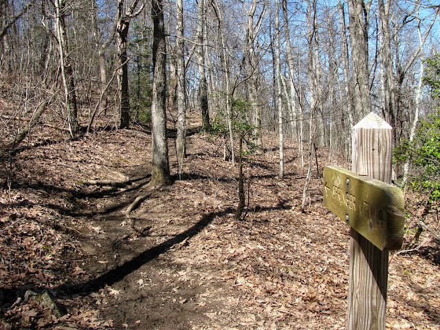
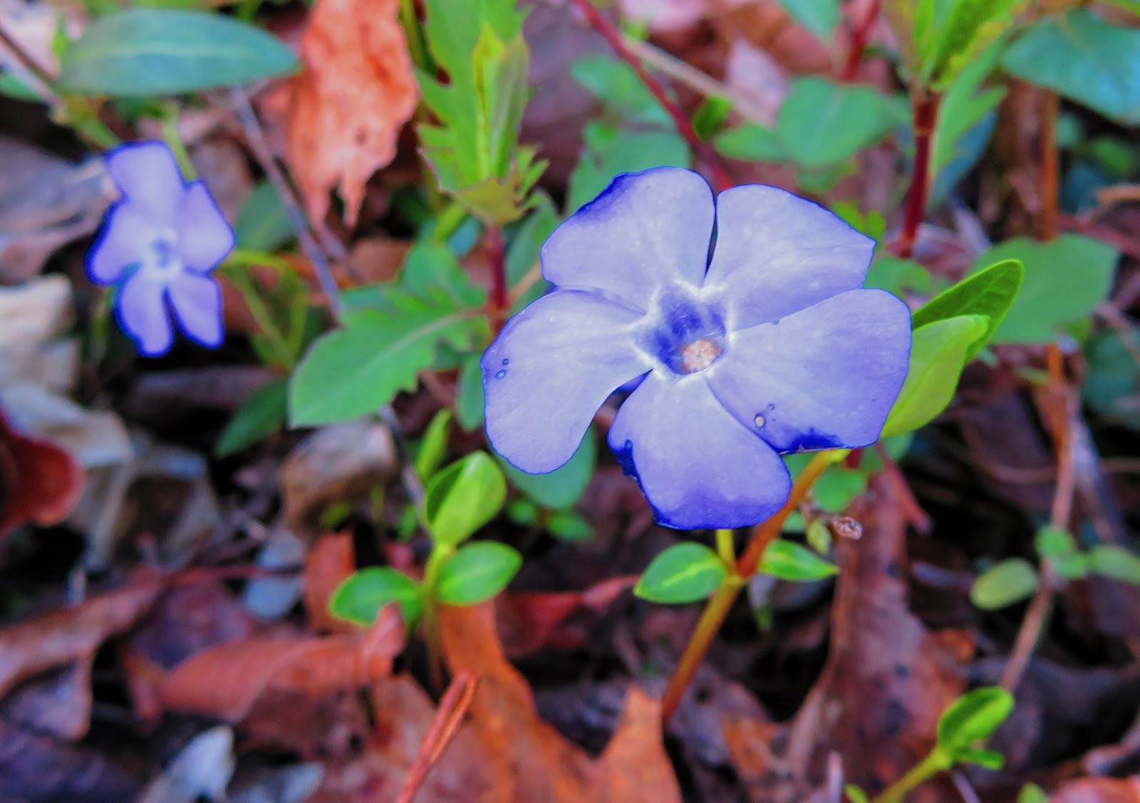
I was getting concerned about COVID-19 when I went to Rich Mtn. in February.

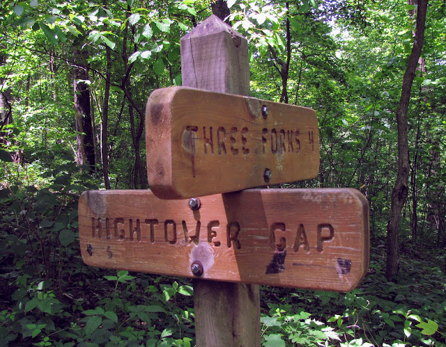
Besides following what has been going on in the world (not just the USA) I have been keeping track of what has been going on with the hiker community. As anyone he keeps up with this blog knows this is the hikers descend on Georgia for the start of Appalachian Trail (AT)  Thru-Hiker season. Well, even with the coronavirus threat growing thru-hiking season still started as a good number have started in February. 

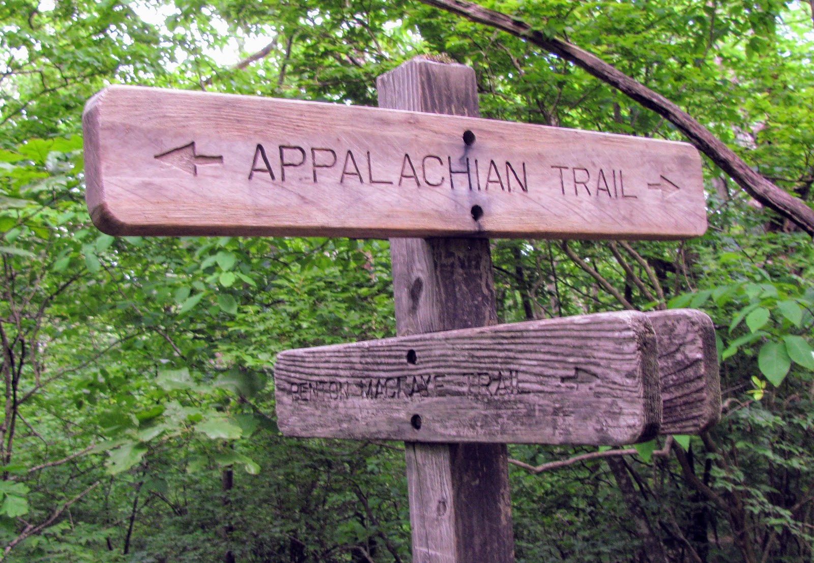
Where AT dreams start.

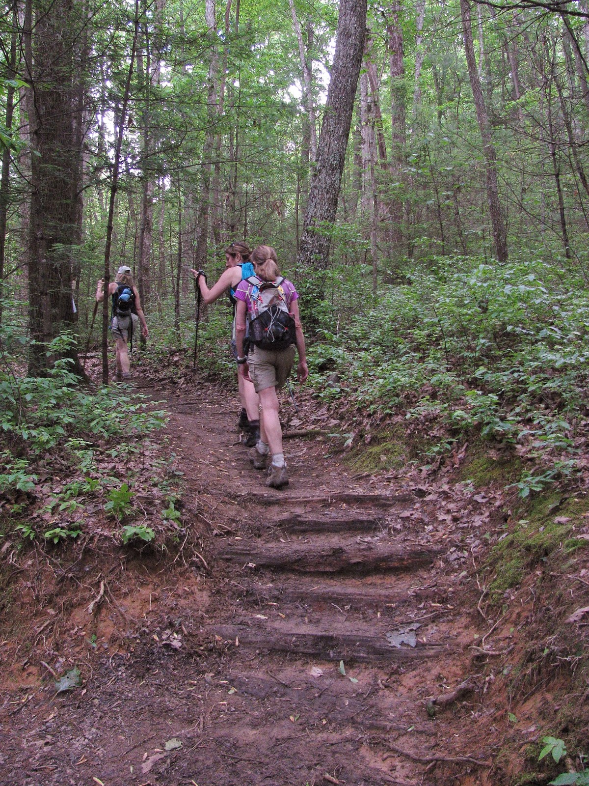
Thru-hikers two years ago at Newfound Gap.

However, when most were about to start is when this crisis started to explode. I did an AT Section Hike on Monday, March 9th because I had a feeling that it might get harder to do one soon, but I had no idea how quick. Two days later I sat here when an NBA Players, Rudy Gobert, tested positive. After that was a cascade of events where sports leagues were suspended, events like the NCAA Basketball Tournament canceled, soon schools restaurants and other things would follow. I did one last hike before I decided to shelter in place. Even when I went to the store I wore a mask for the first time. Anyway, on this day there were a lot of people on the trail (I went to Laurel Run Park) but that was soon to change.

Hikers I met at No Business Knob Shelter.

Laurel Run Falls.

One thing that didn't close were trailheads and with a lot of people with nothing to do a lot decided to go hiking, especially to the most popular spots like Carvers Gap, Laurel Falls, and the Smokies. Soon it started to dawn on organizations like the Appalachian Trail Conservancy (ATC) and the US Forest Service (USFS) that having large numbers of people gathering together was not a good idea and soon wasn't in line with CDC guidelines. Then the Great Smoky Mountains National Park (GSMNP) started to close facilities and before long closed the park around the same time a park employee tested positive for COVID-19. 

Closed...

...closed...

...& closed.

At the same time, the ATC first advised that aspiring thru-hikers postpone their journeys and ones on the trail to exit ASAP. Plus a lot of the establishments like hostel along the AT closed, AT Ridgerunners were pulled and a lot of Trail Angels deciding it is best not to take the risk. By this time the State of North Carolina had closed dining areas, so to eat it was carryout or delivery only. It became harder to do a Thru-Hike. Damascus Trail Days has even fallen victim to the crisis as it has been canceled this year. Now saying this has divided the hiking community would be an understatement. 

ATC at advise get off the AT.

No Trail Days in 2020.

A lot of thru-hikers decided to take, in my opinion, the prudent course, and postpone their journey. It isn't an easy decision, because a great many thru-hikers leave jobs and commented on a great number of resources to this undertaking. The hard decision is actually leaving the trail not staying. This virus isn't the ATC's fault they are trying to protect the trail and the communities that are a part of it.
It is still caused a schism since there are a good number who think this is overblown, they won't get it, or I am young so I won't or don't care if I get it. That type of cavalier thinking is not needed now.

It is a big commitment for thru-hikers.

It is not their fault.

I bet 95 percent (or more) of people who are bound and determined to stay on the trail don't know bushcraft and can't be self-sufficient on the trail. That means they will go into a town to resupply which means they can get it and spread it on up the trail or take it to a town because they have it and are asymptomatic. Also remember that because of this said towns, may not be as welcoming and I have heard anecdotally that this is the case.

Hot Springs....

...& Damascus.

I know some people don't want to believe this and it is some kind of hoax. Not everything is opinion facts are real and it is a fact that people are getting sick and dying. It is a fact people can pass this without showing symptoms, and while it is a fact that people over 65 and having underlying medical conditions are the most vulnerable. My Dad falls into this group, so I can't bring it home to him because I love him more than hiking. But it is also a fact that people of all ages are dying. Oh, it is also a fact people and corporations are losing a lot of money and people with it don't do that for no reason.

My Dad & I.

For myself, I probably could find places to hike because I know a lot of out of the way spots, but it is not just that. Trailheads have been closed like I said, so these places might now have people on them. However, it is not just that. I have to drive which means I will have to get gas at some point, which means exposure to the virus. If I had an accident... exposure and what happens if something happens on the trail? The USFS has said that you might be on your own because resources are rightfully been put to other purposes and they are short-staffed. I mean someone died this week on the Pacific Crest Trail (PCT) and I don't want to be a problem for the USFS or any essential services.  Plus, I could again get exposed and I can't bring this home and that is why I stay home! 

Better days.

Thru-hikers here have been affected by COVID-19 (KUOW-Megan Farmer).

Don't get me wrong this has been tough. For those who don't know (and I am not ashamed one bit) I suffer from acute anxiety and major depression. So, hiking is not just something I love to do but is enteric to my mental health. That means not going out is extra tough for me. Some people believe I am crazier than normal, but it is what I have to do. .I know at some point I will get back out on the trail it isn't going anywhere and that is my message to everyone. Fighting and backbiting won't get us through this or just thinking of yourself. Remember we will get through this together...


**Update April 4, 2020 -After I wrote this all TN State Parks are closed.**

COVID-19 Links:

Wednesday, April 1, 2020

Wildflowers Of March 2020


I wish what has been happening was an April Fool's Joke, but it is obvious it's not. Yes, this year March has been a lost month because of the COVID-19 Pandemic and it is not looking any better for April. While it is looking like a lost Spring that doesn't mean there are no wildflowers. I did get out before the worst hit and as always there are plenty right around her at St. Clair. However, there weren't as many as in years past. So, take a break look at some wildflowers and stay safe...remember, enjoy!

The Cabin, Fort Blackmore, VA (03-06-2020)

Dafadill

Nolichucky River, Chesota, TN (03-09-2020)

Periwinkle

Crocus Flower

Bays Mountain Falls, Hawkins County, TN (03-12-2020)

Bloodroot

Laurel Run Park, Hawkins County, TN (03-12-2020)

Coltsfoot

Carolina Spring Beauty

Rue Anemone

Another Rue Anemone

Slender Toothwort

Harbinger of Spring

Bloodroot

Periwinkle

Star Chickweed

St. Clair, TN (03-13-2020)

Wild Pear Tree

Wild Pear Tree 2

Dandelion

Purple Dead Nettle

St. Clair, TN (03-22-2020)

Blue Violet (Multi-Color)

Blue Violets

Dwarf Cinquefoil

Field Pansy

Wild Cherry Tree

Field Mustard

Wild Cherry Tree

St. Clair, TN (03-29-2020)

Baron Crabapple

Baron Crabapple Bloom

Red Bud

Cherry Tree