

It springtime and for some it means thru-hiking season for
others just getting back out after a long winter. Still, with warm and longer days the problems of
winter hiking abate. So for my Weekday Hike Georgia group what better day hike
could there be than the AT (Appalachian Trail) Approach Trail loop to the Len Foote Hike Inn. For me this is a day hike I have wanted to do for a while.
Coming in at over 10 miles (my final count was about 10.4) that violates Deb’s
six-mile rule and it seemed when I thought about a solo trip something else was more pressing.
As for Hike Georgia I had seen it put up a number of times and whether there
was a conflict or weather I just never had gotten around to doing it. So, on
St. Patrick’s Day with my Weekday group I final got to do this day hike.
This loop hike combines the AT Approach Trail with the Hike
Inn Trail with the halfway point being the inn itself. Most times when I have
seen it posted they went up via the Hike Inn Trail and came back on the AT
Approach Trail. Lori was hike leader on this outing and decided to have us hike
up the AT Approach and come back on the Hike Inn Trail. Well, the night before
she text me and asked if I could lead the hike because she had a conflict and
wouldn’t be able to make it.
So, in the spirit of thru-hiking season I decided to hike it
as Lori had listed it, let me say I now know why people go up the Hike Inn
Trail first. After visiting the visitor center at Amicalola Falls State Park, we parked at the Top of the Falls, which is also the parking area for
the Hike Inn. The trail starts out as a
duel trail of the blue blazed AT Approach and the green of the Hike Inn. It
cross the road and two-tenths of a mile ahead the AT Approach goes left and the
Hike Inn right, we went left.
 |
| Start day at the Amicalola Falls Visitor Center. |
 |
| Turn into the parking area. |
 |
| The trail for the AT Approach... |
 |
| ...& Len Foote Hike Inn. |
 |
| Headed up... |
 |
| ...the blue & green blazed trail. |
 |
| Crossing the road to the lodge. |
 |
| Purple light blocking the trail. |
 |
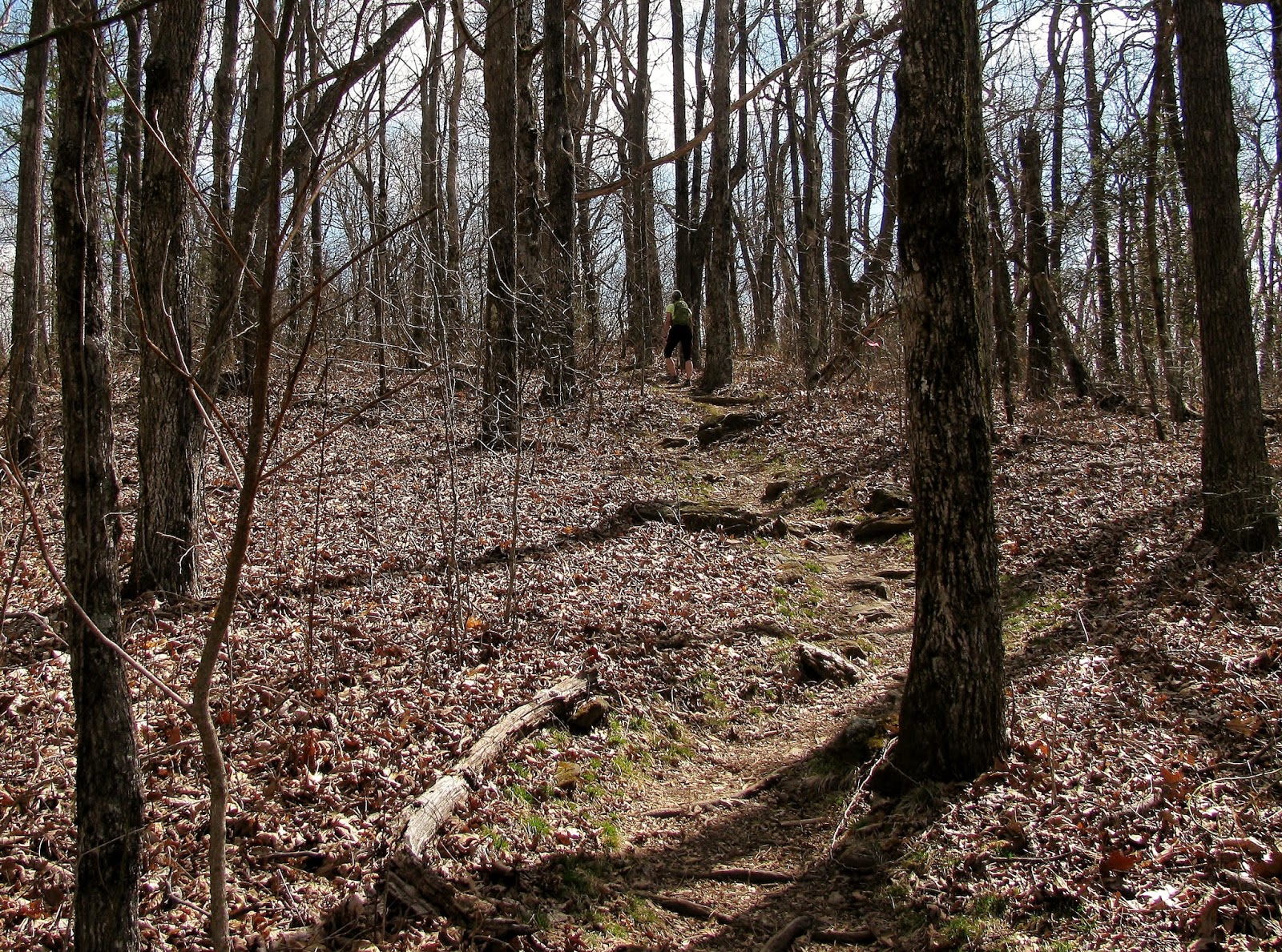
| We headed left on the AT Approach Trail. |
Let me say that a lot of thru-hikers start from Amicalola Falls State Park. Lugging a 25 or more pound pack up the 604 steps at the falls would be tough in itself, but add to that the AT Approach Trail, that is a tough way to start the journey to Maine.
 |
| Some of the 604 steps. |
The first part of the trail is not too bad there is a footbridge across Little Amicalola Creek (which becomes Big Amicalola Falls) but the point it starts up hill is where it leaves the state park and enters the Chattahoochee National Forest.
 |
| The blue blaze of the AT Approach Trail. |
 |
| Footbridge over Little Amicalola Falls Creek... |
 |
| ...the flows to become a big waterfall. |
 |
| First time it crosses High Shoals Road. |
 |
| Old blue blaze. |
 |
| Leaving the state park for the national forest. |
 |
| Mikki leading the pack. |
 |
| Ultra-light through hiker. |
 |
| John & Lea |
One of the good things about this first uphill section is
that it flattens out at High Shoals Road, which gives one a point to catch ones
breath. I will say that on this first section we passed four thru-hikers. No I
mean we were going north like them, we just passed them. I will say as nice as this one couple was I
don’t know if they will reach Maine, but I wish them the best and hope they do
make it.
 |
| One of the thru-hikers. |
 |
| More hikers. |
 |
| Here is the couple... |
 |
| ...we passed. |
 |
| Everyone took a break at High Shoals Road. |
From here the climb is much steeper up Frosty Mountain.
While not the highest mountain coming in a 3,384 feet or the steepest climb I
have ever done, it still wasn’t easy because the climb was about 1.5 miles. While
I felt a little bad about the route choice at High Shoals Road, I really did
about here. What did I do later, blame Lori (LOL). However, it we did pass
another thru-hiker on the way up Frosty. I will say this climb is the first
lesson in the North Georgia Mountain School of hard knocks.
 |
| Start of the climb up |
 |
| Mikki took this picture of John & the Wood Booger. |
 |
| There were some flatter parts... |
 |
| ...but it was mostly like this. |
 |
| Passing another thru-hiker. |
 |
| Still going up Frosty Mountain. |
At the top of Frosty Mountain is campsite and the trail goes slightly downhill to the site of an old fire tower that once serviced the region. The tower was removed in the 1970’s and at one time an old Warden’s Cabin stood near it. The cabin long since gone was converted to a shelter in the early 50’s by the Georgia Appalachian Trail Club (GATC). When the southern terminus was moved to Spring Mountain in 1958 the shelter was removed, but there is one, the Black Gap Shelter, two and half north.
 |
| At the summit of Frosty Mountain. |
 |
| Trail... |
 |
| ...crosses FS 46... |
 |
| ...site of the old fire tower. |
 |
| Blue blaze on old fire tower foundation. |
After a short downhill stretch we once again were headed up, this time Woody Knob. This climb while not as steep or long (just 0.3 miles) was not welcome by my hiking group which was a little tired of going uphill. Like all good things they must come to an end and we reached the junction to the Hike Inn Trail.
 |
| This medallion pin was above where I could reach. |
 |
| Back across FS 46. |
 |
| Headed toward Woody Knob. |
 |
| Cool tree. |
 |
| At the junction to the Hike Inn. |
 |
| Straight goes to Springer Mountain. |
 |
| Our destination is one mile... |
 |
| ...to the right. |
 |
| Looks like a tree near Cowrock Mtn. |
 |
| Now on the green blazed trail. |
 |
| Nice spot on the trail. |
 |
| Ball & Hawk Mountains. |
 |
| When you reach the Fire Break Trail your almost there. |
While we still had a mile-to-go the trail was relatively flat and actually gently sloped down. I guess with the hard climbs it didn’t seem to take us no time to traverse the mile to the Hike Inn.
So we finally arrived at our destination the Len Foote Hike
Inn. I have read and heard plenty of things about the Hike Inn and it lived up
to most or all of these. It opened in 1998 and is made up of four large interconnected
buildings first there is the lobby. It is large wood room with a line of old backpacks on one wall, it is really cool. Then there is a dining room for
eating, one called Sunrise for relaxing and the bathhouse explains itself then
there is the sleeping area. As the brochure says the twenty rooms at the Inn
offer bunk beds, while not luxurious they are said to be comfortable. There is electric lights, but
there are no outlets to plug up say a cell phone. The policy of the Hike Inn is
no cell phone usage; even in common areas…nice!
 |
| Photo bombed at the Hike Inn. |
 |
| Google map view of the Hike Inn. |
 |
| Back of the Hike Inn... |
 |
| ....wood stove in the lobby... |
 |
| ....wall of old packs... |
 |
| ...cool GATC sign in the lobby... |
 |
| ...kitchen in the dining hall... |
 |
| ...& the wood stove... |
 |
| ...one of the showers. |
One of my favorite spots is what is called the Star Base. Here stands a massive granite rock formation (it looks kind of like the United Artist A) and cave which aligns with the rising sun during the spring and fall equinoxes. The Star Base was designed by Fernbank Science Center in nearby Atlanta. Here there is also an overlook with chairs that gives visitors a great view of the North Georgia Mountains including Yonah Mountain.
 |
| The Star Base... |
 |
| ...the cave the rising sun shines into. |
 |
| Some of our group enjoying... |
 |
| ...this vista. |
 |
| Yonah Mountain. |
 |
| Daniel & Mikki attempt to build rock cairn... |
 |
| ...like this. |
Best of all the only way to reach the Hike Inn is what its name indicates you can only come in by foot. I have to admit I do want to stay here one day it is really cool. There is also a two little trail around the Inn, the shorter one-eighth of mile Cove Trail and the slightly longer one-third of a mile Fire Break Trail, which like the name says is also a fire break to protect the Inn.
 |
| Leaving the Hike Inn... |
 |
| ...for Amicalola Falls. |
 |
| Sign for Fire Break & Cove Trails. |
After having lunch it was back on the Hike Inn Trail for the five-mile trek back to Amicalola Falls State Park. The first part of the trail is pleasant in winds through Mountain Laurel and Rhododendrons, which later in the spring will be beautiful (maybe another trip is in order). There were also spots where the trail was elevated by these walking planks, reminiscent of ones I have seen in the Smokies on the Forney Ridge Trail.
 |
| Looks like it was once yellow now it's green. |
 |
| The elevated trail. |
 |
| The Wood Booger. |
 |
| I thought here I might see a Leprechaun. |
 |
| Back up hill. |
 |
| Spot with rock cairns. |
 |
| More green. |
 |
| Where Lea & Mikki hiked on. |
There were some nice spots on the way back. At about a mile
from the Hike Inn there is a nice vista looking south off the trail. While on
really clear days Stone Mountain, Kennesaw Mountain and Atlanta are visible
with the hazy today only Sawnee Mountain was clearly in view. Then a mile from
the parking area there is winter vista with a bench. With leaf cover it would
not be the best, but today it was nice.
 |
| The south view. |
 |
| Sawnee Mountain. |
 |
| Benches were welcome. |
 |
| Back on the green blazed trail. |
 |
| More elevated trail. |
 |
| Looks like it is time... |
 |
| ...for a new tree blaze. |
 |
| This winter view is with a mile to go. |
It took us a little longer to get back than expected, while
I know Anat was glad to see the parking area I will say I was glad too. I will
say that this turned out to be a harder hike than I ever expected. But overall
it was a good hike and the Inn was more than worth the trip.
As a bonus John, Mikki and I took in the Top of the Falls and walked out to the middle footbridge that gives the wonderful view of the falls. No, we didn’t walk down the 425 steps; instead we drove down and walked out on the West Ridge Falls Trail.
 |
| Leaving the National Forest. |
 |
| Where we came from... |
 |
| ...where we are going (sort of). |
 |
| Crossing the road to the lodge...again. |
 |
| Almost back to the parking area. |
As a bonus John, Mikki and I took in the Top of the Falls and walked out to the middle footbridge that gives the wonderful view of the falls. No, we didn’t walk down the 425 steps; instead we drove down and walked out on the West Ridge Falls Trail.
 |
| Top of the Falls. |
 |
| Used the xshot to hang over the falls. |
 |
| Spring tree at the reflection pool. |
 |
| Headed out toward the middle falls footbridge... |
 |
| ...on the rubber trail. |
 |
| View of the lodge... |
 |
| ...& that old wrecked truck... |
 |
| ...& its door. |
 |
| Beautiful Amicalola Falls. |
 |
| More shots of the main falls... |
 |
| ...&... |
 |
| ...parts of it. |
 |
| Top of the Falls from the middle footbridge... |
 |
| ...& the reflection pool. |
 |
| Best falls in Georgia! |
I had never been down this 0.3 mile path that is one of those
rubber trails that are spongy. Off this
trail there is a nice view of the Amicalola Lodge, but the coolest feature (besides the falls) was
an old truck that must have slid off the road and was now lodged on a tree
above the trail. It has been there a while and one of its rusted doors has
fallen off lays beside the trail. But the main event was the falls itself. Yes,
I was just here about a week and a half ago, but I never tire of this majestic sight.
Also on this day the water flow was much better than my visit during the ATKO.
It was an end to a long day but a good one.
 |
| Our motley crew! |
What a great post Thank you for your efforts
ReplyDelete