When Being Second Is The First Winner...Rabun Bald
In some ways Rabun Bald is about being second. It is Georgia’s second
highest mountain. So to many that means it is second best. However, it was on
my second trip to the summit that I discovered that second can sometimes mean
you are a winner.
One of the Georgia Giants, Rabun Bald later in the day from Black Rock Mtn.
As I pointed out here there are a lot of perks to being first, as in
Brasstown Bald the highest mountain in Georgia. In that blog I talked some
about my first trip to Rabun Bald which ended with a fogged in finish at the
summit. I felt that the mountain was either hiding itself because it felt
inferior to its taller cousin or unlike Brasstown, Rabun just doesn’t give
up its pleasures that easy.
Brasstown Bald summit.
Like the first time I scaled the mountain, last October (2013), I went up from
the Beegum Gap Trailhead. To get there you first go through Sky Valley which is
about a two hour drive from Dawsonville. What's funny is on my way up I
ran into fog at Dillard, which is eight miles from Rabun Bald and I said to
myself "here we go again." But when I got to the Sky Valley Overlook, off GA 246,
the mist was confined to the valley which was a big relief!
Headed toward Gainesville...
...as the sun rose.
Here is what met me in Mountain City & Dillard.
Stopped at the Sky Valley Overlook...
& the beautiful mist in the valley.
To get to Sky Valley, GA one has to go through North Carolina.
I pointed out in my previous blog about my first visit that there was no sign at
the turn on to Bald Mountain Road. However, to my surprise (it is like the U.S. Forest Service read my blog) there was a sign indicating the Rabun Bald Trailhead. I
hate to point this out, since I am not the best speller, but they misspelled the name of the trail it was
spelled Bartrum where it should be Bartram.
The new sign at the turn off at Bald Mtn. Rd.
Parking at Beegum Gap.
Still, when I got to Beegum Gap it was just the same as the last time I was
there (except most of the leaves had fallen) plenty of parking because I was
the only car there. I will say the trail was different with leaf drop, but I
always find this with trails, the difference between the trail with leaves and
without.
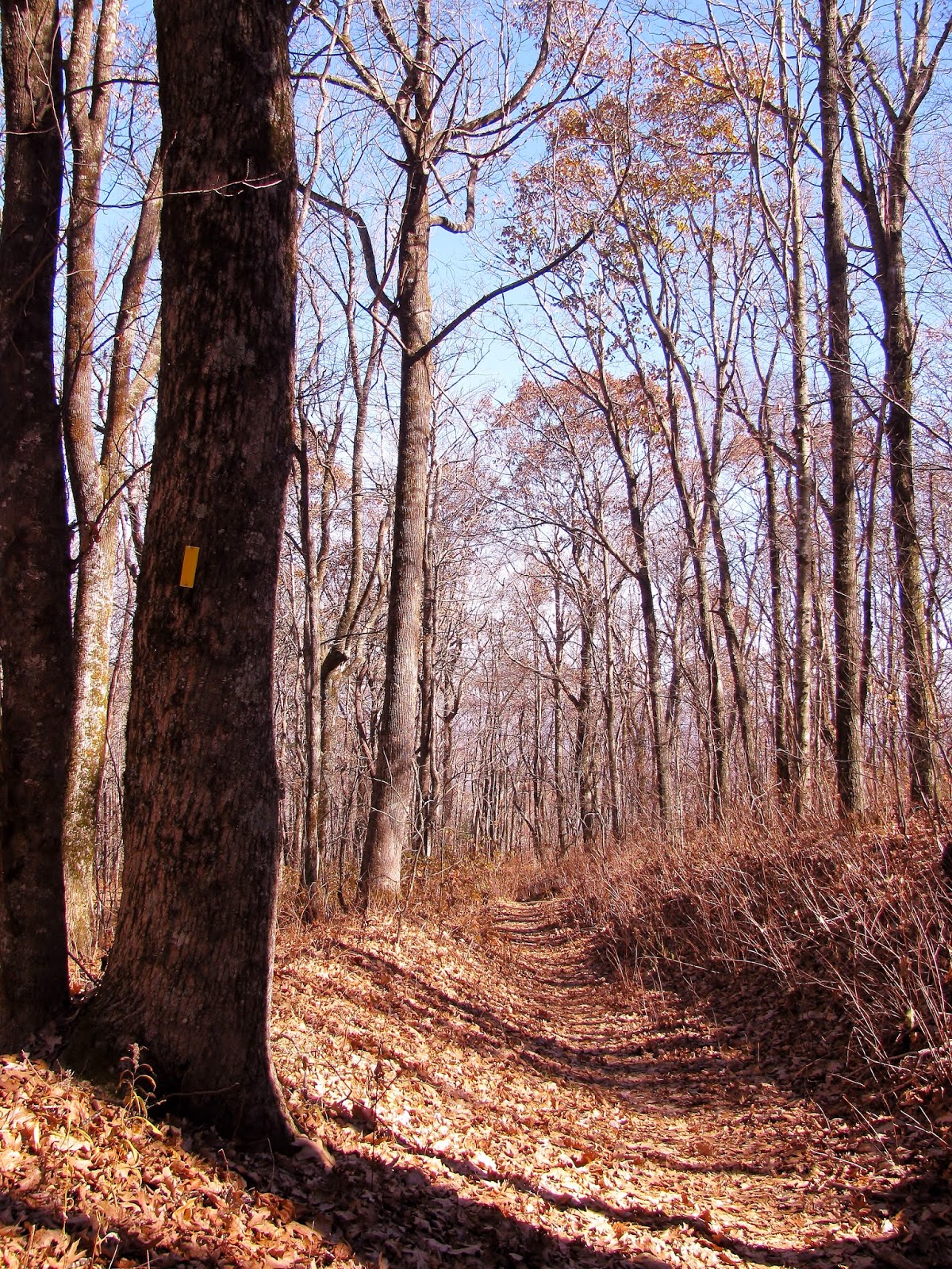
The start of the trail in October, 2013...
...& in November, 2014.
1.6 miles.
More leaves on the ground in 2014...
...in the trees in 2013.
Sunrise on the trail.
On the way up another addition I found was where the Rabun Bald spur
connects with the Bartram Trail. For those who don’t know this is a 115 mile
trail that follows the path that 18th Century Botanist William Bartram
took. The trail visits three states North Carolina, South Carolina and Georgia
and Rabun Bald is the highest peak it passes over in the Peach State.
New markers at the junction with the Bartram Trail...
...remember to right which is this way.
The difference between mid-fall...
...& late-fall on the Bartram Trail.
More contrast between my October, 2013 trip...
...& my November, 2014 one.
The Bartram & the Bald.
Anyway, at the spot where the spur connects with the Bartram Trail they
added some arrows and yellow blaze pointing the way. I will say this
trail can be described as strenuous because it has over 1,000 feet in elevation
gain. But since this is a major regional trail it is well maintained and it
switchbacks the first half of the trail is just less than a mile where it comes to
an open area where the trail meets the 4WD road. The start of this road is to the right at Beegum Gap. That means from here the hike can actually have a loop. When I did the hike last October I went back via the 4WD road, but for my latest hike I did an out-and-back on the Bartram Trail. But, from here there is only one trail for the final 7/10 of
a mile push to the top.
Here is the view from the 4WD road...
...on the way back to Beegum Gap.
This is the Bartram Trail...
...on the way back...
...to Beegum Gap.
Here is where the Bartram & 4WD road meet back in 2013.
Rabun Bald 0.7 miles.
At my last visit the leaves are almost on the ground.
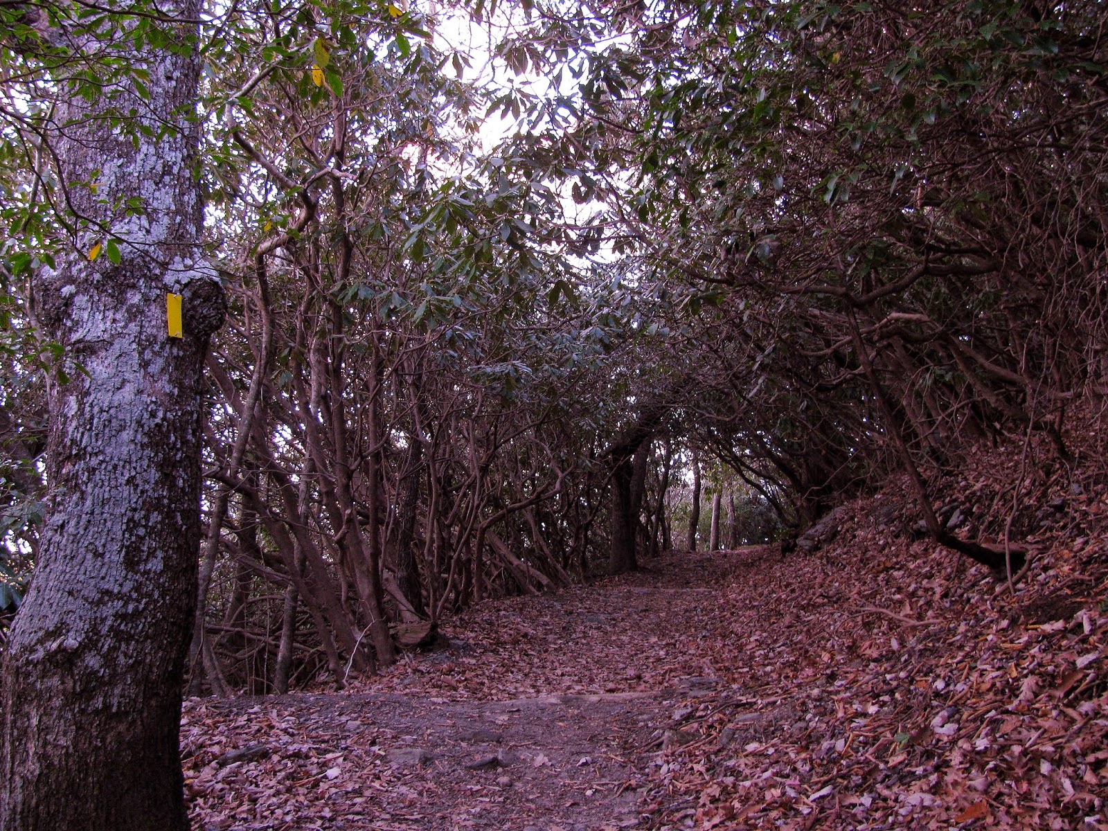
The trail mostly tunnels through Mountain Laurel and Rhododendron on the way
to the top. There is a spot halfway that looks like it used to be steps and it
even has an inscription. I will say that the first time I came up it seemed a
little spookier, but that might have been the leaf cover and mist rolling
across the top blocking out the sun. This time there were less leaves and sunshine, I really enjoyed this trip
more than my first. Well, the homestretch is a long uphill through more
Rhododendron it was about here the last time that I saw a turkey cross the
trail.
Rhododendron tunnel on my first visit...
...same spot in November.
More Laurel & Rhododendron tunnels from October, 2013...
...& November, 2014.
The steps area...
...& the inscription it was greener in 2013...
...than 2014.
The steps in late autumn.
Early fall on the Bartram Trail in 2013...
...& November, 2014.
When the trail finally reaches the summit area one finds these two stones one
for the Bartram Trail and the other for the Three Forks Trail which heads down
the eastside of the mountain, three miles, to another trailhead. However, there
was a new addition (once again it is like they were reading my blog) a
trail sign pointing the way I came from Beegum Gap and where the Bartram
continues, the 15 miles to Warwoman Dell.
There is more color in October...
...than November on the homestretch to the summit.
This was once the only trail markers...
...but this sign has been added.
For me it is on to the summit where I am greeted by the old CCC Tower.
Unlike the huge observation deck at Brasstown Bald this one has a quint charm.
The CCC Tower, shrouded in leaves & clouds...
...in November it is bathed in sunshine.
The front of the CCC Tower...
...& the back as seen from the Three Forks Trail.
Before I headed up I decided to look at the US Geological Marker, again. Again to my surprise it even
looked like someone had cleaned it up or replaced it too.
With the US Geological Marker...
...when I found it in November it looked like it had either been cleaned or replaced...
...it looked a lot rougher in 2013.
Looking down at it from the tower.
When I got to the summit and climbed the tower I noticed that blue sky had
replaced the fog from my first visit. When I stepped out on the view platform
all I can say was….WOW!
The view in October, 2013...
...& my recent visit.
West Vista...
...North Vista...
...East Vista...
...South Vista...
The Wood Booger likes!
The tower offers a 360° view and because of its smaller size it feels more personal. The location of the mountain doesn't hurt. One can see the most
prominent peaks in North Georgia, the higher peaks of South Carolina and the Smokies. It also affords views of four
states (Georgia, Tennessee, and North & South Carolina) and the highest
peaks in three of these, Clingmans Dome (TN), Sassafras Mountain (SC) and
Brasstown Bald (Ga). This quite possibly is the best vista in Georgia, bar
none.
On my previous visit I saw no one, but today after about 15 minutes a lone
hiker came up. He said that he lived in Scaly Mountain and that his house was
visible from the mountain and guess what it was.
Shadows on the summit.
There was a number of planes in the sky.
One last look back at the CCC Tower.
Headed back to Beegum Gap.
What is funny is he wasn't the last hiker
I would meet. I had read that the mountain could get busy, but up to this point
I had seen no evidence of this. On the way back down the mountain I passed 12
more hikers. I guess on a nice day like this was it does get rather busy, but it was
Veterans Day.
Where the trail & 4WD road meet.
In November I took the Bartram Trail which went right.
When I got back in October of 2013 my car is the only one parked...
...but is was a different story on Veterans Day.
It also tested another theory. I think in my previous blog I had heard there was
room for around five-to-six, but it will hold at least seven (because that is how many was there). At least no one
blocked me in like at Buffalo Mountain last December. I still remember you
Maryland guy!
Next time I think I want to come here on the Three Forks Trail.
Well, that about covers my two visits to Rabun Bald. I have to say that while
both hikes were fun the vista on the second hike made that trip extra special. I
hope to hike this again via the Three Forks Trail in the future. I would just like to
add while it might be second it is the first winner and earns its place as one of Georgia's Giants.
Trail Rating:
My Take:
For Difficulty – 3Stars
For Trail Conditions – 4 Stars
For Views – 5 Stars
For Solitude – 3 Stars
Overall – I went over my review above.
Pete’s Take :
For Difficulty – 2½ Rabbits Paws
For Trail Conditions – 4 Rabbits Paws
For Views – 5 Rabbits Paws
For Solitude – 2½ Rabbits Paws
Overall – This was a excellent hike both times, but the Lummox was spooked by the fog the first trip up. Anyway, it is a nice hike not too hard, but challenging. Since it is a major regional trail the maintenance is good and it was nice to see the new signs. On the view, I have to agree with the Lummox the vista is outstanding. As for solitude I preferred it the first time because there was nobody. It got busy on our second trip, but there was only one kid and the crowd was nothing like Brasstown Bald.


 My Take:
 Pete’s Take :
No comments:
Post a Comment