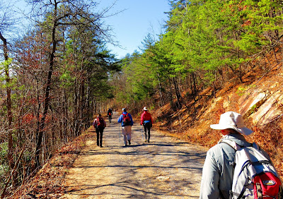
It is 2016 and with Yule winding down what better way to start the New Year than hitting the trail. For my first hike of the year I joined the Johnson City Hiking Club on Saturday for a outing to the Meadow Creek Tower. This was not my first hike with the club as I went out with them back in October up to Mount Cammerer. Today, we were starting out just inside Cocke County from the Houston Valley Campground.
While it is gated for the season there is room for at least six cars here and more parking can be found a mile down at Burrnet Gap, which serves as the parking lot for horse trailers. Once everyone arrived we just crossed TN-107 to get to the trailhead.
The first part of the hike was on the Gum Springs Trail. Part of this 1.3 mile trail is literally on Gum Springs Branch, combined with horse travel, made for a sloppy path. Oh, also on this part there where some down trees, which was no problem for Joel as he pulled out a hand saw and cut out some of the thicker branches.
The uphill path finally connects with the Meadow Creek Mountain Trail at Gum Springs Gap. This part of the hike, on the Meadow Creek Mountain Trail was a pleasant 1.2-mile jaunt on a ridgeline.
Most of it was uphill, but it did dip down Tweed Springs Gap before it heads up connecting with FS 142. Here the trail follows the road, about half-mile, up to the parking area (yes you can drive up but what is the fun in that).
It is then just a short distance up to the tower. Now, the reason I say tower is that describes the structure now. It once was the site of a fire tower, but all that remains of it is the concrete base. After being taken out of service in 1980's it became the victim of vandalism. However, the tower was refurbished in 2013 with a vandal-resistant metal viewing deck. Unlike Pinnacle Mountain, there is no roof, but similar to it there are wonderful views.
Some notable peaks to the east were Camp Creek Bald and Rich Mountain, south Bluff Mountain and just little futher west the Great Smoky Mountains and Mount Sterling, Mount Guyot and Mount LeConte. To the north is the Nolichucky River Valley and in the distance Clinch Mountain.
After relaxing on the tower, trying out my new camera and drinking hot tea (Joel brought hot water, coffee, tea & hot chocolate) it was time to head down. Most of the way back was down FS 142 (just over two miles) to the junction with the Gum Springs Connecter, which as you guessed leads back to the Gum Springs Trail and then to the trailhead. The total hike was at least six miles (some had it even longer) but overall was a really nice hike and once again my club members were a pleasure to be on the trail with.


very informatic article on Meadow creek tower, You can also read Ajman
ReplyDeletecreek tower here