Last November I did this hike going up and back on the Sarvis Cove Trail. However, today I decided to do this differently and go up the Coldspring Mountain Road also known as Horse Creek Road or FS-94. I had thought of coming back via this route last year but didn't.
 |
| 2020 Thanksgiving Weekend Hike |
So, for this trip I decided to go up Coldsprings Mountain Road while it is a bit longer (about half a mile) I knew it couldn't be as steep. Whether Sarvis Cove or Pete's Branch all of these hikes start on Coldsprings Mountain Road, but unlike all of these you don't go right at the sign, but left on FS-94 (0.8 miles).


 |
| Going left not right at the sign |
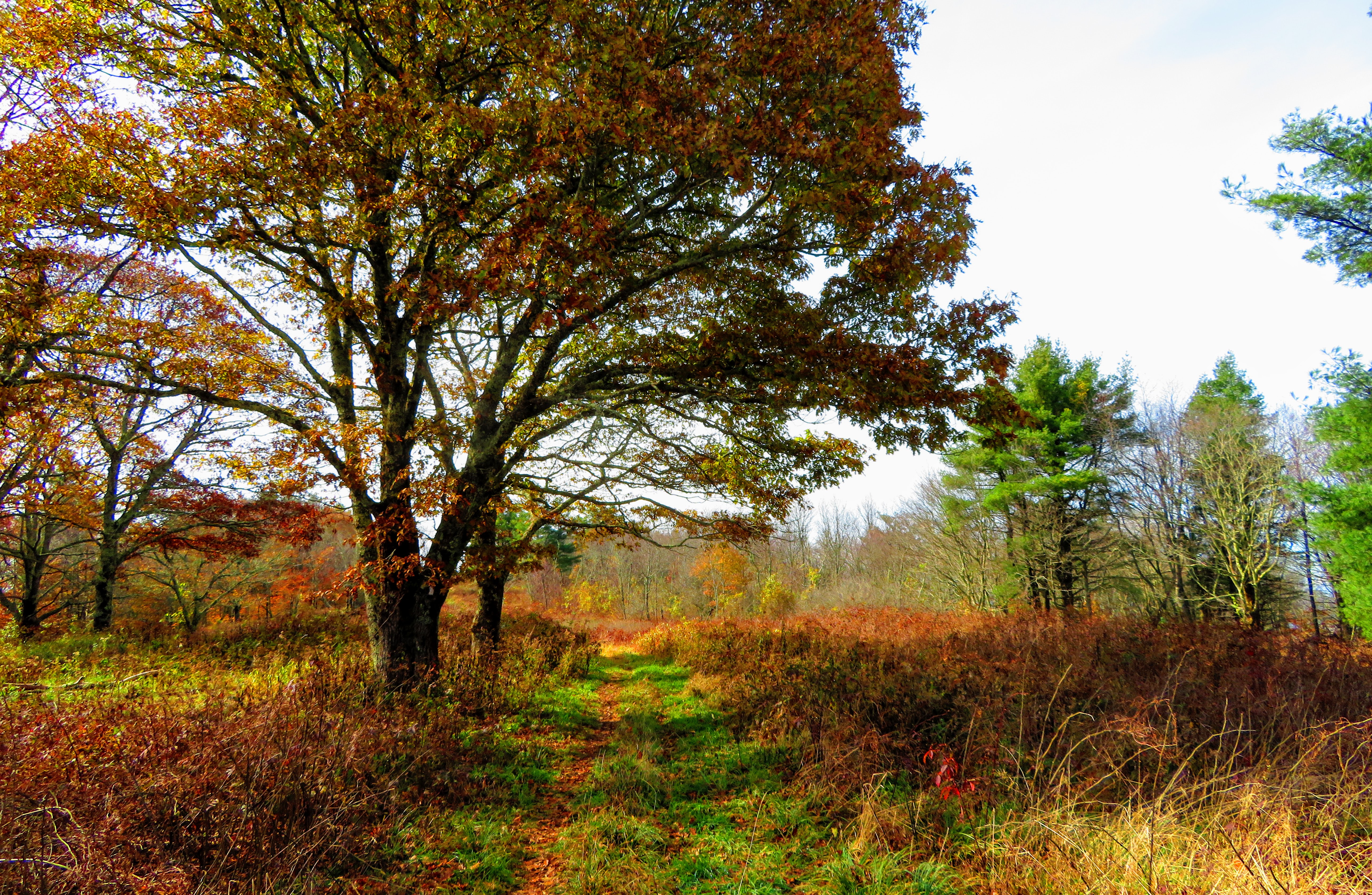
From this point, this was a virgin trail for me the last in the Bald Mountain Ridge Scenic Area.
Oh, and scenic it is as the autumn colors were fantastic. While on the road it crossed Horse Creek a couple of times. This one-mile section, while rocky, wasn't too steep. However, that all changed 2.3 miles in as the path started its climb out of the valley and up the mountain. The road does start to switch back in this section. You will know that you have gone three miles when a road comes in from the right.
 |
| First part of the Coldsprings Mt. Road |
 |
| Wonderful autumn colors |
 |
| Starting the climb |

After you will cross a couple of streams with small waterfalls to the left. I will admit this is the toughest stretch f this hike. As the top of the ridge comes into view, it still looks out of reach (in summer with tree cover it might not be as visible). But, when the trail flattens out at 4.4 miles and with it a turnaround you will know that you are closing on the top.


This is also the spot of a side trail that leads to one of the highlights of the trip, a rock outcrop I am calling Coldsprings Mountain Overlook. Besides a view into the valley below this vista also has included Greene Mountain, Greystone Mountain, Blackstack Cliffs, and Camp Creek Bald. This alone was worth the trip up.
 |
| Rock outcrop & spots that can be seen |
 |
| ColdSprings Mountain Overlook Panorama |
From here it is a short climb to a gate. The road right is FS-94 and dead-ends at a parking area. Left past the gate is FS-94A it heads up about a tenth of a mile and reaches a junction. The left fork heads towards Big Butt and right the Coldsprings Moutain Meadow, both intersect the Appalachian Trail (AT). I have spoken a number of times that this is one of my favorite lesser-known spots. It might be because that it isn't easy to get to that makes it this way. I mean in the A.T. Guide it is described as "Bald Ridge."


Anyway, I had lunch at the spot I camped at over a year ago and it was relaxing. I then hiked to the other end of the meadow to the heading AT South. Because I spent more time at the meadow than I planned (this always happened) so I started down the Sarvis Cove Trail.

 |
| My tent from 2020 & where I had lunch |


This blue-blazed trail is steep as I remembered, but it did have some beautiful fall colors. About half-way down the trail passes Sarvis Cove Cascade. Then the final stretch of the Sarvis Cove Trail is pretty rocky, made worse by the leaf cover. I was relieved when I reached the half sign and the junction with Poplar Cove Trail.


After heading down more rocky surfaces the Poplar Cove will pass the trail to the falls and cross Pete's Branch. The final 0.2 miles is one I have done many times. Then I finally arrive at the big sign and where I started the lollipop loop earlier in the day.


I will admit I was glad to see that last creek crossing (with the road rocks) this meant I was in the homestretch to the trailhead and the finish of a 10-mile outing. I even got sunset on the way home...nice!


No comments:
Post a Comment