First a brief history of the Thanksgiving Weekend Hike. It started back in 2013 with a snow hike to Rich Mountain. Winter weather would be part of two of the next three with snow on Max Patch in 2014 and rime ice in 2016 on Camp Creek Bald. The one that didn't was Laurel Run Park in 2015. Other locations were Camp Creek Bald again (2017), Mount LeConte (2018), and Margarette Falls last year.
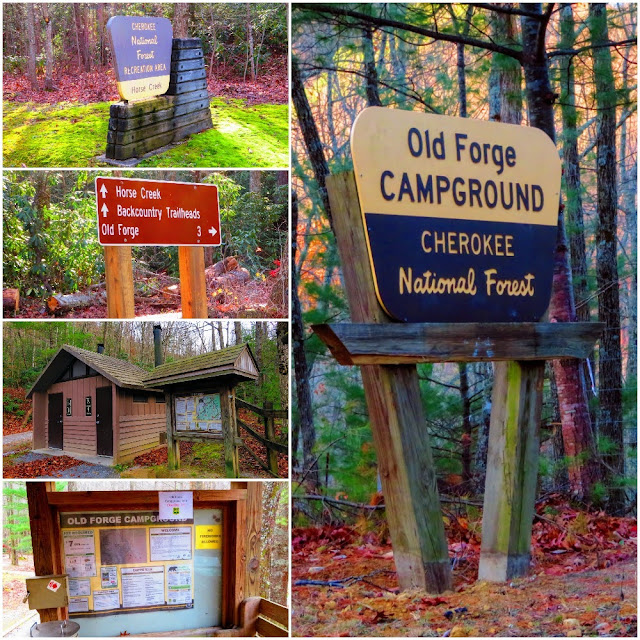
If this year seems a little familiar this was most of the aborted outing I had a bailout of in early November. While I was still staying at Old Forge, I changed the order with camping first. The other difference, instead of starting at Old Forge I was going out from the Horse Creek Trailhead.
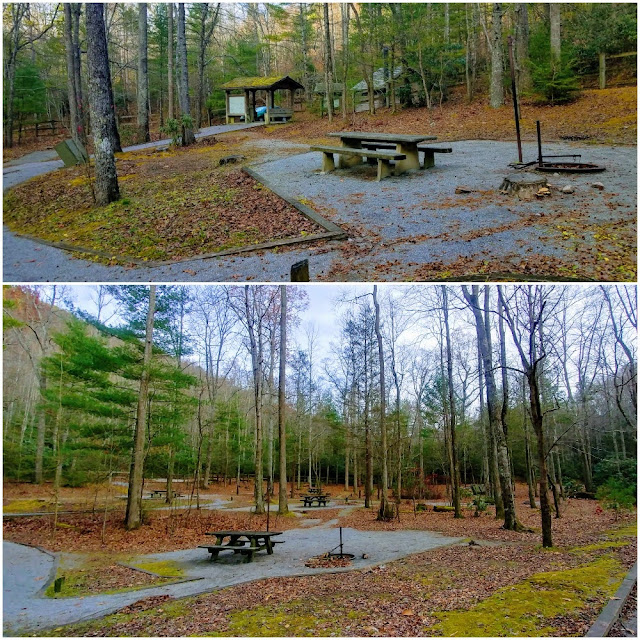
So, I got to Old Forge in the mid-afternoon on Friday. On my way, I thought it could be busy but that was the furthest from the truth. When I arrived I was the only camper and person, but that is Old Forge. I, a course, chose my campsite, Old Number Eight. Later a family came in and took site number one on the other side of the campground.
This outing gave me a chance to field test my new Coleman Sundome 2, which I had blogged about just last week. It was even bigger inside than I first thought because I used my twin inflatable bed instead of my backpacking sleeping pad. I even got some rain during the night and it stayed dry. Anyway, it was an excellent evening as I enjoyed another Thanksgiving dinner, but this time by the campfire.
It was a chilly Saturday morning and after breaking down camp and cooking breakfast (which I did at campsite three because it was close to the car) it was on to the trailhead. When I got there I noticed two vehicles, which reminded me that this weekend was the peak of rifle season so I put orange tape on my toque and backpack.
Like Pete said, the first part of the hike was the same as what I do for the one to Pete's Branch Falls. It is up to the Horse Creek Road. Then right at the sign on the Poplar Cove Trail. However, once across the Creek you keep right on the yellow-blazed, Poplar Cove Trail had head up. Get used to it as this will be the norm for the next three miles.
One thing you will notice on this section of the Poplar Cove Trail is a view of a cascade that is at the top of Pete's Branch Falls (so there Pete). After a half-mile, you reach a junction with the trail I need, the Sarvis Cove going left. You can't tell by the sign as only half of it remains, but you will see a blue blaze so you know you're going the right way. It was obvious this trail doesn't get lots of traffic as there was brush blocking the trail which I cut out and I would see more later. Oh, it does looks like some new blazing has been done recently.
For the first 1.5 miles, the trail is pretty much straight uphill and steep. It is also rocky in spots.
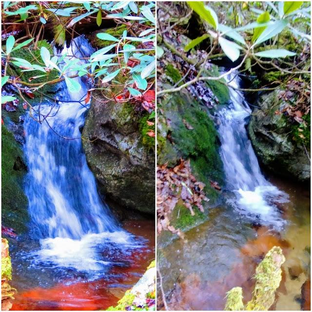
At 1.3 miles the trail crosses a stream with a small waterfall to the left. It is a little tricky crossing here, so this could be a trip ender. On up the trail is hard to follow because of flood damage so it is a good thing someone put up a piece of orange rope so look for it. Right after this, there was a nice cascade I am calling Sarvis Cove Falls.
I had read that this would be a hard trail to follow in summer and I ran into evidence of this. There were a lot of tree limbs and briers you have to brush aside. Some of the worst I cut out. While the trail had been steep up to now Coldsprings Mountain saved the worst for last. While it switchbacks the reason it gets really steep. Pete wasn't wrong, I almost threw in the towel a few times as I ran out of gas. Finally, after what seemed like a hundred switchbacks the trail headed straight and I saw the finish line the parking area for the Horse Creek Road.
Now for a little editorializing...the book Cherokee National Forest Hiking Guide edited by a friend of mine Will Skelton I am afraid I will have to call out again. Back in 2017 when I wrote about the Middle Springs Ridge Trail that it was rated moderate in this guide and how off that was. The Sarvis Cove Trail is also rated moderate...that is even crazier! This is one of the hardest trails I have been up, it is Low Gap Smokies hard. There is 2,240 feet elevation gain in 2.6 miles. If you look up a strenuous trail in the dictionary you see this one.
My next stop was where I camped, just off the Appalachian Trail, back in September. This is where I had lunch and hiked across most of the meadow. Coldsprings Mountain is a personal favorite of mine.
I thought of going back on the Horse Creek Road, but I decided I want to see how the Sarvis Cove Trail was going back. While I made a lot better time going back it was still very steep and I had to watch my steps as a almost fell a good number of times. I have to say I was pretty happy when I reached the broken Sarvis Cove Trail, even more, the junction with the Pete's Branch Trail (some was crazy if they thought I was going out to his falls) and most when I reached the big sign at the Horse Creek Road junction.
From here those creek crossing didn't seem as hard as I really didn't care if I got my feet wet, but I didn't. I have to say I was happy when I got to the parking area. I will say that I will probably not be hiking up Sarvis Cove Trail anytime soon. When I do this hike again, and I plan to, it will be up the Horse Creek Road and I will return via Sarvis Cove.
Overall it was a fine two days. Old Forge is still a great place to camp. While I didn't conquer the Sarvis Cove Trail I did survive it this was worthy of the title, Thanksgiving Weekend Hiking Extravaganza...


No comments:
Post a Comment