The Roan Highlands, one of my favorite places to hike...period! Since I had started hiking again I had hiked the Roan Highlands from Carvers Gap twice out to Grassy Ridge Bald crossing Round and Jane Balds, I have chronicled these hikes in an AT Day Hikes blog and two others (here & here).
The main trailhead for the Roan Highlands
Jane Bald, Round Bald & a misty covered Roan High Knob (Oct. 2013)...
...same part of the Roan Highlands in July of 2014
I also visited the Roan Mountain Rhododendron Gardens, and hiked to both the Roan High Bluff and to the old Cloudland Hotel site, which a blogged about here. So, when I discovered I could day hike up to the Humps on the north end of the highlands, I did and here is my AT Day Hike to the Humps.
Rhododendron Gardens...
...Roan High Bluff...
...old Cloudland Hotel site
First, what are the Humps? They are the last two mountains the Appalachian Trail (AT) crosses as it traverses the Roan Highlands. The first is 5,459 feet Little Hump Mountain and the slightly bigger Hump Mountain, checking in at 5,587 feet. The hike from Carvers Gap just too Little Hump is over seven miles and then it is two-plus up to Hump Mountain. So an out back would be close to 20 miles. I have been talking of doing the whole section, but that hasn’t come to pass yet. Anyway, I then discovered in a story, in the Greeneville Sun, that I could reach the Humps from the Roaring Creek area at the Overmountain Trailhead.
Hump & Little Hump Mountains from Grassy Ridge Bald in October 2013...
...July 2014
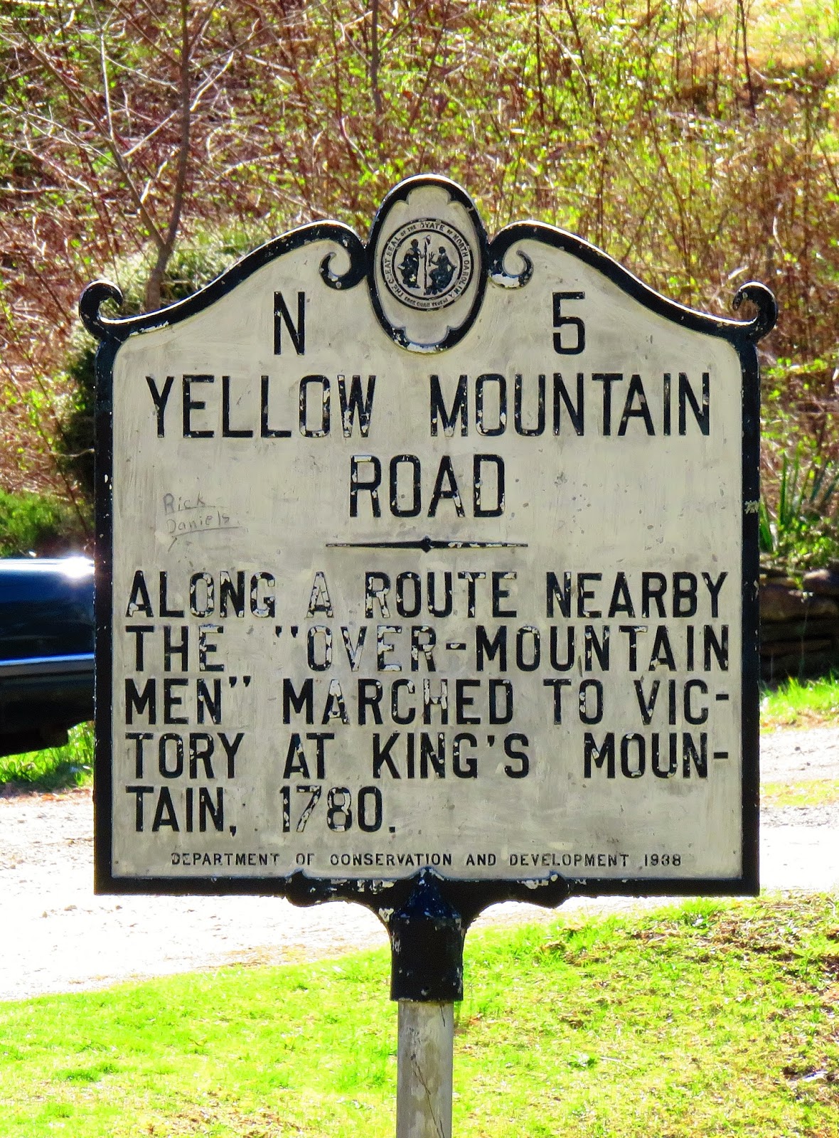
So, on St. Patrick’s Day, with a clear, cool day forecast I decided it was time to head to the Humps. From Saint Clair it is a decent drive clocking in just over two hours. Unlike going to Carvers Gap you keep driving through Roan Mountain for eight miles (you will also pass through Elk Park) on US 19E. The turnoff is for Roaring Creek Road. While there is no road sign you will know it is the right place when you see the sign for the Roaring Forks Community and Yellow Mountain Road Historical Marker.
You will pass my antique store on the way
When yo see this sign it time to turn on to Roaring Creek Road...
...you will also fund this historical marker
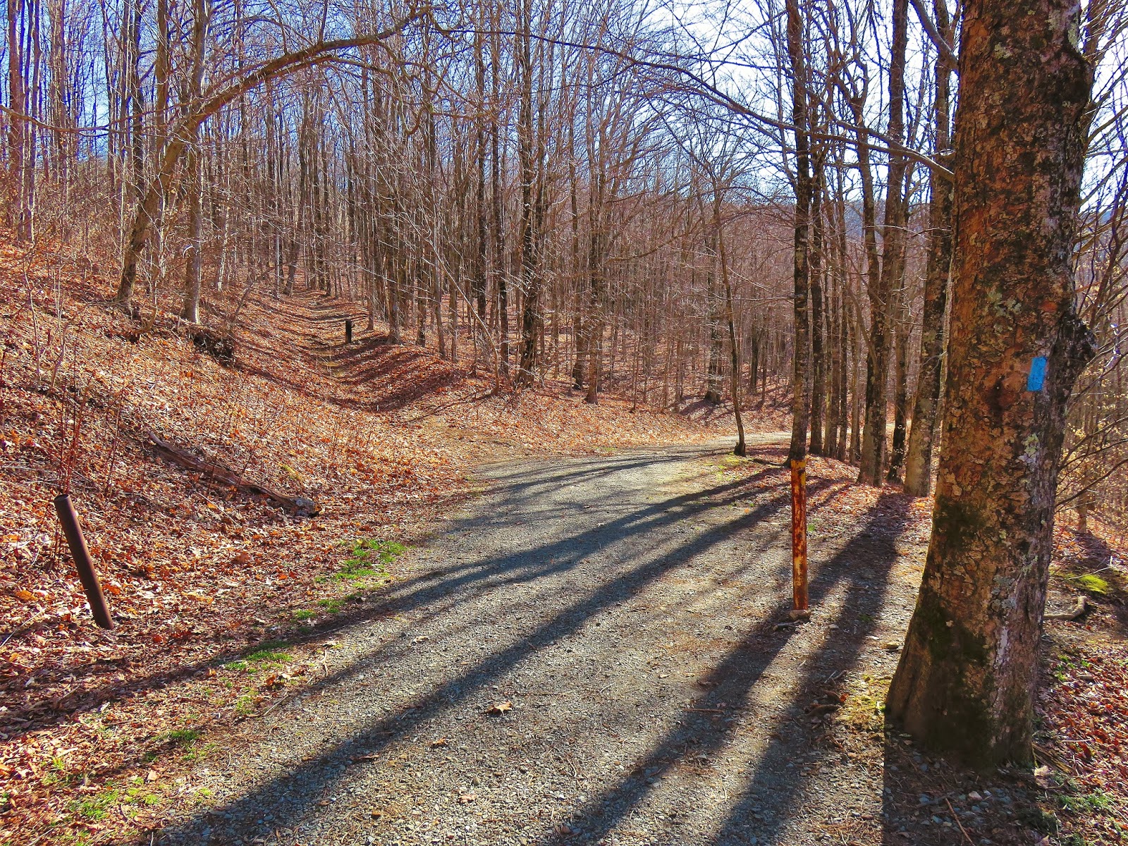
It is then a six mile drive with the last mile on a gravel road, while not bad it has two rough patches. You will know you are there when the road runs out. There is a decent amount of parking (six or more), but on this day mine was the only car. I knew this was the trailhead for the Overmountain Victory Trail, but there was no sign for it and since I wanted to visit the Overmountain Shelter I decided to hike the old road to the left up.
The gravel part of Roaring Creek Road
Parking area
Trail up the road
It is about 0.7 miles up the road before coming to a blue blaze and a clearing. The first thing you will spot is the old red barn that has been converted into the Overmountain Shelter. One of the most unique and famous shelters on the AT was built in the 1970’s for farming. In the early 1990’s the barn was converted into a two story shelter by the Tennessee Eastman Hiking & Canoeing Club (TEHC). It sleeps 30 (which is a lot) and is the only TEHCC shelter with a privy. Besides the shelter the area offers a wonderful view into the Roaring Creek Valley and has become a hiker stop over.
Follow the blue blaze...
...to an open area & the Old Red Barn...
...that is now the Overmountain Shelter
Here are some...
...photos of...
...this iconic AT shelter
The vista at the shelter
It is just a short three-tenths of a mile from here to the AT. To get to the blue blaze you go back to the road, because I passed it on the way. The trail to water goes right, the road straight and the blue blaze to the AT left. The connector trail final comes to a junction with the AT and the Overmountain Trail. The Overmountain east trail heads downhill back to the car and the west trail heads about four miles into Tennessee before ending at the Hampton Creek Cove Natural Area. All of these trails meet in Yellow Mountain Gap. The gap is famous as the Overmountain Men headed to South Carolina and the Battle of King Mountain and the trail heading west to east shares their name. There are two historical markers in the gap.
The junction where...
...to the right leads to water...
...left up the blue blaze trail...
...to Yellow Mountain Gap
One of the two markers at Yellow Mountain Gap...
...here is the second
So, at Yellow Mountain Gap to head toward the Humps go right and follow the white blaze. This first part is a nice steep uphill. It wasn’t as bad as some because I stopped a lot to take pictures. First, to the east, there is the view into the Roaring Creek Valley. However what you will notice the most is the peaks of the main part of the Roan Highlands. In the distance is Roan High Knob, then Round Bald (you can even spot Dr. D.M. Brown’s trees), Jane Bald and finally Grassy Ridge Bald. I would say it is with a since of accomplishment that a thru-hiker can look back and see the beautiful peaks they crossed. I know I felt that way. Once nearing the tree-line you can look back and see the old red barn and the area around Overmountain Shelter.
Head right up the AT
The AT cuts through some open area...
...with views into Roaring Creek Valley...
...the Roan Highlands, including...
...Jane Bald, Round Bald & Roan High Knob
Dr. Brown's Trees can be seen to the right on Round Bald
Grassy Ridge Bald
The Roan Highlands & the Overmountain Shelter
Big Yellow Mountain
After about a half-mile one will reach the tree-line and it soon tops out on the ridge-line. This is a nice half-mile section that has a gentle up slope. Finally the trail comes to a junction with a road, where the AT goes left. Now there is no double blaze here I guess that the TEHCC doesn’t like them like the Carolina Hiking Club.
AT heads into the woods
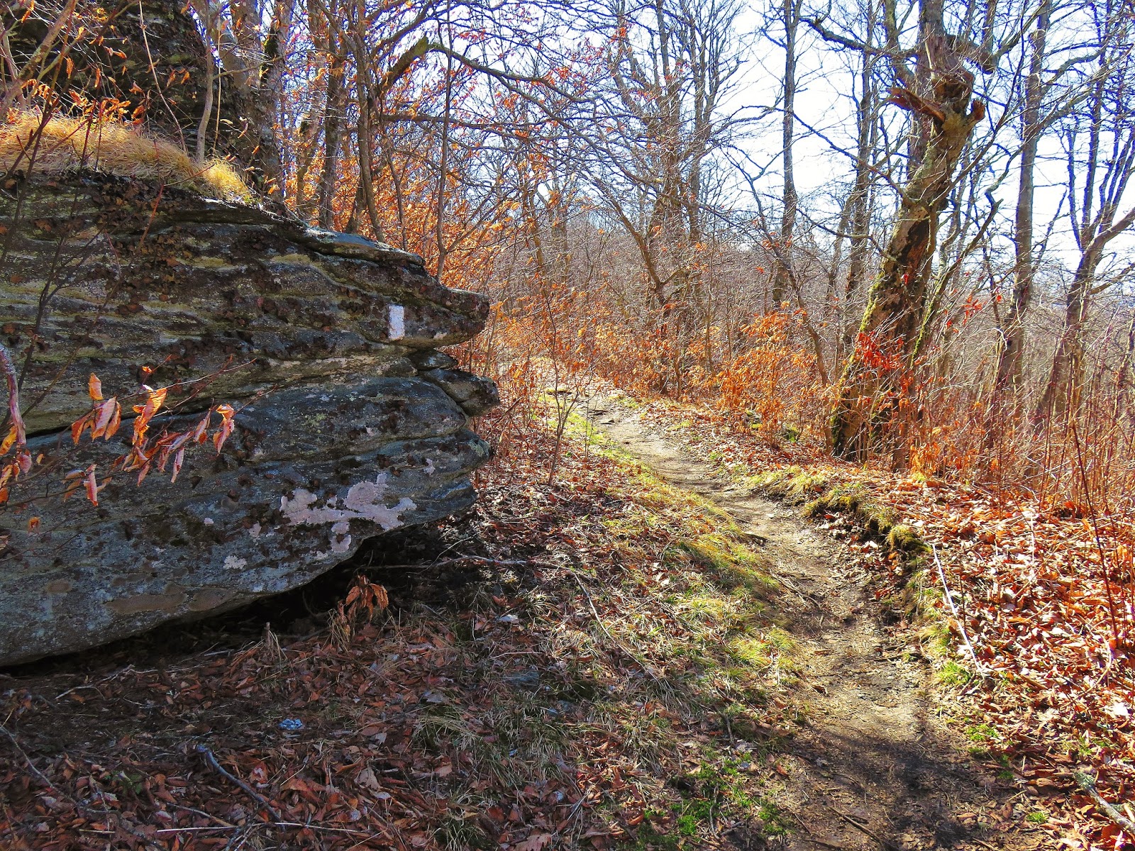
White Blaze Rock a staple of the Highlands
The junction with a old road (AT goes left, right Little Yellow Mountain)
The trail finally breaks into the open and the first objective comes into site...Little Hump Mountain. This is a beautiful spot with 360 degree views. While I enjoyed the view this open area introduced me to my friend for the day...wind. Yes, it was windy, very windy and this was just the preliminary round. The trip up is a steep 0.2 miles, but is broken up by the view. About halfway up that is a set of rocks, one with an AT logo, that allows a great view east-to-west. Once at the top besides the view behind you, the second object of the day is within eye sight, Hump Mountain.
Into a clearing with great views...
...of Little Hump Mountain
AT logo...
...on this rock (with a Wood Booger)
Looking back south from the summit of Little Hump
Roan Highlands from Little Hump
Next stop...Hump Mountain (the AT goes right, trust me)
As the trail heads down from the top it looks like a fork one faint trail heads straight down while the other curves into the woods. Logic says that heading straight is the way because that is the direction of Hump Mountain, but it is not; go to right and follow the white blaze. Don’t worry even as the AT heads back below the way you came be patient it eventually will bank left and head into the woods toward Hump Mountain. At almost a mile through the woods there first is a double white blaze and two side trails. I didn’t explore them, but from what I have read both ways lead to camping sites. Just on down the trail will be a tree that looks like a bench. Here the trail goes left and right heads down to a piped spring. If you need water this is a good place to get it before the trail heads out of the woods to Bradley Gap and the looming Hump Mountain.
As the AT heads down Little Hump...
...into the woods...
...back headed back south...
...but it curves & heads back toward Hump Mountain
The double blaze that has side trails to campsites & not to far...
...to the bench tree...
...which has a side trail...
...to a piped spring
Out of the woods into Bradley Gap
I will say that the view of Hump from Bradley Gap is just amazing, but it does look a little intimidating as the AT snakes up the mountain. One of the things about a bald like Hump is you can see exactly where you are going, Which looking at the trail up Hump might not be a good thing.
AT rock & Hump Mountain
On said rock (notice hat & wind breaker)
Another shot of "Hump"
Where I am headed
Anyway, the climb up starts once you pass the Bradley Gap marker and it is one steep go. It didn’t help that the wind gust had to be 40+mph, and it was a cold wind. Luckily I brought my pack-able winter jacket/coat and when I reached the first group of boulders I put it on and I was fine the rest of the way up.
Winds picked up at the Bradley Gap marker...
...so much so I had to get out the winter jacket & toque
It was uphill
The fence is just over halfway
Just over halfway one will come to a fence which has a spot to cross. From time-to-time the U.S. Forest Service uses livestock to graze here to maintain the balds. Once across it not long before one finally reach the top, just let me say the vista is breathtaking. It is a 360 degree view into Tennessee and North Carolina. while bigger than Little Hump, the summit on Hump Mountain was surprisingly small, much smaller than Round or Grass Ridge Balds.
Getting close to the summit...
...Yes!
Eest to South Vista...
South to West Vista...
...West to North Vista
Some of the peaks visible are GrandfatherMountain, Mount Mitchell, Big Bald and the other summits of the Roan Highlands; Roan High Knob, Round Bald, Jane Bald, Grassy Ridge Bald, Big Yellow Mountain and a course Little Hump Mountain. Also visible are the ski slopes of Beech Mountain and that eyesore at Sugar Mountain. Down in the valley on the Tennessee side is Roan Mountain and I even could see the house Glen and his Dad are building. The view is as good as or better than from the southern half of the Highlands.
Grandfather Mountain
Mt. Mitchell & Mt. Craig
Little Bald & Big Bald
Jane Bald, Round Bald & Roan High Knob
Grassy Ridge Bald
Big Yellow Mountain
Little Hump Mountain
Ski slope of Beech Mountain
The eyesore!
Upper left the house Glen & his Dad are building
Before heading back I went down the AT a couple 100 yards to the Stan Murray Monument on Houston Ridge. Murray was instrumental in bring the AT across the Roans and was founder of the Southern Appalachian Highlands Conservancy which has protected thousands of acres in the Roan Highlands.
Houston Ridge...
...Stan Murray Memorial
Anyway, on the way back I passed a couple with a cool Brittany spaniel named Gus. Back on the trail while the wind was gusty coming up it was blowing harder on the way back and for a while it was hitting me in the face.
Gus & the vista
Headed back down to the fence...
...& plenty of...
...boulders
Hump Mountain...
...is one big vista
One last look back at the "Hump"
When I got back to Little Hump Mountain I had a decision to make whether to just take the AT back or take a detour over a small bald I am calling Little Yellow Mountain. Earlier I mentioned a junction with a road and I figured it went over that knob, so up the bald I went. From the top of this bald a there was a wonderful view back to Little Hump Mountain. There is a faint trail that goes left toward Big Yellow Mountain but I read you need permission to head that way. I was right the trail down was the road and it reconnected with the AT.
Headed into the woods below Little Hump Mountain
Straight AT
I decided to head up to that little bald I called Little Yellow Mtn...
...it offered a wonderful shot of Little Hump Mountain
Hikers headed up Little Hump
The trail that led back to the AT
On the ridge-line back I missed a trail that led to some beautiful rock that at first look like they were covered in ice, but there not. They were interesting and lovely. Also here is a winter view of both Little Hump and Hump Mountains.
AT ridge-line
Little side trail to the cool "ice" rock...
...& this view of the Humps
When I finally reached Yellow Mountain Gap I did find someone left a sleeping pad here (for more read here). I decided to take the Overmountain Trail back to the car. It is about 0.7 miles the last third of a mile follows Roaring Creek back to the car. When I got back I discovered why there was no marker at the parking area...it was laying face-down next to the gate.
Getting close to Yellow Mountain Gap
The blue blaze back to the shelter.
Overmountain Trail
Roaring Creek
This gate was the for the Overmountain Trail...
I had to pick up the trailhead sign
On the day I hiked around 10 miles total, and while challenging it was a great hike over some of the most scenic trails in the Southern Appalachians. So, if you have ever wanted to head to Hump Mountain you can and if 10 miles is too much you can get a taste of the Humps just at six miles to Little Hump.
The Humps Rating:
My Take:
For Difficulty – 4 Stars
For Trail Conditions – 3 Stars
For Views – 5 Stars
For Solitude – 3 Stars
Overall – This hike has length and the hike up the Humps, especially Hump Mountain is a tough go. The AT here is well maintained, but there are some spots that could be blazed or signed better. The views are magnificent there are not many better. This section is not as busy as the area around Cavers Gap. While I passed some thru-hikers it was surprisingly I was alone most of the day.
Pete’s Take:
For Difficulty – 3 Rabbits Paws
For Trail Conditions – 4 Rabbits Paws
For Views – 5 Rabbits Paws
For Solitude – 2 Rabbits Paws
Overall – This is a challenging hike and carrying 200 pounds up Hump Mountain made it more so. The AT is great and I had no problems. Even I was more than impressed by the rolling vista..nice! We passed people on the trail, but they were hikers which was cool. Oh, no kids,


 Pete’s Take:
No comments:
Post a Comment