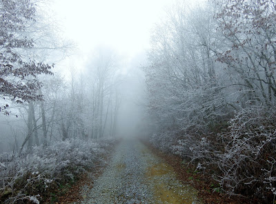
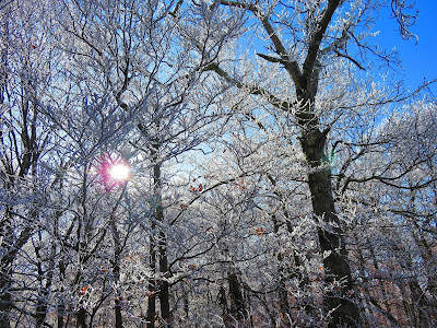
While the calendar says it is fall, but it felt like winter for the 4th Annual Thanksgiving Weekend Hike around the Camp Creek Bald area. on Saturday. Actually, this year is back on form, with winter weather, because the first two years at Rich Mountain and Max Patch featured hiking in the snow. Last year, at Laurel Run Park, the temperatures were in the 60's with a little rain.
I didn't expect to find a winter wonderland on top of Camp Creek Bald (or as locals call it Viking Mountain). It got cold Saturday morning, but it wasn't that cold in Greeneville. Then on the way toward Camp Creek Bald, I couldn't see the summit as it was shrouded in clouds. However, when I reached the gravel half of the road up the mountain I noticed what looked like ice just under the fog. I thought no way, but when I got almost to the Viking Mountain Overlook I realized that was what it was...ice. But, since it wasn't sticking to the road and I was almost at the top I pushed on.
When I reached Jones Meadow it was thick with clouds and while there was no view, plenty of ice coated trees. This condition is called Rime Ice, which is when fog freezes to things like trees. My original plan was to hike from Jones Meadow and do the loop with the Appalachian (AT) and Bad Weather Trails. Because of the lack of views, I decided to hike the road to the summit of Camp Creek Bald and hike back on the AT. I was hoping it would clear and I could hike to Big Firescald Knob, but if it didn't I might just head back to Greeneville. Well, the trip up had plenty of ice coated trees and so was the old fire tower on the summit.
The trip back down also featured some nice trees in winter dress, but there was also some changes to the trail. First, one of the buildings on the summit had been painted, then there was a new Pounding Mill Trail sign. But, the biggest change was at the junction of the Pounding Mill Trail and the AT. Gone was the old AT speed sign and it has been replaced by a traditional AT sign. The Carolina Mountain Club has done some work up there.
Anyway, by the time I got back to the car the fog had started to lift, so I decided to hike on. I parked at my usual spot but hiked down from the old sight of the Valhalla Inn. Once at the AT my first stop was at White Rock Cliffs.
Next stop was Big Firescald Knob, first I passed Bearwallow Gap, where a new Jerry Miller Trail sign stood. Since I wasn't doing the loop I went straight up. After passing more icy trees I a came out on the ridgeline vista of Big Firescald Knob. While the vistas were a little hazy (especially on the North Carolina side) the views were spectacular mainly because of the ice.
After about a half-hour I headed back I had one more spot Blackstack Cliffs. First, there was a new sign which was cool. The vista was great as always, but today the cliffs themselves were maybe the most beautiful. While standing on the cliffs you could see the coating of ice, it was from the old inn that you noticed how spectacular it really was. I have to say overall it was beautiful at Camp Creek Bald and it was one of my best hikes here and another successful Thanksgiving Weekend Hike.
 |
| First Thanksgiving Weekend Hike at Rich Mtn... |
 |
| ...the 2nd at Max Patch... |
 |
| ...the 3rd at Laurel Run Park. |
I didn't expect to find a winter wonderland on top of Camp Creek Bald (or as locals call it Viking Mountain). It got cold Saturday morning, but it wasn't that cold in Greeneville. Then on the way toward Camp Creek Bald, I couldn't see the summit as it was shrouded in clouds. However, when I reached the gravel half of the road up the mountain I noticed what looked like ice just under the fog. I thought no way, but when I got almost to the Viking Mountain Overlook I realized that was what it was...ice. But, since it wasn't sticking to the road and I was almost at the top I pushed on.
 |
| It is about here that I started to see Rime Ice... |
 |
| ...& a better shot. |
When I reached Jones Meadow it was thick with clouds and while there was no view, plenty of ice coated trees. This condition is called Rime Ice, which is when fog freezes to things like trees. My original plan was to hike from Jones Meadow and do the loop with the Appalachian (AT) and Bad Weather Trails. Because of the lack of views, I decided to hike the road to the summit of Camp Creek Bald and hike back on the AT. I was hoping it would clear and I could hike to Big Firescald Knob, but if it didn't I might just head back to Greeneville. Well, the trip up had plenty of ice coated trees and so was the old fire tower on the summit.
 |
| The icy trail up the road to Camp creek Bald. |
 |
| Foggy tower. |
 |
| Beautiful! |
 |
| A good look at Rime Ice. |
 |
| More of the... |
 |
| ...the towers at the summit. |
 |
| The frosty Camp Creek Bald Fire Tower.... |
 |
| ...& a closer look at the icy tower. |
 |
| More ice & fog at the summit. |
The trip back down also featured some nice trees in winter dress, but there was also some changes to the trail. First, one of the buildings on the summit had been painted, then there was a new Pounding Mill Trail sign. But, the biggest change was at the junction of the Pounding Mill Trail and the AT. Gone was the old AT speed sign and it has been replaced by a traditional AT sign. The Carolina Mountain Club has done some work up there.
 |
| The buildings with graffiti... |
 |
| ...it might have been painted over in August, but I just noticed it. |
 |
| Blue blaze trail... |
 |
| ...now has this sign. |
 |
| This sign had been removed... |
 |
| ...& this new sign replaced it. |
 |
| Hoarfrost & Rime Ice on the AT. |
 |
| At the junction for the trail back to Jones Meadow. |
Anyway, by the time I got back to the car the fog had started to lift, so I decided to hike on. I parked at my usual spot but hiked down from the old sight of the Valhalla Inn. Once at the AT my first stop was at White Rock Cliffs.
 |
| Frosty Jones Meadow. |
 |
| Icy trees |
 |
| Still some fog on Camp Creek Bald. |
 |
| Ice on Blackstack Cliffs (more later). |
 |
| Headed down to the blue blaze trail. |
 |
| I know Charlie Brown would be happy to know... |
- |
| ...his big mud hole is still there even with the drought. |
 |
| Old shelter. |
 |
| Headed out... |
 |
| ...to White Rock Cliffs. |
Next stop was Big Firescald Knob, first I passed Bearwallow Gap, where a new Jerry Miller Trail sign stood. Since I wasn't doing the loop I went straight up. After passing more icy trees I a came out on the ridgeline vista of Big Firescald Knob. While the vistas were a little hazy (especially on the North Carolina side) the views were spectacular mainly because of the ice.
 |
| No sign back in August... |
 |
| ...& a new sign (looks like it might not be there long). |
 |
| I went right. |
 |
| Some of the ice on the way to Big Firescald Knob. |
 |
| A Hazy vista into North Carolina. |
 |
| There was more ice on the Tennessee side. |
 |
| Rime Ice at Big Firescald Knob. |
 |
| Looking back at icy Camp Creek Bald. |
After about a half-hour I headed back I had one more spot Blackstack Cliffs. First, there was a new sign which was cool. The vista was great as always, but today the cliffs themselves were maybe the most beautiful. While standing on the cliffs you could see the coating of ice, it was from the old inn that you noticed how spectacular it really was. I have to say overall it was beautiful at Camp Creek Bald and it was one of my best hikes here and another successful Thanksgiving Weekend Hike.
 |
| The old sign... |
 |
| ...no sign... |
 |
| ...& the new sign. |
 |
| Big Firescald Knob. |
 |
| Looking toward Greeneville. |
 |
| Wood Booger enjoying the view. |
 |
| Looking back toward Camp Creek Bald & Jones Meadow. |
 |
| Sun & ice. |
 |
| Frosty Blackstack Cliffs from Jones Meadow. |
 |
| I love this photo! |
 |
| Headed back down. |


No comments:
Post a Comment