Moving from Georgia to North Carolina-Tennessee for the fourth
Appalachian Trail (AT) Section I completed, lucky number 13...Devil's Fork Gap to Allen Gap. This section includes what I call my "AT Backyard" the area of
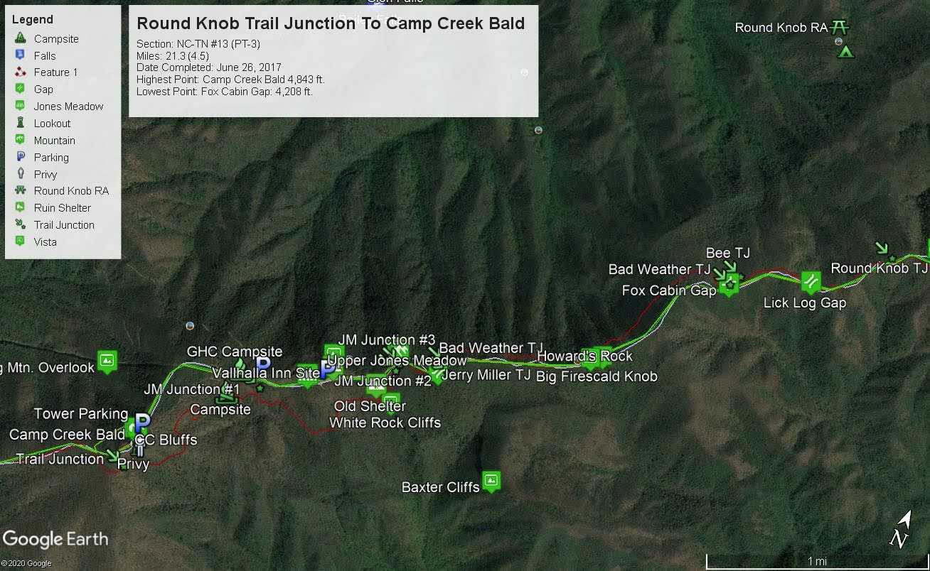
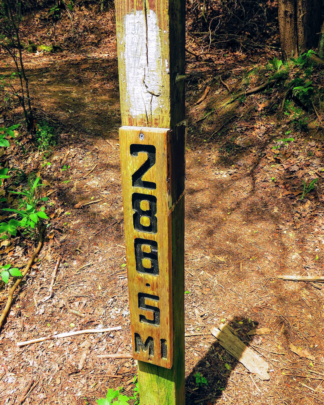
Camp Creek Bald above Greeneville. The southern end (Allen Gap) of this section is the closest the AT comes to where I live in St. Clair at 40 miles. This section of the AT goes over or past some of my favorite spots like Shelton's Graves, Coldsprings Mountain, Big Firescald Knob and the aforementioned Camp Creek Bald, just to name a few. For this 20.5 mile section, I did it in a number of segments. Because of this, I will be doing it AT North to South.
This section starts at Devil's Fork Gap, which like almost all of this part of the AT straddles the state line between North Carolina and Tennessee. I just
recently did the first part of this again, so you go right at the Gap and uphill past a new Devil's Fork Gap sign. Over the next 1.5 miles, the AT moves uphill on a gentle grade. There are spots were old roads criss-cross the trail, so keep aware of the white blazes. You will also cross a spring if you need water. There are also winter views of Flint Mountain.
Speaking of said mountain, before you know it you will come to a sign and see Flint Mountain Shelter at 2.7 miles. It is a very nice shelter it sleeps eight and like all
Carolina Mountain Club, shelters have a privy and bear cables. If you are day hiking it makes a good spot for a snack or lunch.
After leaving the shelter the AT will cross another old road before heading right down towards Flint Gap. On the mile to the gap the trail narrows and passes a nice Winter view of White House Cliffs in
Rocky Fork State Park. Once down into Flint Gap to the right is the Flint Connector Trail down to the park.
 |
| Flint Mountain Shelter |
 |
| Flint Gap... |
 |
| ...junction to Rocky Fork State Park |
For the AT it isn't down, but up, 500 feet in 1.2 miles. This is a steep spot and you will feel it going up. After a hard climb, you will pass the junction to Green Ridge Trail. It is here while going AT South you actually head Compass North. From this point the AT levels out. It is a short distance (0.3 miles) to the junction a trail junction at 5.7 miles. If you go left on a short side trail it will take you to
Shelton Graves. I talked about this before (here) but the two Shelton Brothers, William and David, and Millard Haire were ambushed and killed by Confederate Raiders near here.
 |
| David Shelton |
 |
| William Shelton |
 |
| Millard Haire |
The AT goes downhill, before heading quickly up towards Gravel Knob at 5.5 miles. The trail skirts the high point of Greene County and you might even hear banjos. For the next 1.1 miles, it is relatively flat. Before long you will reach a small meadow known as Ball Ground. At the far end of the meadow, the Middle Springs Ridge Trail comes up from
Horse Creek Recreation Area. After crossing Jeep road (the first of a couple) before heading up to Big Butt.
 |
| Ball Ground |
Here the AT goes left and the blue-blazed Big Butt Bypass goes right. Straight ahead is a very short side trail up to a rock outcrop. Also known as Big Rocks, this spot I think once had better views, but there are some, especially Camp Creek Bald. The AT down from Big Butt is steep, up or down, and really rocky. The Bypass Trail is the easier of the two. After passing the other end of the Bypass Trail start down crossing the Jeep Road for a second time. Before long you will reach the Howard C. Bassett Memorial on the right just as the AT reaches what I call "the Turn." The reason is the AT turns left 90°, following the ridgeline, west at mile 7.6.
 |
| Big Butt Bypass Junction |
 |
| Up to... |
 |
| ...Big Rock, High Rock but all are Big Butt |
 |
| Camp Creek Bald |
 |
| The other side of the bypass |
 |
| The turn &... |
 |
| Bassette Monument |
For a third time cross the road before heading past a larger boulder I call Commandment Rock. At eight miles there will be a sign for the Sarvis Cove Trail which enters from the right. This trail heads eventually to Horse Creek Recreation Area or if you want
Old Forge Campground. Right past the AT enters the large meadow of Coldsprings Mountain. This hidden gem is one of my favorite spots not just on this section, but the southern AT. This meadow stretches for almost half-mile with views to the west.
 |
| Commandment Rock. |
 |
| Sarvis Cove Trail Junction |
 |
| Out to... |
 |
| ...the Meadow on Coldsprings Mountain |
Entering the woods the AT heads down to Chestnutlog Gap and Jerry's Cabin Shelter at mile marker 9.2. I have been to this shelter on four occasions, staying in it on my last visit. I am going to write more about Jerry's Cabin in a future blog but for the record, the shelter was built in 1968, sleeps six, has bear cables, privy, and water nearby. Also, if you don't want to stay at the shelter there are plenty of tent sites before you reach it.
 |
| Jerry Cabin Shelter |
The trail cross a stream and heads two-tenths-of-a-mile, uphill and past the junction with the Fork Ridge Trail which heads down into North Carolina. The next 0.8 miles first heads steeply up Andrew Johnson Mountain and the along the ridgeline past Bald Mountain. On the other side, you reach the halfway mark (10.2 miles) at the sign for the
Round Knob Trail which heads down two miles to the recreation area of the same name.
 |
| Fork Ridge Trail Junction |
 |
| The Elephant Tree |
 |
| Round Knob Trail Junction |
The next part of the AT is relatively gentle for the next seven-tenths towards Fox Cabin Gap. You will know you are almost there when you pass a sign for the Bee Tree Hollow Trail, which isn't on most maps. Right after you will reach the sign and junction. The AT goes left up the exposed ridgeline of Big Firescald Knob. However, the AT original went right, which is now the Blue-Blazed Bad Weather Trail. About the Bad Weather Trail, it is a mostly flat, but rocky path which travels 1.4 miles to Bearwallow Gap.
 |
| Bee Tree Hollow Trail Junction |
 |
| The Bad Water Trail (Old AT) Junction... |
 |
| ...the trail is Blue Blazed |
 |
| The other end of the junction |
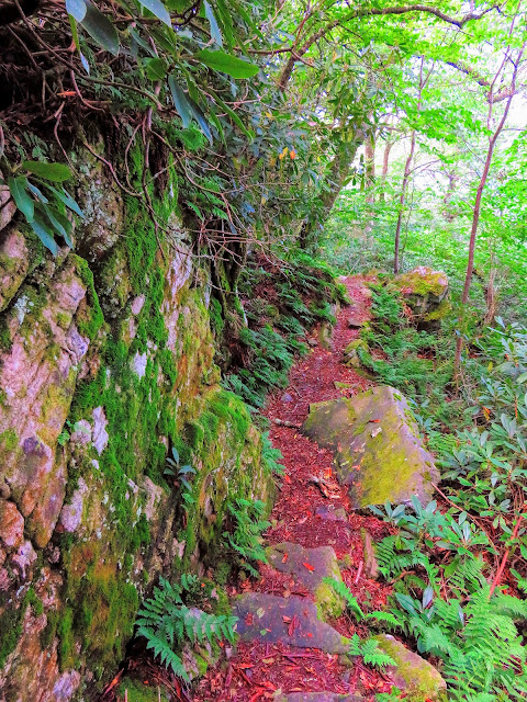
Back to the AT, you head up with plenty of rock scrambling, including one spot which is an eight-foot climb. For all the work you reward some views, but there is plenty more too come. Because of moving in and out on the ridgeline, there is a new (new for me) "bailout trail" for bad weather. Still, unless it is because of bad weather or you're doing "the loop" going over Big Firescald Knob is a must.
 |
| AT Blaze Rock |
 |
| Start of the exposed ridgeline of Big Firescald Knob |
 |
| Big Firescald Knob & Camp Creek Bald |
 |
| There is an escape hatch trail on the ridgeline |
 |
| It is a bit of a climb |
I have probably said this before, this is the best spot on this section and one of my favorite AT spots in the Southeast. There are views stretching into Tennessee and North Carolina. Besides peaks, already passed there is the main one to come, Camp Creek Bald. Oh, there are plenty of other peaks in all directions. It is a great place to have lunch, a snack or a well-timed break. On the ridgeline look for Howard's Rock with a plaque in honor of Howard McDonald, Master Trail Builder. Before long you will leave the sweeping vistas and drop back into the woods.


The trail gentle heads down and up you know when you are getting closer to Bearwallow Gap when the trail starts steadily down and gets rocky. Finally, the Bad Weather Trail will come in from the right at the 12.5-mile mark. For the record, the ridgeline is also just a tad shorter, by a tenth-of-a-mile. Oh, and a new sign was recently put in here. Also in Bearwallow Gap, the AT will pass the Jerry Miller Trail on the left, before starting up and passing one of my favorite trees.
 |
| Jerry Miller Trail Junction |
 |
| My favorite tree |
It is just 0.2 miles to the junction over Little Firescald Knob (which is actually higher than Big Firescald Knob...go figure) down a slight Rock scramble to Blackstack Cliffs. It is worth the short round-trip (0.2 miles). The side trails to Jones Meadow come fast as there are signs for the two that head to the large meadow that was once home to the Viking Mountain Ski Resort. I have used Jones Meadow for day hikes many, many times.
 |
| The old AT route... |
 |
| ...goes past the remains of the Old Camp Creek Bald Shelter |
It is still only about a half-mile since leaving Bearwallow Gap to teach the side-trail, this time on the left, to the scenic White Rock Cliffs. While not as popular as Blackstack, Oh, you might see a sign for protecting Peregrine Falcons. White Rocks are worth a stop. The trail drops down for here for another good stretch. You will pass a log with an AT logo carved in.
After a mile the last blue-blaze to Jones Meadow on the right at just under 14 miles (13.9). This is a really short side-trail past where the
Greeneville Hiking Club sets up for Trail Magic. It also makes up part of my Camp Creek Bald Loop. A couple hundred yards down the AT is a great campsite with water down the Blue Blaze. The climb up Camp Creek Bald is mitigated by some switchbacking (which this section as little of).
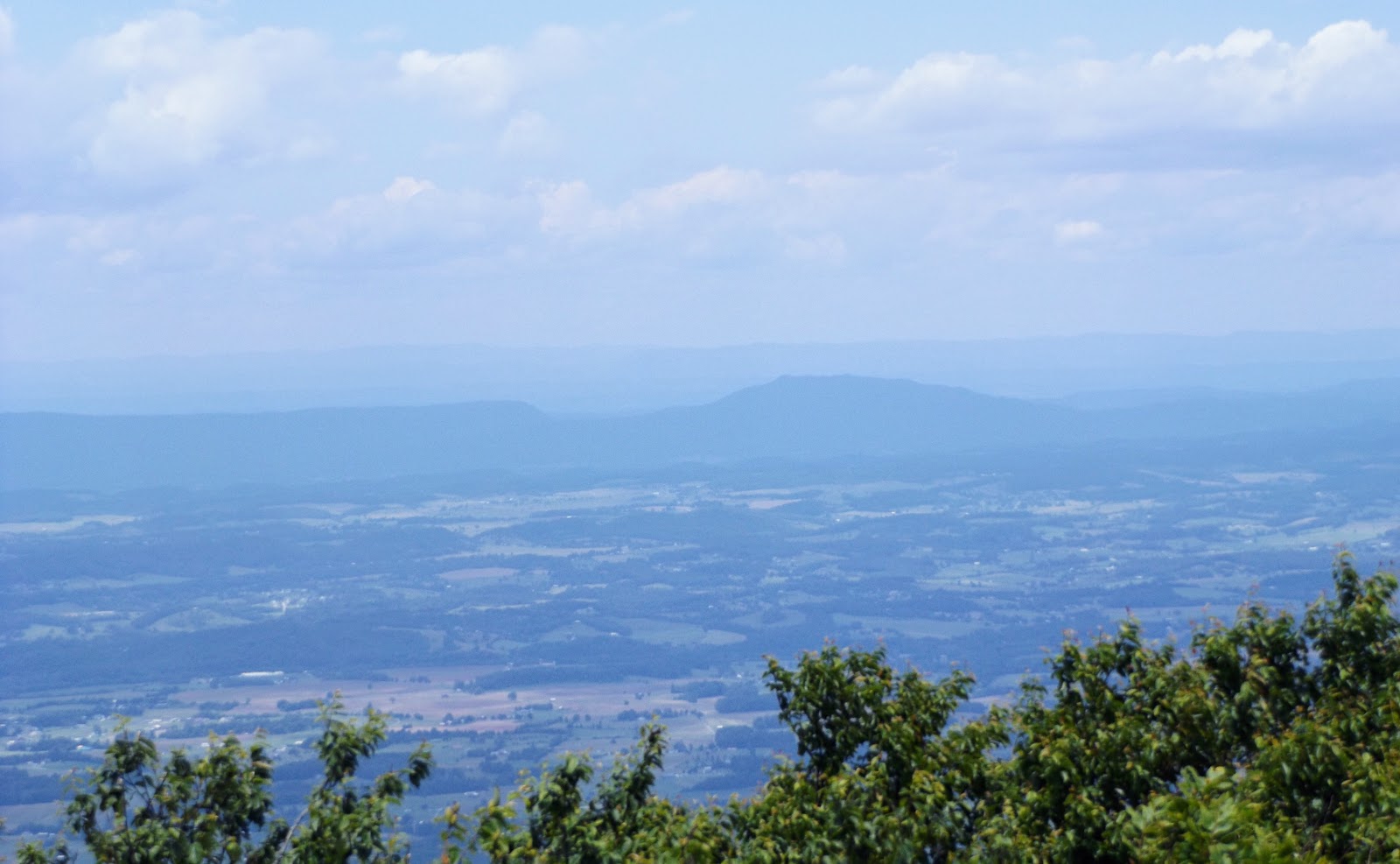
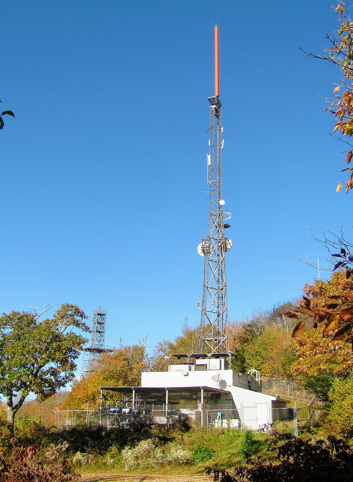
At 14.7 miles the AT comes to a junction with the Pounding Mill Trail (left) and the trail to Camp Creek Bald (right). As books, like the AT Guide, will correctly point out the old fire tower on Camp Creek Bald is locked so there is only a view from the stairs up. While I think a look at the tower is worth the time there are views to be had. The best way to come up is to go left on the road where you will come to a communication tower. Go left behind the fence and up the faint trail through the rhododendrons to reach Camp Creek Bluff...your welcome. Another point about this part of the AT is that it was rerouted a few years back, see if you can spot where.
 |
| Camp Creek Bald Summit Trail |
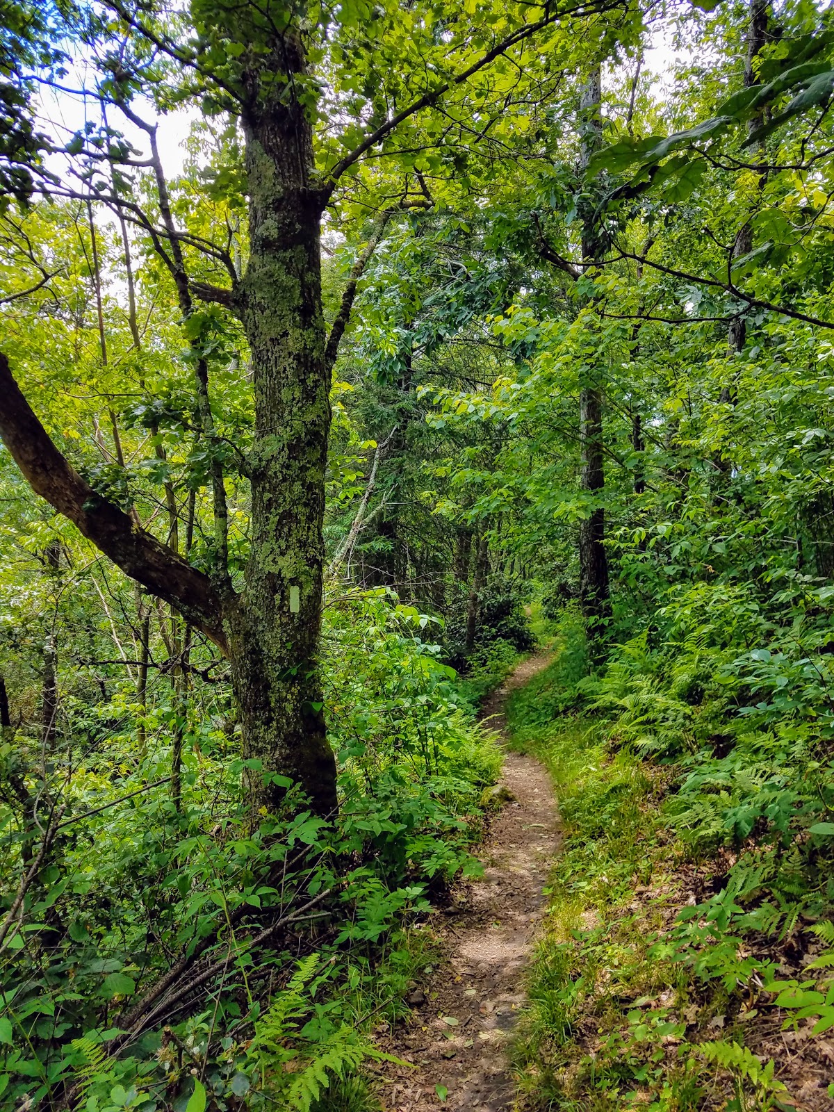
From this point, the AT heads downhill towards Allen Gap. It is far easier going south than north. This is a beautiful stretch of woods and in Spring it is loaded with wildflowers. It won't seem too long (1.3 miles) to reach Little Laurel Shelter at 16 miles. This is a cozy stone shelter, rebuilt in 1967, it sleeps five. Water is located in the West on the blue-blaze trail. Like all
Carolina Mountain Club Shelters, it has a privy and bear cables.
 |
| Little Laurel Shelter |
 |
| Privy |
Leaving Little Laurel it is down the AT. It is 3.3 miles (18.7 miles total) when you reach Log Cabin Road. To the left is a private cabin, but right, 0.7 miles west is the
Hemlock Hollow Inn and Paint Creek Cafe. The AT skirts the road, which signals the mile to go, homestretch. The sounds of TN-70/NC-208 will let you know that you're at Allen Gap. That a large sign,
Cherokee National Forest on one side and a smaller (& older) Pisgah National Forest on the other. That completes TN/NC section 13 coming in at 21.3 miles.
 |
| Down to Log Cabin Road |


No comments:
Post a Comment