
The six Appalachian Trail (AT) Section I completed was North Carolina-Tennessee #11, Sams Gap to Spivey Gap, including going over Big Bald. I did this section on two hikes in the week of July 2018.

I first thought a shuttle hike from Sams Gap to Spivey Gap since it was only 13.4 miles. But arranging a shuttle is hard and paying for one is expensive. Then on a previous year's backpack Will mention wanting to lead an outing from Sams Gap to Spivey Gap over Big Bald, so I was so in for that since I was wanting to do it. When the hike got closer Will decided to shave two-and-a-half miles off the hike by starting at Street Gap instead of Sams Gap. So, two days later, and did an out-and-back from Sams Gap to Street Gap to finish the section. I am doing this AT Section South to North as I had only done both ends Southbound.


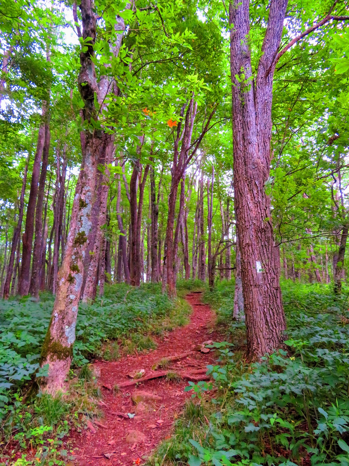
So, the starting point for this section is Sams Gap. I have hiked out of here twice and the second time involved this AT Section. This is a great place to start a hike as there is a large parking area below I-26 which the AT crosses under. The trail starts through a gate to the left. Then it runs parallel to I-26 for a couple a hundred yards before turning right up There is one more look down to Sams Gap before the AT heads into the woods.


It is here that the AT passes another gate at one-tenth of a mile in. The trail cuts around the right side of the ridge. Just over half-mile down the trail crosses two springs. Just over a half-mile later the trail crosses another spring in a sag before coming up to an area of a former talc mine. There is also a campsite here plus an AT log.


Then the trail has a long uphill to a large area with a campsite and a milage sign. It is here, 1.8 miles in when the AT enters a meadow giving an excellent view of Big Bald. It is a beautiful 0.4 miles across this open meadow. You will come to a junction as the AT goes straight before heading into the woods. The trail turns left and you will see where the trail that broke left comes too. The AT switchbacks again and heads down into Street Gap, at 2.3 miles.


This is where we started the Sierra Club backpack from and I have some advice if you decide to start from here. Only do it with a high-clearance vehicle, do not use a passenger car! Also, you will find a nice vista, which there is more to come. Anyway, once on the trail, it was uphill, but not too steep. There will be another South facing view, this time of I-26.


I was still heading up before the AT starts down in Low Gap at 3.7 miles. It wasn't long before the trail ascending and the day I did it was into the clouds. It gave the appearance that it was remote, but housing development and Wolf Laurel Ski Resort are on the North Carolina side of the mountain. You will first notice this because there will be a side path that says Nature Trail. But, this was illustrated even more when there is another side trail hitting a paved road and cabins.


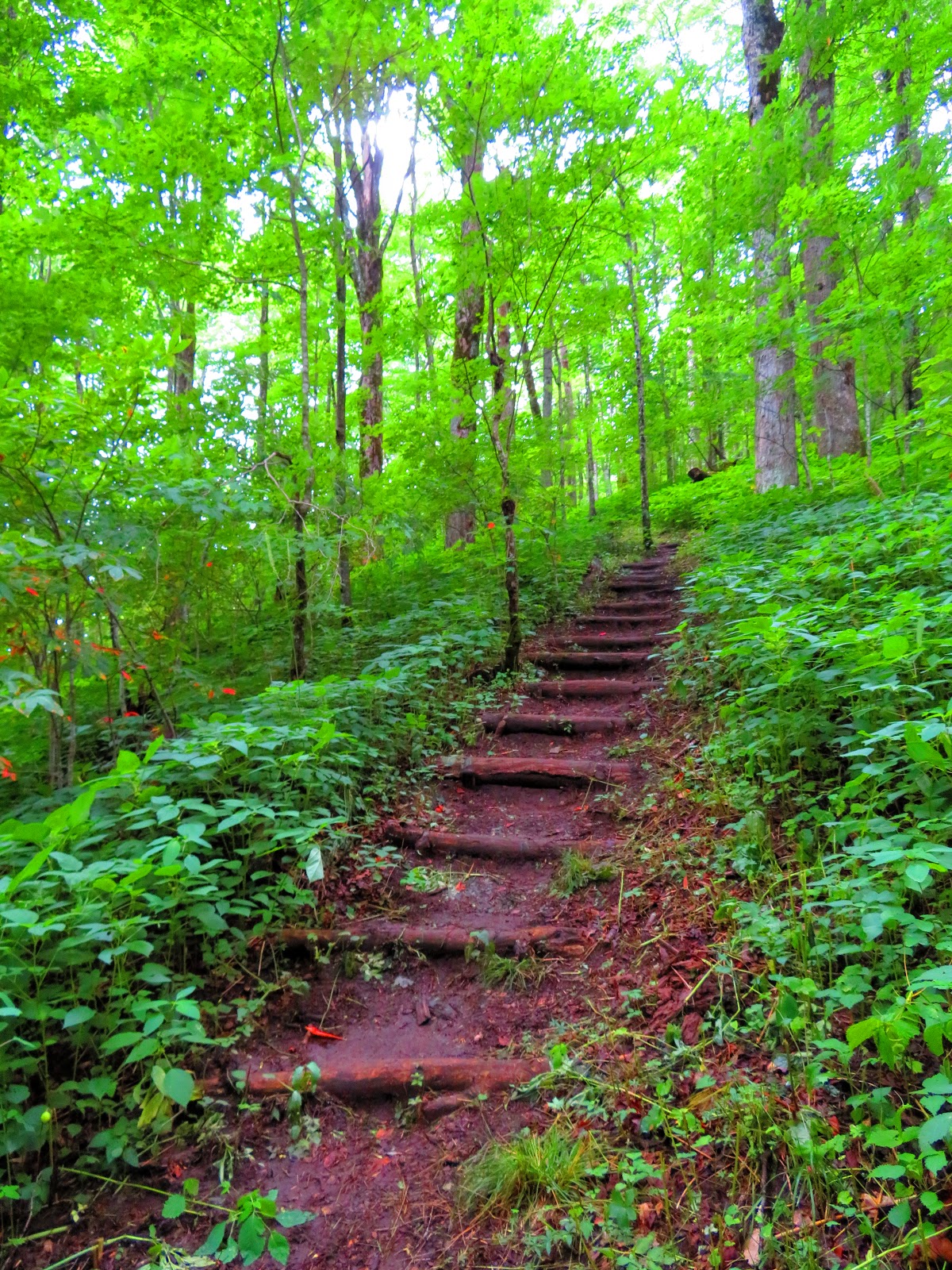


The trail will continue up through hardwoods and rocks, not super steep, just a steady incline. So, at six miles, even though you are still in the woods, you know you're getting close to the summit of Big Bald when you reach the junction with the Bad Weather Trail. Like the bypass at Big Firescald Knob (AT Section NC-TN #13), this trail is as the name says in case of bad weather most of the open summit can be bypassed. After crossing some small streams it is a short distance when the trails leave the woods for the open meadow at Slipper Spur. It is a short but beautiful hike to the summit of Big Bald at six-and-a-half miles.


I will now speak about my visit to the summit. When we hiked up on Saturday it was banked in by clouds. Don't get me wrong it had its own haunting beauty, but on my first visit, I wanted to see its famous views. So, on Sunday morning some of us backtracked just over a mile back to the summit. Starting a hike in the dark has a beauty of its own, but it started to lighten once our small group approached the summit of Big Bald.


Once at the top it was one of the most spectacular sunrises I have ever seen. As the Sun brightens the sky it revealed one of the best vistas in the Southern Appalachians. We hiked on down, Big Stamp, a saddle before we got to the tree line again. Where there is a road that comes in from the right is where the other side of the Bypass Trail merges back with the AT.


Once at the top it was one of the most spectacular sunrises I have ever seen. As the Sun brightens the sky it revealed one of the best vistas in the Southern Appalachians. We hiked on down, Big Stamp, a saddle before we got to the tree line again. Where there is a road that comes in from the right is where the other side of the Bypass Trail merges back with the AT.


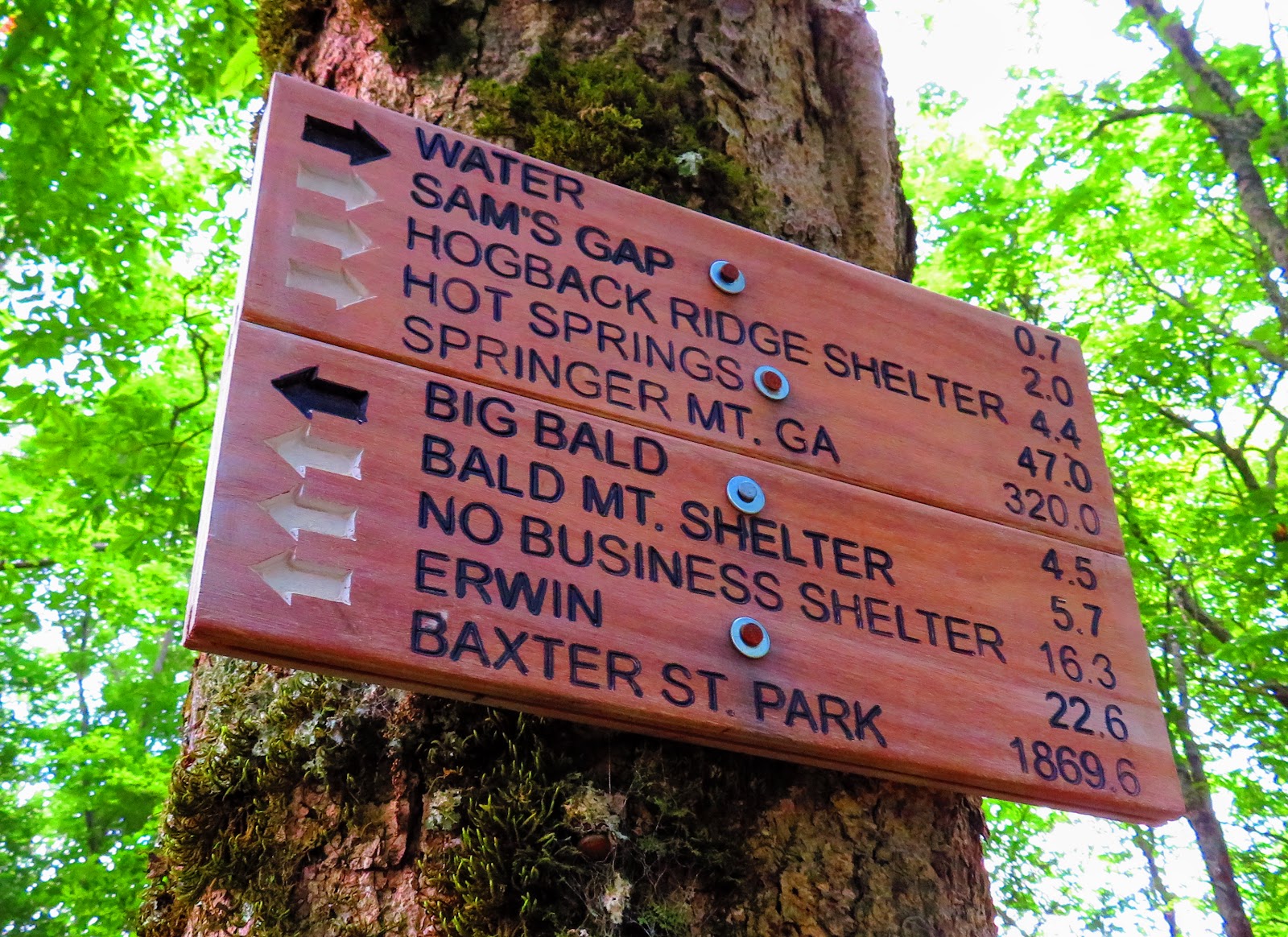
We thought of camping here, Saturday, and even found evidence that people do as we found tables and chairs. From what I read this is Greer Rock where the old hermit David "Hog" Greer lived under in the early 1800s. The AT heads through a nice flat section for the next mile towards the junction with the Bald Mountain Shelter, which is where we set up camp. It is a nice 10-person sleeping shelter with bear cables and privy that is about tenth-of-a-mile off-trail.


After leaving Bald Mountain Shelter the first two-tenths of a mile is flat, but it gives way to an uphill trek to Little Bald. At mile marker 9.1, it once was a bald, but now a wooded summit except for a small vista to the north. For the next two miles, the trail is downhill. The trail passes a spring before reaching a rock blazed with AT logo. Right after you will finally reach Whistling Gap.


Now begins the climb up to High Rocks. I had been to High Rocks before on an out-and-back from Spivey Gap, but not coming up North on the AT. When I looked at the profile in both the ATC and AWOL's guides it didn't look like that bad of an uphill (only 352 feet in 0.6 miles) but looks can be deceiving. It might have been carrying the big pack, but the uphill grade seems to go on and on. So, the short climb on up to High Rocks is a welcomed break. I was also met by a new sign here. Oh, High Rocks is a better Winter view.


Now begins the climb up to High Rocks. I had been to High Rocks before on an out-and-back from Spivey Gap, but not coming up North on the AT. When I looked at the profile in both the ATC and AWOL's guides it didn't look like that bad of an uphill (only 352 feet in 0.6 miles) but looks can be deceiving. It might have been carrying the big pack, but the uphill grade seems to go on and on. So, the short climb on up to High Rocks is a welcomed break. I was also met by a new sign here. Oh, High Rocks is a better Winter view.


From High Rocks, the AT is pretty much downhill from here. It will start switching back through some rocky areas. It will eventually flatten out through a twisty section before straighten out. You will know that you are in the home stretch to Spivey Gap when you reach the Deer Cut. It is an area that is mowed to give deer a place to graze.


After crossing Big Creek a couple of times you will hear 19W and know you have made it to Spivey Gap. This is also the place where the Carolina Hiking Club gives way to the Tennessee Eastman Hiking and Canoeing Club.


Gorgeous, as always!
ReplyDelete