One-year-ago on my Day Blog chronicling my trek across the High Country of The Smokies, from Clingmans Dome to Silers Bald, I promised a more in-depth analysis of this outing. So, this post is a Back In the Day Blog on this hike in the Great Smoky Mountains National Park (GSMNP).
This hike starts in a place I have visited before the highest point in the Smokies (and Tennessee)...Clingmans Dome which I have done in detail before (here). Because it was such a nice morning in the mountains I decided to head up to the tower on the summit of Clingmans Dome. The biggest surprise was that it wasn't near as crowded as normal with most of the people being thru-hikers.
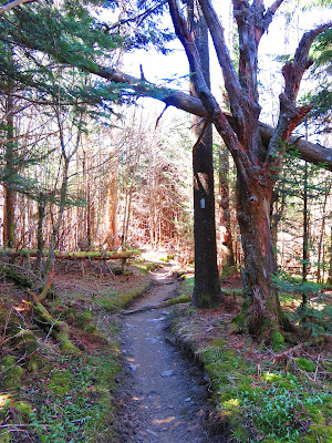
The rest of the hike to Silers Bald would be on the Appalachian Trail (AT), so once I passed the junction with the Clingmans Dome By-Pass Trail it was all new territory from here. The hike here heads up Mount Buckley and then down. On the way, they are a number of great views to enjoy before the trail enters the forest and down to Double Springs Gap.
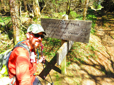
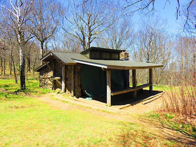
Here there is a junction with the Goshen Prong Trail before the AT heads sixth-tenths of a mile to the Double Springs Gap Shelter. This shelter seemed to be a popular one with plenty of thru and section hikers milling around. It looked like most Smokies Shelters, sleeping 12, but it is in a nice location and has two water sources.
After a quick stop I continued on toward Silers Bald, but first I went through a stretch of wildflowers, mostly Spring Beauties, before heading through a section called the Narrows. This is a narrow ridge, with views, before it the AT reached the final trail junction with the Welch Ridge Trail.
From here it is a pretty steep climb the next four-tenths of a mile to the summit of Silers Bald. I have read there was once a 360-degree view here, but now there is a rock with the summit marker and a good view of Clingmans Dome. Since the view was a little less than advertised I decided to follow the AT another 0.2 miles to the Silers Bald Shelter. Like Double Spring Gap Shelter, Silers Bald sleeps 12 but wasn't near as popular as the shelter south on the AT because there was no one here. It might be the lack of bear cables or a privy, but it was very quite.
Anyway, this was the turnaround point to head back toward Clingmans Dome. Besides stopping by Double Springs Gap Shelter the most notable event on the way back was the hike back-up...Mount Buckley. It might be because I was tried, but it was a tough climb.
Once at the top I decided to head back to Clingmans Dome instead of taking the By-Pass Trail back to the parking area (it was such a beautiful day). Let just say it was a bit more crowded than the morning up. Anyway, this hike clocked in at 10.5 miles and I will say that it was a wonderful day of hiking on the AT in the High Country of the GSMNP.


No comments:
Post a Comment