While I have thru-hiker dreams right now my
Appalachian Trail (AT) focus is knocking out sections and that is what I did, this past Saturday, hiking from Tanyard Gap to Allen Gap.
The actual section is from Hot Springs to Allen Gap, but I had completed the first-half from Hot Springs to Tanyard Gap in the
summer of 2016 and chronicled it back in
August. I had also hiked as far as the junction with the Rich Mountain Fire Tower. I had hiked this on three occasions and went into detail about
here. If I had hiked on to Hurricane Gap on any of my three hikes to Rich Mountain I might have not needed a shuttle, but I didn't, so my friend Glen (who I did my first Rich Mountain hike with) dropped me at Tanyard Gap.
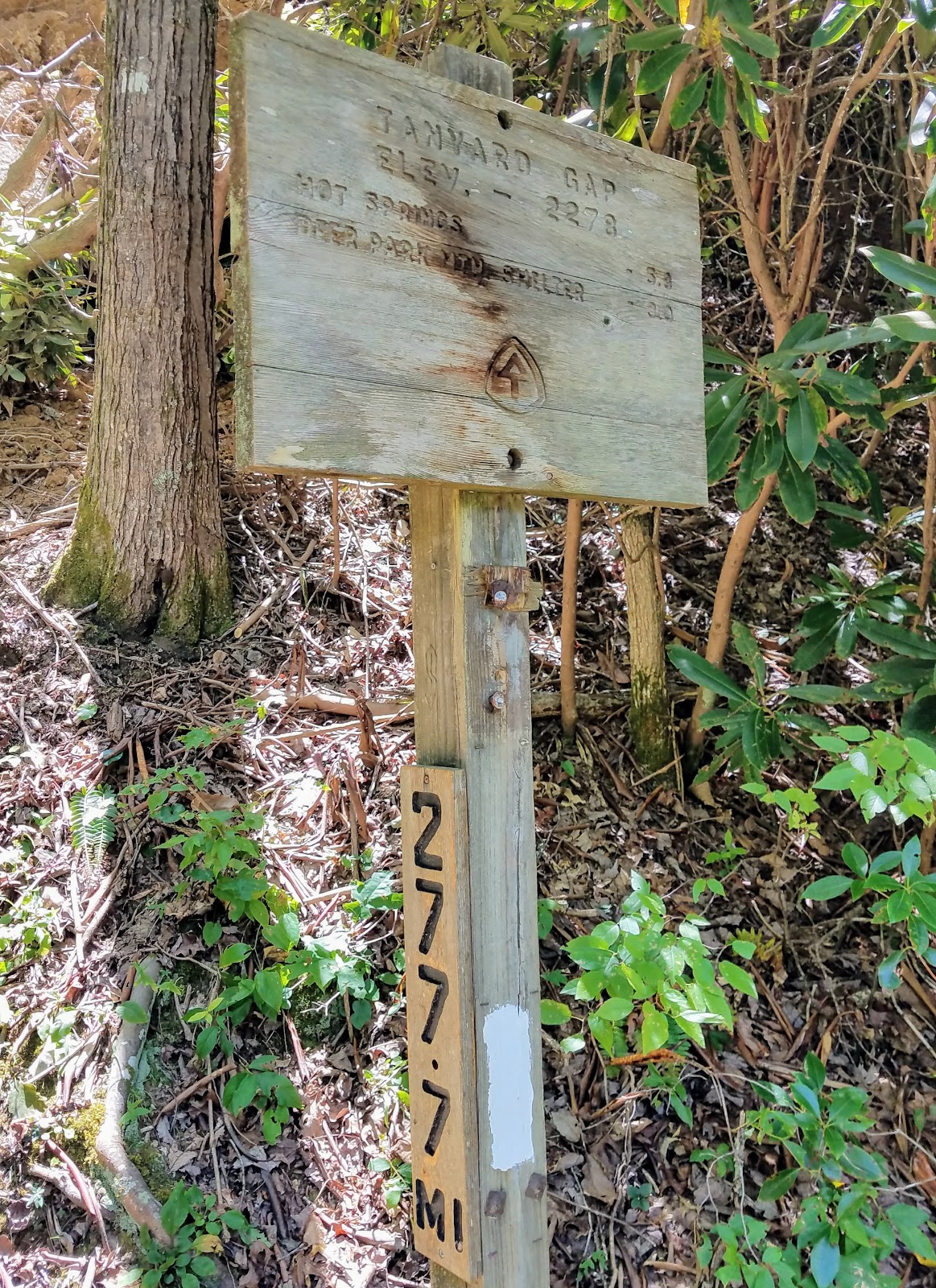
 |
| Hot Springs... |
 |
| ...Mile 277.7 (AT-N)... |
 |
| ...at Tanyard Gap. |
The two most standout items of note (one good and one bad) on the way up Rich Mountain were first the good and that is the forest is rebounding from the fires here in April of 2016. The second, not so good, is the closing of the Rich Mountain Fire Tower.
 |
| The first... |
 |
| ...& second steps out of Tanyard Gap. |
 |
| Fire damage is... |
 |
| ...healing. |
 |
| Wide shot at firebreak. |
 |
| I think Honey Mushrooms. |
 |
| Some water has dried up... |
 |
| ...but piped spring is flowing. |
 |
| Getting close to Rich Mountain. |
As I said I had hiked to the fire tower on three previous occasions. The view from the old 30-foot tower is spectacular any time of the year, but especially in winter. So, when I reached the junction for the trail to the fire tower I noticed on the post at the junction someone wrote closed. I was hoping this was a joke, so I headed on up. Unfortunately, when I reached the tower what was written was true. The first level of stairs had been removed basically closing easy access to the tower. The reason they didn't block the first landing, so if you are crazy enough you can climb the tower and access it. If they wanted to keep yahoos out...fail. I hope this tower gets the same treatment as Meadow Creek and Pinnacle Fire Towers which were refurbished (the view from Rich Mountain is better than both of those, but I will have a special blog on Fire Towers).
 |
| Inside the tower... |
 |
| ...here is the winter view... |
 |
| ...another... |
 |
| ...now autumn... |
 |
| ...& summer. |
 |
| The post at the tower junction... |
 |
| ...the old fire tower... |
 |
| ...steps are gone. |
After leaving disappointed from the tower it was time to start the 6.5-mile portion of the AT section I had not finished. The first part the AT descends toward Hurricane Gap. Just couple hundred yards down the trail were a great campsite and a piped spring. The hike down to Hurricane Gap is not too steep. It passes next to the road and then crosses it again, twice, the last time at the Gap, but there is no longer a road walk. Also, the Forest Service Road here didn't look too bad.
 |
| Headed back... |
 |
| ...to the AT. |
 |
| This spring... |
 |
| ...& campsite just down Rich Mountain. |
 |
| This little guy peeking out. |
 |
| Headed north on the AT. |
 |
| That use to be a sign! |
 |
| The other end of this use to come out at Tanyard Gap. |
 |
| Finally made it... |
 |
| ...to Hurricane Gap... |
 |
| ...which brings one back to the NC/TN line. |
From Hurricane Gap, the AT heads uphill and on the elevation profile map it didn't look too bad, but the uphills here are tougher than advertised. While tough the trail through here was beautiful and poignant. First one passes two monuments the first, for Rex R. Pulford, I had read about. He died on the trail of a stroke near Hurricane Gap. The second I hadn't heard about was in honor of Jackelyn Mae Kelly Morris.
 |
| Heading out of Hurricane Gap not far up the AT... |
 |
| ...one passes Rex R. Pulford... |
 |
| ...& Jackelyn Mae Kelly-Morris monuments. |
After here the trail was draped in lush foliage, wildflowers, and some impressive trees. I am glad I did this in early fall...nice.
 |
| On the still green AT... |
 |
| ...lush vegetation... |
 |
| ...on the AT. |
 |
| Some of the wildflowers, New England Aster... |
 |
| ...Autumn Sneezeweed... |
 |
| ...Honey Bee... |
 |
| ...Pale Touch Me-Not Jewelweed. |
 |
| Some of the large... |
 |
| ...AT... |
 |
| ...trees. |
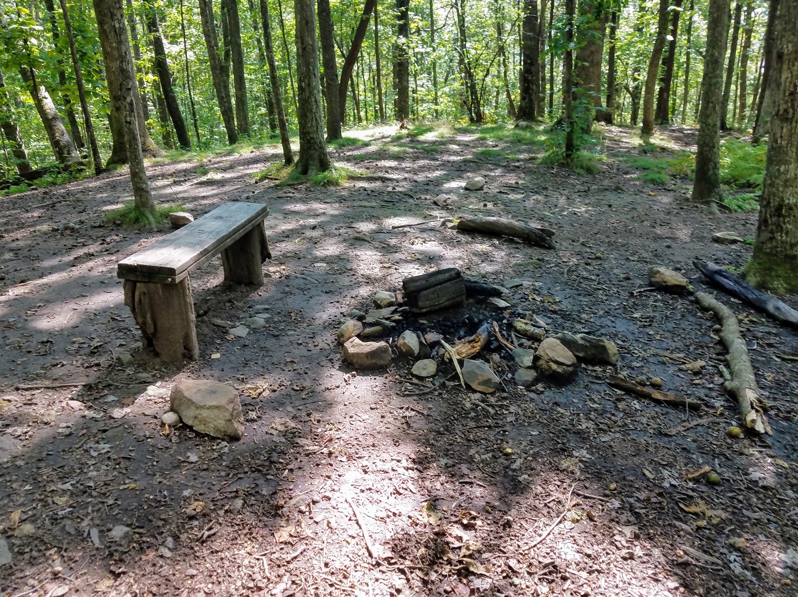
Eventually, the trail arrives at Spring Mountain Shelter. This small shelter was built in 1938 by the Civilian Conservation Corp and is now maintained by the Carolina Mountain Club. It sleeps five, had water, a privy and bear cables it is a nice little shelter. Also near the bear cables are some good campsites.
 |
| Tree eating a sign... |
 |
| ...near Spring Mountain... |
 |
| ...Shelter. |
 |
| 282.8 Miles. |
 |
| Inside the shelter. |
 |
| Water one way... |
 |
| ...privy the other. |
 |
| Bear cables... |
 |
| ...& great campsite near by. |
It is not long before the AT tops out on Spring Mountain before heading down to Deep Gap. The trail is on the Tennessee side of Spring Mountain and is narrow in spots. When I finally reached Deep Gap I somehow missed the junction with Little Paint Creek Trail (no double blaze), but there was a campsite.
 |
| The trail up Spring Mountain... |
 |
| ...this AT log is near the top. |
 |
| A toad. |
 |
| The AT narrowed here & is hidden by vegetation... |
 |
| ...on down to... |
 |
| ...Deep Gap. |
 |
| Proof the AT straddles the state-line. |
 |
| Campsite at Deep Gap. |
After going up, down and up the AT made its final descent into Allen Gap. Up to this point with all the uphill I thought maybe I should have gone southbound. Not after heading down to Allen Gap as this was by far the steepest section of the day and it was around a mile-and-a-half. Finally, I started to hear traffic and then could see TN-70/NC-208 through the trees. This meant I was back to where I left my car at Allen Gap.
 |
| Rock blaze. |
 |
| The trail heads up... |
 |
| ...heading down... |
 |
| ...encountered blow down... |
 |
| ...& autumn colors. |
 |
| More blow down. |
 |
| Homestretch to... |
 |
| Allen Gap... |
 |
| ...mile 286.5... |
 |
| ...past Cherokee NF... |
 |
| ...Pisgah NF signs... |
 |
| ...to my car. |
Not only had I finished a section, but I have now completed the AT from Hot Springs to Devil's Fork Gap (35 miles).


No comments:
Post a Comment