
I find it hard to believe that I have yet to do a blog on the Appalachian Trail (AT) half-section from Hot Springs to Tanyard Gap. When I hiked it I did this in two parts going from Hot Springs to Pump Gap in December of 2015 and then last August I went from Tanyard Gap to Pump Gap to complete this seven-mile stretch of the AT.


So, for this blog, I am going to north on the AT from Hot Springs to Tanyard Gap, since this is how I hiked it because I used loop trails for both hikes (which I will go over at the end of this blog). The first part of this hike is actually on the sidewalk as the AT cuts through the middle of Hot Springs. On the sidewalks are AT logos in the concrete, which is really cool. For those who don't know Hot Springs is a mountain oasis of just 560 people that is famous for its..., you guessed its, hot springs (specifically the Hot Springs Resort & Spa). It has a great outdoor store in Bluff Mountain Outfitters and a good place to have a beer at Spring Creek Tavern. As AT trail towns go it might be my favorite.


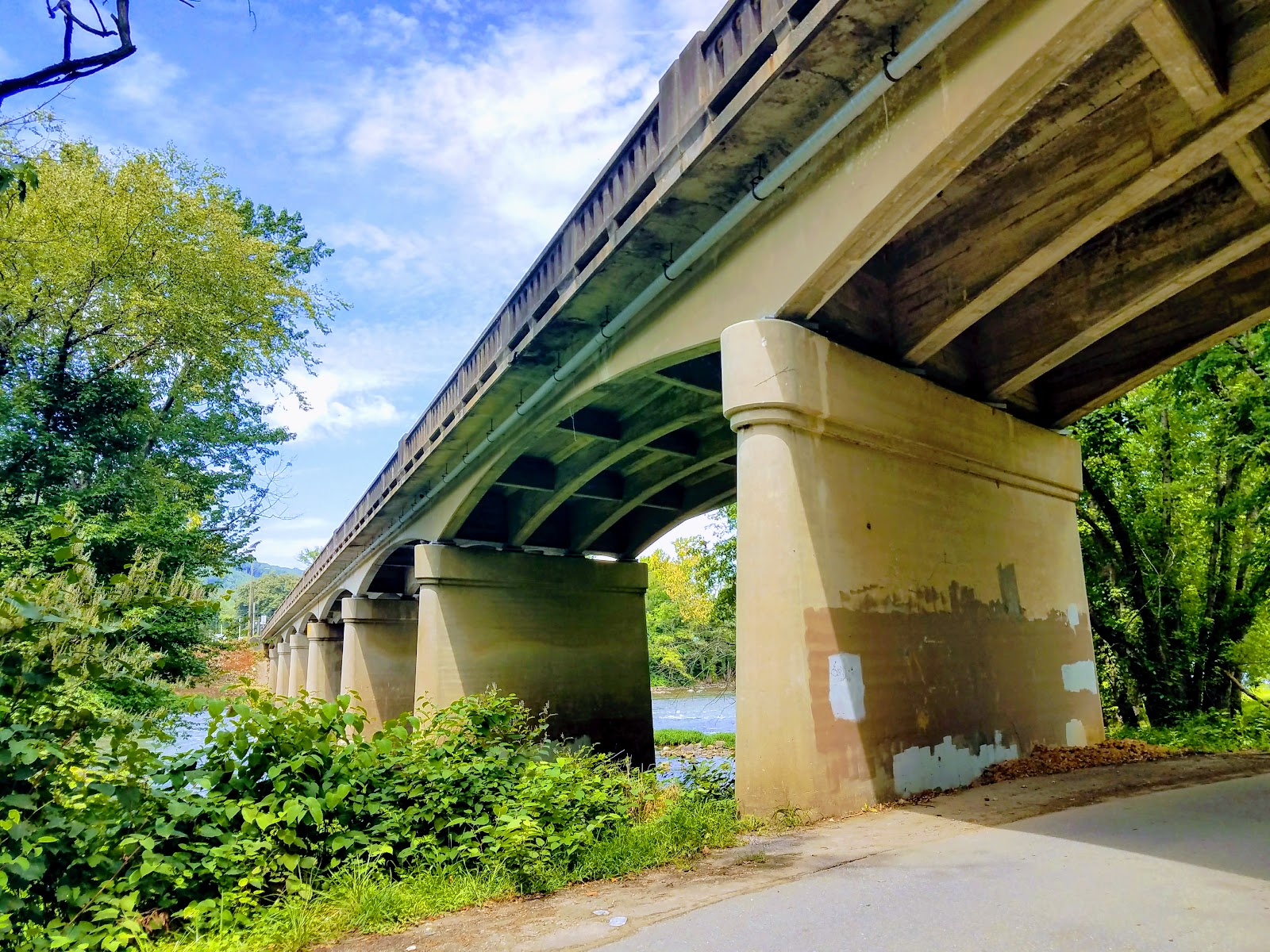
Once the trail heads out of town it crosses the bridge over the French Broad River before heading off the road at the far end of the bridge. The AT follows some steps down to another road that it follows for a short time cutting through the French Broad Outpost of the Nathalala Outdoor Center. It crosses a bridge and becomes a trail again as the AT parallels the French Broad River for the next half-mile.


Besides the river itself, one of the highlights is passing by Lovers Leap Rock (which I will talk about climbing down to) The other is what I call the French Broad Cascades. While only couple of feet high it stretches almost all the way across the river....cool. Finally, the AT turns left and heads up. While a nice climb it isn't the steepest and the AT is pretty wide through here.


At about two-tenths-of-a-mile on the climb up, you reach the first vista and no this isn't Lovers Leap. That will come in about another two-tenths. When you get there you will see a trail that leads steeply down to a narrow outcrop that looks a lot like a mini Charles Bunion, that might be because both are quartzite formations. There is no question it provides the best vista, but it is not for the faint of heart. As the trail goes up it will switchback the trail turn and here to the right is another nice view.


Finally, the AT reaches a junction with the Lovers Leap Trail as it goes left and the AT straight. There is a decent view of Hot Springs from here, but remember this isn't the Lovers Leap. The AT climbs Lovers Leap Ridge, but there is another nice view along the way. To get to it there is a junction with the AT going left and right leads to what I call "the Narrow." The reason it is a knife edge outcrop which offers a vista of the French Broad River and Hot Springs.


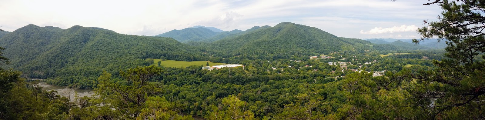


Once back on the AT the path leads up to a sideline before turning down toward Pump Gap. On the way, there is a view of Rich Mountain and the old fire tower, which is easier to view in winter. You will know you have reached Pump Gap because the is a sign which acknowledges the work of Boy Scout Troop #374, out of Raleigh, where they treated Hemlock Trees infested with the Woolly Adelgid. Also, the yellow blazed Pump Gap Trail crosses here.


Since it is a gap the trail climbs out of it, but the feature one will notice is the fire damage from the blaze in April of 2016. It is about two miles when you finally reach Mill Ridge Pond. This is a nice place to take a break and in August you will find Cardinal Flowers on its banks.


The trail heads up and intersects with Mill Ridge Road, which heads up to the open fields of Mill Ridge. This is a beautiful spot with a good view of the Rich Mountain. Also, on my first visit here in August 2016, the field was full of beautiful sunflowers. The road forks at a huge Oak Tree to the right is the parking area for Mill Ridge Bike Trail while the AT follows the road.


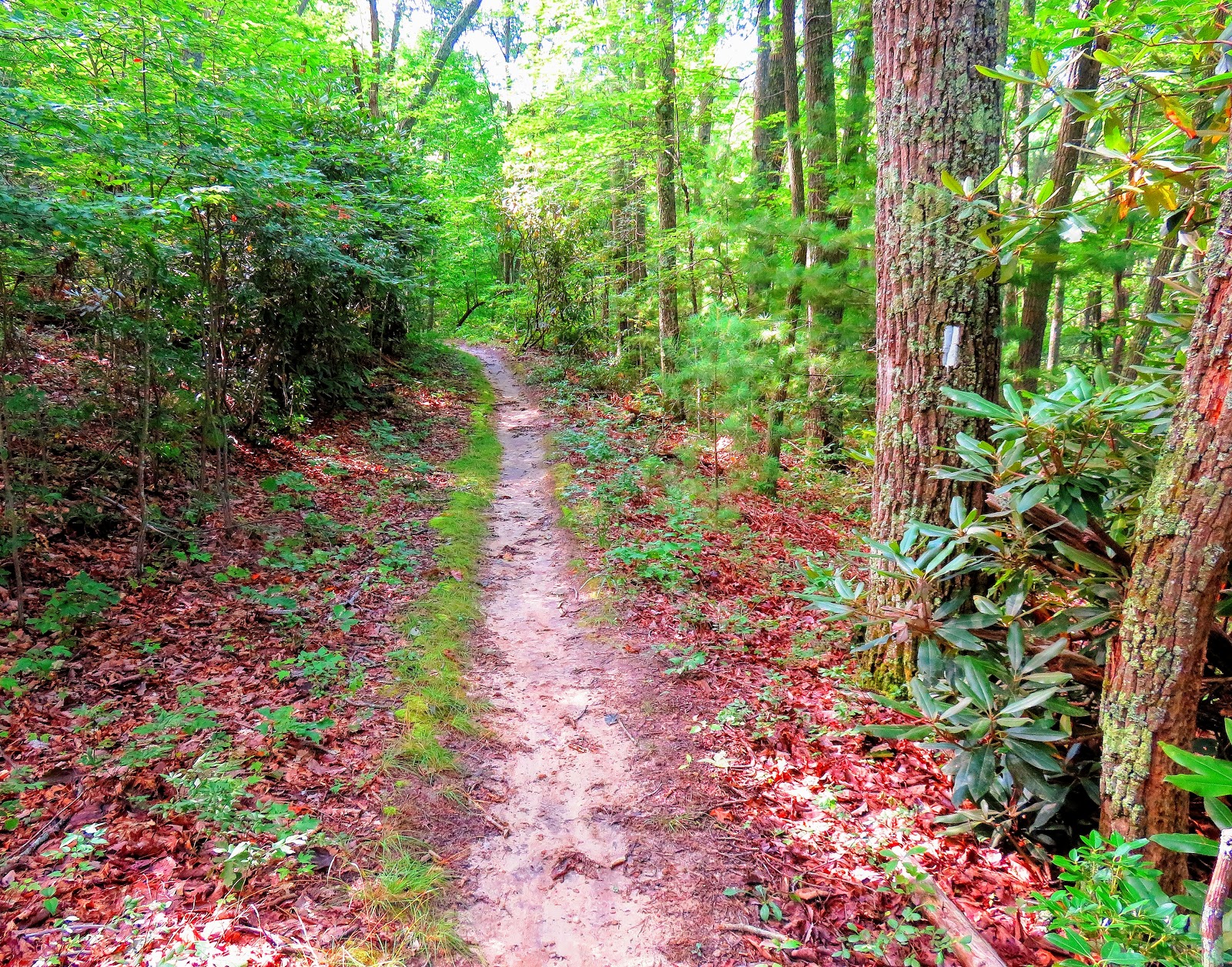
As the road heads down it curves left as the AT heads back in the woods. The last half-mile the AT travels above Mill Ridge Road heading through some rhododendron tunnels before heading to the steps that lead back down to the road and the bridge crossing at Tanyard Gap. For my description of the AT heading up Rich Mountain check out this AT Day Hike Blog. I hope at some point in the near future to finish this complete section.


This brings me back to some of the loop trails that can be done in this section. I am going to head toward Hot Springs for this part. At about a half-mile from Mill Ridge, south on the AT, there is a junction to the Upper Pump Gap Trail, which hasn't done. But about four-tenths-of-a-mile going left is the lower part of the Pump Gap Trail. This is all wooded hike and is nice, but you will find fire damage on it. It eventually cuts across the AT at Pump Gap. The whole part is relatively flat and is mostly a wooded hike with some rhododendron tunnels before the Upper Pump Gap Trail rejoins (from the right) at about half-mile.


From here the trail runs parallel to Silvermine Creek crossing it a number of times and literally been in it others. The trail does this for about a half-mile before it widens onto a roadbed. Just up the path, one passes the remnants of the old Silvermine here, hence the name of the creek. Some of the old bunkers that once housed dynamite are there and they still have danger explosive signs on them. Next one passes the Silvermine Campground with vault toilets and a Picnic Pavilion. Not long before you will cross the creek and the Lovers Leap Trail will come in from the left.


I mentioned this trail before as it starts at the junction up on Lovers Leap Ridge, going left. This half-mile or a little more trail starts off pretty steep as it heads down toward Silvermine Creek. It eventually comes out just above the Silvermine Trailhead and allows for a shorter loop hike. Now if you drove to this trailhead you can get in your car, but if you are like me you have to road walk back and rejoin the AT at NOC.


So, that is all about this half-section of the AT and some of the loop trails that can be used in this section. These provide hiking opportunities for novice day hikers to some who want more of a challenge for a great day on the trail.

No comments:
Post a Comment