Wednesday, June 29, 2022

Southwest Virginia Is Bear Country!

I interrupt the scheduled blog with this special report...Southwest Virginia is Bear Country! I mean I originally didn't plan to do a blog on this trip to the Cabin because this was just an overnight mowing trip. Because of events out of my control, I didn't even hike as I had to mow this morning. But that all changed on my way out. We had just passed Travis; Cabin Dad and I spotted something big and shiny black, a bear...Bernie to be specific. I did see a bear last year, at Rocky Fork State Park, but it had been two years since I had seen Bernie scratching on a Spruce Tree.

Mama Bear from 2021

Bernie in 2020

I had seen signs of him, but not the bear. I had even thought of getting a new trail camera to hopefully get a look. So, it was a welcomed surprise to see his big bareness. 

Spotted him on the road...

...he looks back at us

Oh, since I'm doing a blog I'm going to experiment with a new way to use my wildflower pics. I'm either going to add them to a blog (like here) or a specific one. Anyway, enjoy...

Milkweed

Queen Anne's Lace

Butterfly Milkweed

Wild Bergamot


Thursday, June 23, 2022

Three Days On The Roans & A Crashed Drone...Just Two Sweet!


Well, since the Lummox isn't going to get to this I guess I must. Early this week I dragged the Lummox off the couch and to the Roans for two nights (three days) on the balds...HELL YEAH! On Monday we first went up to the Roan (Rhododendron) Gardens. We hiked the AT (Appalachian Trail) to the Roan High Shelter and my trip was made here as the Lummox crashed his drone. I was hoping it was out of action, but he got it working, but it was still funny! 


We stayed the night at Jane Bald and then moved on to one of my favorite places...Grassy Ridge Bald on Tuesday. I had to laugh again someone was at his campsite. But the guy Lynn was cool and said we could set up. His mutt was too bad either (better than that slobbering Bax). 


Then on Wednesday, I had to load the Lummox on my back and carry him back to Carvers Gap as he whined all the way. I could have stayed longer, but the Lummox wanted to go home on Monday, so it was back to hell...I mean cultivation. Well, that is all Peteoholics so there is just one more thing. I'm out...BITCHES!


Tuesday, June 14, 2022

My First Edited Video...

As a number of posts on this blog attest, I was gifted a drone back at the Holidays in 2021 and started flying it in late February (2022_. Since then I have been learning to fly it. That means getting more comfortable flying, not panicking when I lose sight, and just getting better all around. I can now launch it when it isn't totally clear and I have even flown it through the clouds. I have also learned about warning messages as I have got them for reaching legal height (400 feet), low signal, and high winds. I will admit taking photos was my number one reason for getting a drone, but I have gotten into the video side. So, after going to Camp Creek Bald I decided to make my first, edited, video from the footage around the fire tower since it was here that was the inspiration for getting the drone.


The video is called Flying Above Camp Creek Bald Fire Tower and I created the video using Windows Movie Maker. I'm still learning as I go, so it is a little rough. The thing about the video that I loaded to YouTube isn't the first version. No, for the original video I used the 10,000 Maniacs song...A Campfire Song. Well, YouTube said there were copyright issues. While I think it would have been okay to put it up, I decided to change it. So, I used Creative Commons music (Vens Adams: adventure is Calling) and I think it came out well. However, for this blog, I'm putting up both versions...sue me. Anyway, this is the first, but won't be the last...enjoy the show!


Saturday, June 11, 2022

Into The Fryingpan & Out Of Spring At Mt. Pisgah On The BRP


The signs of Summer are all around. Whether it's the unofficial start with Memorial Day Weekend or the end of the school year or the 90° temperatures Summer seemed in full swing. However, Spring (meteorological) still had two days and I decided to enjoy them in the shadow of Mount Pisgah. 


I was staying at the campground that is named for said mountain. It's located off the Blue Ridge Parkway (BRP), at mile marker 408. Oh, it is directly across the Parkway from the Pisgah Inn, which I stayed at in October of 2016. I will say here to Richard Balsam is my favorite stretch of the BRP. 
After a stop at REI for the Anniversary Sale, it was up the BPR from Asheville. There are a lot of great overlooks and tunnels on the way up. 


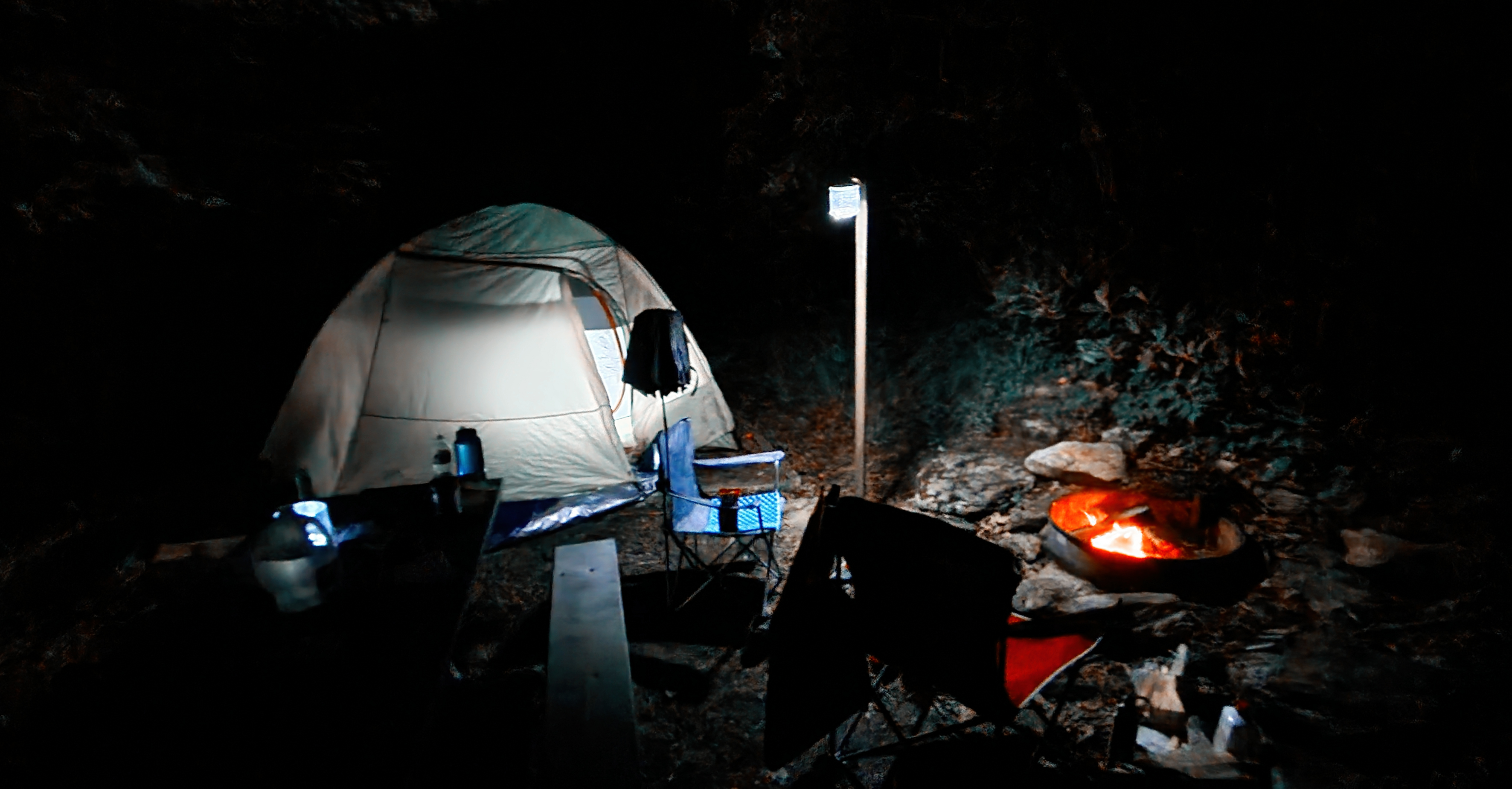
As for the campground, it was the highest dedicated one that I had stayed at coming in just shy of 5,000 feet (4,980 feet). The sites here are small and I know that is a turn-off to some, but I liked it. I was reminded of my site at Blockstand Creek at Rocky Fork State Park. Also, like at Rocky Fork, there are problems with bears. While I didn't have anything stolen the park ranger said they recently had to trap one. Because of the bears, the sites have a bear box, which I like better than hanging. Oh, the car was five feet away, so food storage wasn't an issue.


I did find a nice place to view the sunset at the Mount Pisgah Trailhead. Besides a view of the mountain, there is an overlook for Buck Springs. It was here in 2016 and I hiked the Mount Pisgah Trail to the observation deck below the summit communication tower and back to the Pisgah Inn. However, this time I had another tower in mind...the old fire lookout on Fryingpan Mountain. 


I was originally going to hike from the campground, but I had to cut that short and instead drove the BRP to Fryingpan Gap to hike the final 0.7 miles to the fire tower. I passed the trail I would come in on as this part of the trail is the old tower road. It was long before the 70-foot tower came into view.
Sitting at 5,340 feet atop Fryingpan Mountain the tower was built in 1941. The tower had a 12-by-12-foot live in cabin which was used by the USFS until  the early 1990s when it was retired. It would be refurbished in 2010, but because of people camping in the tower the cabin is now closed. So, you can only reach the highest stairs platform, about 60 feet up, which means there were still wonderful views.'


Once down I decided to run the drone around the tower. It gave me 360-degree views and great photos of the tower. After I got the drone down it was time for the trip back. I have to say it was a great trip and Mount Pisgah Campground is one of the best I have stayed out...I loved it! 


Oh, one last thing...there were plenty of wildflowers including Mountain Laurel, Flame Azalea and Catawba Rhododendron...


More Photos: SmugMug

Tuesday, May 31, 2022

A Hiking Machine's Happy High!


How do you make the Hiking Machine happy? Get him high in the mountains, which is what I got to do Monday and Tuesday with a trip to Mount Pisgah and the BPR (Blue Rudge Parkway). It seems these days I don't get to crush as many miles because of the Lummox, but I did get to camp at my new favorite place...Mount Pisgah Campground. While the posers stayed across the BPR at the Pisgah Inn, in my tent the way a Hiking Machine is meant to be! One of the best things that happened Monday was that damn drone of the Lummox stopped working! The camera was working or something (how should I know I'm just about crushing trail) so I thought of a drone-free trip. But somehow that idiot got it working...🤦‍♂️

Anyway, I did get some miles in Tuesday morning ripping it up to Fryingpan Mountain Fire Tower. I will cut the Lummox some slack for cutting the hike from 3.2 to 1.4 miles. A the Fryingpan Gap parking I hauled him up the 0.7 miles to the tower. I got a big laugh when he discovered that the catwalk was closed on the 70-foot tower. But, he would pull out that damn drone! Well, as another great bunny said..."that's all folks" and I'm out BITCHES!


Sunday, May 29, 2022

It's The 6th Annual Wildflower Hike At & Above Buffalo Mountain


It is May and it means one thing...it is time for the annual wildflower hike at Buffalo Mountain Park on Wednesday. This was my sixth time going to this mountain I have enjoyed since the late 80s. The main reason is this is one of the best spots for Mountain Laurel. I saw plenty of it and Flame Azalea, but no Pink Lady Slippers.

I was also here for another reason...to fly the drone. I wasn't sure I would get to it as Buffalo Mountain was obscured by clouds. But when I got to my first take-off spot of Huckleberry Knob it was somewhat clear looking toward Johnson City.


However, by the time I got to Tip Top, it had learned...well, almost. Looking towards Pinnacle Mountain It was clear (except for the higher peaks like Unaka Mountain and Big Bald). However, the communication towers of Buffalo Mountain had a bank of clouds rollover.


The last place I flew the drone was at White Rocks. By this time it was clear except for the higher peaks. But it still made for some incredible panoramas looking back towards Tip Top.


When I returned on the Noggin Trail where it bottoms out the rain had made for a wet trip back to the trailhead, the last thing of note. It didn't help I tried to backtrack to at waterfall, but the trail was unpassable. Anyway, it was another excellent May trip to the Buff!


More Photos: SmugMug