 For this Hike Georgia outing three wasn’t a magic number
that would be four. We had tried three times to complete this hike, from
Brasstown Bald to Locust Log Ridge on the Arkaquah Trail, but because of
weather it had to be moved or cancelled.
For this Hike Georgia outing three wasn’t a magic number
that would be four. We had tried three times to complete this hike, from
Brasstown Bald to Locust Log Ridge on the Arkaquah Trail, but because of
weather it had to be moved or cancelled.
Wednesday was our fourth attempt and on my fourth trip to
the Brasstown Bald the hike finally happened. As I have said I had been to the Georgia’s
highest peak on three occasions and blogged about it twice (here & here). However, the only
hiking I had done was the 1.2 mile round trip up to the summit from the parking
area. I hadn’t done any hiking in the Brasstown Wilderness. I should say first
something about the Arkaquah Trail. It is a 5.5 mile ridgeline path that goes
from Track Rock Gap up to Brasstown Bald.
So, most of the time I had seen this hike posted it had been for a 12 miles hike (including up to the Brasstown Bald summit). This hike is not only long but there is a 1,000+ foot climb for 1.5 miles out of Track Rock Gap to Locust Log Ridge. While I had thought about posting this hike for our group I decided to put up a hybrid of that hike that is listed in Johnny Molloy’s 50 Hikes in the North Georgia Mountains (it is number 33). In short it is 7.4 mile out-and-back hike from the Brasstown Bald Parking Area to the large outcrop at Locust Log Ridge, where the Arkaquah Trail ends its steep climb from Track Rock Gap. Anyway, I first put the hike up in April, but on the day it was scheduled it rained and Brasstown Bald was blanked in clouds. I had to cancel it again in that same month and then when I put it up last week I had to move it Raven Cliffs and Dukes Creek Falls. Like I said in my Quick Blog of this hike, because of this being a fourth try and scheduled for a Wednesday we only had two others come out, they were Hike Georgia regulars Beth and Kelly. Let me say weather definitely was not an issue because we couldn't have asked for a better day. Clear skies, cool and low humidity…nice!
So, most of the time I had seen this hike posted it had been for a 12 miles hike (including up to the Brasstown Bald summit). This hike is not only long but there is a 1,000+ foot climb for 1.5 miles out of Track Rock Gap to Locust Log Ridge. While I had thought about posting this hike for our group I decided to put up a hybrid of that hike that is listed in Johnny Molloy’s 50 Hikes in the North Georgia Mountains (it is number 33). In short it is 7.4 mile out-and-back hike from the Brasstown Bald Parking Area to the large outcrop at Locust Log Ridge, where the Arkaquah Trail ends its steep climb from Track Rock Gap. Anyway, I first put the hike up in April, but on the day it was scheduled it rained and Brasstown Bald was blanked in clouds. I had to cancel it again in that same month and then when I put it up last week I had to move it Raven Cliffs and Dukes Creek Falls. Like I said in my Quick Blog of this hike, because of this being a fourth try and scheduled for a Wednesday we only had two others come out, they were Hike Georgia regulars Beth and Kelly. Let me say weather definitely was not an issue because we couldn't have asked for a better day. Clear skies, cool and low humidity…nice!
 |
| At the base of the mountain. |
 |
| Observation deck. |
 |
| It is early at Brasstown Bald. |
So, the trailhead for the Arkaquah is to the left of the
main rest room area where the shuttles are parked. There is a sign which gives
the distance to Track Rock Gap. The trail tunnels through Rhododendrons before
reaching an information board and right past it one of those wooden signs that
welcomes one to the Brasstown Wilderness.
The first part of the trail continues through Rhododendrons before heading into a small gap I am calling Little Brasstown Gap. The trail then heads up Chimneytop Mountain and cross ridge-line, which makes up most of this hike. Across Chimneytop Mountain there are a number of rock outcrops the best given a view back of the observation tower on Brasstown Bald.
 |
| Headed on the Arkaquah Trail. |
 |
| Information board... |
 |
| ...some of the information. |
 |
| Entering the Brasstown Wilderness. |
The first part of the trail continues through Rhododendrons before heading into a small gap I am calling Little Brasstown Gap. The trail then heads up Chimneytop Mountain and cross ridge-line, which makes up most of this hike. Across Chimneytop Mountain there are a number of rock outcrops the best given a view back of the observation tower on Brasstown Bald.
 |
| Headed through Rhododendron tunnel. |
 |
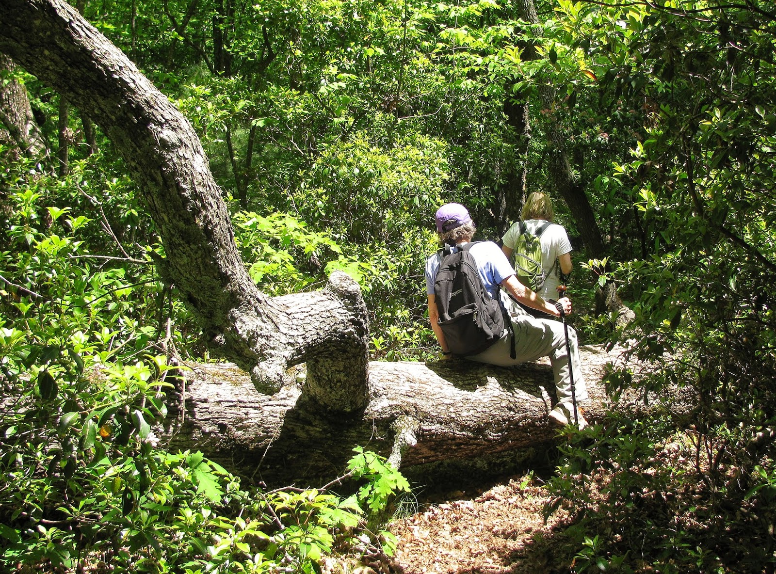
| Beth & Kelly. |
 |
| Squawroot. |
 |
| The trail on Chimneytop Mountain. |
 |
| Looking back, in the morning, at the observation deck... |
 |
| ...& on the way back, in the afternoon. |
It was also up here that Beth and Kelly spotted a wildflower
I had seen only in pictures, Pink Lady Slippers. Mainly found in the northern U.S. and Canada
these orchids are considered to be unusually in Georgia. I was glad to finally
get a look at some up close. These weren’t the only wildflowers, there were
ones I have seen during the spring including Purple Violets, May-Apple, Dwarf Cinquefoil, Catesby’s
Trillium, Large-Flowered Trillium, Rattlesnake Weed, and personal favorites
Flaming Azaleas and a course Mountain Laurel. Besides the Pink Lady Slippers
the other surprise of the day was the blooming Catawba Rhododendrons. I know in
Tennessee and North Carolina they start blooming in mid-June, so I wasn’t
expecting to see them, but since Brasstown Bald is further south and at a
slightly lower elevation I guess it shouldn’t be a total surprise.
 |
| Pink Lady Slipper. |
 |
| Purple Violet. |
 |
| May-Apple. |
 |
| Catesby's Trillium. |
 |
| Large-Flowered Trillium. |
 |
| Cutleaf Toothwort. |
 |
| Naked Broomrape. |
 |
| Flaming Azalea. |
 |
| Mountain Laurel. |
 |
| Catawba Rhododendron. |
 |
| Blackberry. |
 |
| Wild Geranium. |
It wasn’t long before the trail heads down. In Molloy book
he describes the trail “descending on switchbacks” I will say that this is not
the most accurate description of the trail as it doesn’t really switchback it
is more like curve around the ridge. Molloy is right that the trail does pass
through boulders in what he describes as a “fat man’s squeeze.” Around here is
a huge boulder overhang that looks to have been used as a campsite. As it
continues down it will go around some more boulders before coming to a spot
with a gnarly tree that, while still alive, looks like it has been struck by lightning and has seen better days.
Just up the trail one will find some steps before the path bottoms out at
Low Gap. Here there is a cool stone and a coil of steel cable and a place to
catch ones breath before heading up Locust Log Ridge.

 |
| One of those "Indian Tree Markers." |
 |
| Trail heads off Chimneytop Mountain. |
 |
| "Fat Man's Squeeze." |
 |
| Group headed down a steep section. |

 |
| Gnarly tree... |
 |
| ...Beth at its base. |
 |
| Cable & Stone at Low Gap. |
The trail goes up to a small knob on the ridge before deciding
again to Cove Gap. Around this spot we ran into two other ladies who were
hiking the trail. I had seen them at the parking lot and figured we would run
into them at some point. What is funny is that they got the idea for the hike
from seeing my listing of this on Hike Georgia and thought about doing the hike
with us. They had spotted me at the parking lot, but because they didn’t see my
pack they didn’t think I was hiking and they decided to go ahead on there own, that
was funny.
Anyway, it is back uphill again for a short climb to the
main knob on Locust Log Ridge, but it is a nice section because the trail cut
through blooming Rhododendrons and Mountain Laurel. I must say here that we
missed the outcrop that is the turnaround point for the hike, we somehow just bypassed
it. After passing this spot and another small outcrop we started downhill. Beth
thought the outcrop we were looking for might be on down, so the two of us
scouted ahead while Kelly stayed up the hill. It wasn’t long before we realized
this was the drop to Track Rock Gap. On the way back up we did pass an Eastern
Ribbon Snake and Beth thought it was best not to tell Kelly. These added miles
would bring the hike, in total, to about eight miles.
 |
| Headed up Locust Log Ridge. |
 |
| Catawba Rhododendron on Locust Log Ridge. |
 |
| Butterfly on a Flaming Azalea. |
 |
| On Locust Log Ridge there were blooming bushes of... |
 |
| ...Mountain Laurel. |
 |
| Here is the outcrop where we were suppose to stop. |
 |
| Here was the last vista... |
 |
| ...before we started down to Track Rock Gap. |
 |
| On the way back up Beth spotted this Eastern Ribbon Snake. |
After stopping for lunch, we headed back and guess what we ran into that outcrop we were looking for. While it is probably a better winter view it was nice with views into the valley and Young Harris College and to the left was Ravencliffs Knob. If you look close one can see the FAA tower on top, it looks like the one on top of Snowbird Mountain in North Carolina.
 |
| We finally found our vista... |
 |
| ...it had an excellent view of Ravencliffs Knob... |
 |
| ...& its FAA Tower... |
 |
| ...also of a view into the valley... |
 |
| ...Young Harris College. |
The hike back was tougher than I thought it would be. I knew there were some steep spots, but the ones that seemed gentler were slightly harder on the way back. Most of the times I do an out-and-back the trail seems shorter coming back, but not today. It was still a nice hike and I have to say that ridge-line hikes like this are some of my favorites.
 |
| Group headed back. |
 |
| There was plenty of trees & sun. |
 |
| Cool tree. |
 |
| Heading up Chimneytop Mountain. |
 |
| More Rhododendron tunnels. |
We finally made it back to the lot, Beth and I were gluttons for more punishment. Beth had never been to the top of Brasstown Bald and we decided to hike the 0.6 mile trail up. Kelly declined hiking and even decided to not take the shuttle.
 |
| Next stop. |
 |
| Back at the parking area. |
 |
| Headed up... |
 |
| ...to the summit. |
 |
| Trail up is paved. |
While I have talked about this hike in more detail before, it seemed tougher going up today than my trip up last October. The one thing that was the same was the view, it was spectacular as always. It was helped by the low humidity, because it wasn’t nearly as hazy as it could have been. Clingmans Dome was visible at 50 miles, Sawnee Mountain at 47 and if you look closely on one of my pictures Atlanta might even be seen.
 |
| The summit & marker... |
 |
| ...& a Wood Booger! |
 |
| Flag & Fire Tower. |
 |
| Summit marker. |
 |
| East vista. |
 |
| Tray & Rocky Mountain. |
 |
| Rabun Bald. |
 |
| Yonah Mountain. |
 |
| Parking area... |
 |
| ...if you look... |
 |
| ...you can see my car from here! |
 |
| South vista. |
 |
| Blood & Slaughter Mountains |
 |
| Sawnee Mountain (if you look close you might see Atlanta). |
 |
| Panorama of the tower. |
 |
| West vista. |
 |
| Panorama. |
 |
| North vista. |
 |
| The bears of the visitor center. |
After a few minutes of enjoying the view Beth headed back
down but I stayed for another 45 minutes, enjoying the view, walking through
the visitor center and talking to the rangers on the mountain. It was about
this time I was deciding whether to head over Track Rock Gap or not. For my decision
on going to Track Rock check out this blog.

Overall – This is a two park hike and they couldn't be more different. The Arkaquah Trail was tougher than I thought it would be the whole path would have been a five, down to Track Rock, but what we did was a solid four. The summit trail while short is steep and being paved doesn't help. The Arkaquah Trail while not blazed a lot is well maintained (it is a ridge-line so there isn't anywhere for other trails). The Summit Trail is paved so that should tell you its condition is excellent. The views at a couple of spots, including Locust Log Ridge, are good, but the trail itself is a beautiful hike. There are not many views in Georgia better than Brasstown Bald, it is stunning and is one anyone can access (because of the shuttle). As for people we only passed two and they got the idea from me for the hike, it may be busier on the weekends, but doing it during the week is nice. The traffic at Brasstown Bald is always steady, but this trip was the least amount of people I had seen.

Arkaquah Trail (AkT)& Brasstown Bald (BB) Hikes

My Take:
For Difficulty – 4 Stars Arkaquah Trail; 2 ½ Star BB
For Trail Conditions – 4 Stars Arkaquah Trail; 5 Star BB
For Views – 3 ½ Stars Arkaquah Trail; 5 Star BB
For Solitude – 4 Stars Arkaquah Trail; 2 Star BB Overall – This is a two park hike and they couldn't be more different. The Arkaquah Trail was tougher than I thought it would be the whole path would have been a five, down to Track Rock, but what we did was a solid four. The summit trail while short is steep and being paved doesn't help. The Arkaquah Trail while not blazed a lot is well maintained (it is a ridge-line so there isn't anywhere for other trails). The Summit Trail is paved so that should tell you its condition is excellent. The views at a couple of spots, including Locust Log Ridge, are good, but the trail itself is a beautiful hike. There are not many views in Georgia better than Brasstown Bald, it is stunning and is one anyone can access (because of the shuttle). As for people we only passed two and they got the idea from me for the hike, it may be busier on the weekends, but doing it during the week is nice. The traffic at Brasstown Bald is always steady, but this trip was the least amount of people I had seen.

Pete’s Take :
For Difficulty – 3 Rabbits Paws AkT; 1 Rabbits Paws BB
For Trail Conditions – 4 Rabbits Paws AkT; 5 Rabbits Paws BB
For Views – 3 Rabbits Paws AkT; 5 Rabbits Paws BB
For Solitude – 3 Rabbits Paws AkT; 1 Rabbits Paws BB
Overall – The Arkaquah Trail is awesome, it is challenging, even for a hiker of my level and it is mostly ridge-line which I like. It is also well maintained. The Summit Trail even kids can do, while a little steep it is just a bit harder than taking the shuttle and it paved so the condition is great. I love the views on the Arkaquah Trail because they are hiking views, but the Lummox is right Brasstown Bald is as good as it gets in Georgia. This is where the Arkaquah wins hands down, the only people we met were hikers which is awesome. I will say that the summit was better than other times I have been (there were no KIDS) so that is why it gets a one.
No comments:
Post a Comment